


The Most Beautiful Drive in Utah
More Utah Eye-Candy

Day Six
Saturday, June 12, 2021
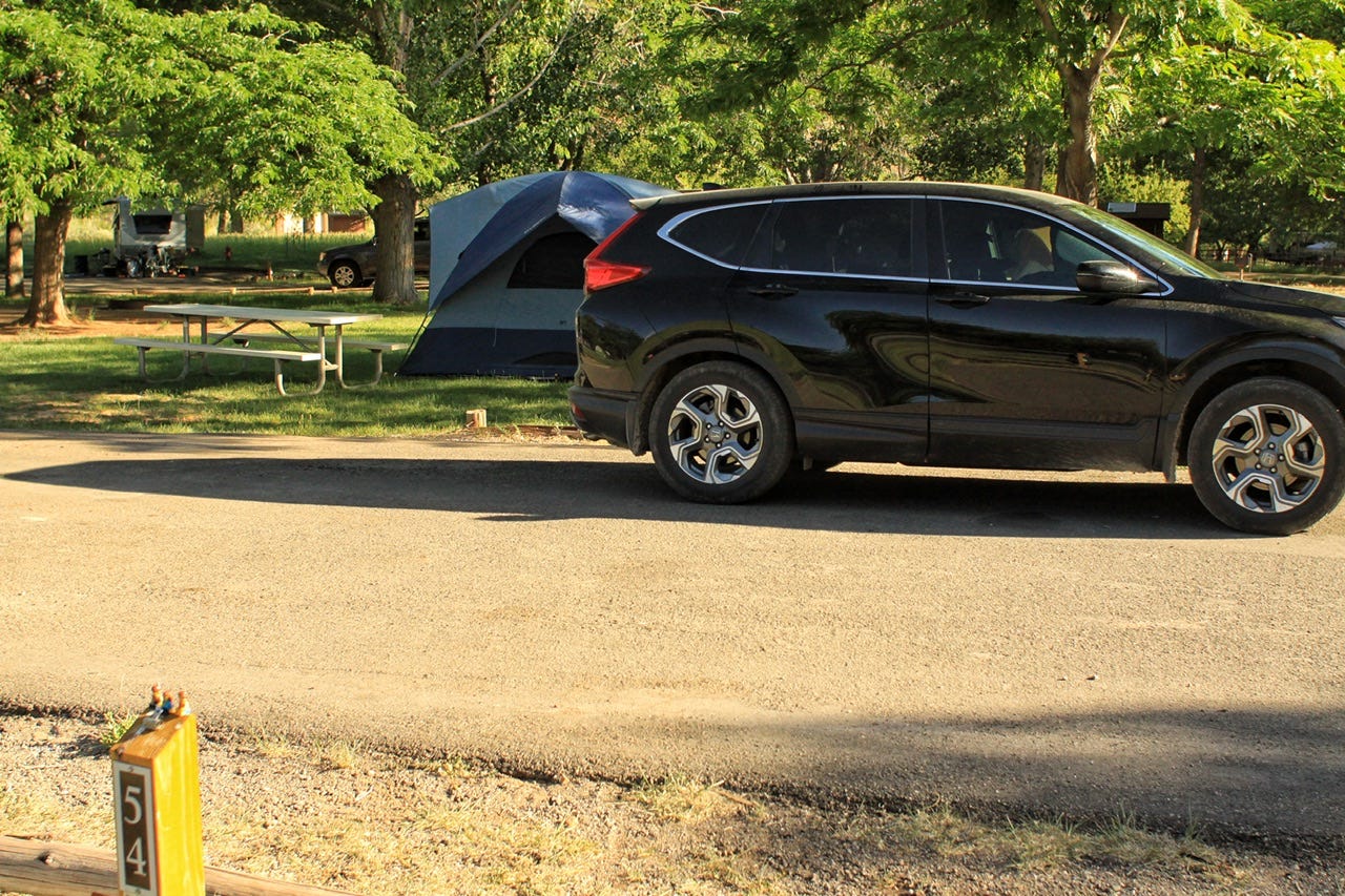
Fruita Campground
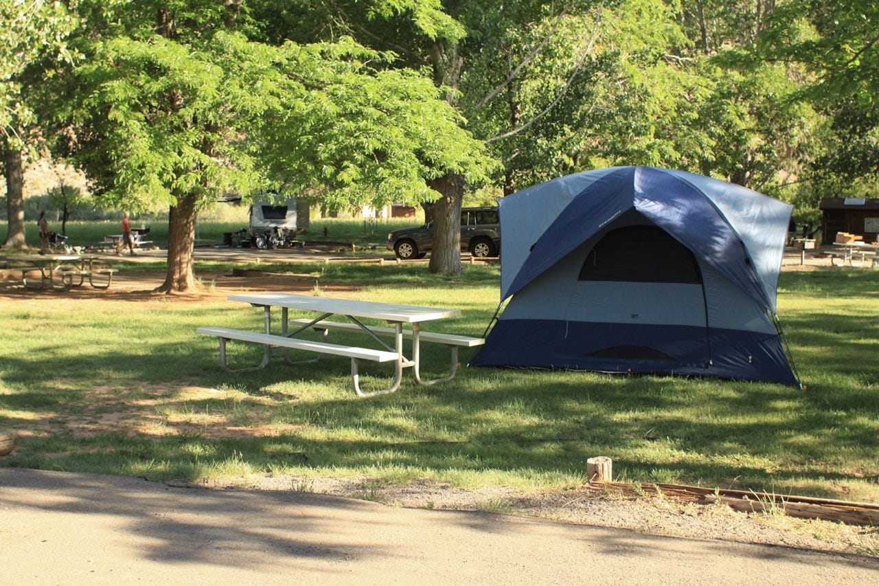
I get the appeal of Fruita Campground for some folks. It’s one of the few places in the desert that has green grass and shade trees. Maybe if we stuck around at campsites longer, those things would be important to us, but I’d rather have an epic view from the campsite when I unzip that zipper in the morning.
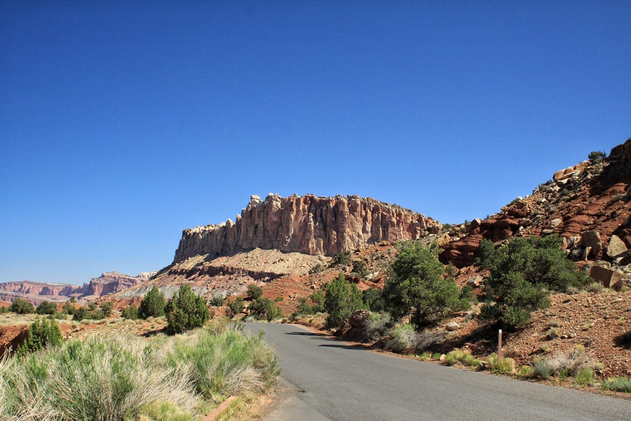
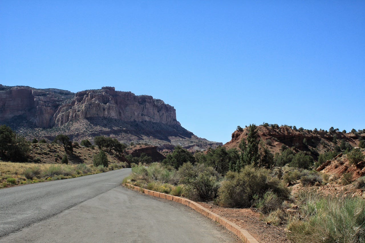
We packed up and headed for the scenic drive. From what I can tell, we drove all the way to the end without stopping and then stopped for photos on the way back out.
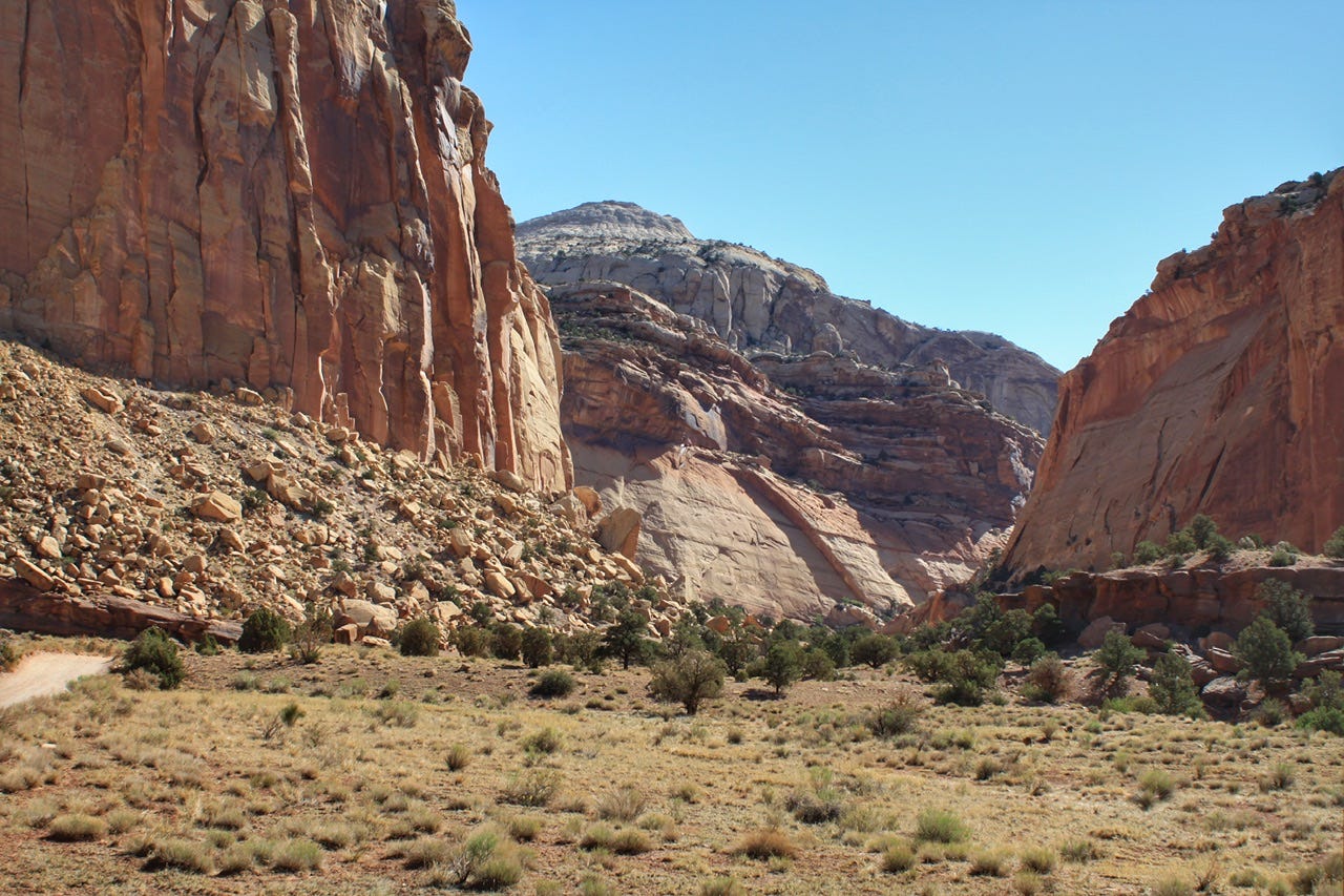
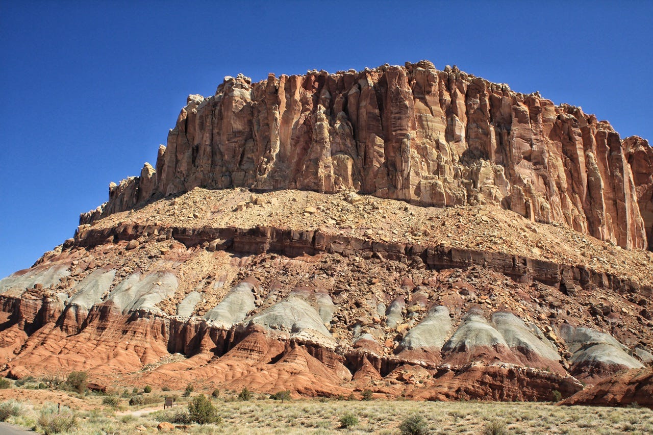
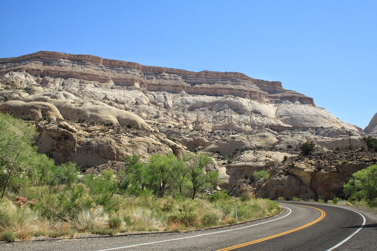
Capitol Reef National Park
Capitol Reef became a national monument on August 2, 1937, but did not open to the public until 1950. It was expanded in 1969 and was designated as a national park in 1971.
Capitol Reef was named for the white Navajo Sandstone cliffs with dome formations. The domes look similar to the domes placed on capitol buildings. A “reef” is a barrier to travel, which checks out. There is a paved scenic road into the park, and one highway that crosses it, but other roads in the park are not paved and some require the use of a high clearance vehicle to access.
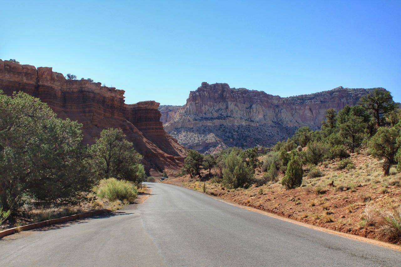
Despite the barriers to travel, this is one of those parks where if you only ever drive the scenic drive and don’t get out to hike, you will still see plenty of gorgeous scenery. That might be why we have yet to hike any of the trails in this park. It was too hot the first time we passed through in 2018, and in 2021, it was just a night on the way to somewhere new.
The park is only 6 miles or so wide and 60 miles long, and it includes the majority of the 100-mile long Waterpocket Fold formation. It’s so remote that the nearest traffic light is 78 miles away!
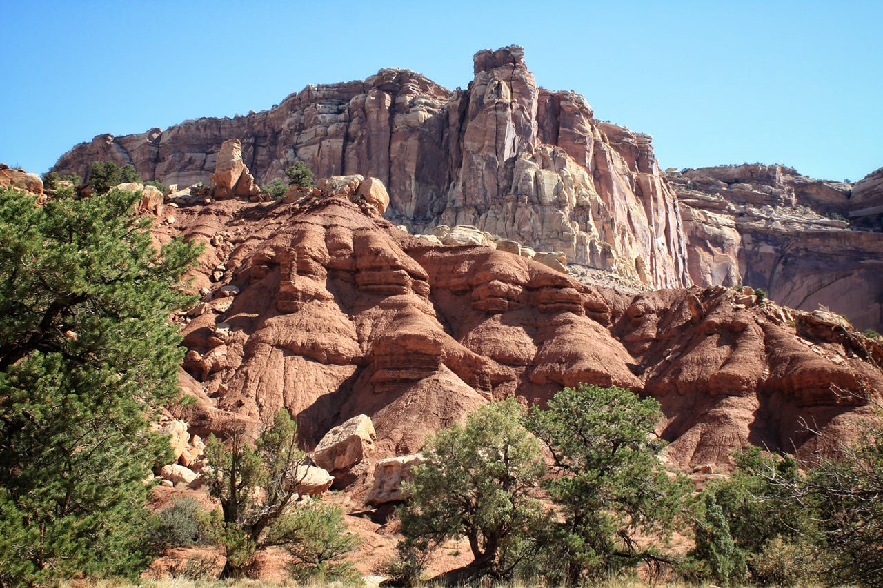
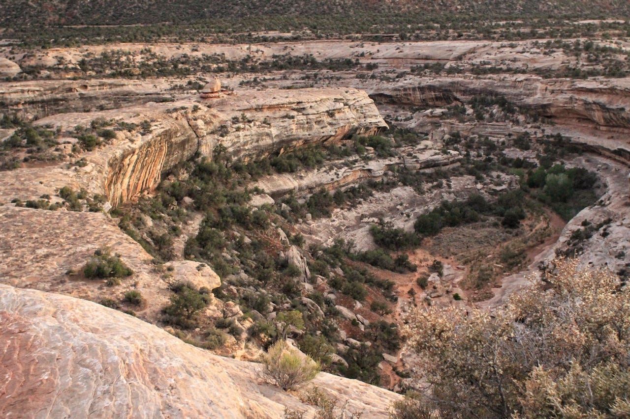
They say a photo is worth a thousand words, but I’m not sure that my photos can even describe the beauty of this park. I remember the first time we visited, which was after hiking into the Grand Canyon, visiting Zion for a day, and hiking for eight hours in Bryce Canyon, and then we went to Capitol Reef. We had already seen so much beauty the prior four days, that it felt like being drunk on pretty rocks. This time, Capitol Reef was just the beginning of the pretty rocks for this trip and it was still so overwhelmingly beautiful in every direction.
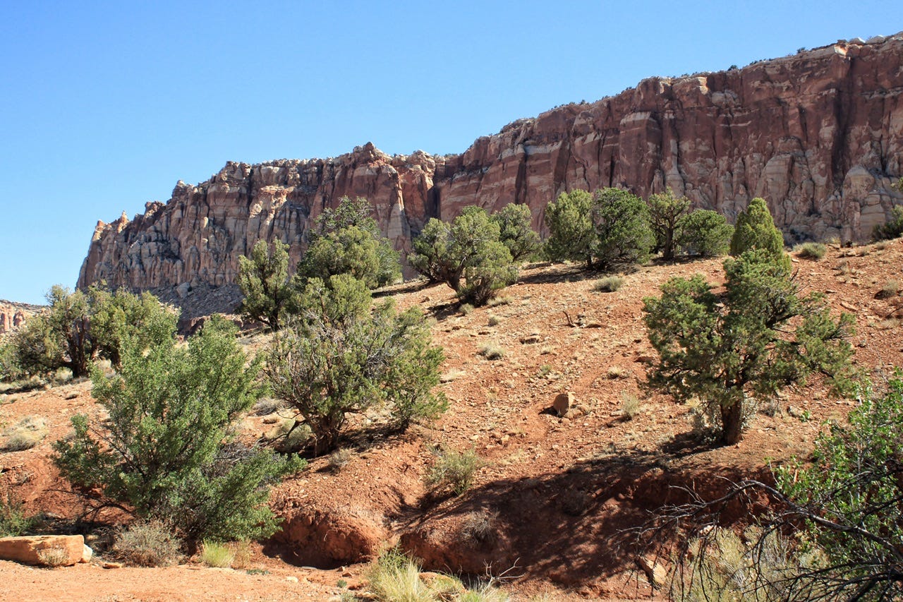
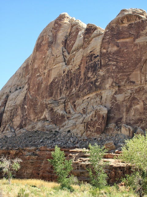
The photos above and below were both taken from the same stop, looking in opposite directions. The one above is looking north and the one below is the view to the south.
Uranium Mining
What I think is kind of crazy about this park is that uranium mining was allowed here in the 1950s. I don’t know why anyone would look at such beautiful scenery and decide that digging holes into it would be a good idea, but they did and apparently, did not find a significant enough amount of uranium. Thank goodness for that! The National Park Service has an article about the mining history for anyone who wants to learn more. I thought it was interesting that the National Park Service was supposed to earn a ten percent royalty on all of the uranium sales and that amounted to $13.50.
Our campground for the night was one of the few first-come, first-served campgrounds I had planned for this trip, so we only spent an hour checking out the scenic drive before heading out of the park.
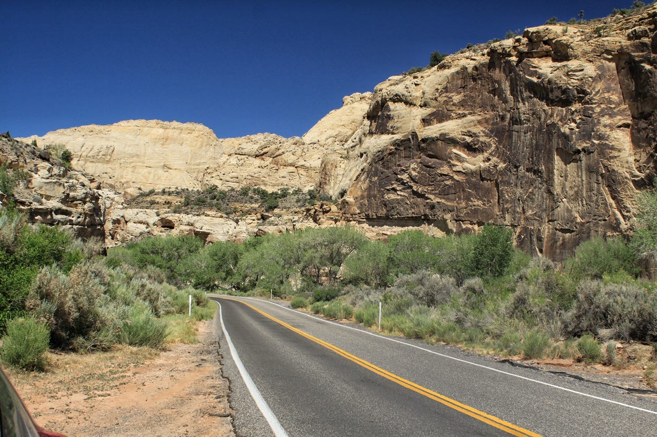
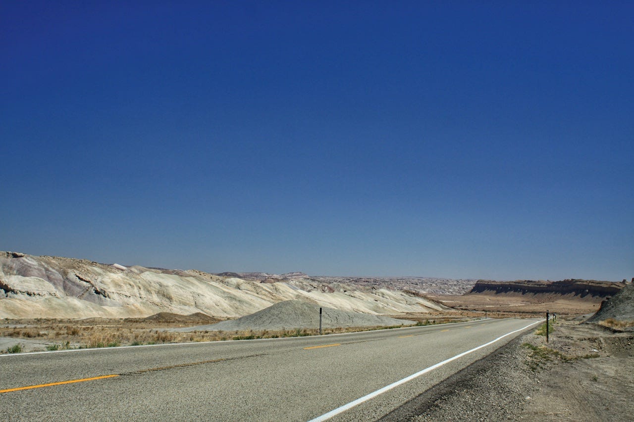
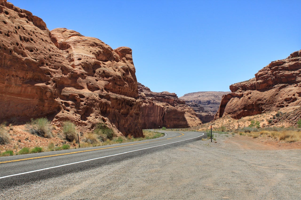
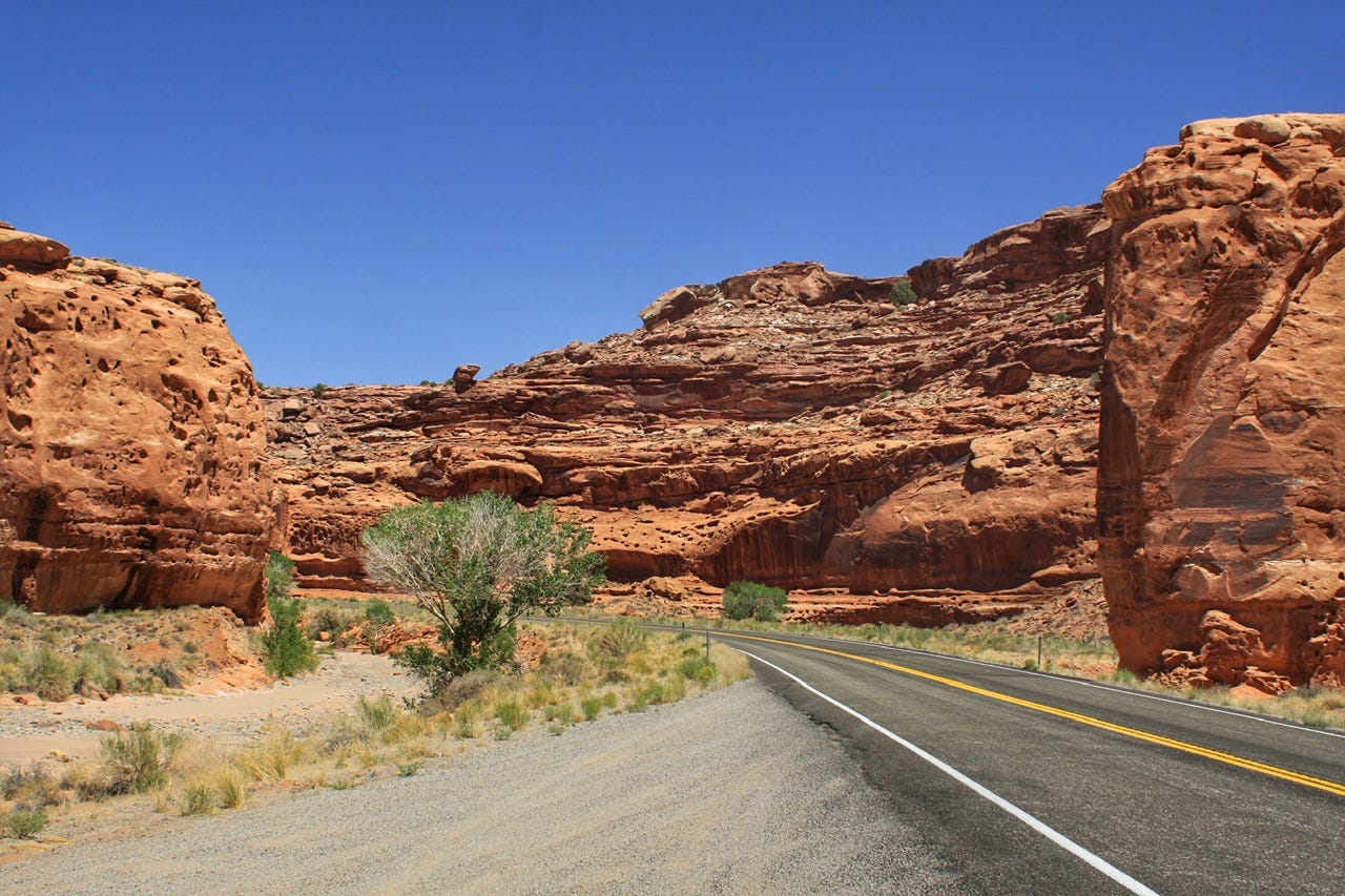
Highway 24
The beautiful scenery in Capitol Reef is not limited the scenic drive, so I had been wondering how I was going to figure out where those photos ended and where Highway 24 started. If I don’t happen to have a cell phone photo that is geo-tagged, then sometimes I can figure out where photos are from by scouring Google Earth. This time, though, I just had to look at the stripes on the road.
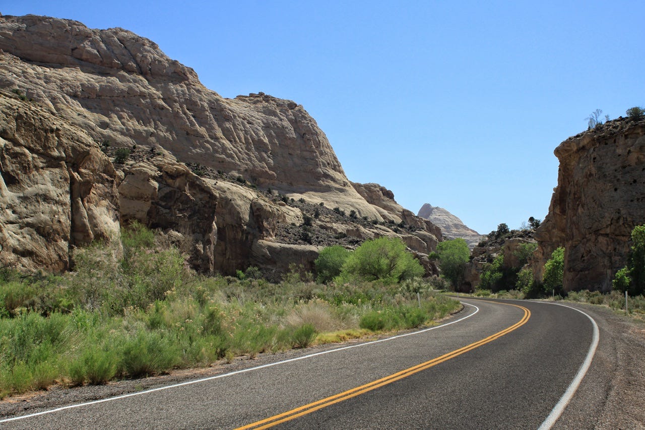
There are not a lot of paved roads in this part of Utah, so when Highway 24 was routed through Capitol Reef in the 1960s to bring in more visitors, it also became a major trucking route. Interstate 70 to the north, wasn’t completed until into the 1980s. Highway 24 is definitely the more scenic route of the two, and well worth going out of the way to see. The roads in this area have an interesting history.
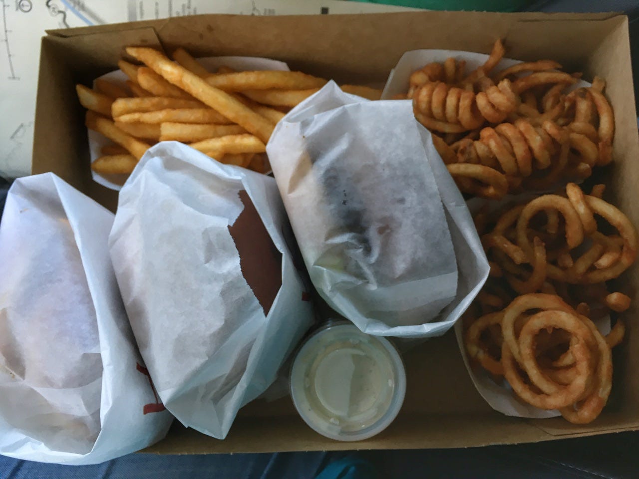
Stan’s Burger Shak
Highway 24 takes you to Hanksville, Utah, home of Stan’s Burger Shak…and probably the best burgers and fries in all of Utah. Granted, we haven’t had any fast food for quite some time at this point on the trip, but we’ve ate here before and it was good then too! The place doesn’t look like much on the outside, and it’s not fancy inside, but those types of places always seem to serve the best food!
While we waited for our food to be ready, we wandered through the gift shop. Megan found a cute shirt from Goblin Valley State Park, which we have visited twice before. We opted to skip it this time, since we were headed down Highway 95 next.
We also topped off the gas tank because there are no services for the next 130 miles.
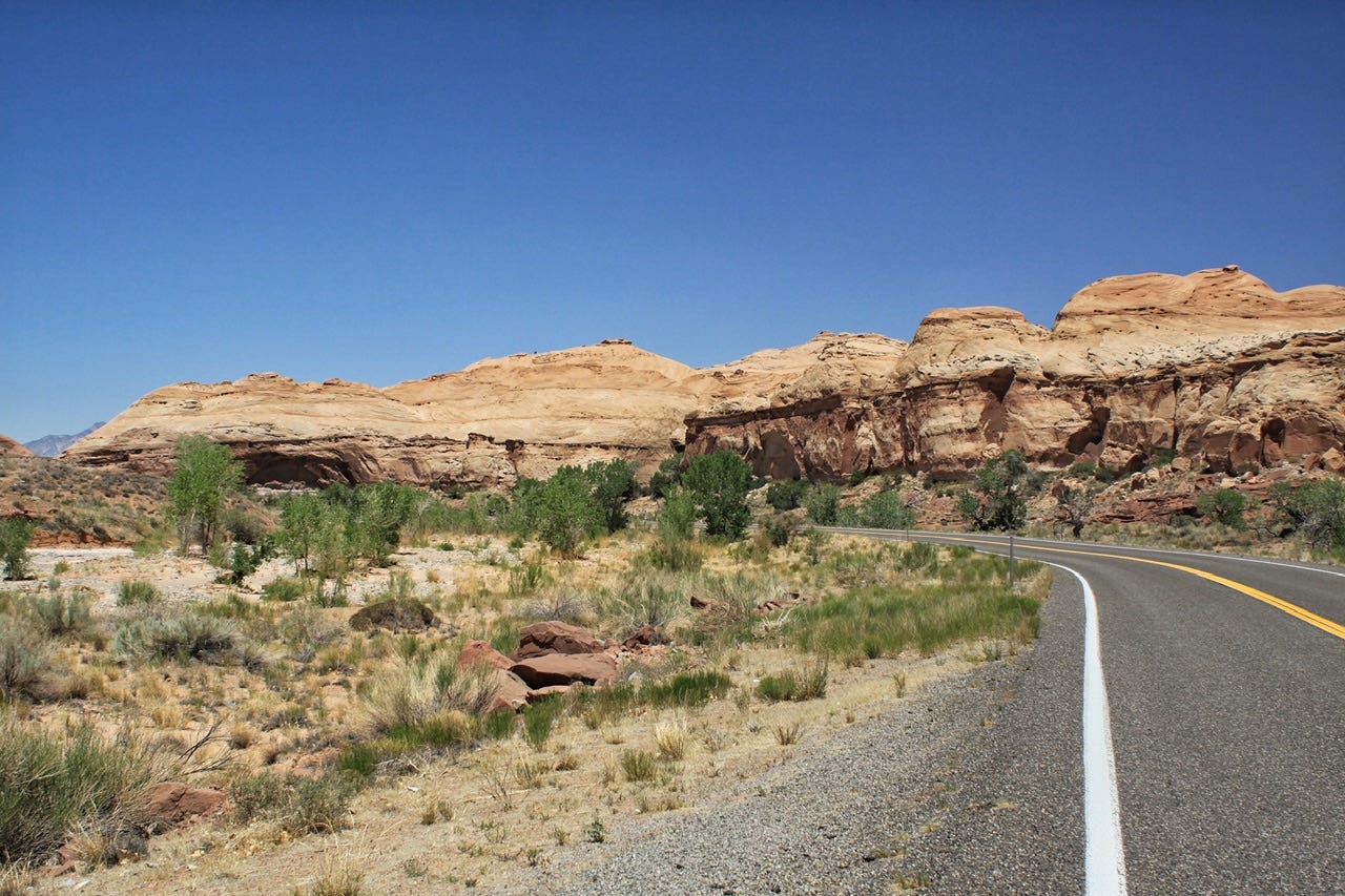
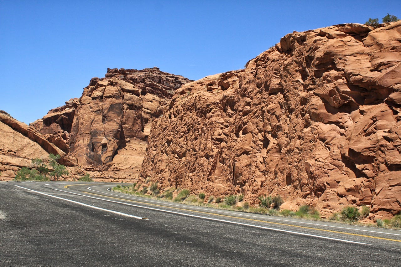
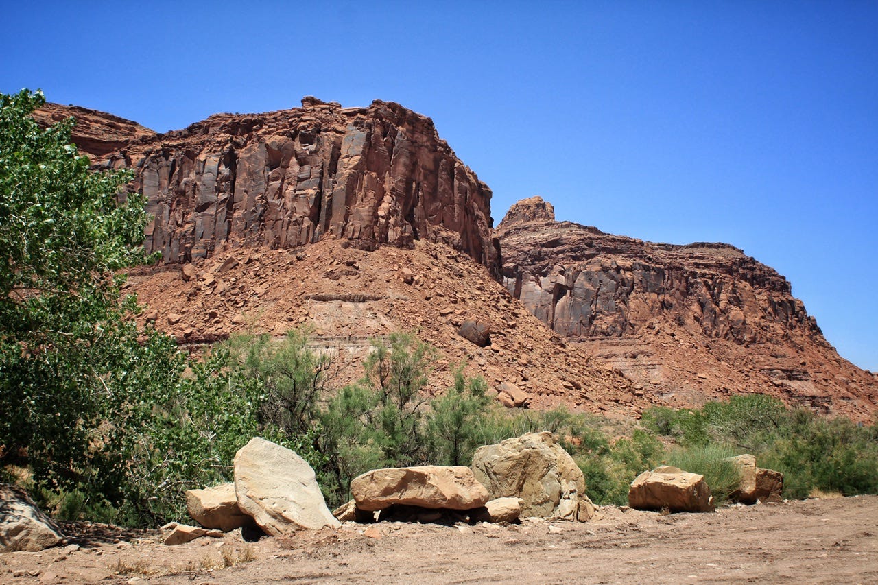
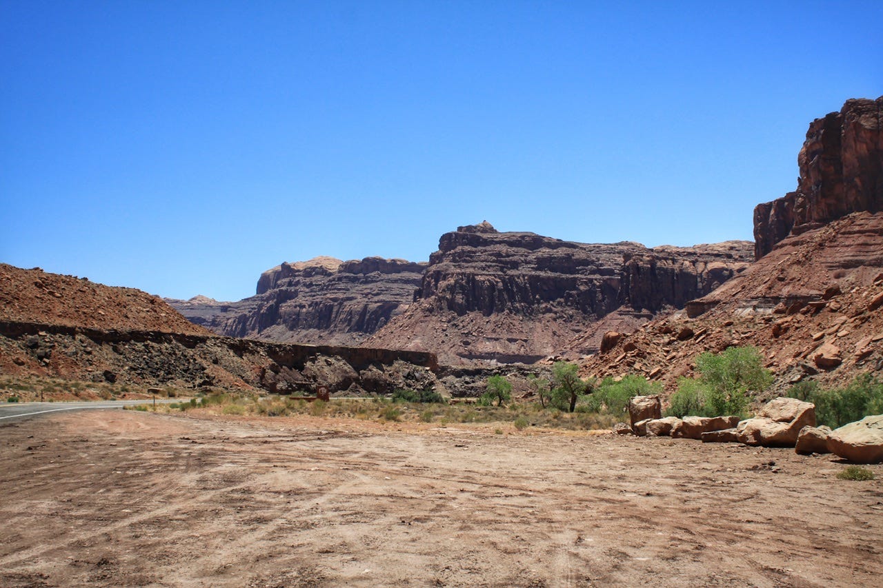
Scenic Highway 95
I had always read that Utah’s Highway 12 was the best scenic road in the state, but I think the folks who say that have never driven on Highway 95! I suppose beauty is in the eye of the beholder, as the saying goes. It’s not like Highway 12 isn’t pretty, with all the sweeping vistas of juniper-sprinkled desert, but the gorgeous red rock canyon walls found on Highway 95 are better! I love driving on curvy roads through canyons. You never know what scenery will be around the next curve.
Bicentennial Scenic Byway
Highway 95 is also called the Bicentennial Scenic Byway because it was completed in 1976 for the United States Bicentennial. Prior to that, it had been a dirt road.
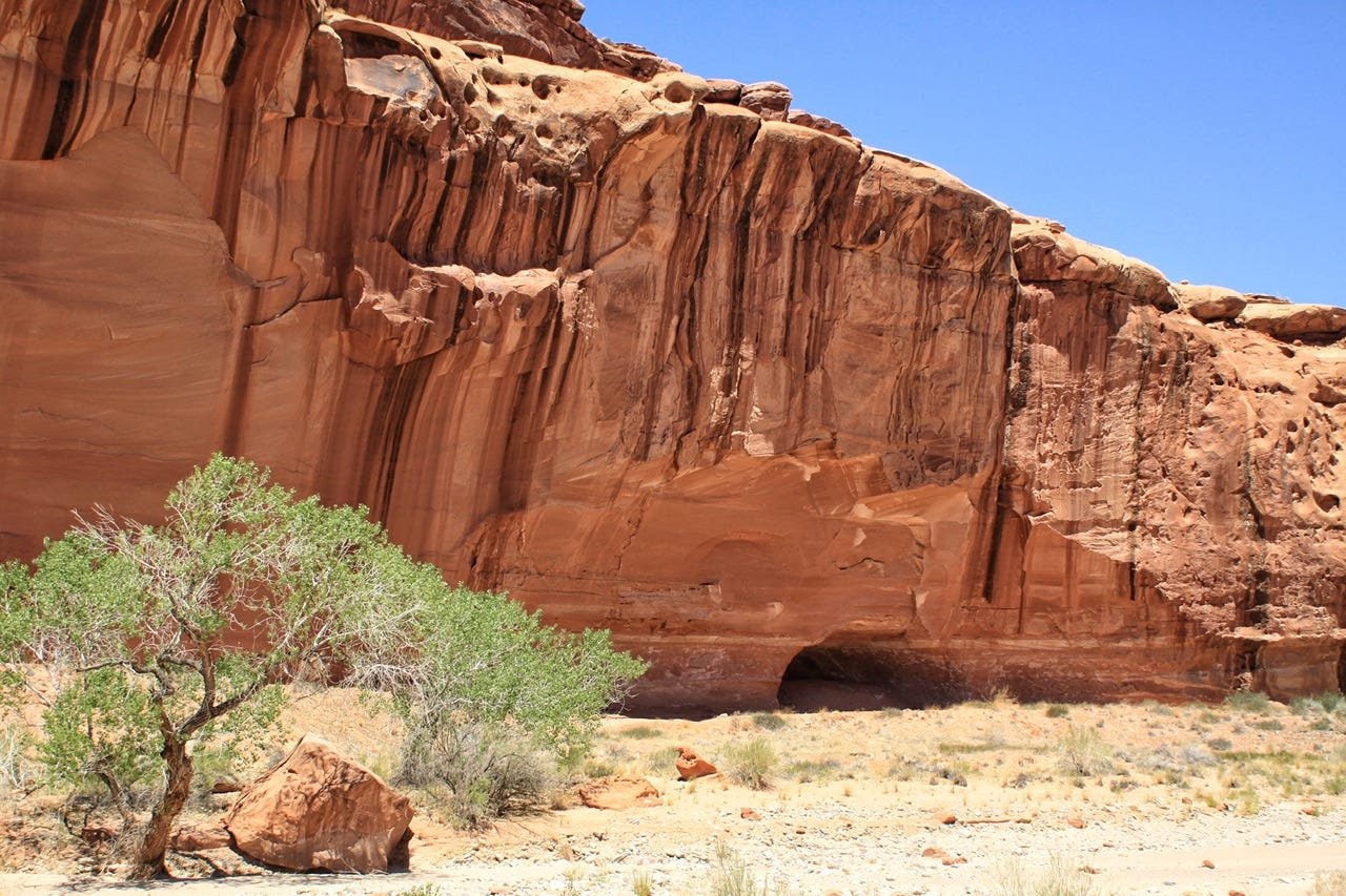
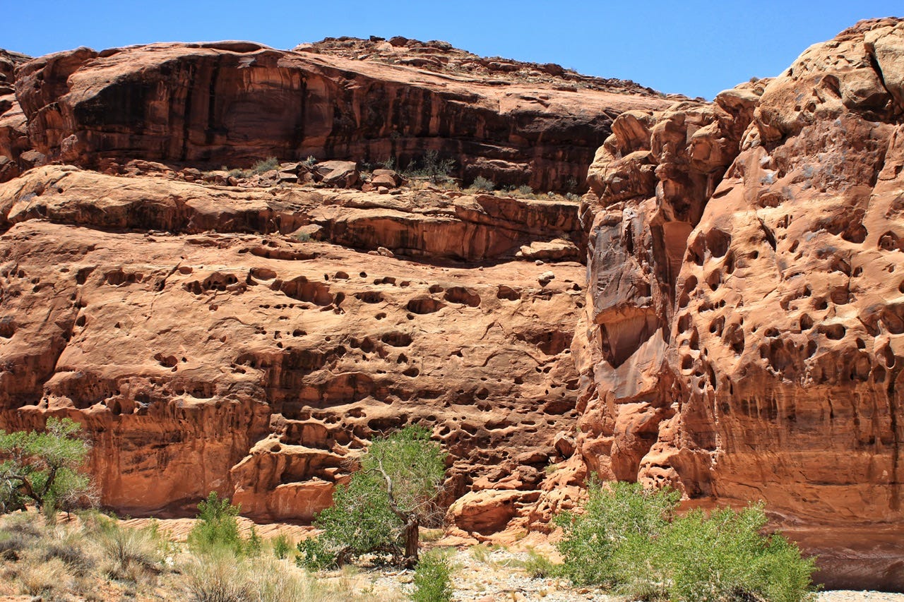
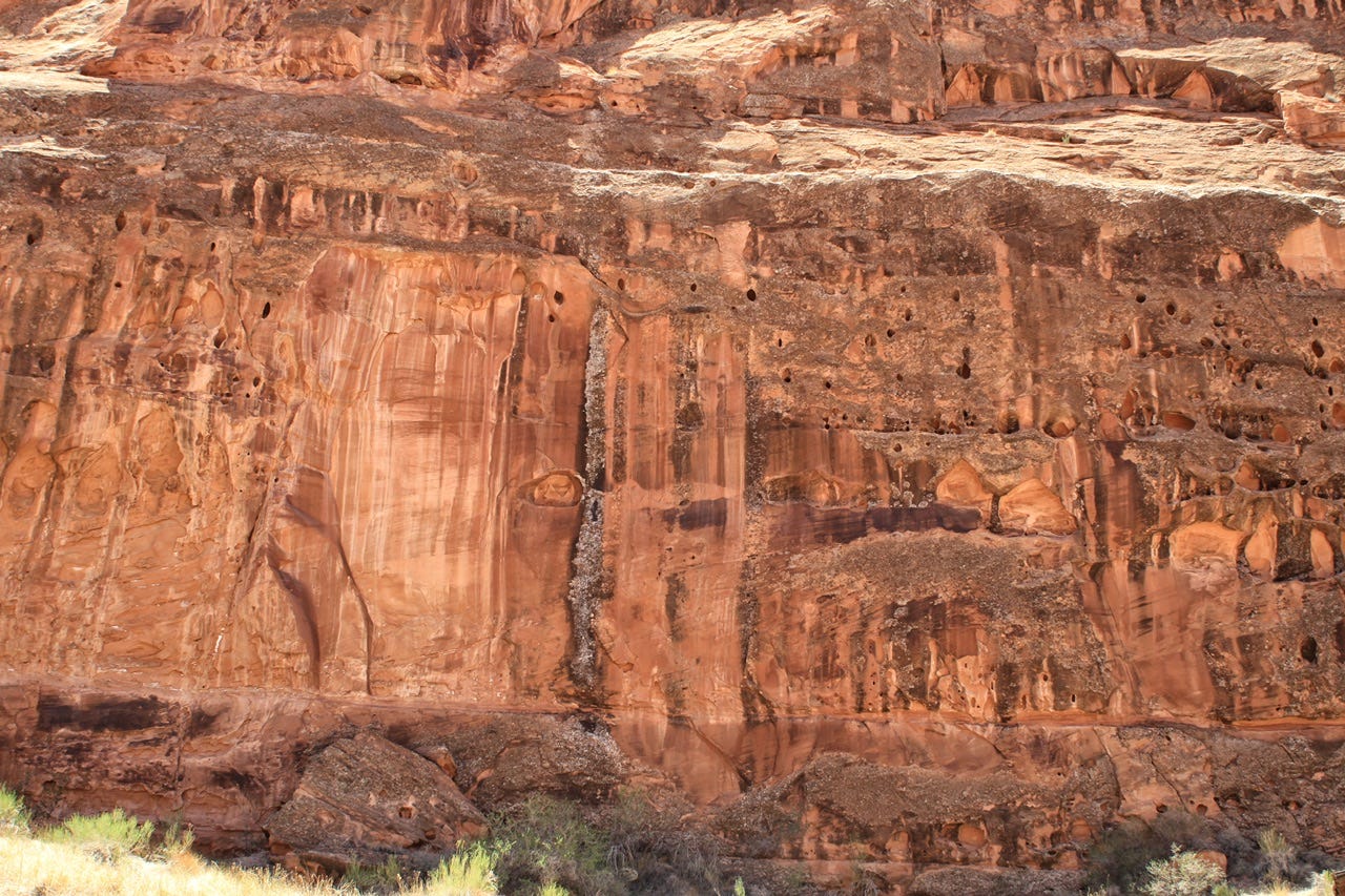
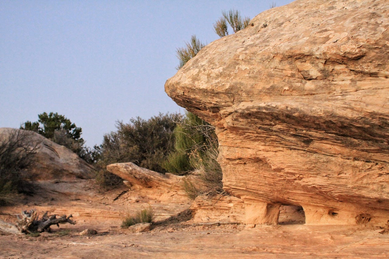
Desert Varnish
The rock surfaces in this area feature a lot of desert varnish. Desert varnish forms on surfaces that are more stable and not susceptible to weathering. I’m not sure that we’ve ever seen any as striking as this was!
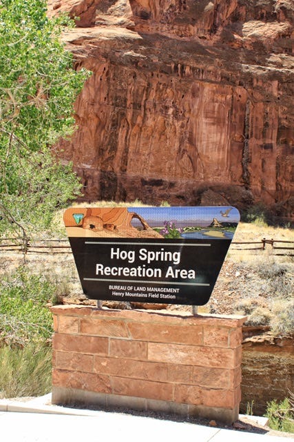
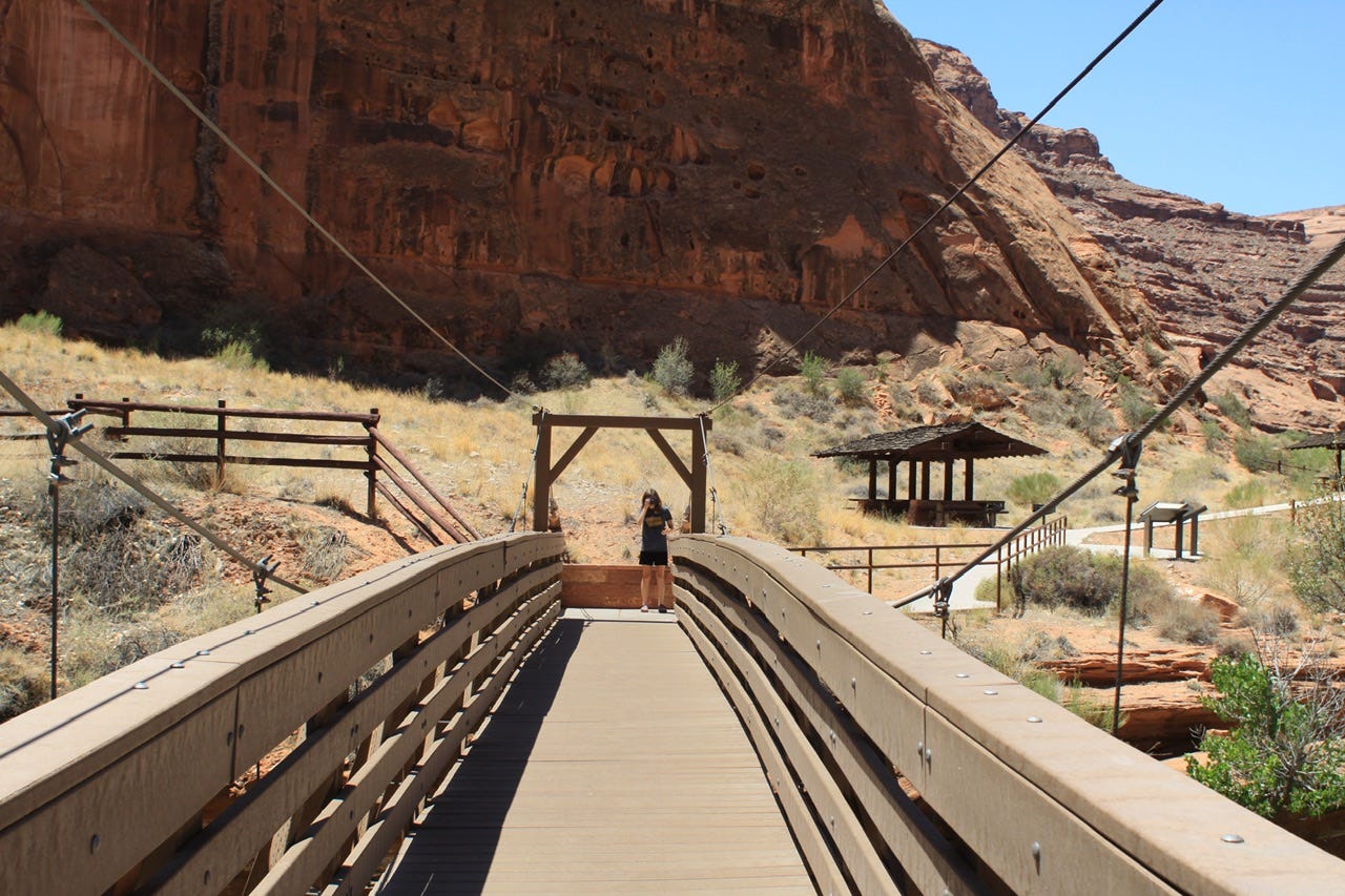
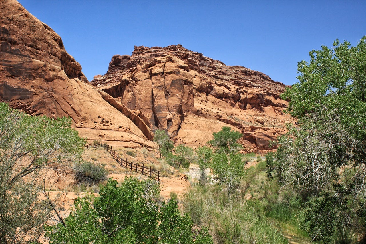
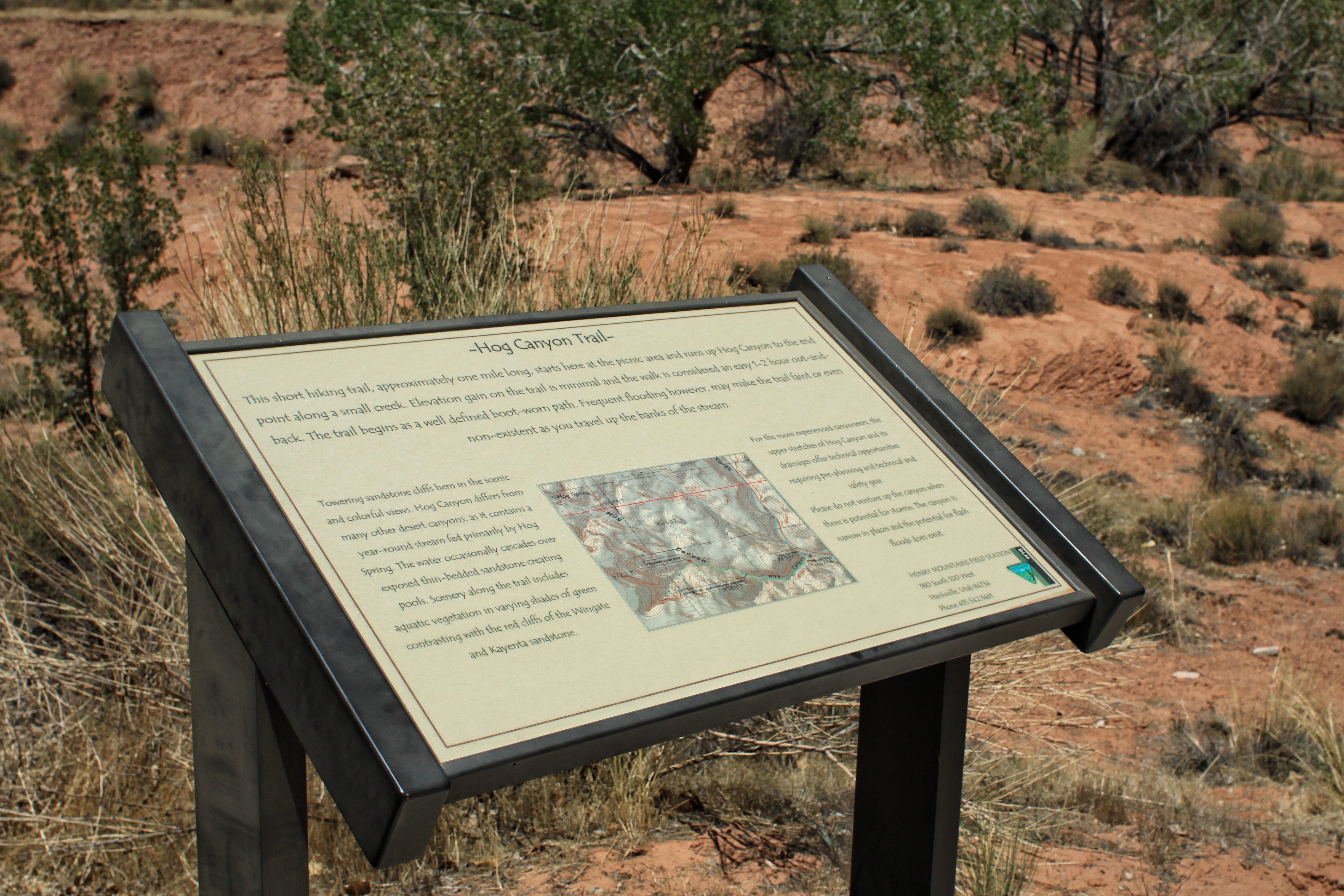
Hog Spring Recreation Area
About thirty minutes after leaving Hanksville, we stopped at Hog Spring Recreation Area to have a look around. The mid-day sun was hot and we still had that campsite to find, so we did not go for a hike on the trail. I didn’t know anything about this stop at the time, but we missed a pictograph called the Cleopatra panel, so we’ll have to go back again someday to find her!


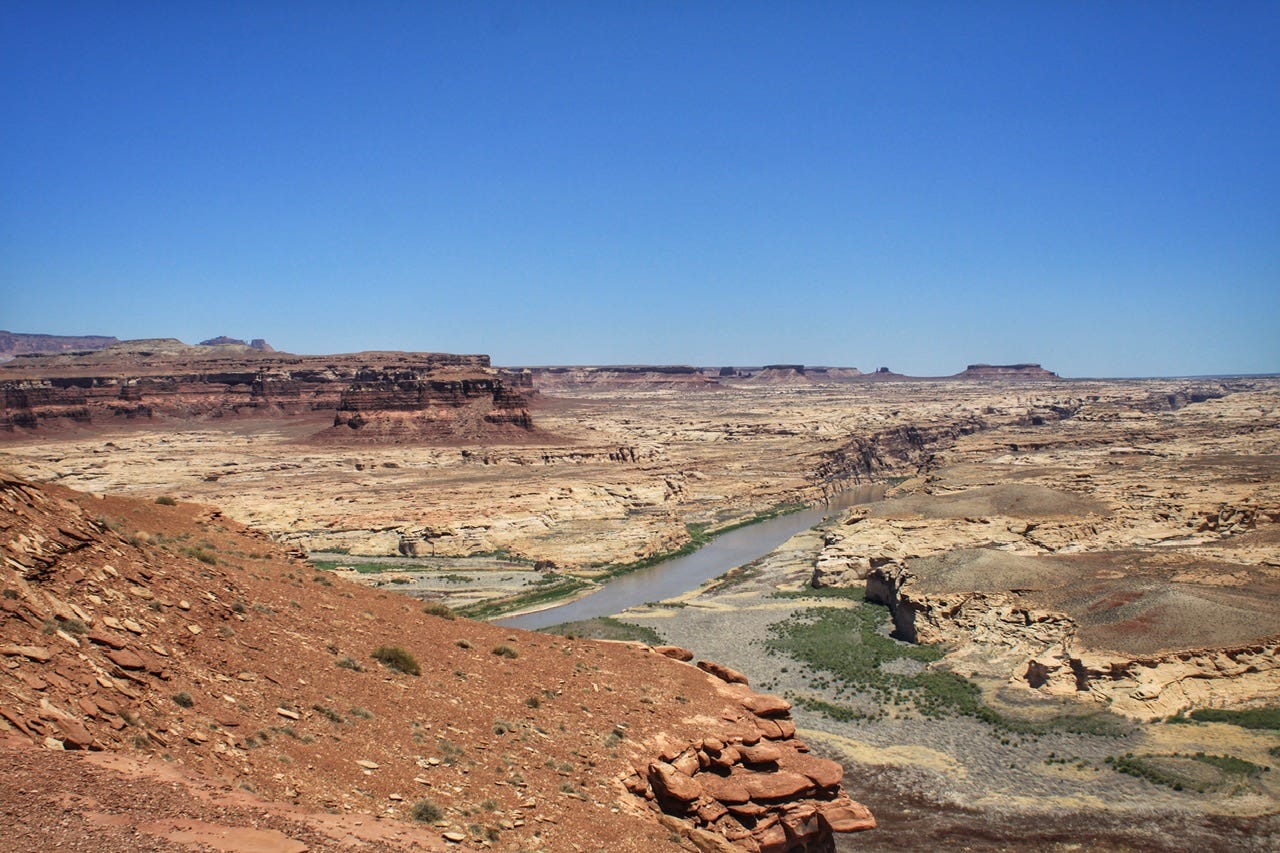
Hite Overlook
Our next stop on Highway 95 was Hite Overlook. I was curious what exactly this was supposed to be an overlook of, since it kind of looks like more water had been present in the past. Sure enough, this area had been full of water at one time. I found a fifty year photo history of someone who had stopped at the overlook many times between 1971 to 2021. I don’t know enough about the situation to know if water being here or not is good or bad, but it’s certainly different than it once was.
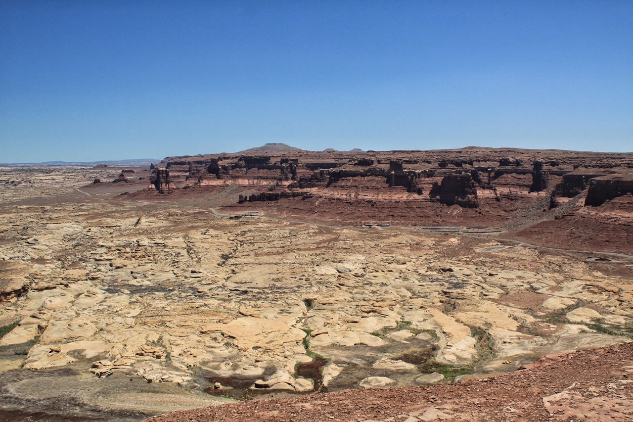
We didn’t know it at the time, but what we are looking at here, is Hite Marina across the way. There is/was a large boat ramp that once led into the water of Lake Powell, which would’ve covered all of the lighter rock in the photo. There was also a campground, gas station, and a ranger station for Glen Canyon National Recreation Area. All services have been suspended and the road to them is now closed.
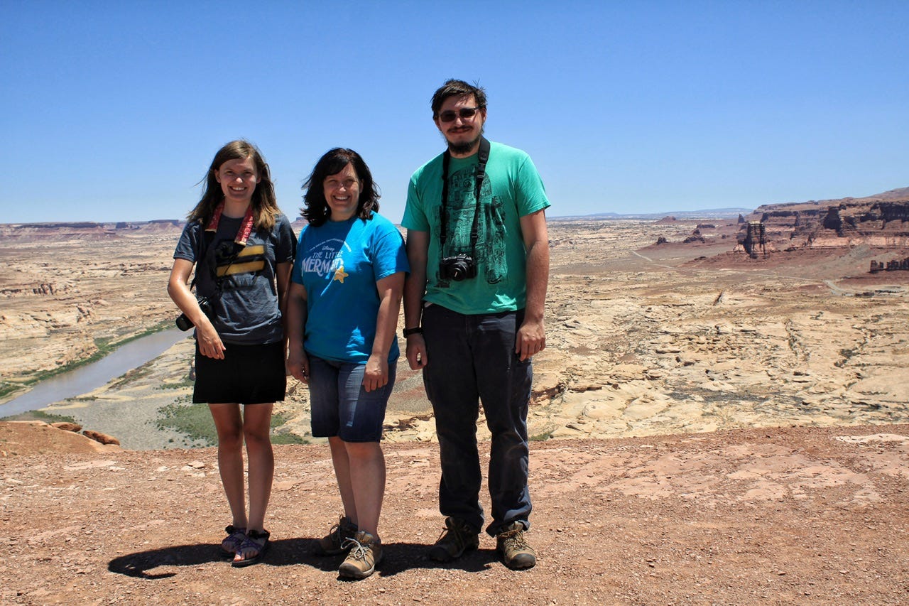
When we were there, a couple asked if we wanted our picture taken, so we took them up on it and then did the same for them. I don’t remember where they were from, but they were driving through the hot sun of the desert in a white convertible with the top down.
An hour and apparently, no more photo-worthy stops later, we reached our destination for the day, Natural Bridges National Monument. Our first order of business was to find ourselves a place to call home for the night.
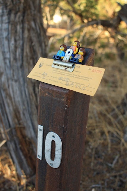
Natural Bridges Campground
The campground only has thirteen campsites, and there were two left when we arrived, sites 10 and 11. We debated the pros and cons of each and since site 11 was an accessible site that was closer to the pit toilet, we opted to grab site 10, even though the tent pad was closer to the road. It was a good thing we decided when we did because right after we parked, someone else took site 11 and the campground was full by 3pm. Since our visit, this campground has switched over to reservation-only.
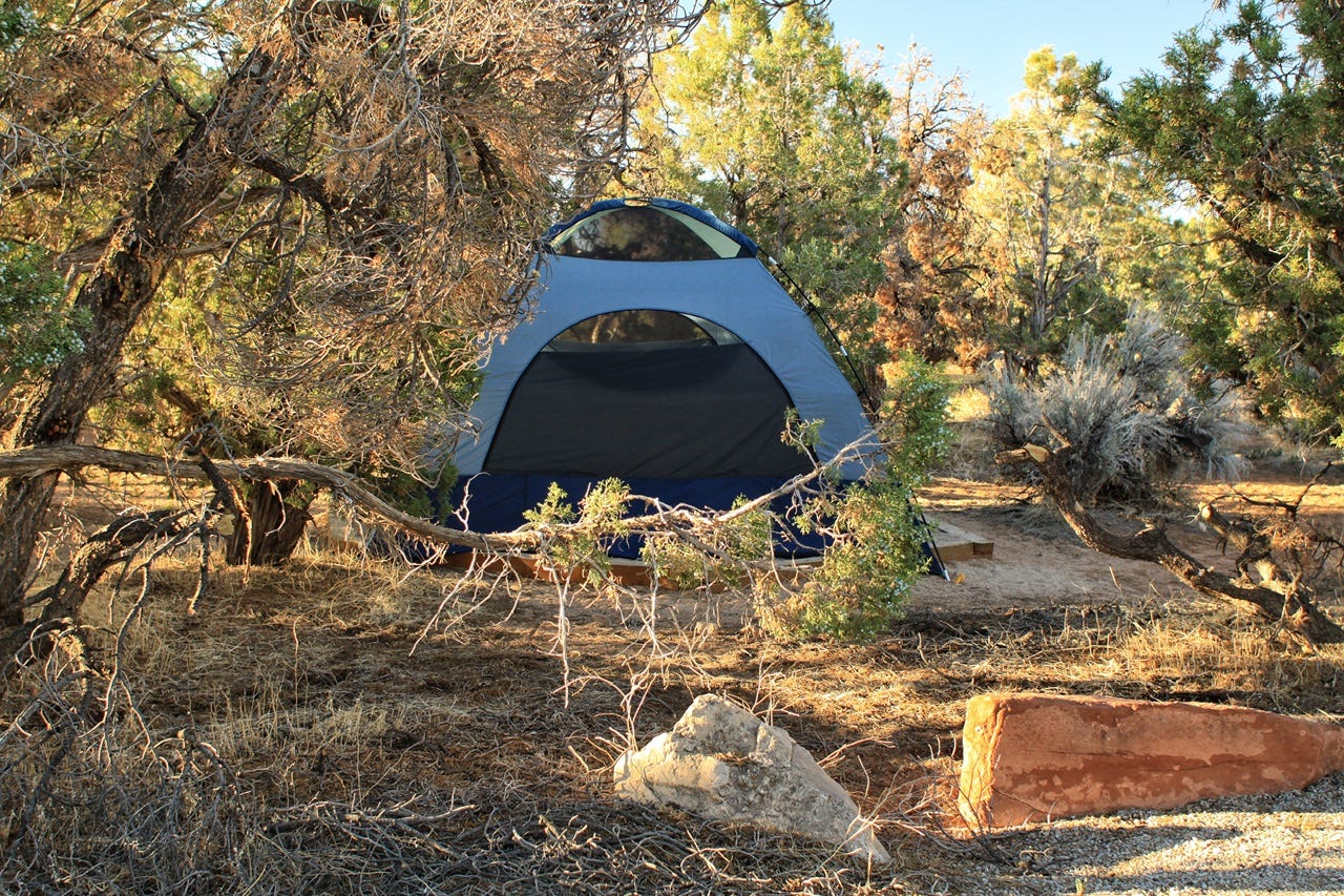
I always have to chuckle at the disheveled look of this campsite. This was the only angle that didn’t include a full view of the neighboring campsite. I think the oddest thing about this campground is that all of the tent pads are hexagons that are not made for eleven foot square tents. We had to put the stakes outside of the hexagon, with the tent wrapped over all of the edges.
After we had the tent set up, I cooked us something for supper, but I have no clue what it was. I know that I bought a pound of hamburger on our Walmart run the day before, but I am fairly certain that I did not make burgers on the same day that we had the best burgers in Utah for lunch.
After supper, we went for a drive on Bridge View Drive, the park’s scenic drive.
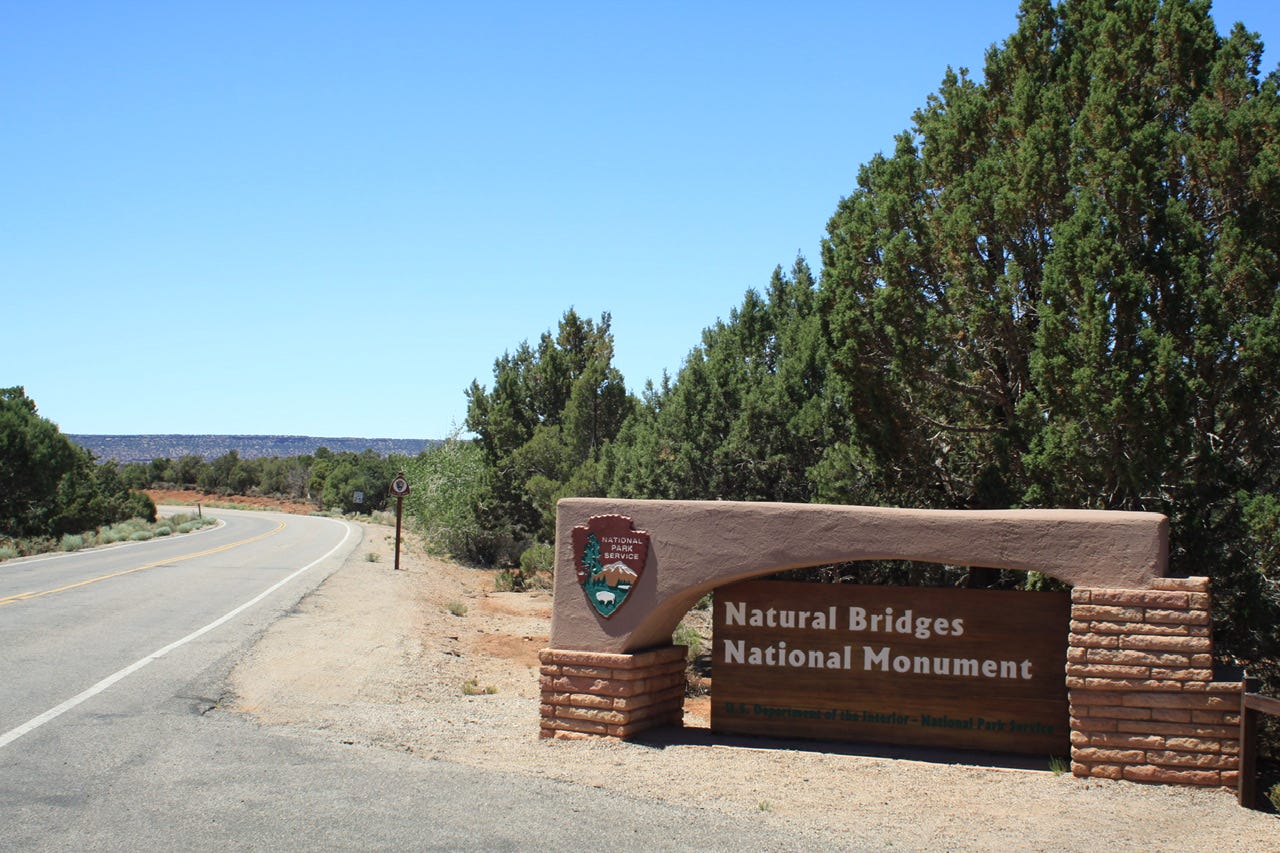
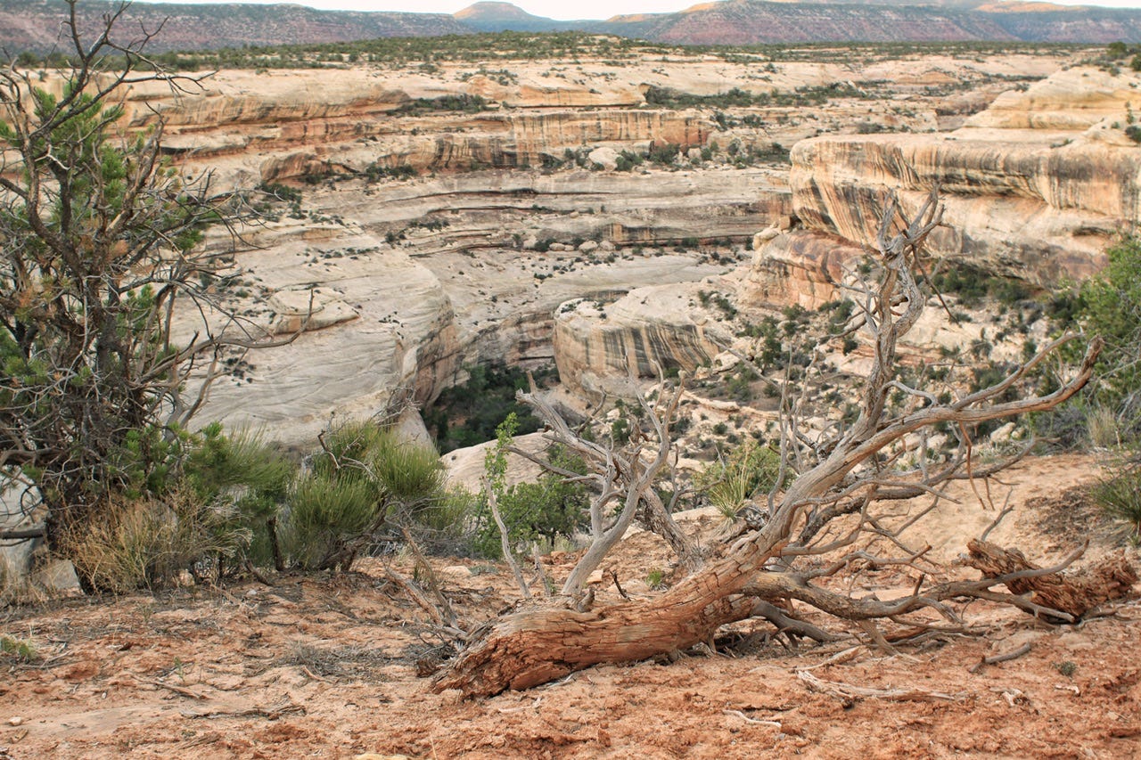
Natural Bridges National Monument
Natural Bridges National Monument was designated as a national monument on April 16, 1908 and became the first national monument in Utah. The only way to visit the park for decades was by riding on horseback for three days! The uranium boom in the 1950s created roads that made it easier to reach the park, but there wasn’t a paved road to get there until 1976 when Highway 95 was paved. On March 6th, 2007, Natural Bridges National Monument became the first International Dark Sky Park certified by the International Dark-Sky Association.
The natural bridges were officially given Hopi names "Sipapu," "Kachina," and "Owachomo" in 1909. Previously, they had been named “President,” “Senator,” and “Congressman” and then renamed to “Augusta,” “Caroline,” and “Edwin.” Let’s hope it’s safe to assume that the previous names won’t be resurrected anytime soon!
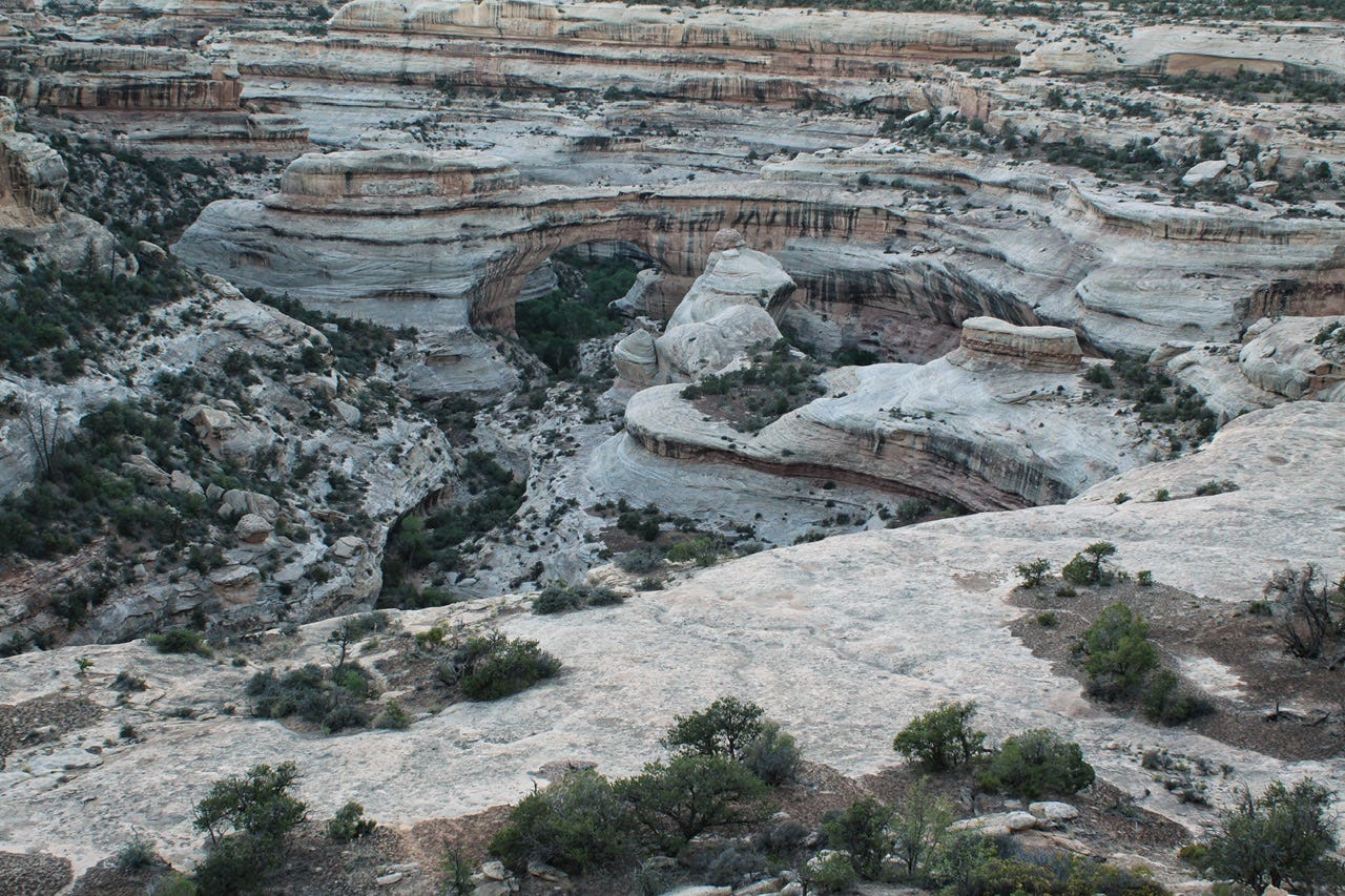
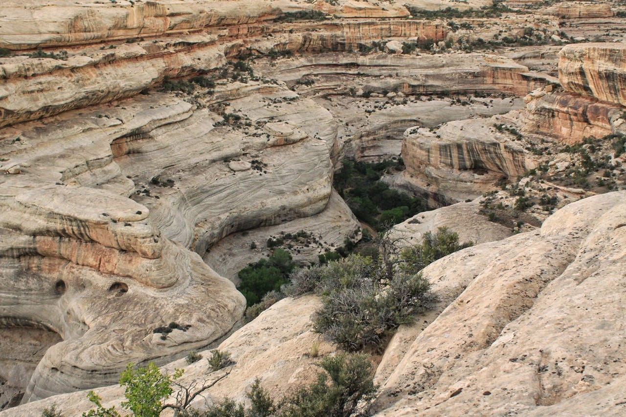
Sipapu Bridge
Our first stop was Sipapu Bridge overlook. Sipapu Bridge is the largest natural bridge in the park and the second largest natural bridge in America. (The largest is Rainbow Bridge.) Sipapu means “place of emergence,” an entryway that the Hopi believe was where their ancestors entered the world. That also seems like a fitting name for the first natural bridge along the one-way scenic drive. Sipapu Bridge is 220 feet tall, 31 feet wide, 53 feet thick, and has a span of 268 feet.
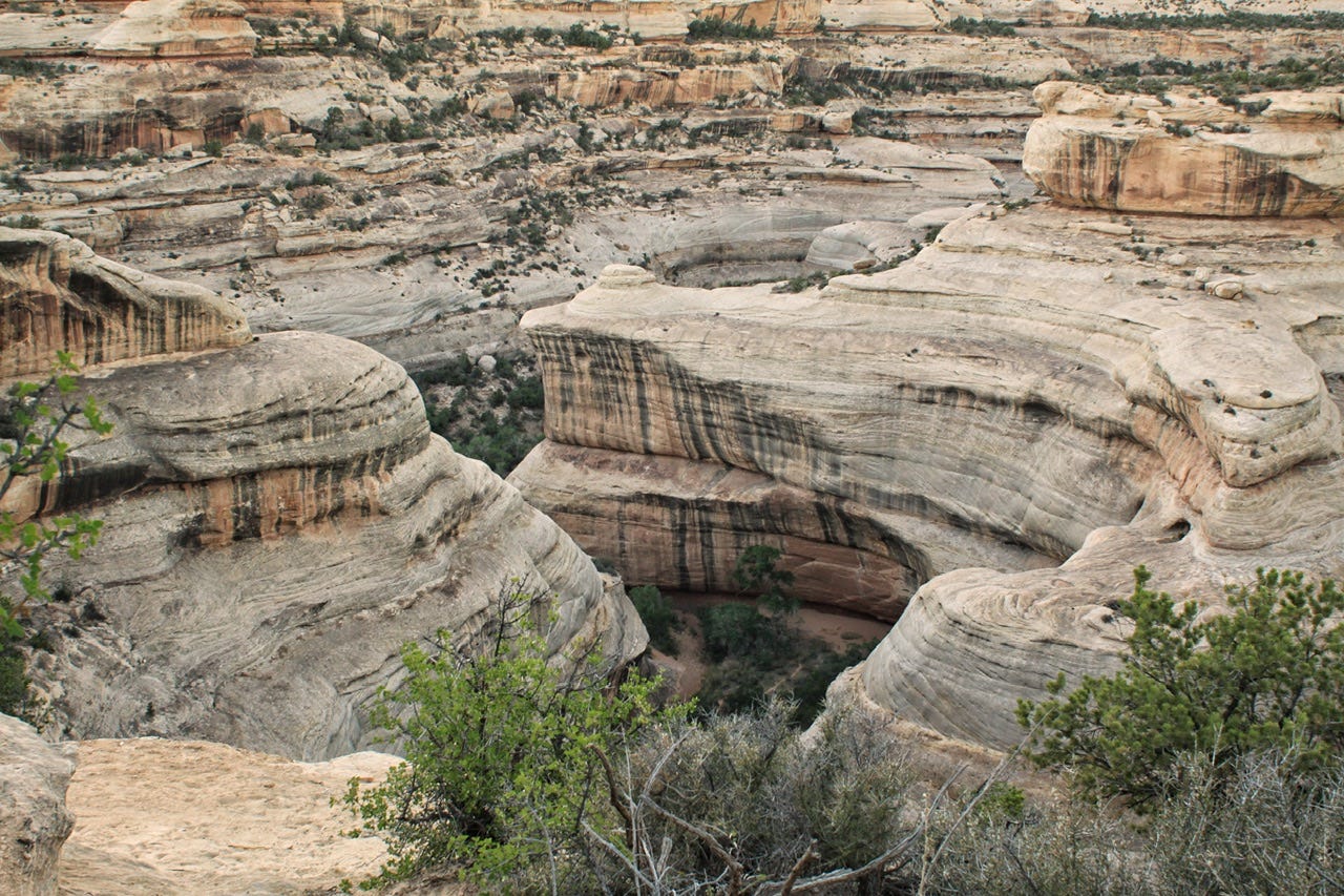
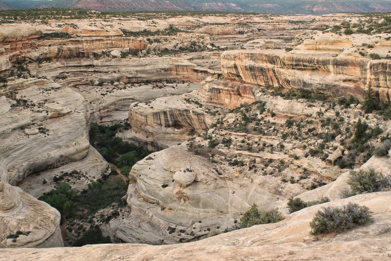
Kachina Bridge
Our next stop was Kachina Bridge, which was named for the rock art found on the bridge that is similar to the symbols used on kachina dolls. It is the middle bridge, both in size and distance from the other two bridges. In June 1992, 4000 tons of sandstone fell from inside the opening, making it bigger…would not have wanted to be hanging out under it on that day! Kachina Bridge is 210 feet tall, 44 feet wide, 93 fee thick, and has a span of 204 feet.
I wish we had hiked down to all of these, but we were on a mission to see them all before it got dark…one more to go!
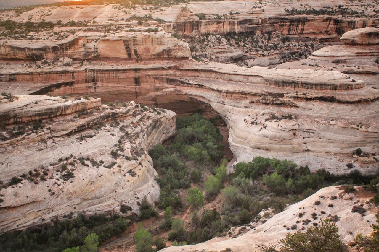
Owachomo Bridge
Our last stop was Owachomo Bridge, which means “rock mound” in Hopi. It was named for the rock mound on top of the eastern side of the bridge. Owachomo Bridge is the smallest and thinnest bridge, and thought to be the oldest of the three. Owachomo Bridge is 106 feet tall, 27 feet wide, only 9 feet thick, and it has a span of 180 feet.
You Never Know Who You’ll Meet
While we were at the Owachomo Bridge overlook, we met a photographer who was arriving to set up for night sky photography. We chatted for a bit and she told us all sorts of fun stories, including one about how she had accidentally got a photo of an arch lit up in red from some hikers with red headlamps in Arches National Park a night or two before. Light painting is illegal in Arches, so she was excited about how lucky she had been to be in the right place at the right time. She told us we could join her if we wanted to, but I wasn’t sure if she actually wanted the three of us to do that.
It was only 10pm and not time for the Milky Way to be visible yet, so we said we’d think about it and maybe we’d come back after we put all of our stuff in the tent. She told us her name was Diane and that we could find her work at Show Center Studios.
At the time, I wasn’t keen on hanging out with a stranger in the dark, in the middle of nowhere, but when I looked up the website today, to see if I might find a photo from that night, her bio says she had retired her day job and was spending time learning about the national parks before volunteering for the National Park Service.
The website didn’t have any photos from Natural Bridges, so I snooped around on her Instagram and found a photo she took that night! I kind of wish we had joined her! We might have learned something, along with seeing the stars. If anything, she seemed like a fun lady with the gift of gab, so I’m sure it would’ve been entertaining.

Once we were back to our tent, and had all the sleeping gear set up inside, the idea of going back out again was less appealing, plus the kids wanted to work on their Junior Ranger books for a bit before we went to sleep. We decided that we would get up early in the morning and capture a sunrise instead.
We still have not made it to our “destination” park, but that’s coming up next time, so be sure to subscribe to find out where we’re off to next!
Gorgeous pictures, would love to visit there one day.