


The Day We Learned About Yaupon Holly
Utah and Colorado

Day Ten
Wednesday, June 16, 2021
Devils Garden Campground
5:42 a.m.
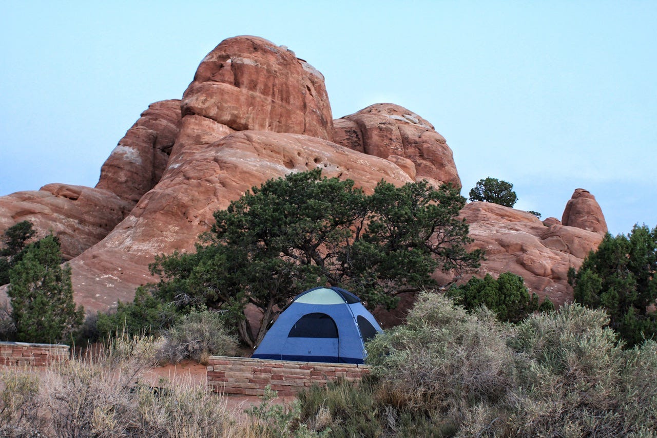
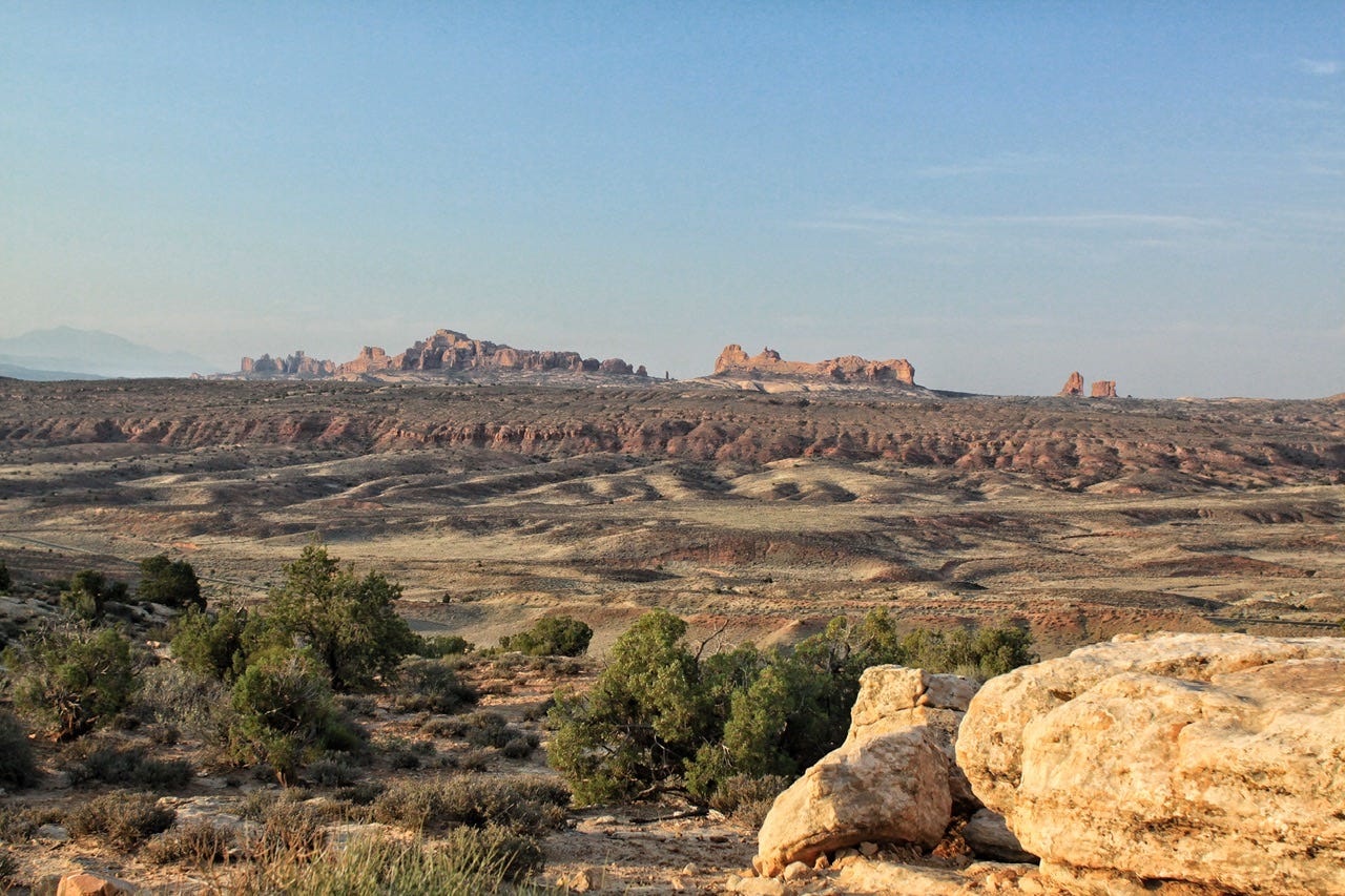
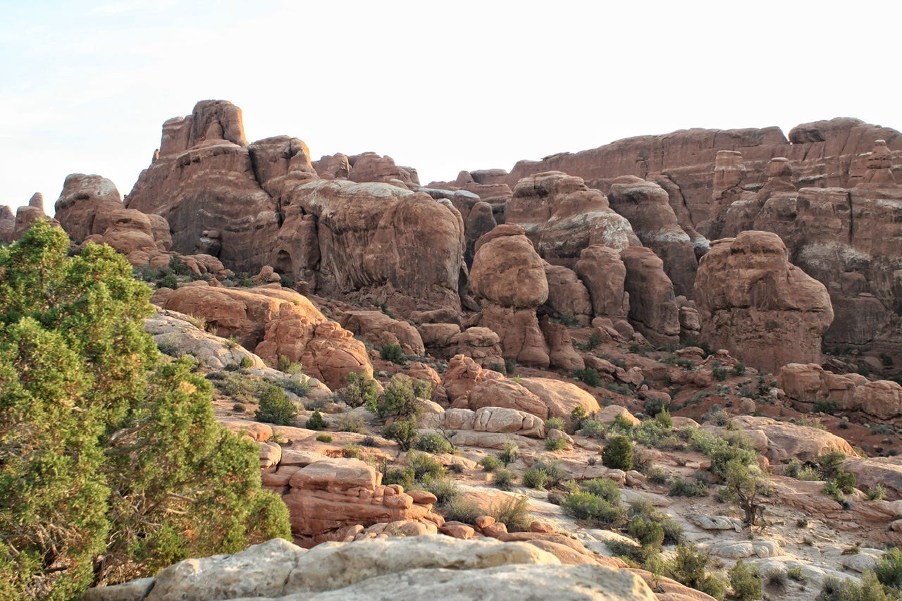
I’ve always thought the best part of arriving at a campground after dark, or as the sun set, was the view in the morning when I unzip the tent zipper for the first time. It’s like unwrapping a surprise! Today’s surprise was the gorgeous red rocks of Devils Garden Campground at Arches National Park. The colors were particularly vivid under the cotton candy colors of the sky before sunrise.
I also love how peaceful campgrounds are first thing in the morning before everyone else gets up for the day. There’s usually one or two other people out and about, quietly doing their morning routine.

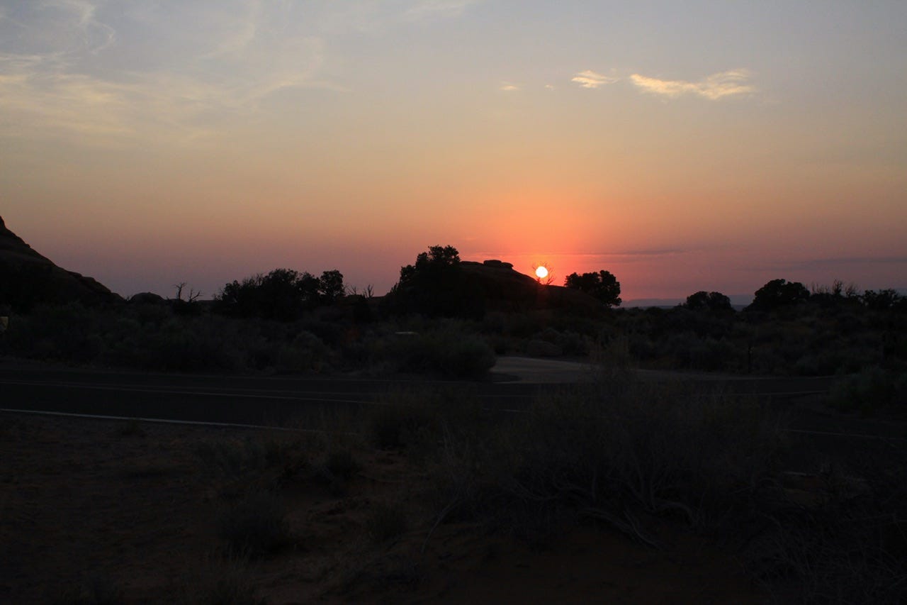
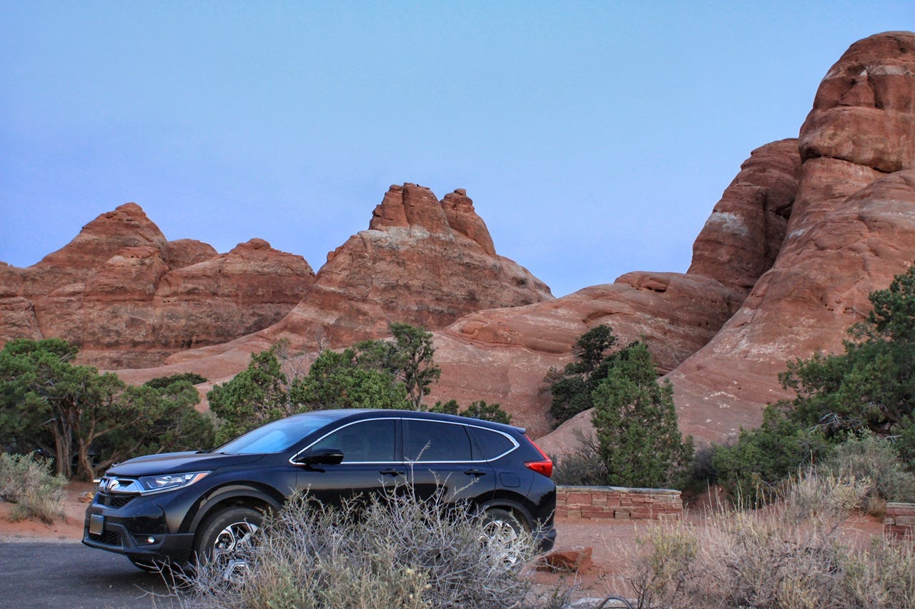
The sun peeked over the horizon at 6:06am. We didn’t smell smoke from the fire in the nearby LaSal Mountains at all during our one night stay, but there was still a bit of a haze in the sky. We packed up and were on our way out of the park by 6:40am.
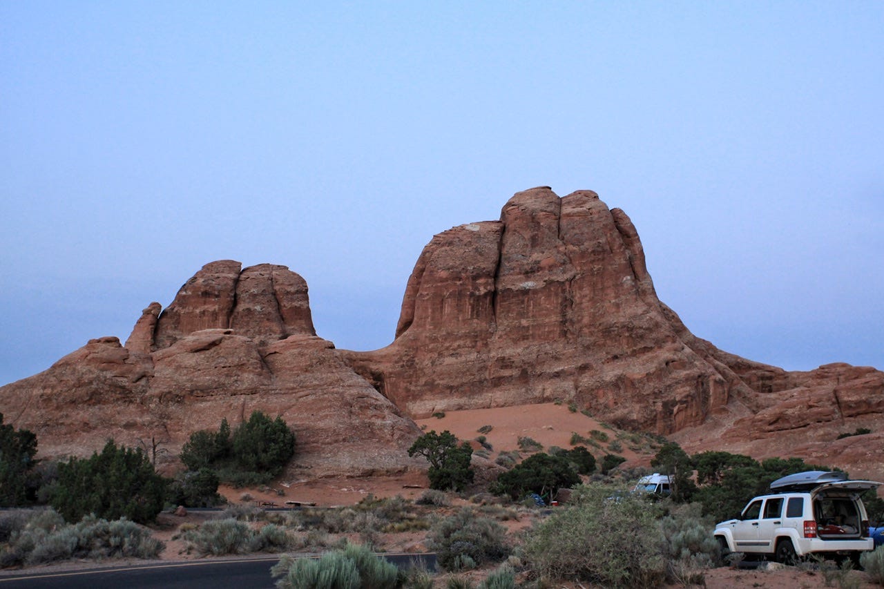
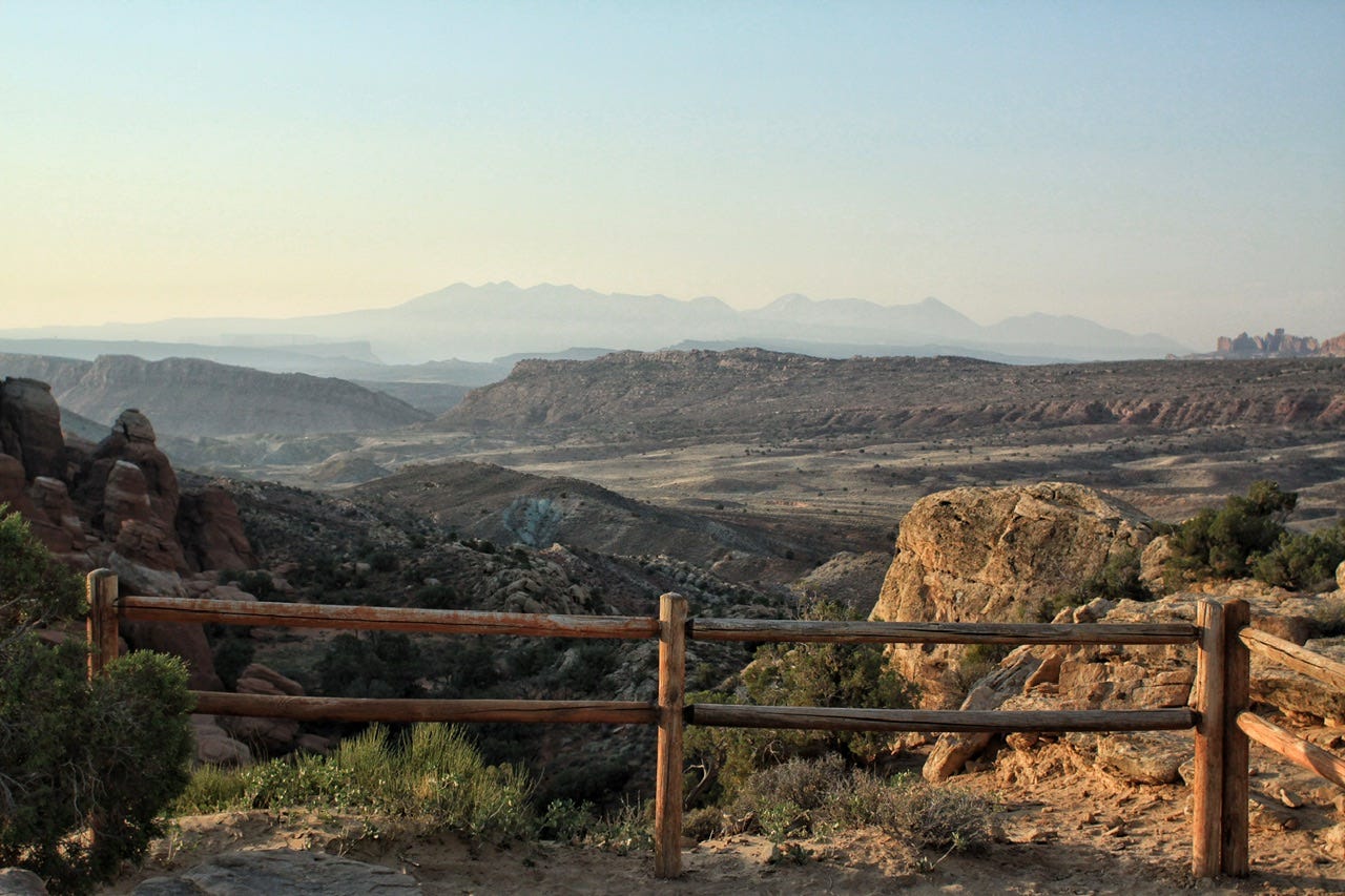
It seemed kind of sad to not spend more time in Arches on this trip. We had planned to spend more time in the park, but it was just too hot for hiking the day before. We also had a tour booked for 11am four hours away from here, so there was no time for a morning hike either. We enjoyed our short time in this gorgeous campground, along with the drives into and out of the park, so it was still a worthwhile visit. We also really enjoyed our day relaxing in Moab. We’ll be back to Arches again for a better visit soon!
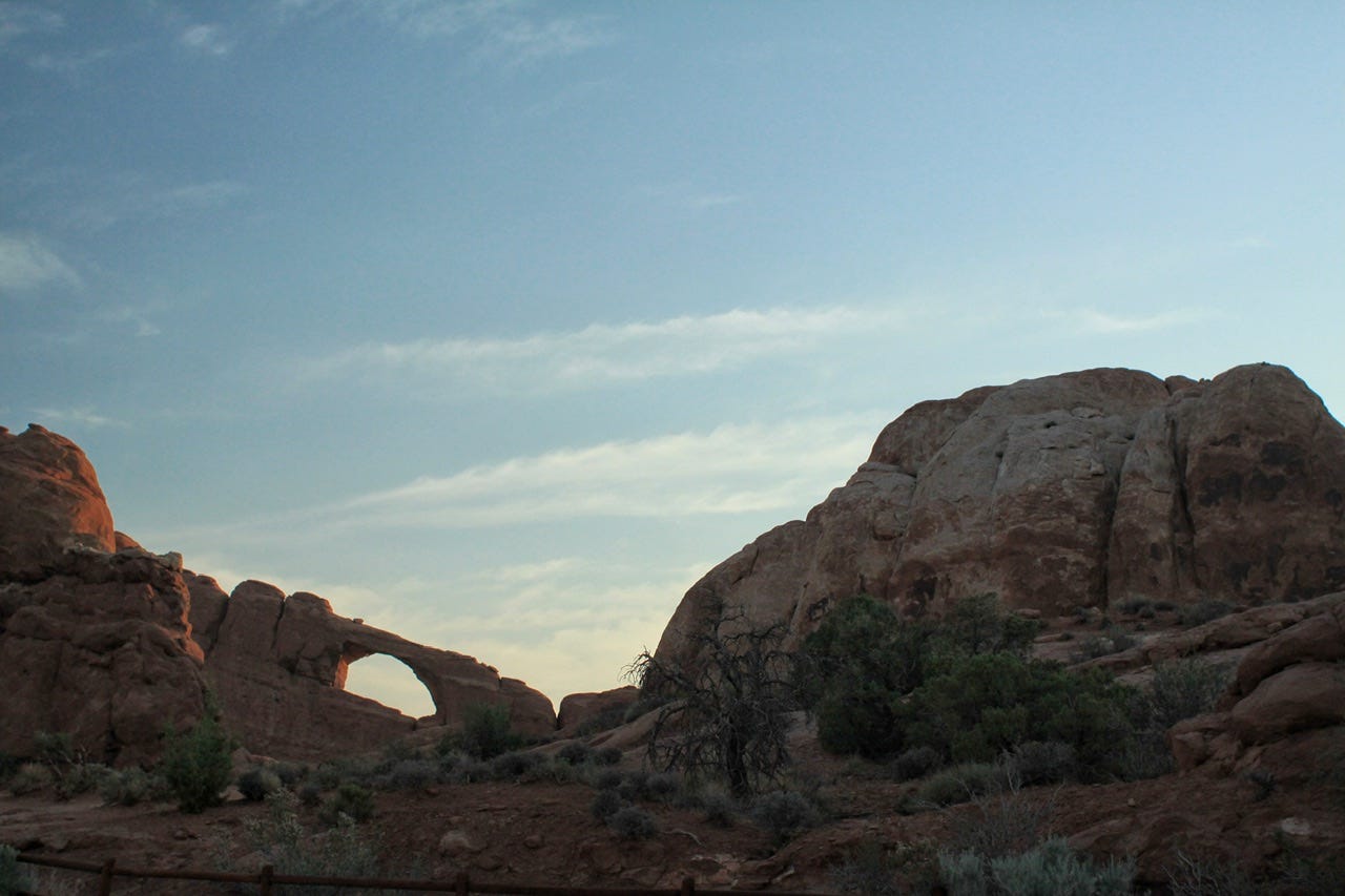


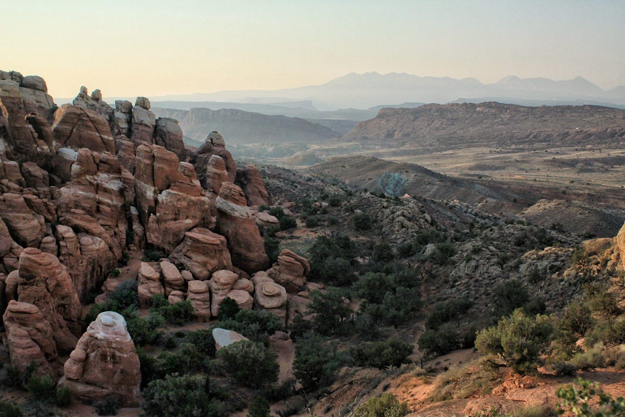
We departed the park before the visitor center opened for the day so I didn’t get a park brochure or the passport stamp for this visit. I thought I captured some amazing photos on our way out, though, so I guess that’ll have to do as proof of our visit.
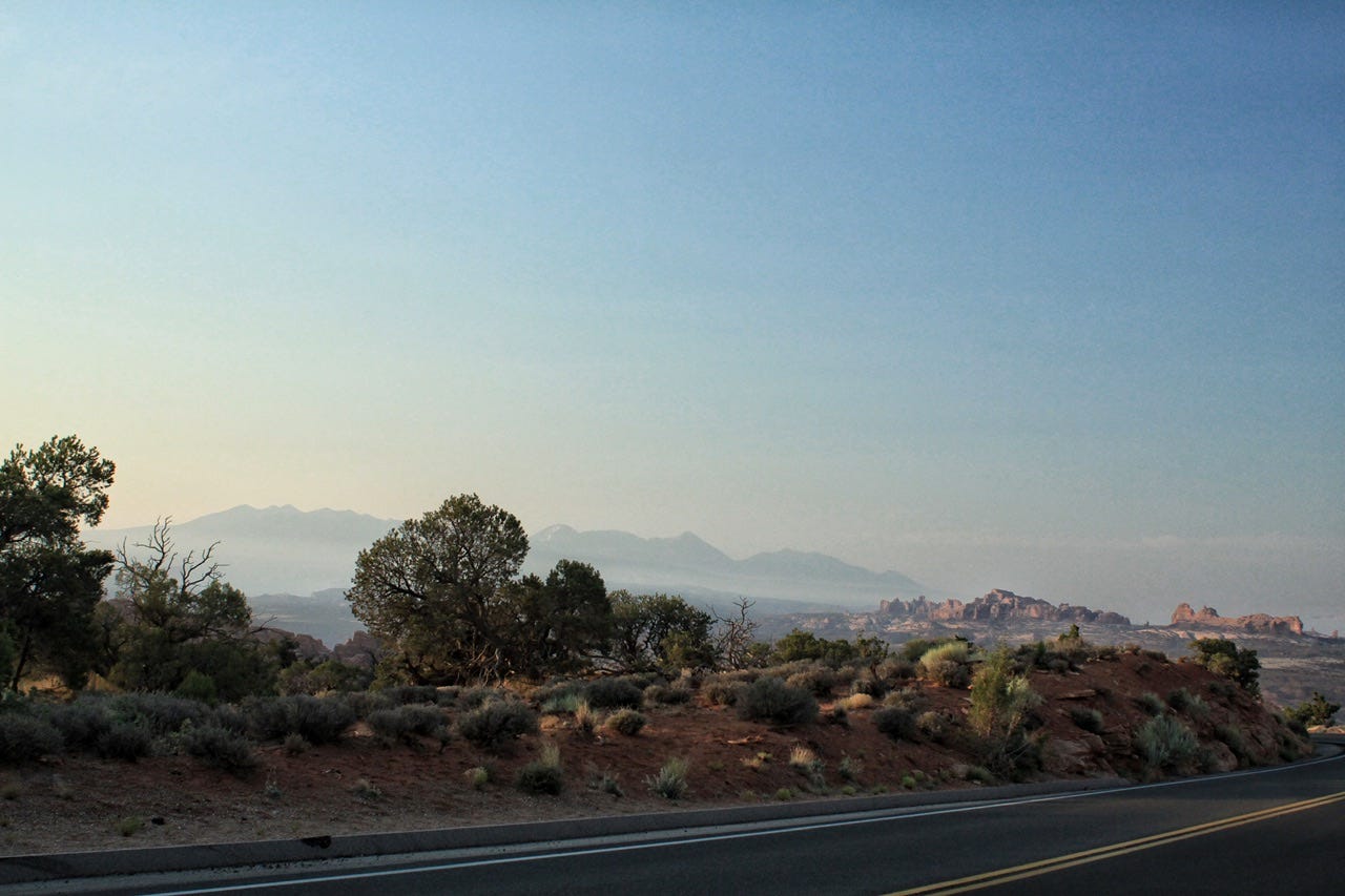
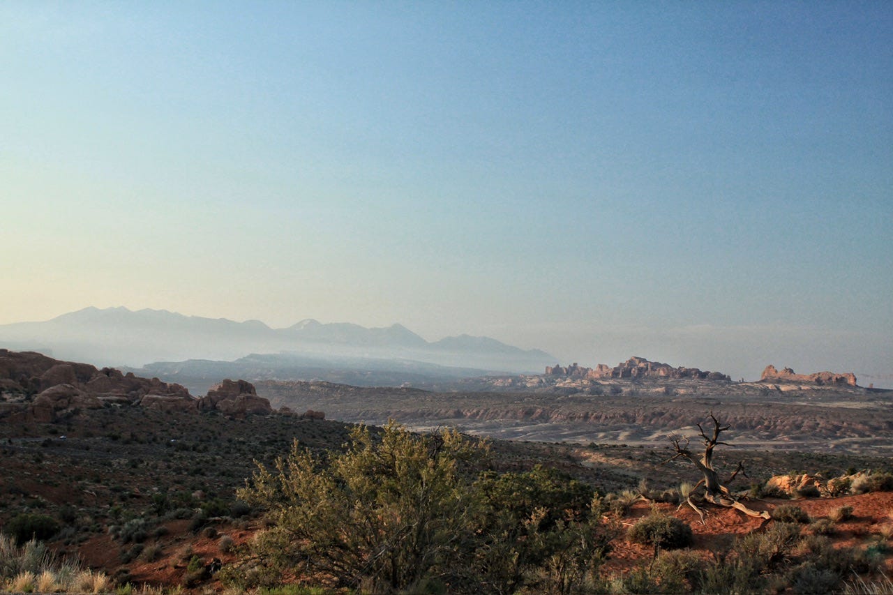
We topped off the tank in Moab and then hit the road for Mesa Verde National Park! I was pretty excited about this next stop because I managed to snag three tickets to an 11am backcountry cliff dwelling tour. From Moab, it was a two hour drive to the entrance of Mesa Verde, plus another hour to drive through the park.
Mesa Verde National Park
Mesa Verde became a national park on June 29, 1906 and was designated as a UNESCO World Heritage Site on September 6, 1978. It is also an International Dark Sky Park. The park protects thousands of Ancestral Puebloan sites, including 600 ancient cliff dwellings.
Guided tours of several major cliff dwellings are available every half hour throughout the day. When I visited Mesa Verde in 2011, I went on the $8 Cliff Palace tour, which was about a 45-minute tour that included fifty people. The cliff dwelling itself was neat to see up close, but we were hustled through with the next tour group lined up right behind us. We could’ve went on that same tour in 2021, but when I reserved our tour, there were a couple additional backcountry tours available. The backcountry tours were more strenuous two-hour tours for $25 each, with only ten people, and they were only offered once each day, two or three times per week. They sounded like a more unique experience, so I splurged on one of those tours!
I tried to find more information to refresh my memory about the cliff dwelling we visited, but there’s not much information available. The National Park Service doesn’t even list it on their website, at least not that I could find. I found a few mentions of it in old park newspapers from back in the day when the parks used to publish those, but from what I can tell, this tour is not offered very often. Somehow, we got pretty lucky to be able to visit this cliff dwelling!
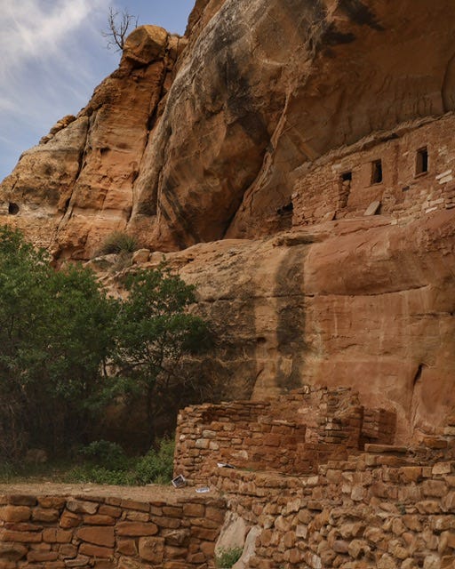
Wetherill Mesa
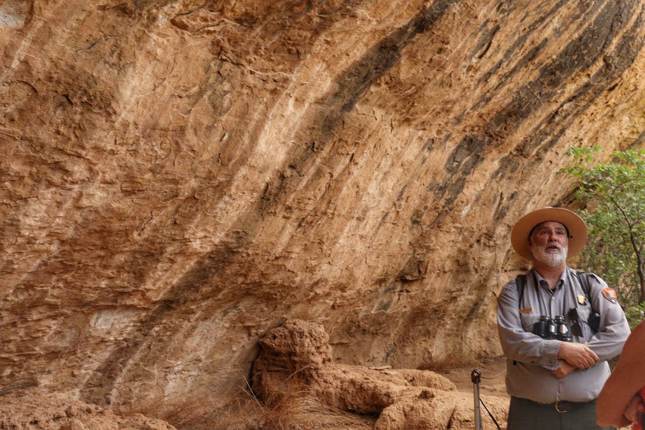
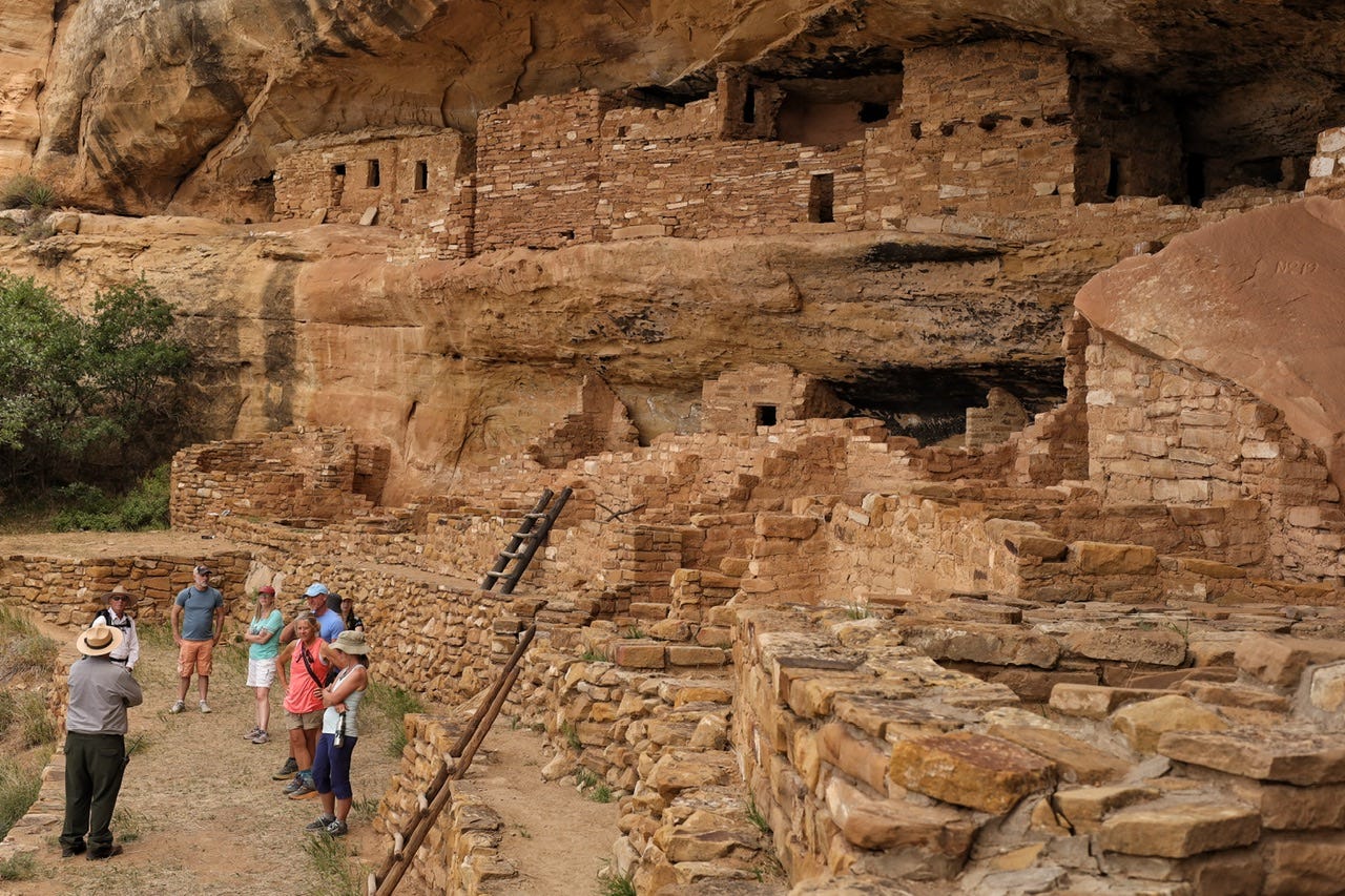
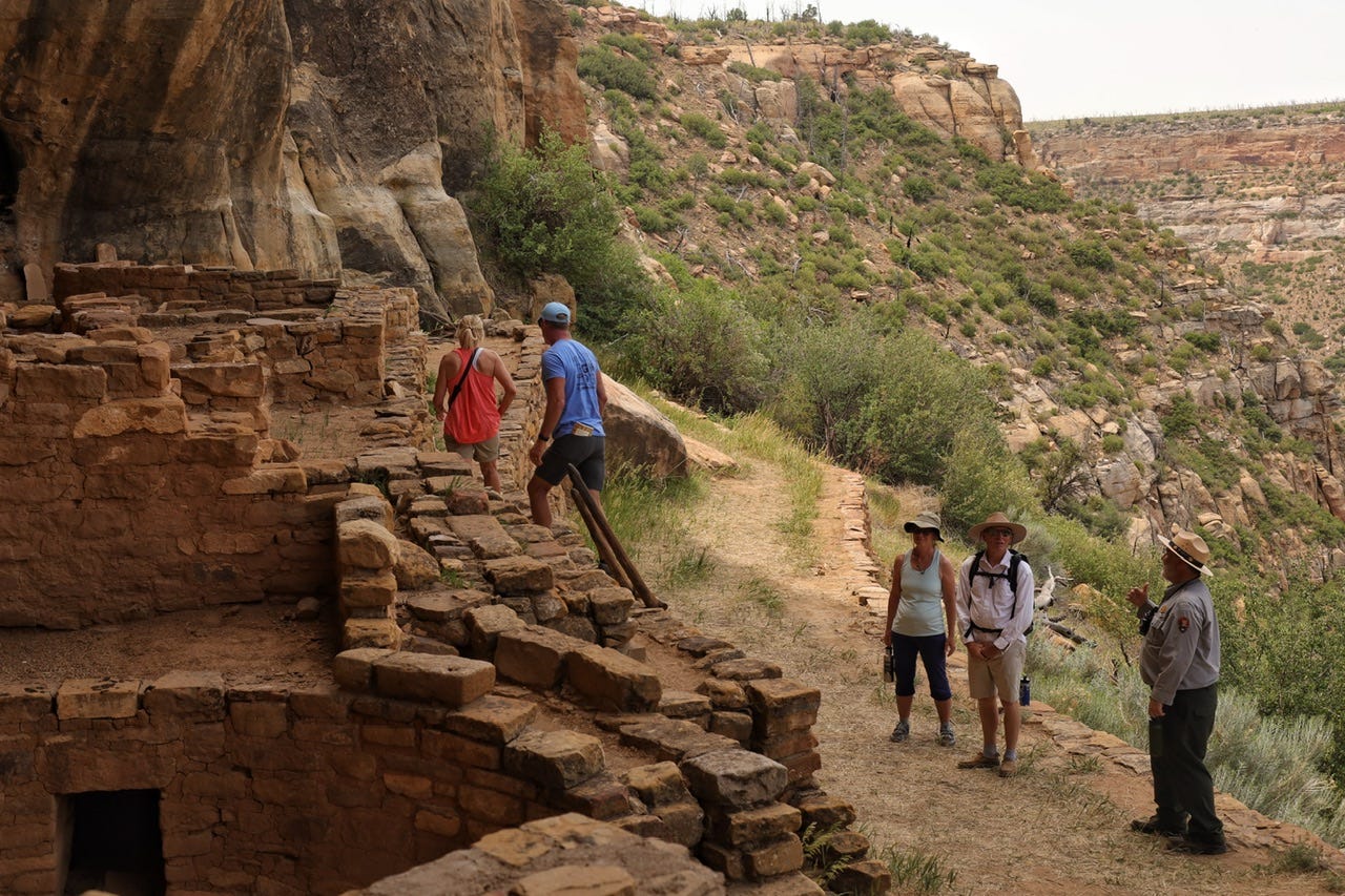
When we reached the park, we didn’t have time for any stops along the scenic drive because we needed to check in at the ranger kiosk on Wetherill Mesa. We circled the parking lot before finally getting a spot to park, and then hustled toward the kiosk to check in. We had just enough time to get in line for the restrooms before finding our park ranger at the designated meeting spot in the shade.
When our group of ten was assembled, the ranger checked our tickets and went over his pre-hike safety talk. It was 95° so we all needed to carry water and we needed to wear sturdy shoes for scrambling on rocks. This walk would be strenuous with steep drop-offs, so if this didn’t sound good, now was the time to let him know. Check, check, and check!
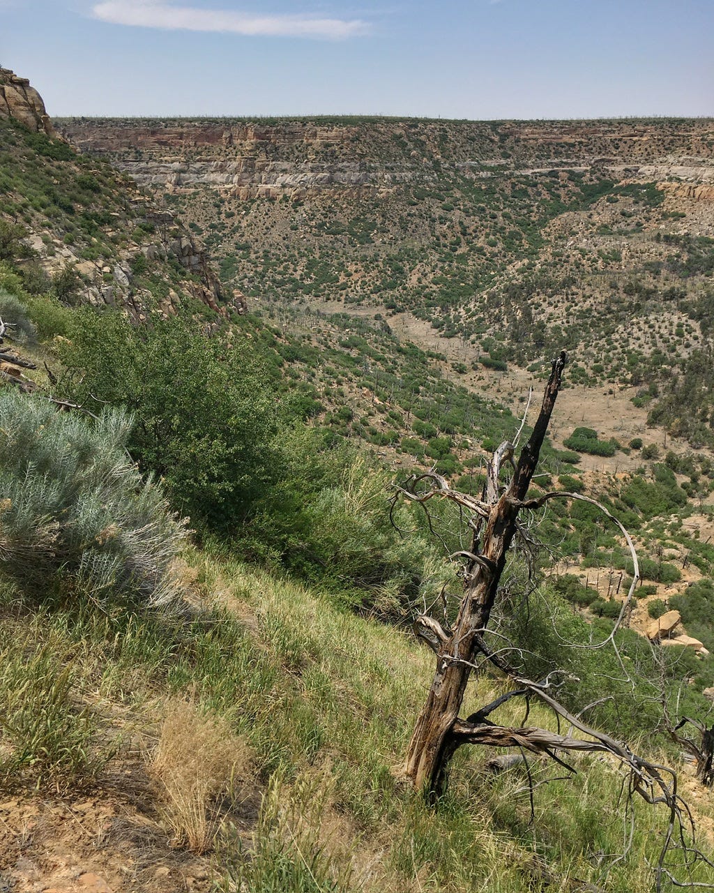
As we started walking, he told us that the most dangerous part of our tour would be the road walk to the trail. I’m not exactly sure how far we had to walk single file along the side of the road. When we stopped, our ranger told us we had to wait to cross the road when there were no cars coming from either direction. This seemed like a perfectly normal safety requirement until he mentioned that the reason for this was so that nobody would see where a park ranger and a group of people were leaving the pavement. This cliff dwelling was closed to the public unless you were on a backcountry tour such as ours, and he didn’t want anyone to get the idea that they could join us without a ticket.
There was nothing along the road to indicate that there was even a trail in the vicinity, which he told us was on purpose to keep people from finding it back. My phone pictures geotagged the location of the cliff dwelling, but I’ve scoured Google Earth in that vicinity to see if I could spot the trail and there’s no noticeable trail anywhere in the area. I suspect that is why this tour is limited to ten people a few times a week every few years. If they did the tour more often, then social trails would develop making it more difficult to hide the location. I would also wager a guess that the rangers all chose a different path to squiggle around the sagebrush, rather than the most direct path to where we climbed down. I had no idea when I booked this tour, that our destination was such a secret!
We quickly lost sight of the road as we wound through the sagebrush and scrambled our way down the rocks. Once everyone made it down to level ground, we continued on. Our first stop was a series of alcoves…which was where I discovered that I did not have my camera in my backpack!
I know exactly how it happened too! I had tucked my camera down on the floor after leaving Arches and then in our hurry to check in at the ranger kiosk, I never noticed the weight of it was missing because I had topped off my 32 oz Nalgene. When that’s full, it weighs two pounds, so my backpack felt about the same as it would if the camera was in the bag and the Nalgene was only half full. All I had along was my phone, which was better than nothing, but thankfully, Joey had his new camera along and he let me borrow it.
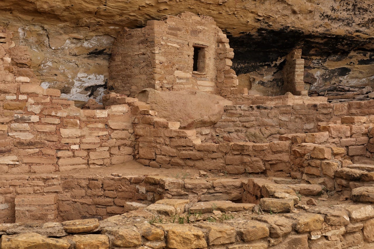
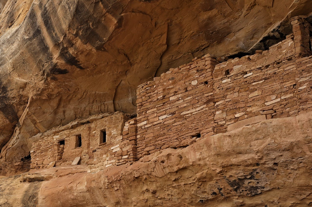
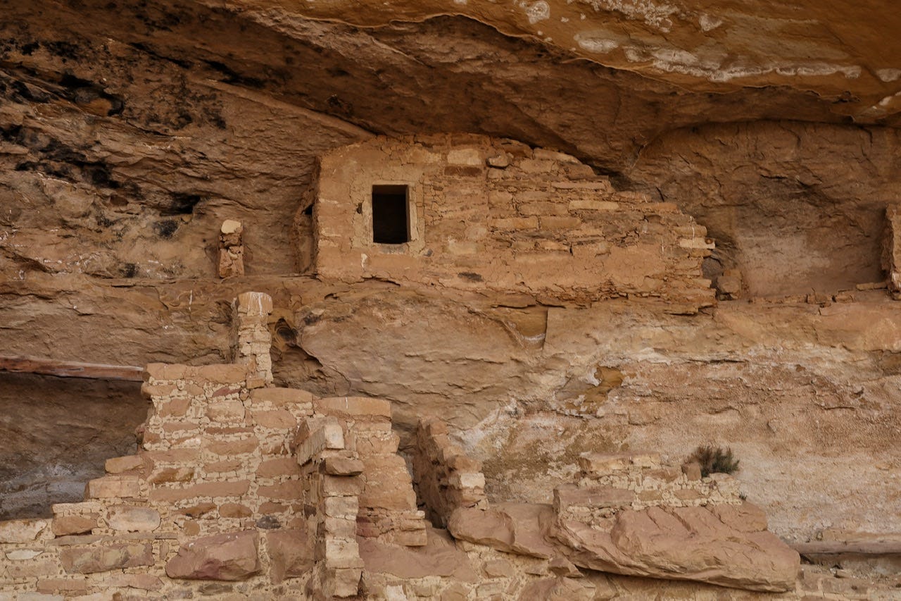
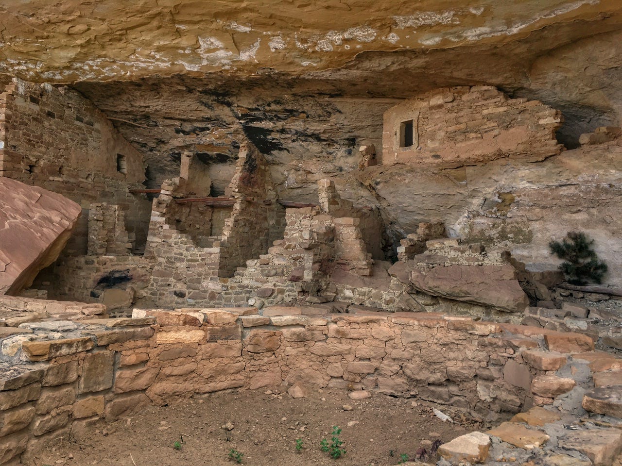
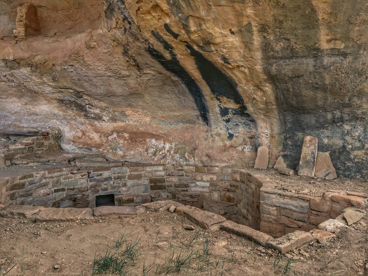
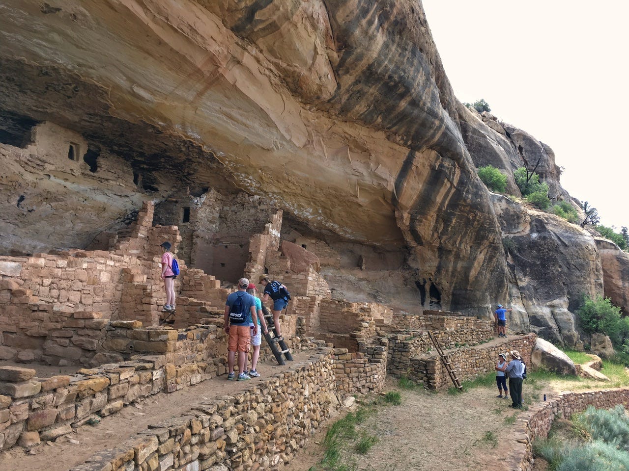
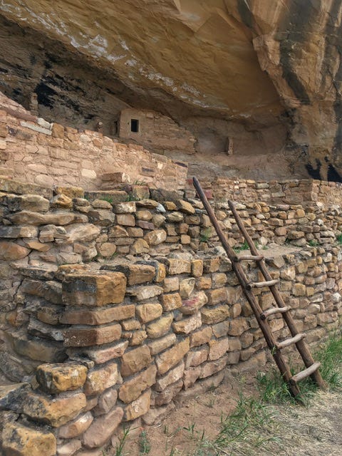
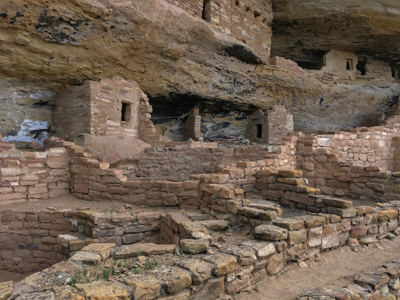
Another ten or so minutes later, we reached our destination, the Mug House cliff dwelling!
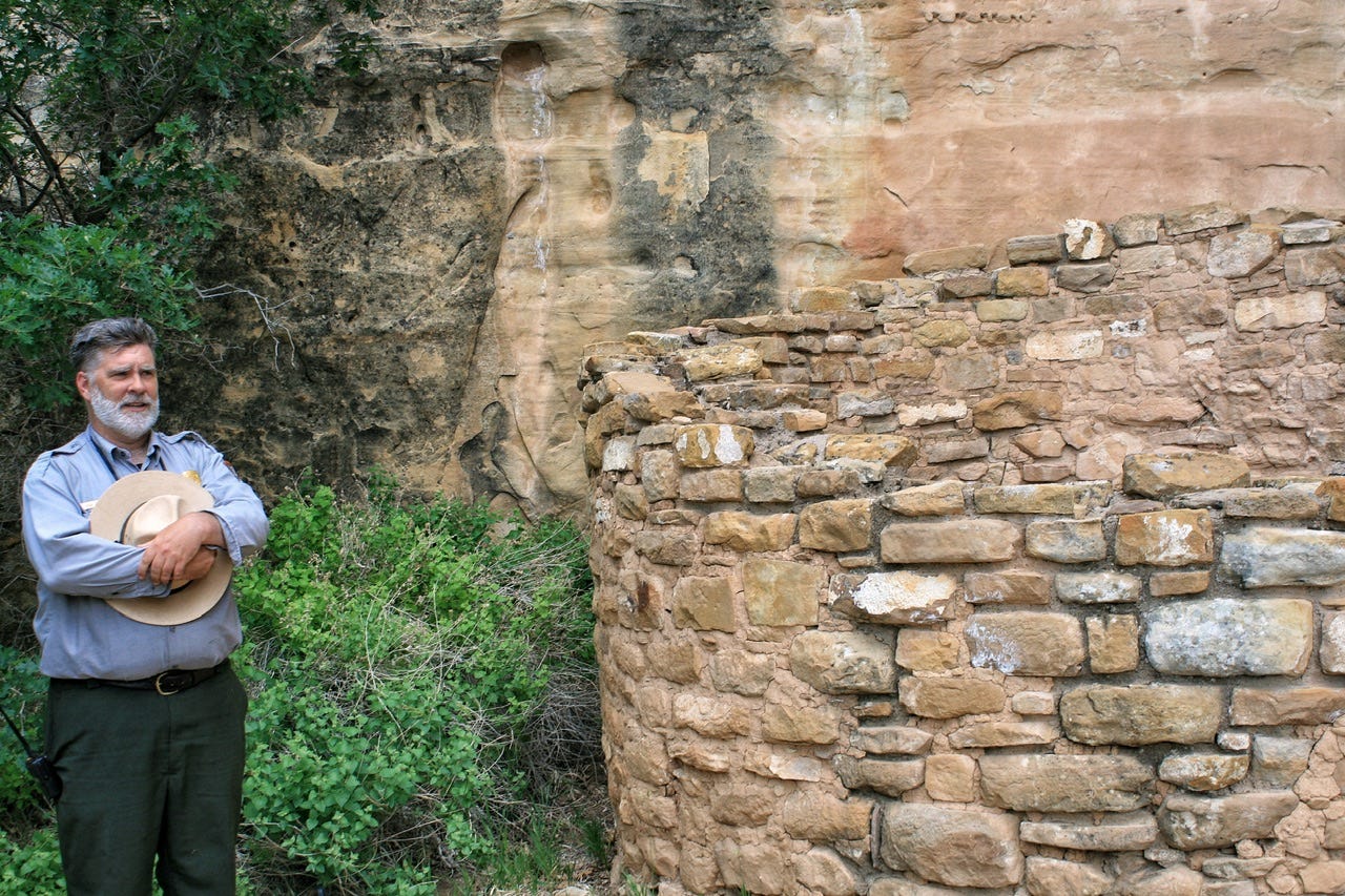
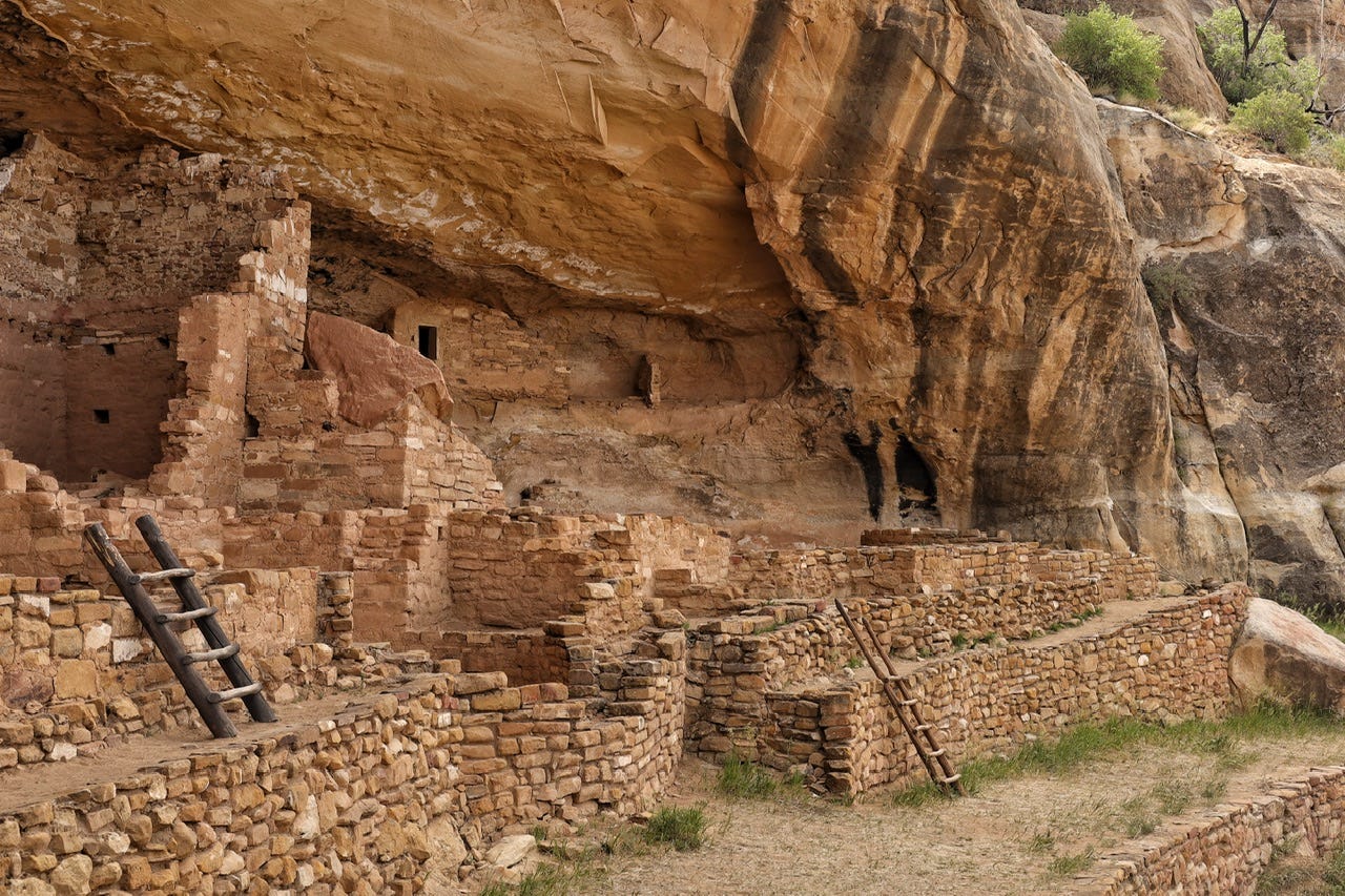
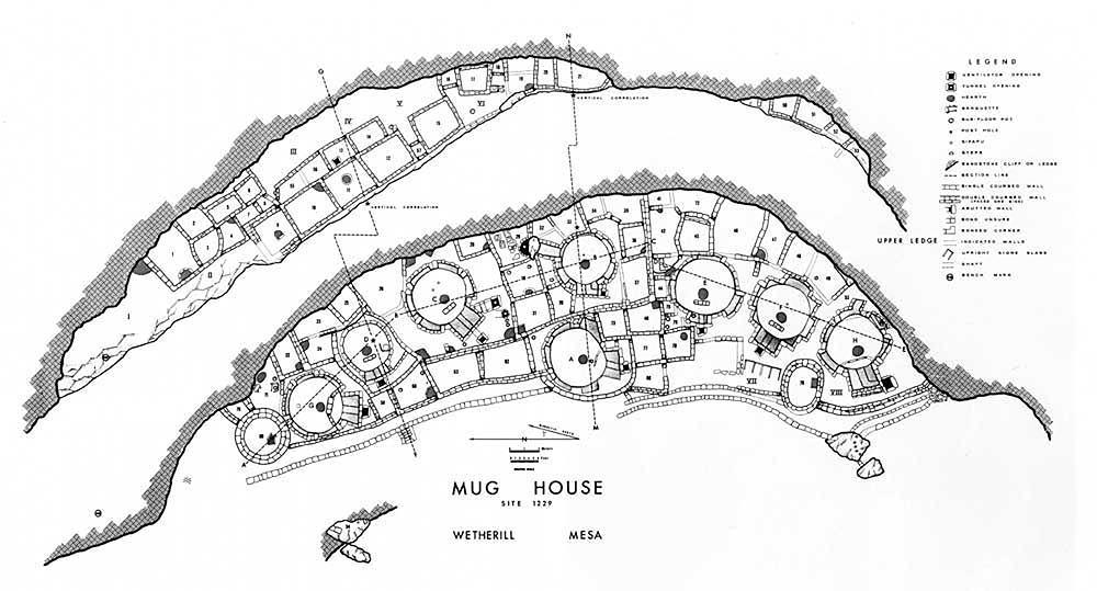
Mug House
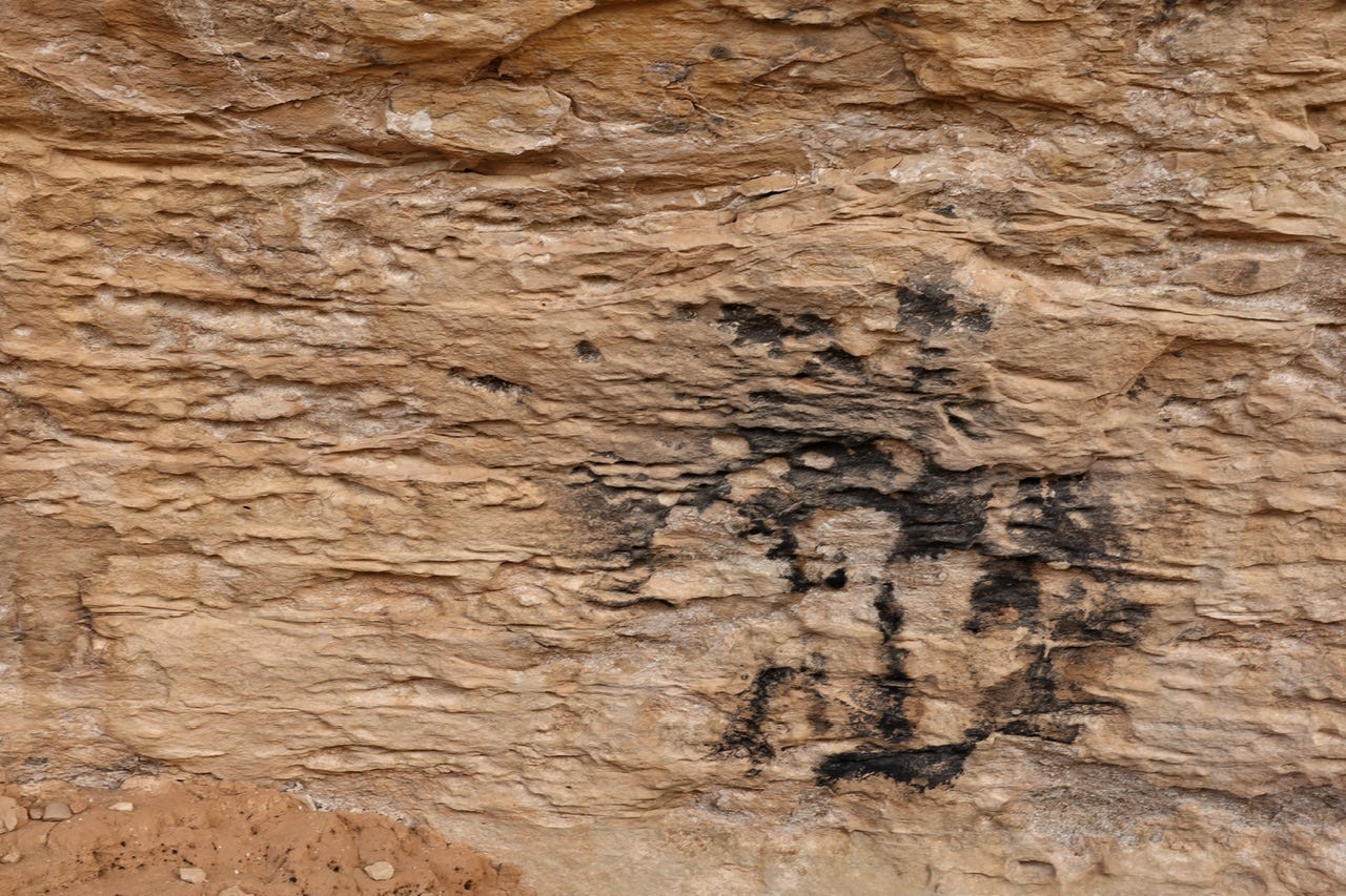
Mug House was a village of 80 to 100 people from 1100 CE to the 1200s CE, and it was named for three mugs that were tied together with yucca rope hanging inside one of its rooms. We learned that a possible reason for the mugs is that the people who lived here may have enjoyed tea made from the leaves of yaupon holly.


Yaupon Holly
Yaupon holly is one of only two plants in North America that contains caffeine. Our park ranger pondered whether the people of Mug House might have enjoyed a bit of a caffeine buzz from their yaupon holly tea. I think he also really enjoyed saying the words “yaupon holly” because that is pretty much the only part of his ranger talk that I remember. His stories about imagining the people and their caffeinated yaupon holly drinks were entertaining and funny, though, so perhaps that’s also why I remember the yaupon holly the most. It’s also fun to say and I would’ve never know that yaupon holly was a thing if it weren’t for this ranger talk.

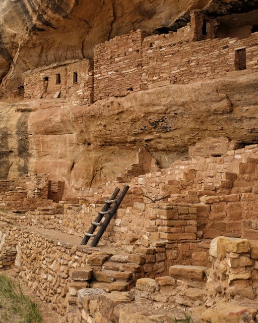
After our ranger talk, we were allowed to wander around the site and climb up the ladders to the different areas of the cliff dwelling. It’s almost incomprehensible that this place was home to people who lived here centuries ago. They planted corn, beans, and squash…the Three Sisters crops…and enjoyed their yaupon holly tea in the mugs they made by hand. I wonder if their time here was as peaceful as it sounds?


After about twenty minutes or so, it was time to start our hike back out. When we reached the road, our ranger pretty much told us it was his lunchtime and that we were on our own to walk back to the parking lot. That seemed kind of strange, what with all the secrecy he talked about at the beginning of our hike. We could’ve turned around and went back down there without him once he was out of sight. I’m also not a fan of paying for a two hour tour, and then the park ranger bugs out for lunch after an hour and fifteen minutes. It just struck me as odd at the time. In looking back, though, knowing that this tour is not offered very often, it was still neat to be able to see it, and he did tell us funny stories about yaupon holly.
Overall, it was a good experience and I’d consider doing another backcountry tour if we’re ever in the area again. If possible, the best option would probably be to do both a backcountry tour and one of the more popular tours during the same visit. I think I learned more about the park in general on the Cliff Palace tour years ago, but the highlight of this tour was the experience of visiting a cliff dwelling that’s not always available to visit.
On our way out of the park, we stopped at the Far View Terrace Gift Shop for a quick look around. It was packed with people and we didn’t see anything we couldn’t live without. We had a bit of a drive ahead of us, as well, so we needed to keep going.
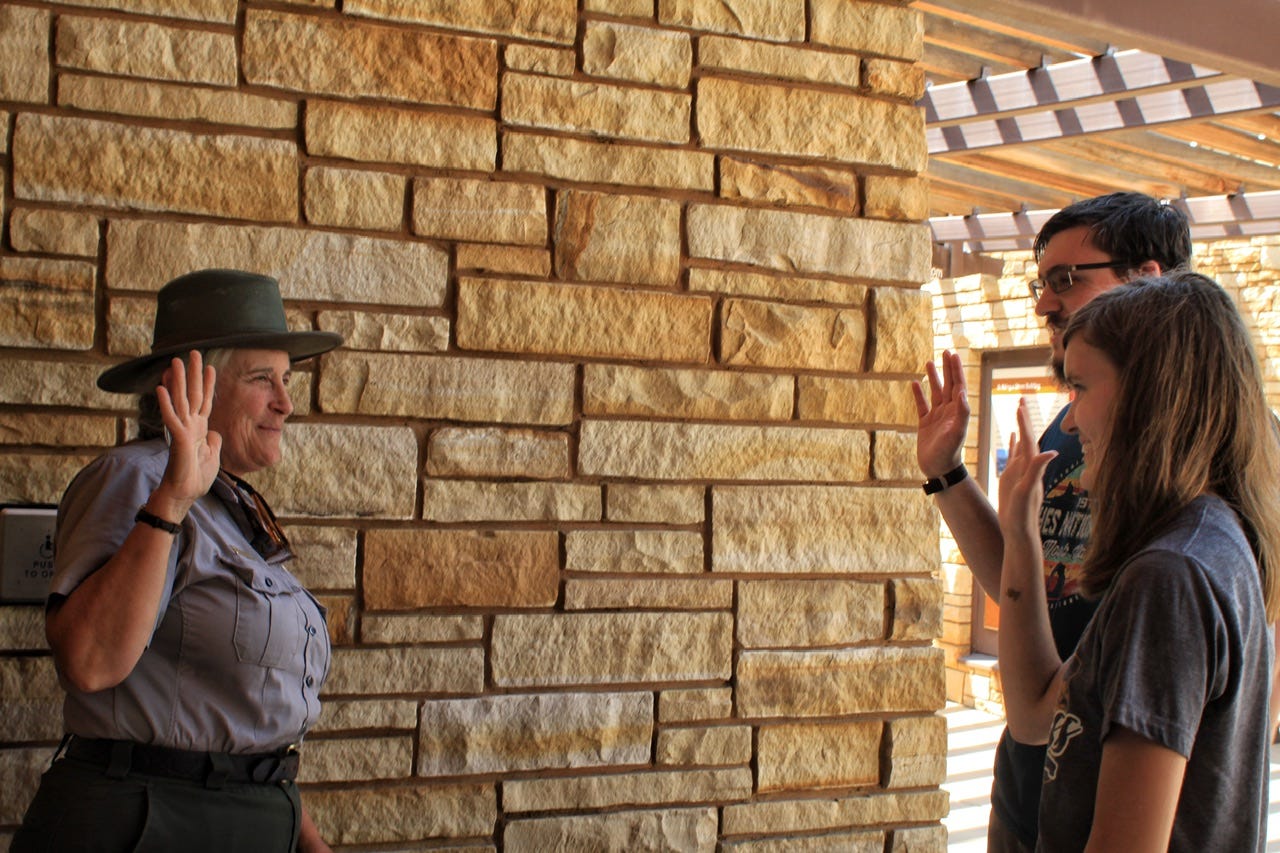
The kids worked on their Mesa Verde Junior Ranger books and had them completed by the time we arrived at the visitor center. Unfortunately, there was quite a long line to talk to the one park ranger who was posted outside, but we waited patiently for our turn.
I love that even though she could probably see how long her line was, she still took the time to go over the books and chat about what we had learned on our tour. She asked which ranger led our tour and chatted about him for a bit. Megan asked her about becoming a park ranger, which she seemed to enjoy talking about, but I don’t remember what she said. I asked her about the different style of hat that she was wearing, and she said the fabric hat was much more comfortable on a hot day than the straw flat hat, which totally makes sense! She was great, and we wished she had been the ranger to lead our tour!
We didn’t get to go inside the visitor center, due to covid times, but that was probably just as well. It was 3:30pm by the time we left Mesa Verde National Park and I really wished we didn’t have a campsite reservation that was four hours away! We had already driven 45 minutes out of Arches, two hours to Mesa Verde, plus over two hours round-trip into and out of the park. I’m not sure what I was thinking, other than the plan looked alright on paper.
Our campsite for that night was another of those ones where I happened to look at recreation.gov on the right day, at the right time, and there was one open campsite that worked out for a day we could use a campsite…soooo…I booked it. I cringe now, just thinking about it!
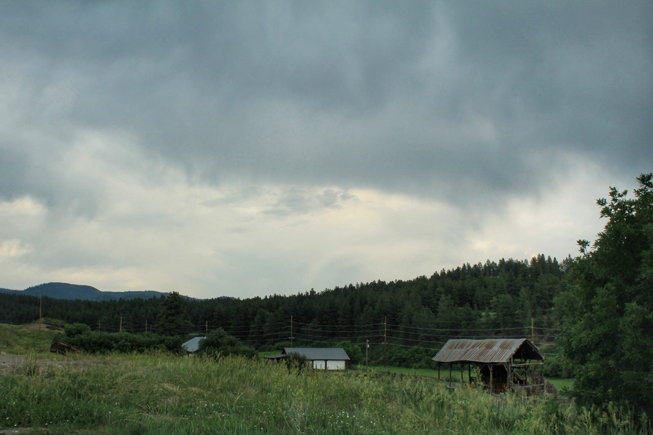
We stopped at the Walmart in Durango, Colorado for some Magnum ice cream bars and sandwich fixings for supper on the road. I thought we also picked up more ice, but according to the receipt I kept, we did not. Our cooler must not have held anything that needed to be kept cold by that point in the trip. We bought three Gatorades, though, which we don’t normally drink. Road trip receipts can be entertaining to look back at, especially if you don’t remember what you did on a busy day!
We also stopped in Pagosa Springs to take a look around, but I think most of the little shops were closed by the time we went through there. It made a good leg stretcher and it looked like a cute little town that we should go back to someday.
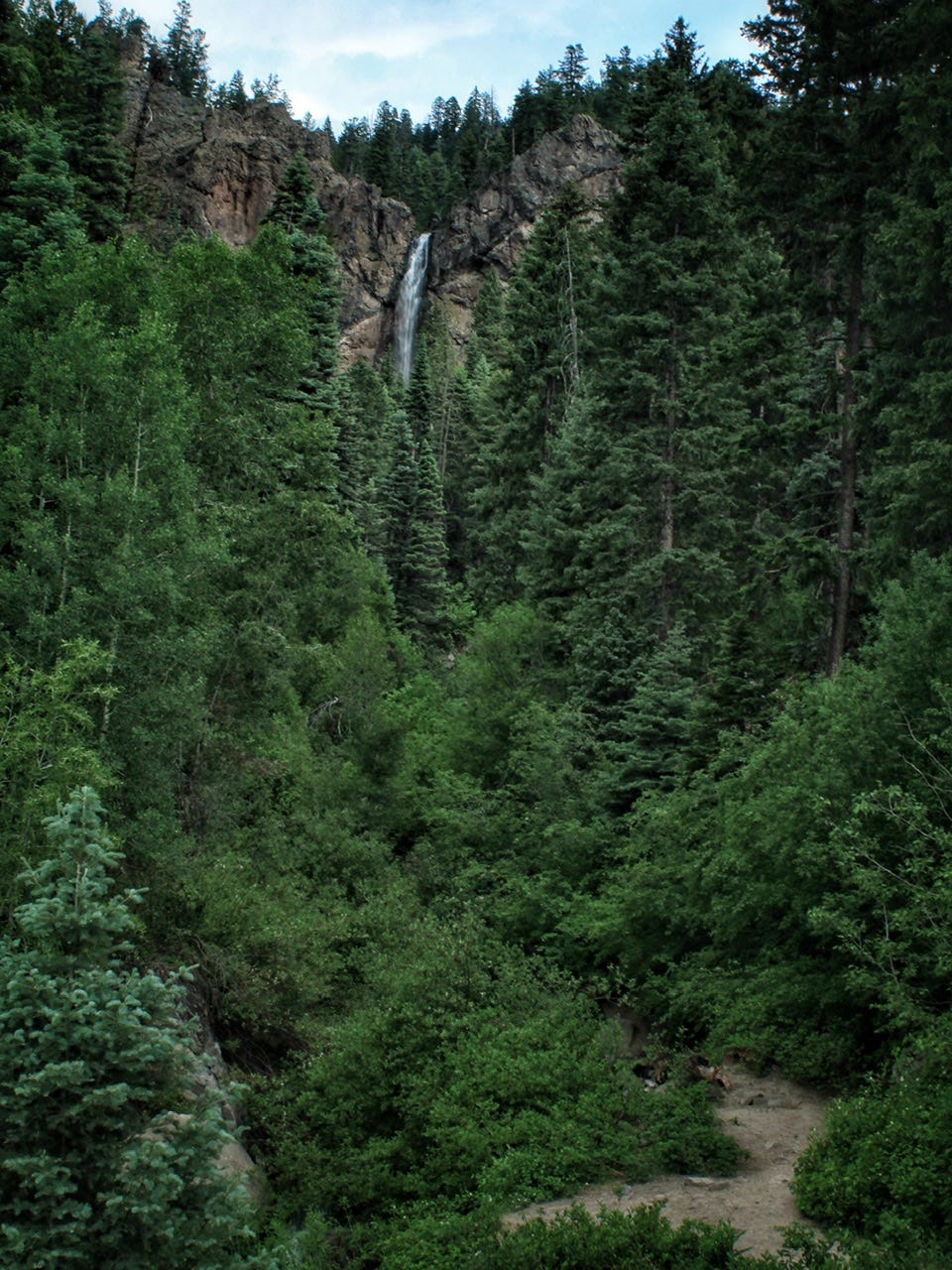
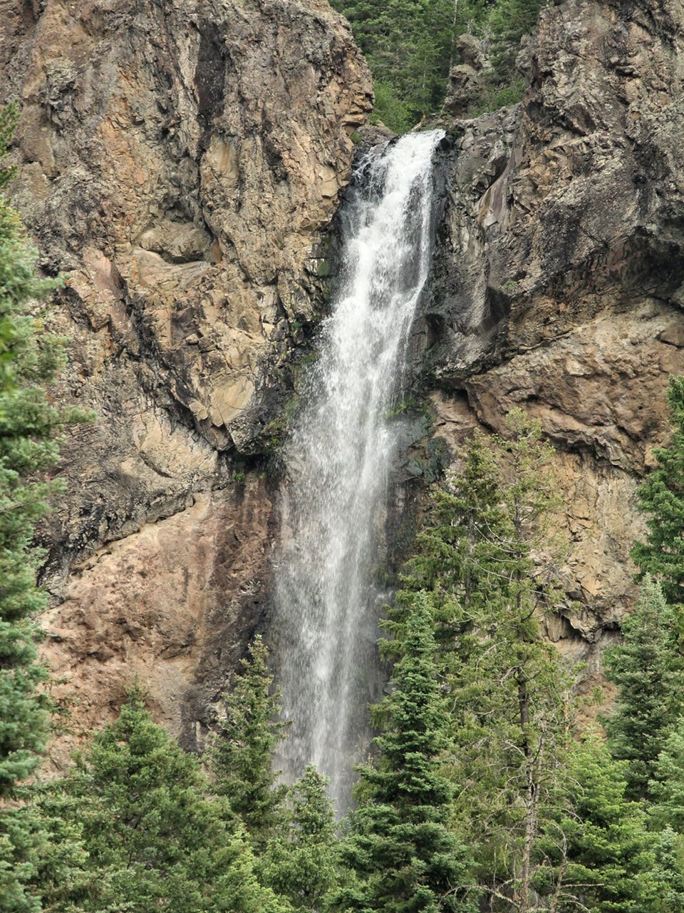
Treasure Falls
Right outside of Pagosa Springs, we stopped at Treasure Falls. There was a trail we could’ve hiked if it wasn’t 6:20pm when we arrived. We could see the waterfall from the parking lot, though, which was good enough, especially with the zoom lens installed on my camera! Honestly, the best waterfalls are the ones you happen to run across on the side of the road like this one! So pretty, but time to keep moving!
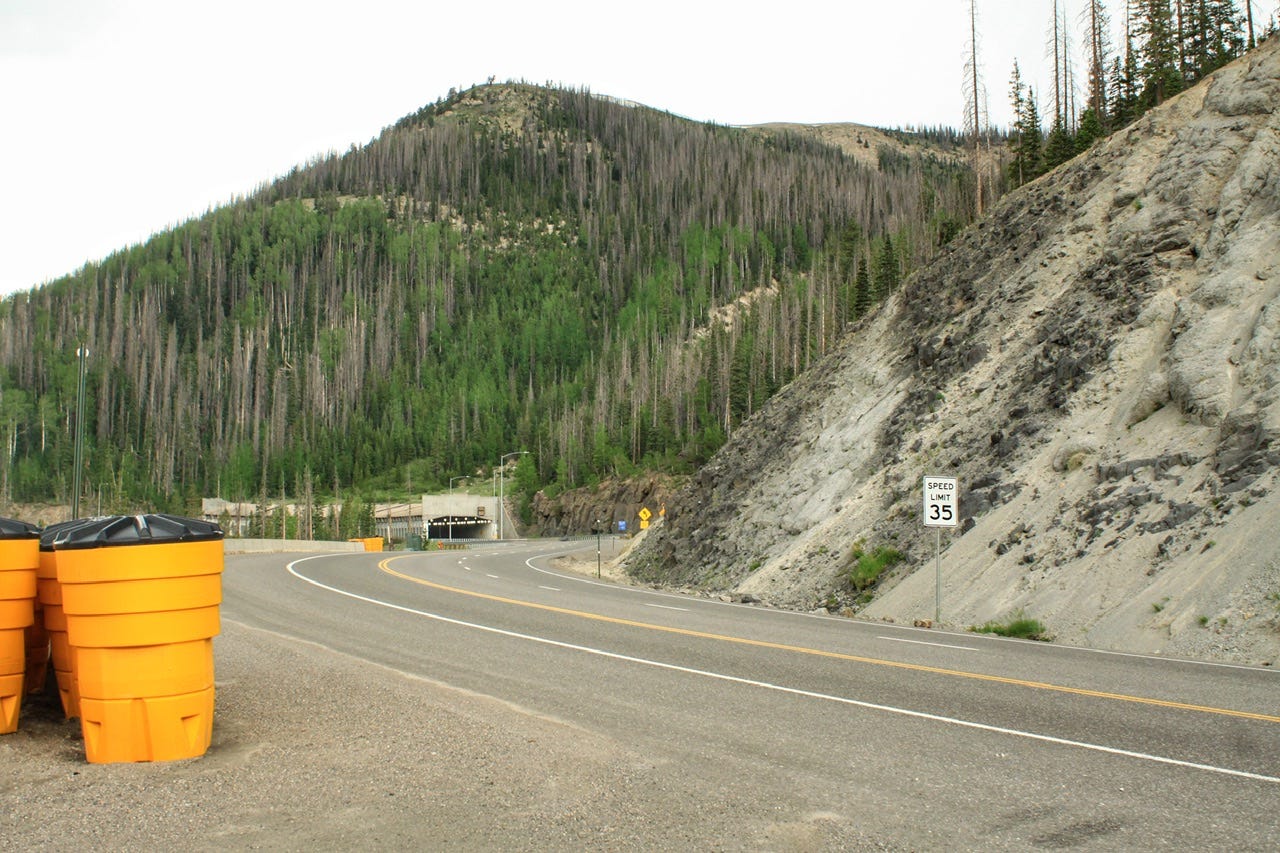
Wolf Creek Pass
We went over Wolf Creek Pass, a high mountain pass of 10,857 feet. We went through a few tunnels, one of which was a snow shed, used to keep the snow from falling down the gully and onto the road. For a tunnel, it was kind of neat because it has windows along the side to let in more daylight. Sadly, this spot was just halfway to our destination!
We stopped for gas in Hooper, Colorado at 8:15pm…almost there.
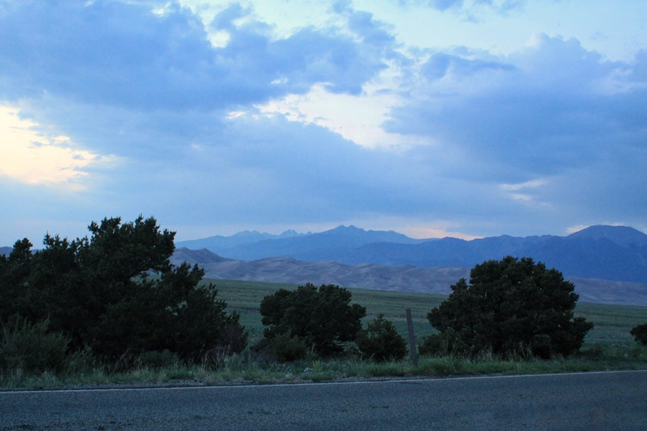
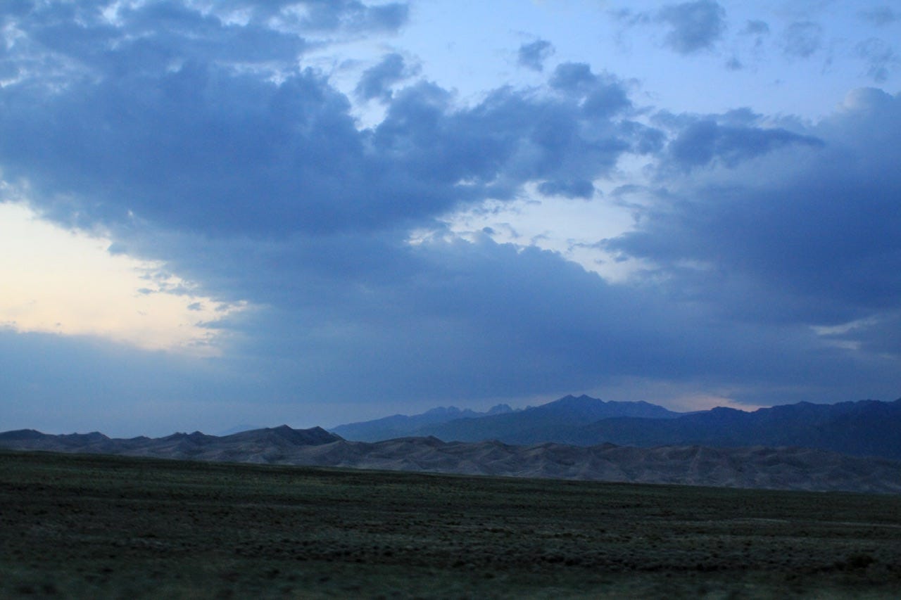
We made it to our destination by 9pm. Our 3 hour and 45 minute drive turned into a five hour drive. I’m kind of surprised it didn’t take longer, considering how many times we stopped along the way! This day had been a super long day. I had been up since before sunrise and we were headed into the Piñon Flats Campground just as the sun was setting for the night.
We’ve got two long days of driving to get home from here, but we still have a few more interesting stops to go! Subscribe to see the Great Sand Dunes in the daylight and find out where we’re off to next!