


Day Three
Wednesday, June 9, 2021
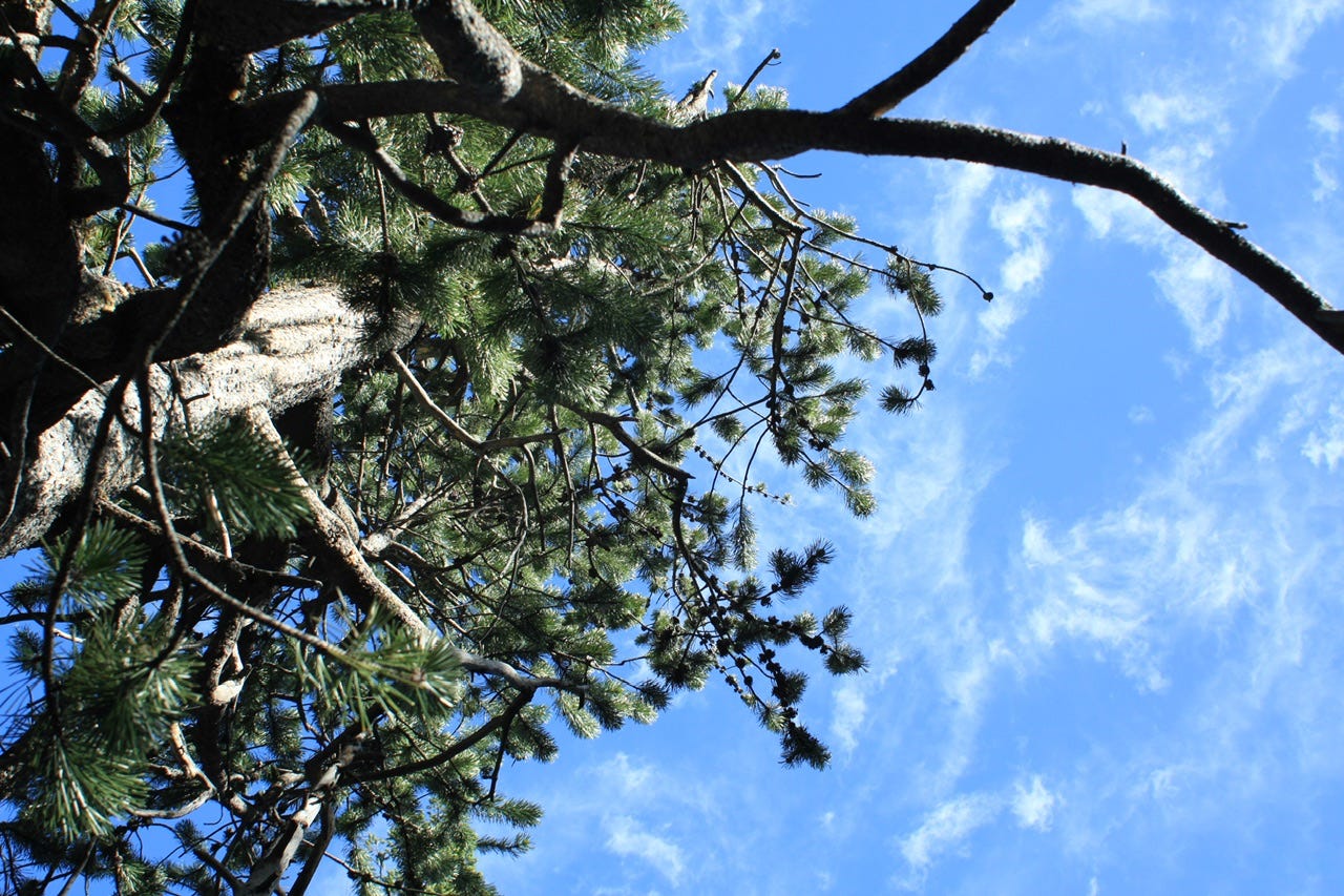
We woke up at Signal Mountain Campground in Grand Teton National Park. Our campsite and the campground were fine, but definitely not one of our favorites. That didn’t matter, though, since we were just there for one night and a drive through the gorgeous scenery on our way to Idaho!
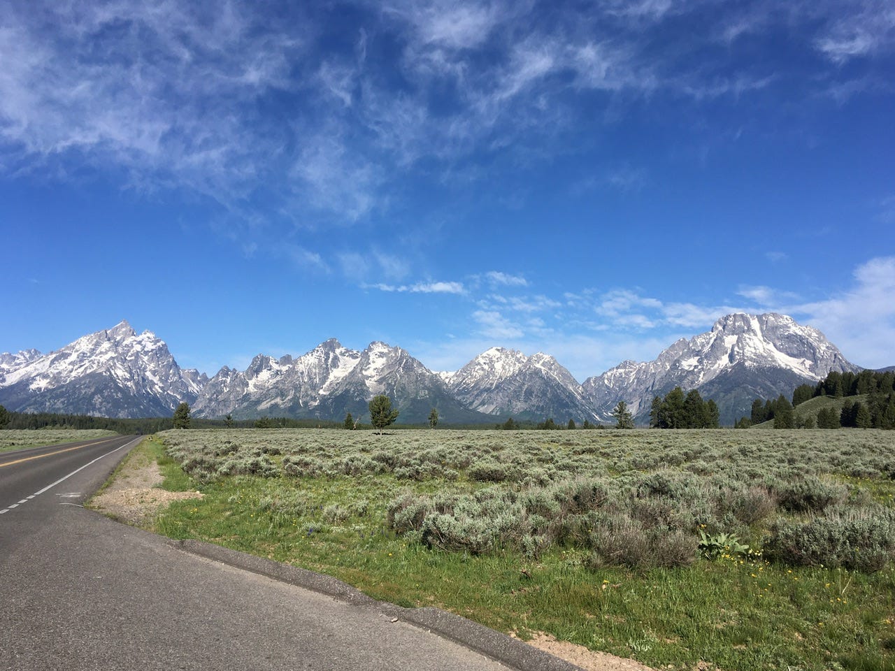
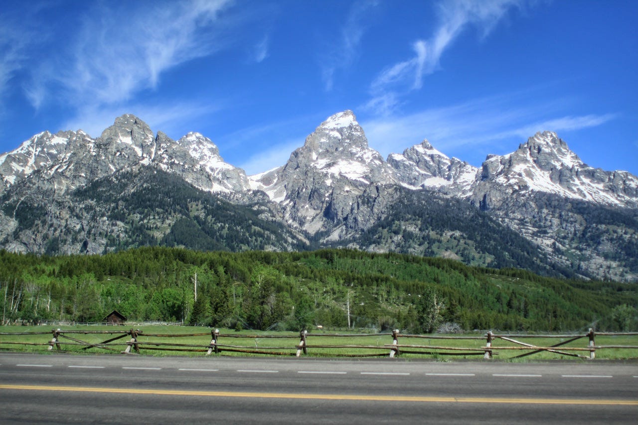
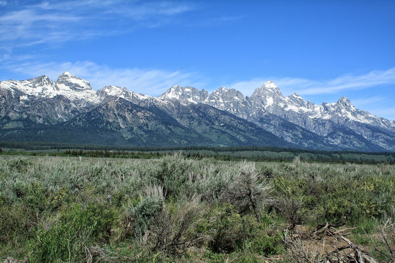
Grand Teton National Park
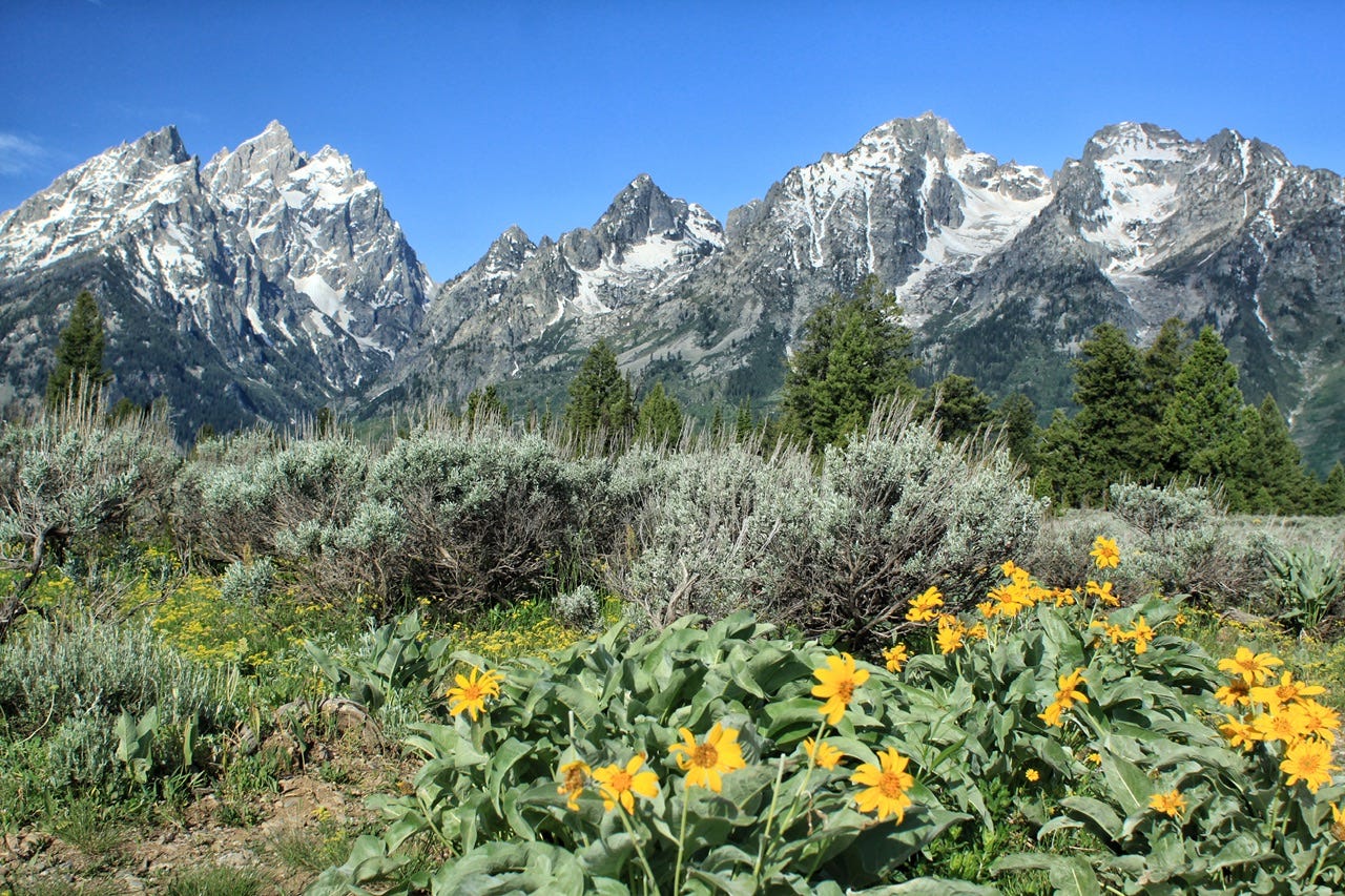
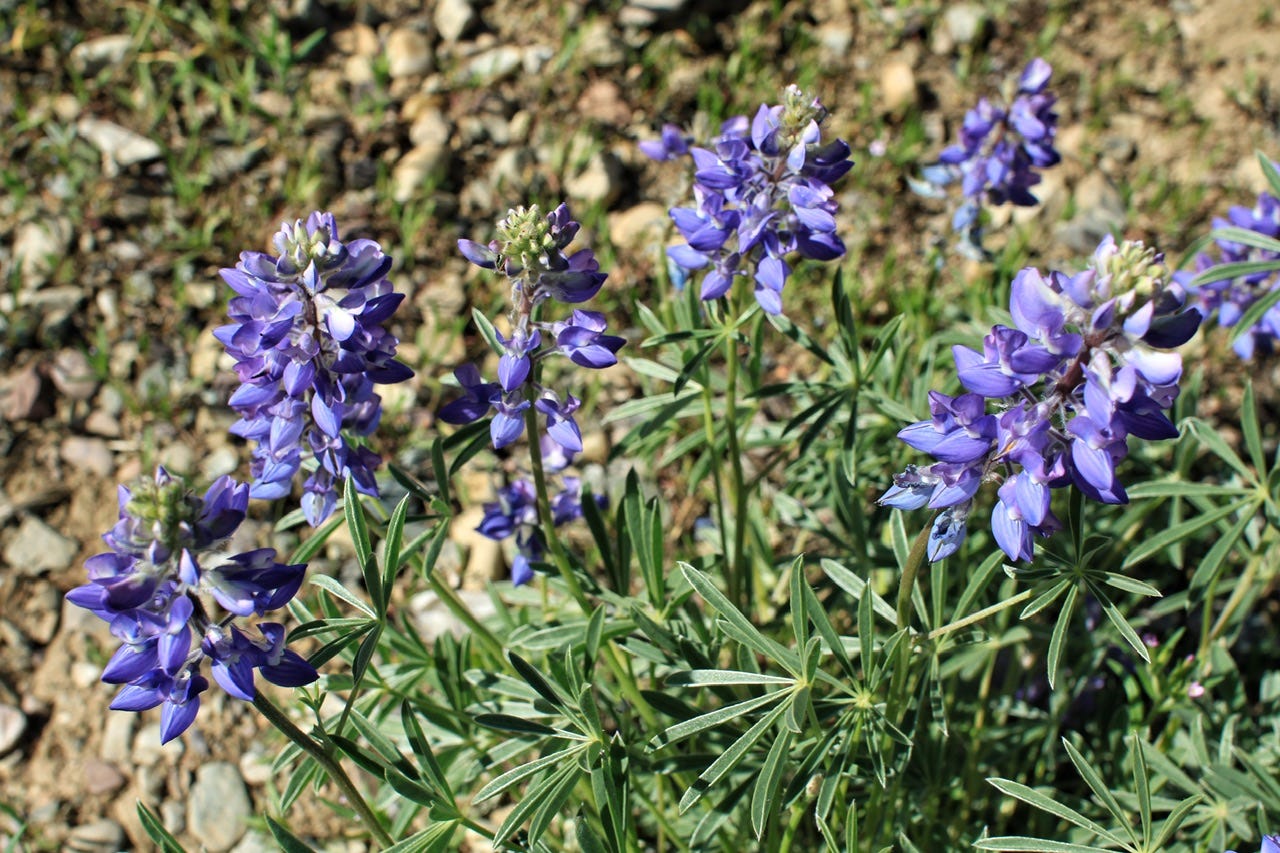
Grand Teton National Park was established on February 26, 1929 and it was the 18th national park. The park originally only protected the high peaks and some lakes in the valley, but it has been expanded through various land acquisitions. The park protects an almost pristine ecosystem and is home to grizzly bears and grey wolves. We didn’t encounter any wildlife on our visit, but we saw many wildflowers blooming, including a perfectly placed patch of arrowleaf balsamroot.
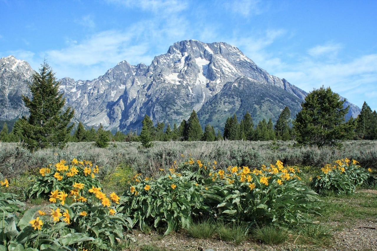
Arrowleaf balsamroot is also referred to as Oregon Sunflower. Nearly all of the plant was used by Native Americans as food, or for medicinal purposes. The roots can be baked or steamed, and they can also be used as a coffee substitute. The stems can be peeled and eaten, and the seeds are nutritious. Wildlife eat the flowers.


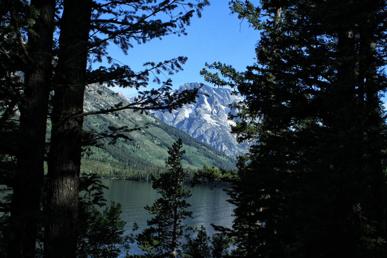
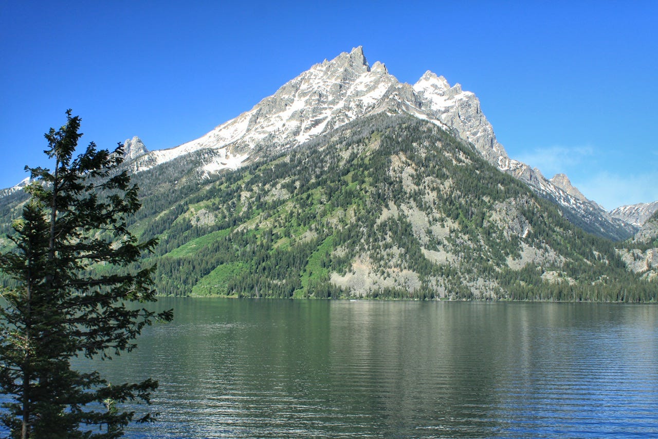
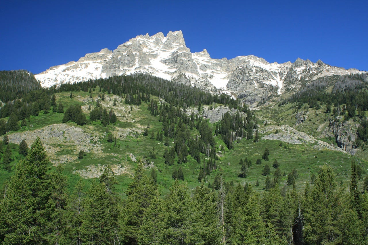
Jenny Lake
We stopped for a quick look at Jenny Lake, as well as a drive through the Jenny Lake Campground, which is a tent-only campground that’s been on my to-do list for camping someday. I’m not sure that I’m willing to pay the $56 a night they are charging now for a tent site, but if a campsite happens to be available for a night that I need when I’m planning a trip, then maybe we’ll make it a stop. That’s how we ended up in the Signal Mountain Campground the night before; one campsite happened to be open on a night we needed, so I booked it and added it to our route. Our whole route for this trip was based on random campsites that happened to open up.
Anyway, we stopped to take a few photos of Jenny Lake. It’s gorgeous in the daylight, but I bet it’s really pretty around sunrise and sunset times, which might make camping there worth the price of admission. The lake and several trails are within walking distance from the campground. I had planned to hike one of the trails, but there was no parking available by the time we arrived, so we skipped that and went in search of another trail on my list.
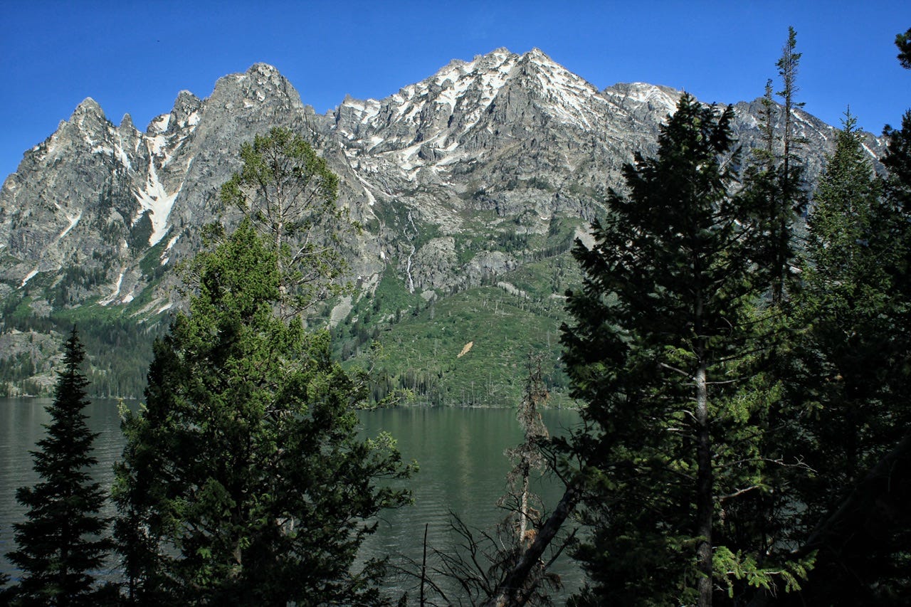
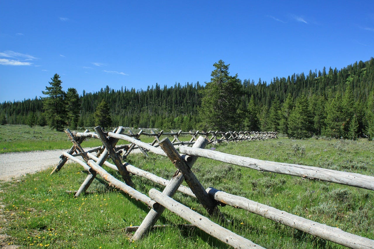
Lupine Meadows Road
We took the Lupine Meadows Road in search of our trailhead, but got distracted by the scenery and had to stop for a few more photos. I also wanted a group photo in front of the mountains and this spot with the cool old fence looked perfect! The last time we visited Grand Teton National Park, I had asked a lady to take our picture and she somehow managed to put her thumb across a large corner of it. She wasn’t especially friendly, even though she had agreed to take the picture, so I didn’t bother asking for a second try. After that experience, I started setting up my tripod to take our own group photos. The best part is that it works even when nobody else is around.
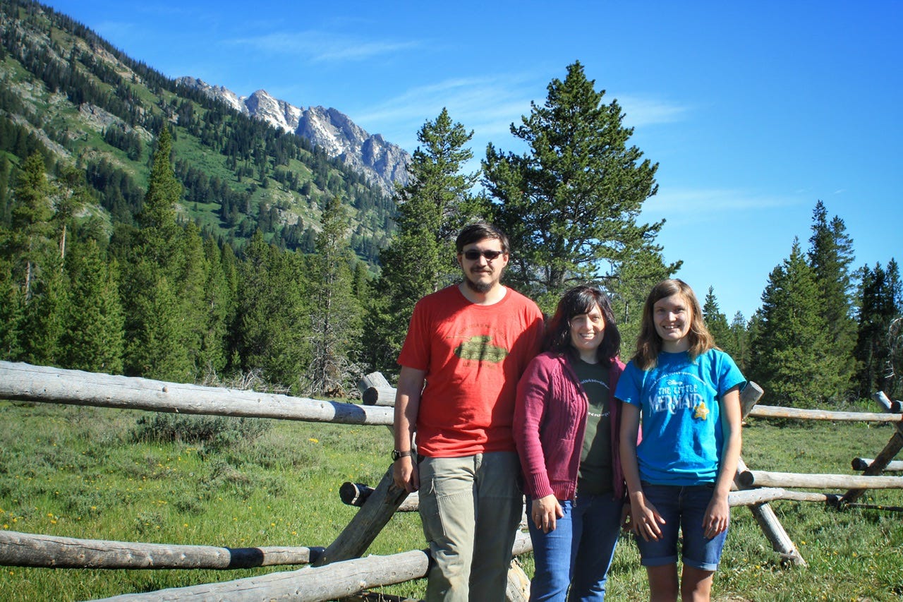
By the time we were done with our photo op, another car showed up, and we had our second encounter with someone pointing out our license plates from South Dakota. This lady told us that she just loved South Dakota and the Black Hills, which is not quite as strange as the lady who said she loved our governor. We were starting to wonder why people were paying so much attention to our South Dakota plates two days in a row. We might look at the plates in a parking lot, but only to help Megan check states off her list.
By the time we were done taking photos and talking to random strangers about South Dakota, I was ready to skip the hike and hit the road. The Bradley Lake Trail I had thought about doing was four miles out and back via the Lupine Meadows Trailhead, but we still had a five hour drive, without stops, ahead of us. It was already 10am at this point.
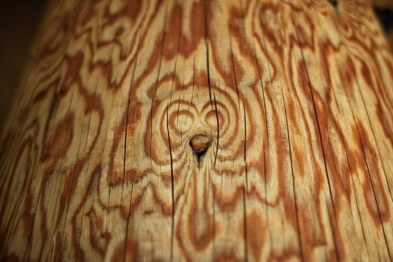
We stopped at the Craig Thomas Discovery and Visitor Center for a bathroom break. Only a certain number of people were allowed inside the visitor center at one time, which meant there was a good-sized line of people waiting to get in. We had been inside this visitor center the last time we drove through the Tetons, so we skipped it and moved on. We spotted critters in the woodgrain of the posts outside.
Moose-Wilson Road
I thought the Moose-Wilson Road might be a fun scenic route to get out of the park, while maybe saving a few miles. It’s a very tiny, winding road that connects the towns of Moose and Wilson, Wyoming. However, it turned into a gravel road several miles in, so we turned around and went back the way we came, going through Jackson instead. That was probably the better option anyway, since we could have one last look at the beautiful Tetons before heading up over Teton Pass.
When I checked the park service website to find the name of the road, there was information about construction projects and it mentioned paving the 1.5 mile gravel portion of the road. I maybe would’ve kept going if I had known the gravel was only 1.5 miles long! We’ll have to try again the next time we’re in the area!


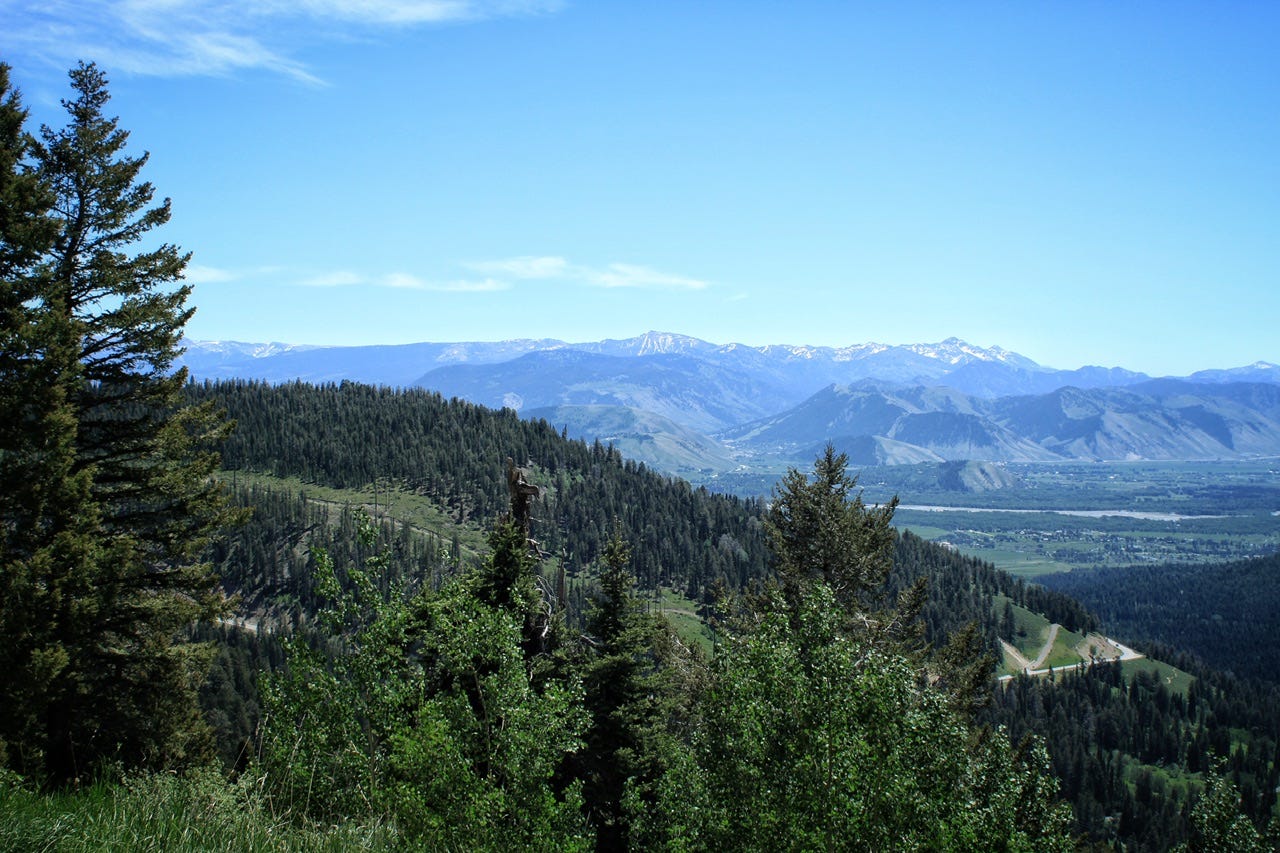
Teton Pass
I wasn’t crazy about the prospect of driving up and down the 10% grades on the Teton Pass highway, but it was the shortest route from Wyoming to Idaho in that area. It was also a road I had not driven on before, which always ranks a little higher than covering the same road twice. Whenever I’m not sure about driving on a particular road, I like to watch one of the many driving timelapse videos on YouTube. The road seemed safe for summer travel, but boy did it not look fun in the winter! The view from the pullout near the pass was pretty spectacular, though.
Side Note: On June 6, 2024, almost three years after we drove on the Teton Pass Road, a motorcyclist hit a crack that had developed on the curve of a switchback. The WYDOT patched the crack the same day, but then a mudslide further down the road, closed the road on June 7th. On June 8, 2024, the part where the crack had been patched, suffered a “catastrophic failure” with almost nothing left of that section of the highway. The fill dirt that held the road up had all washed away in a landslide, taking the road surface with it!
A temporary road was opened on June 28, 2024, but the fix cuts across a switchback and increased the grade from 10% to 11.3% over a shorter distance. The plan was to fix the fill dirt that had collapsed and put the road back in the original alignment. They wanted to have it done by November 2024, but the project is taking more time than planned. The completion date is now scheduled for July 31, 2025.
When I saw the news about the collapse, it seemed pretty crazy that we had driven on that stretch of highway almost exactly three years earlier. The fact that they just patched the crack the first time, without looking into why the crack was there, is also pretty crazy. At least I can say I’ve driven the road, but I probably won’t go out of my way to drive it again, now that I’ve been that way once already.
We did a little more campground reconnaissance by driving through a couple National Forest Service campgrounds along the way. Both of them were nearly empty, so they may have been great options for camping the night before. They were first come, first served campgrounds, though, so I didn’t want to risk not having a campsite for the night. I also didn’t want to have to skip the Tetons or backtrack to the park if we got behind…which is always entirely possible with us.
We crossed the Idaho border between the two campground drive-throughs. Our route took us through Victor, Idaho, and then we took the Pine Creek Road to Swan Valley. That was a pretty drive winding through canyons covered in trees. The scenery changed at Swan Valley and from there to the Interstate, it was flat and treeless, with a lot of farm ground. After a morning filled with geological eye-candy, our afternoon drive was rather boring, and looked a little like we were back home in eastern South Dakota.
Register Rock
We’ve stopped at many Oregon Trail locations, so I wanted to add another one to our list. Register Rock State Historic Site is just outside of American Falls, Idaho. Unfortunately, the site requires a state park entrance fee that I was not interested in paying just to see a rock with names carved into it. They had also built a pavilion over the top of the rock and surrounded it with a fence, which kind of takes away all of the charm it once held as a historic site. Luckily, it wasn’t far off the interstate, so we weren’t out much time for the stop.
Back on the road again, we still had another hour and a half to go to get to our destination. This part of Idaho was a little more interesting, with little mountains off in the distance and more sagebrush than farmland.
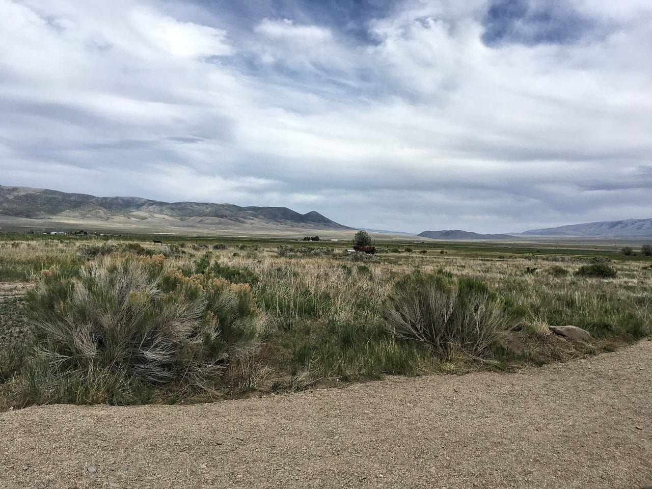
City of Rocks National Reserve Visitor Center
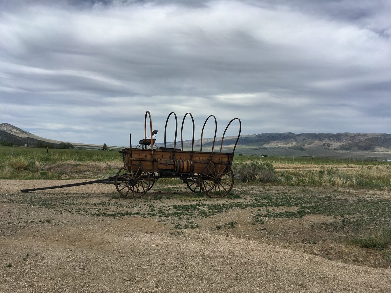
We finally reached Almo, Idaho, home of the City of Rocks National Reserve Visitor Center. Unfortunately, we arrived just as the visitor center was closing, so we didn’t get to look around or grab junior ranger booklets before heading into the park. They had a short nature trail, but we just used the restrooms and snapped a few photos before getting back on the road. The scenery around the visitor center looked so serene, with a covered wagon sitting among the sagebrush and small mountains in the background.
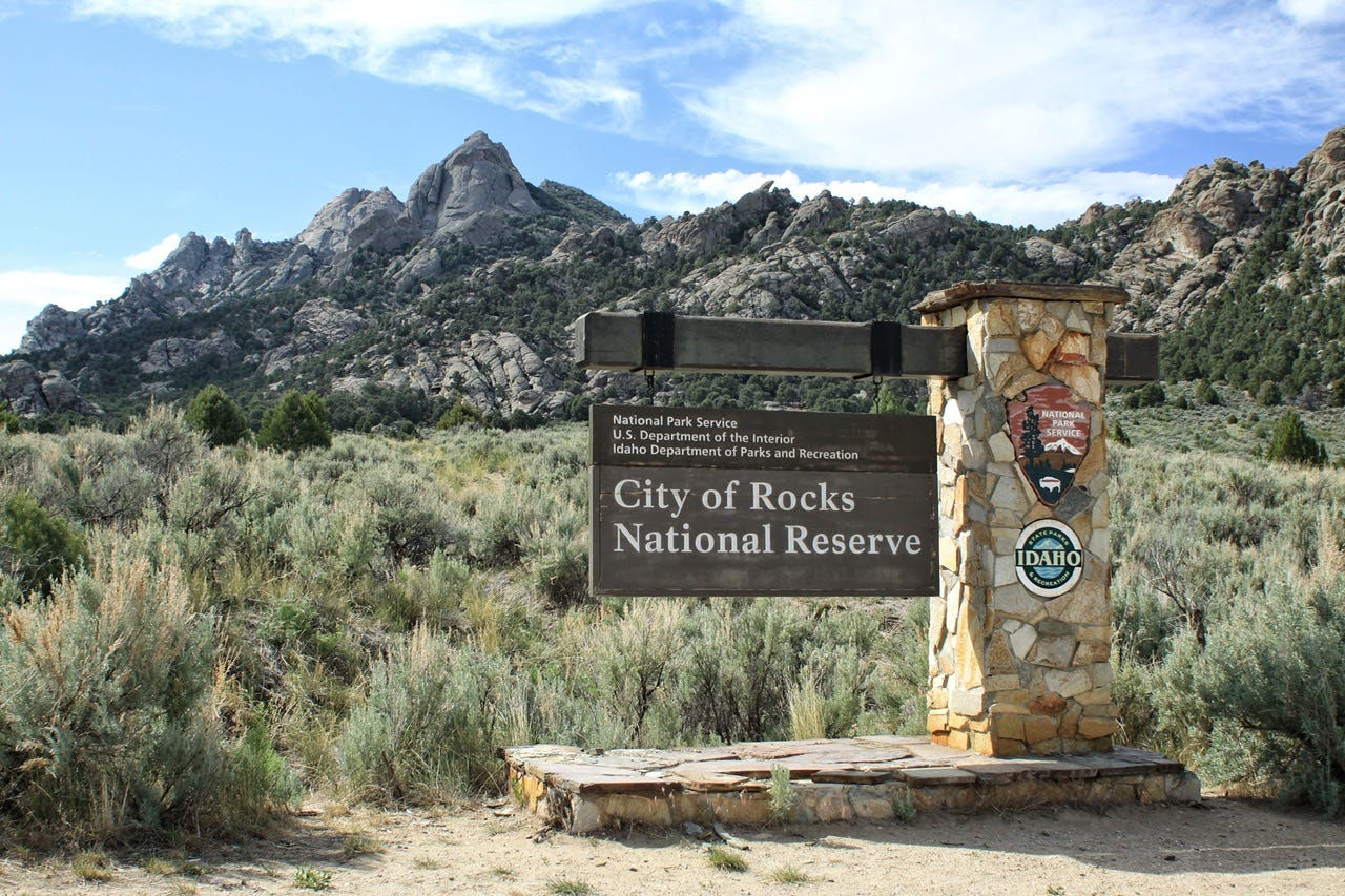
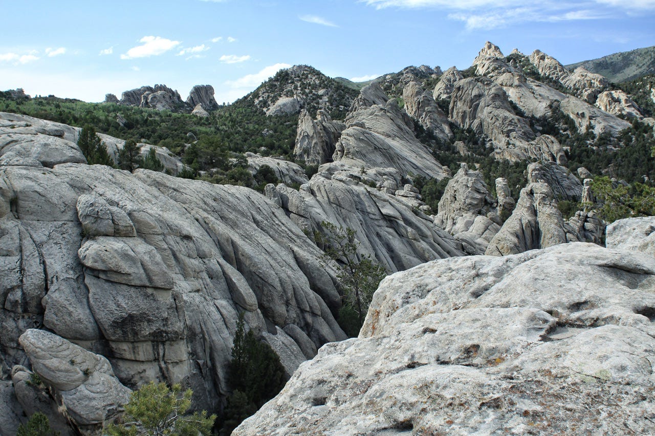
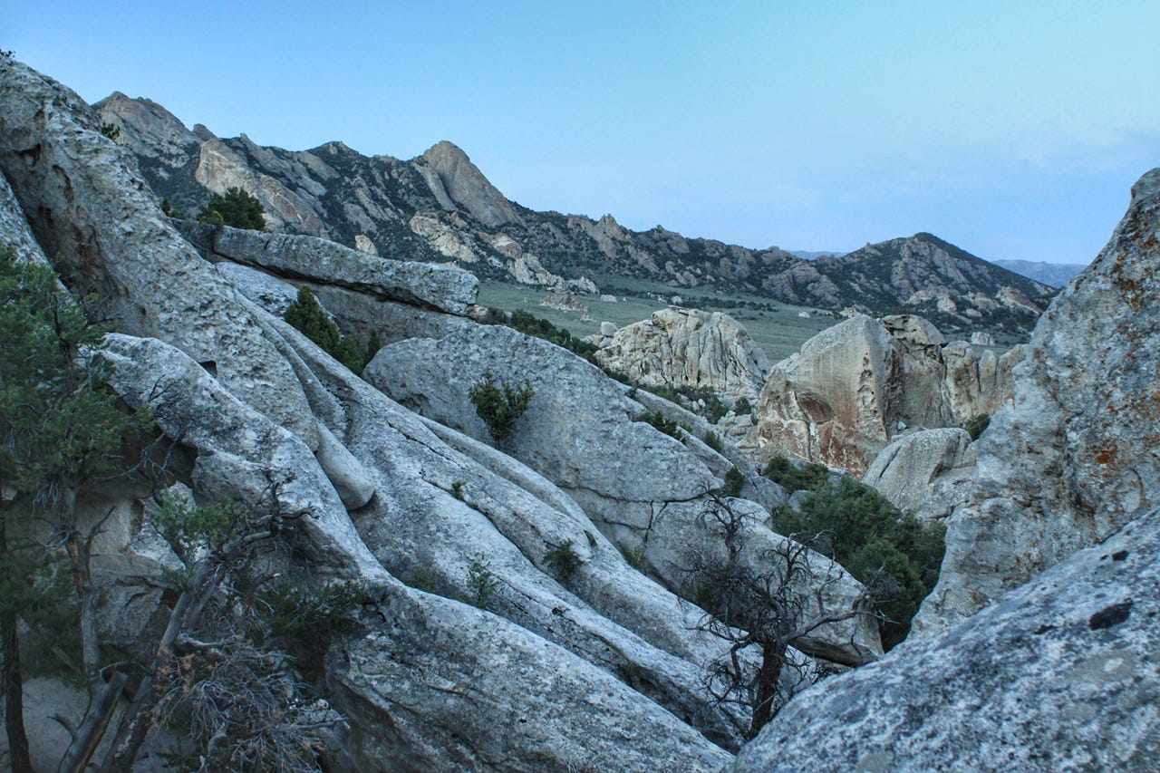
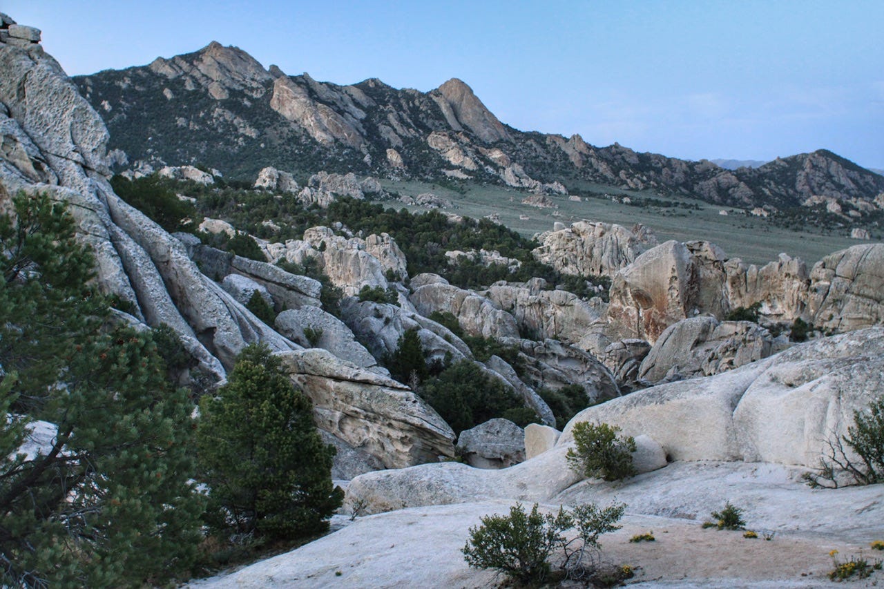
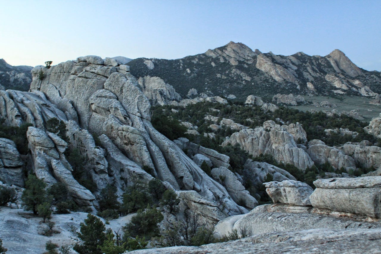
City of Rocks National Reserve
City of Rocks National Preserve is a National Park Service site that is jointly operated by the Idaho Department of Parks and Recreation. The park was established in 1988 and is designated as a national reserve due to the “nationally significant geological and scenic values of its rock formations and the historical significance of the California Trail.” The Shoshone also camped here. I can’t imagine what it must have been like for either group to come across this strange place after wandering mostly flat sagebrush for miles and miles.
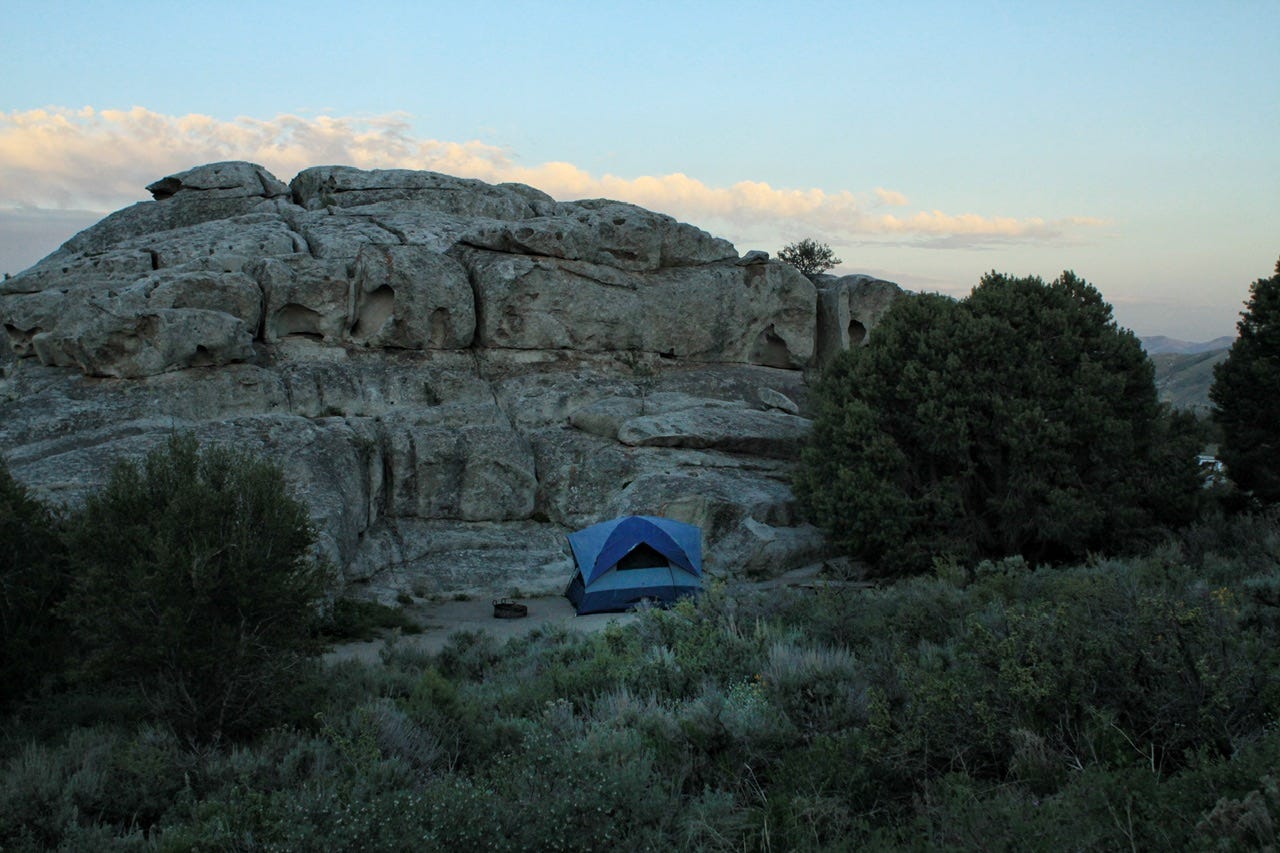
Our Campsite
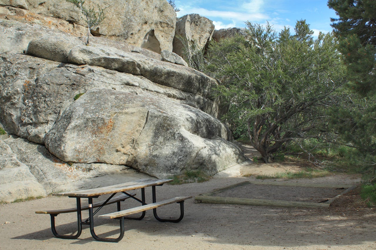
Even though we don’t camp more than one night in most places, I am always on the hunt for the most epic-looking campsites. Site number 36 at City of Rocks Campground was exactly that! I had plenty of campsites to choose from when this reservation was made, and I’m not sure how this one was still available, but I snapped it up immediately!
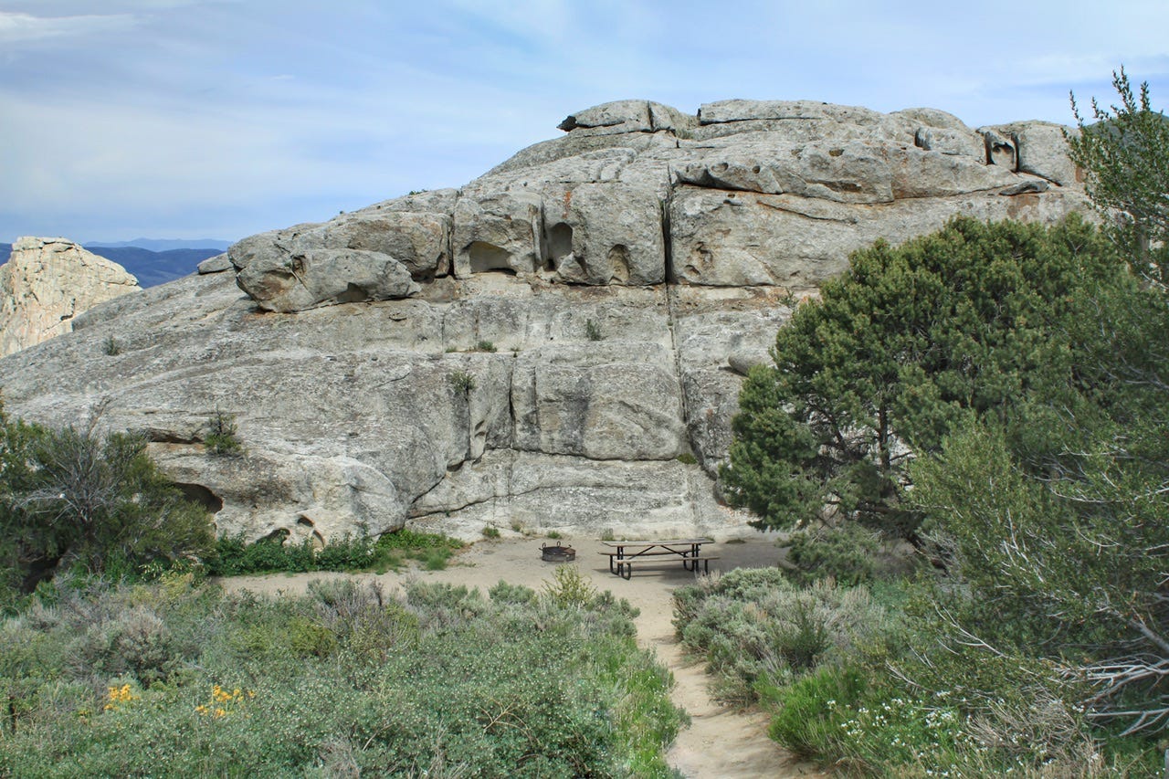
Site 36 is a walk-in tent site, with parking at the top of a fairly steep hill, so perhaps that was the deterrent for some folks. You couldn’t just open the tailgate and empty the contents right there. Everything had to be hauled down a long dirt path to the bottom…but what a great campsite! The site was huge, and had a nice tent pad in the shade, but it was only 9x9…too small for our 11x11 tent. Thankfully, the picnic table was moveable so we moved it into the shade, and then put the tent where the picnic table had been.
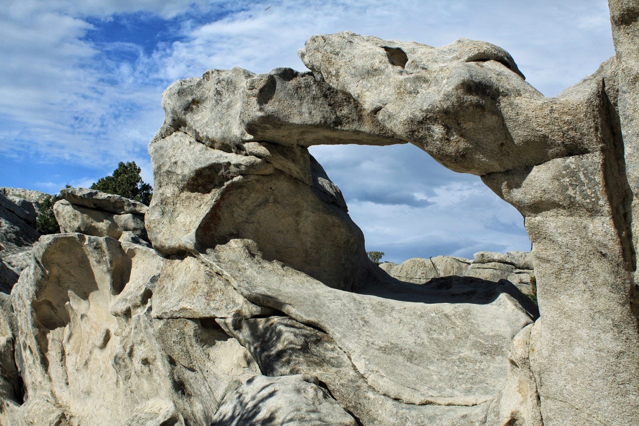
Window Arch Trail
Our campsite parking spot was just a few feet from the very short Window Arch Trail, so we had to go check it out. The trail goes past site 37, which didn’t have anyone in it at the time, and then it’s maybe another 300 feet or so to the arch. The rock in this park is all granite, so it was neat to see an arch of granite, compared to the red sandstone arches we’ve seen in Utah.
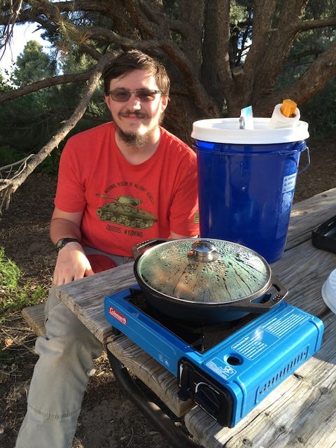
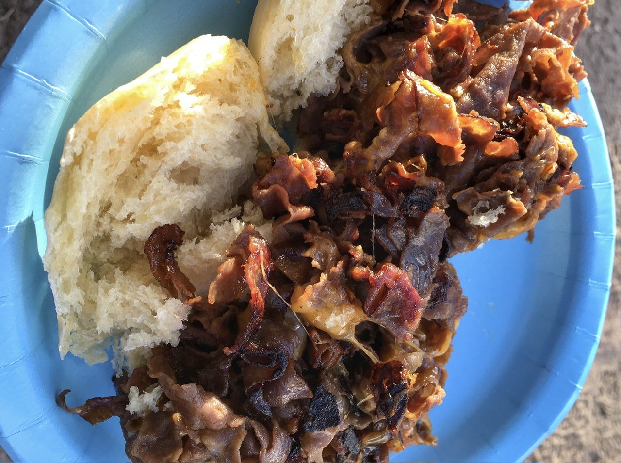
Time to Eat!
With our campsite set up and the nearby trail explored, it was time to eat. One of my favorite easy camping meals is shredded roast beef sandwiches. I’ve put together the recipe with a couple variations.

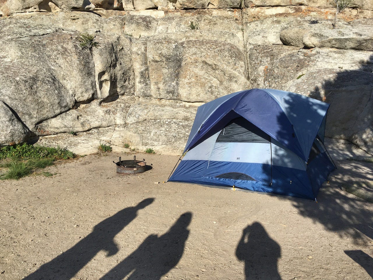
I should point out that we had our tent all set up in the daylight, and we were actually cooking in the sunshine, as seen in the photo below! It happens occasionally! Ha! For as much daylight as we had left, I probably should’ve picked something more time-consuming to make, but our dutch oven omelette the night before had taken quite a while to cook, so it seemed like a day for a quick meal. That way we could go exploring after we ate!
Now that I think about it more, I probably also wanted to eat the homemade buns before they dried out or got squished. Our picnic table was also sitting at an angle after we moved it to the shade, so it was probably good that this meal was not complicated.
Exploring Our Backyard
I have to say that the view of our tent in this campsite is pretty epic, as far as campsites photos go! That’s why when I said the campsite in Signal Mountain was…fine…this one is more our style! I was really glad we had arrived in time to enjoy looking at it in such pretty light. Parks with pretty rocks are almost always better in the evening than in the harsh morning light.
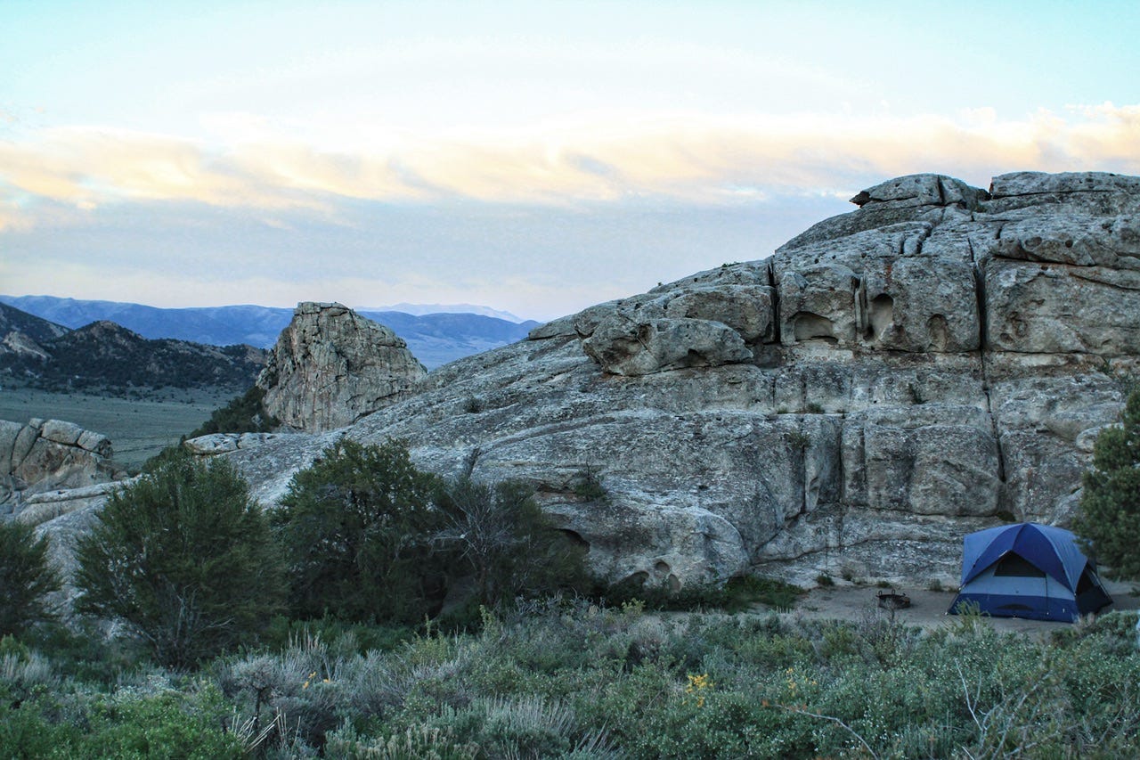
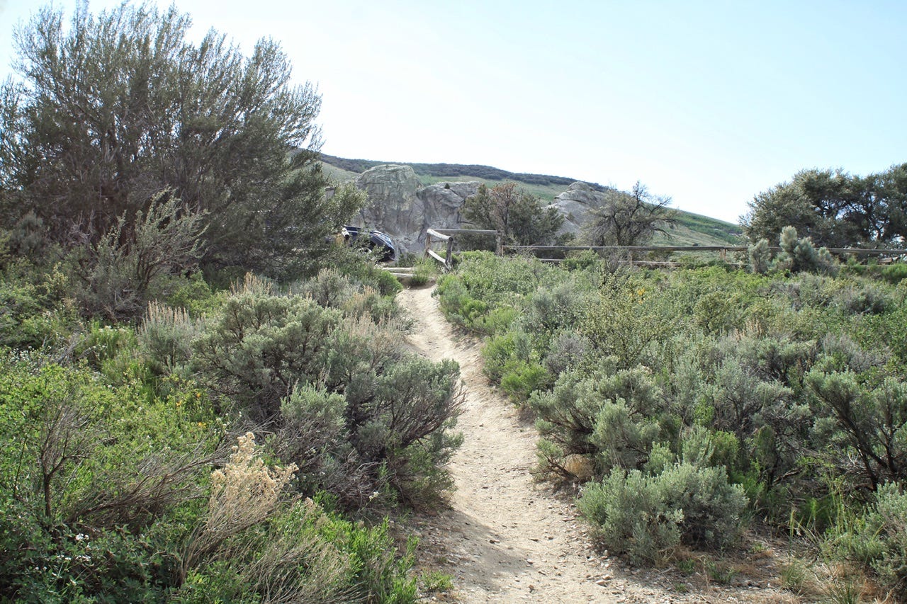
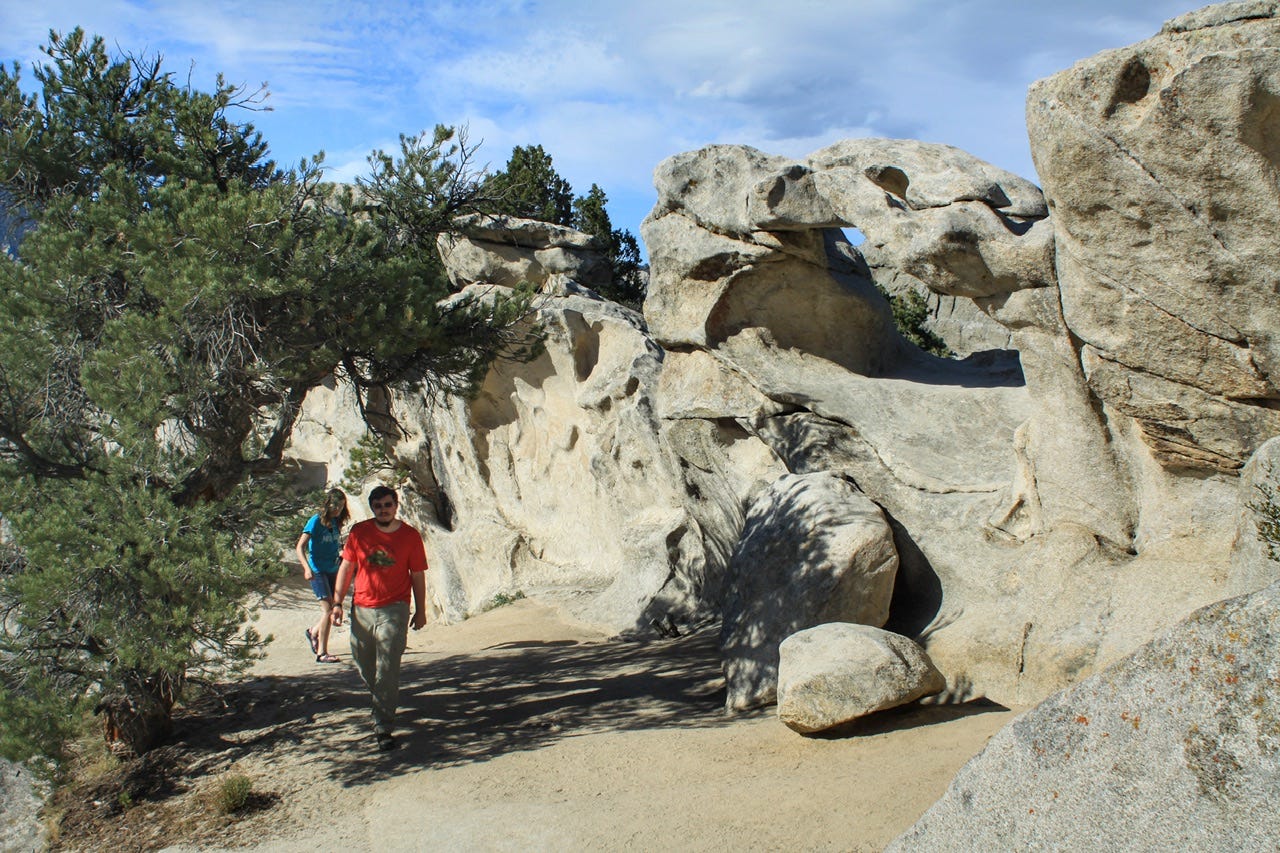
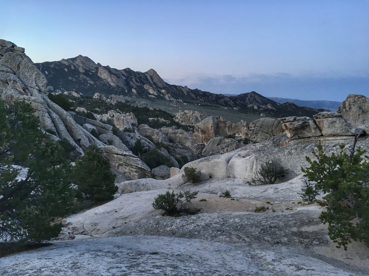
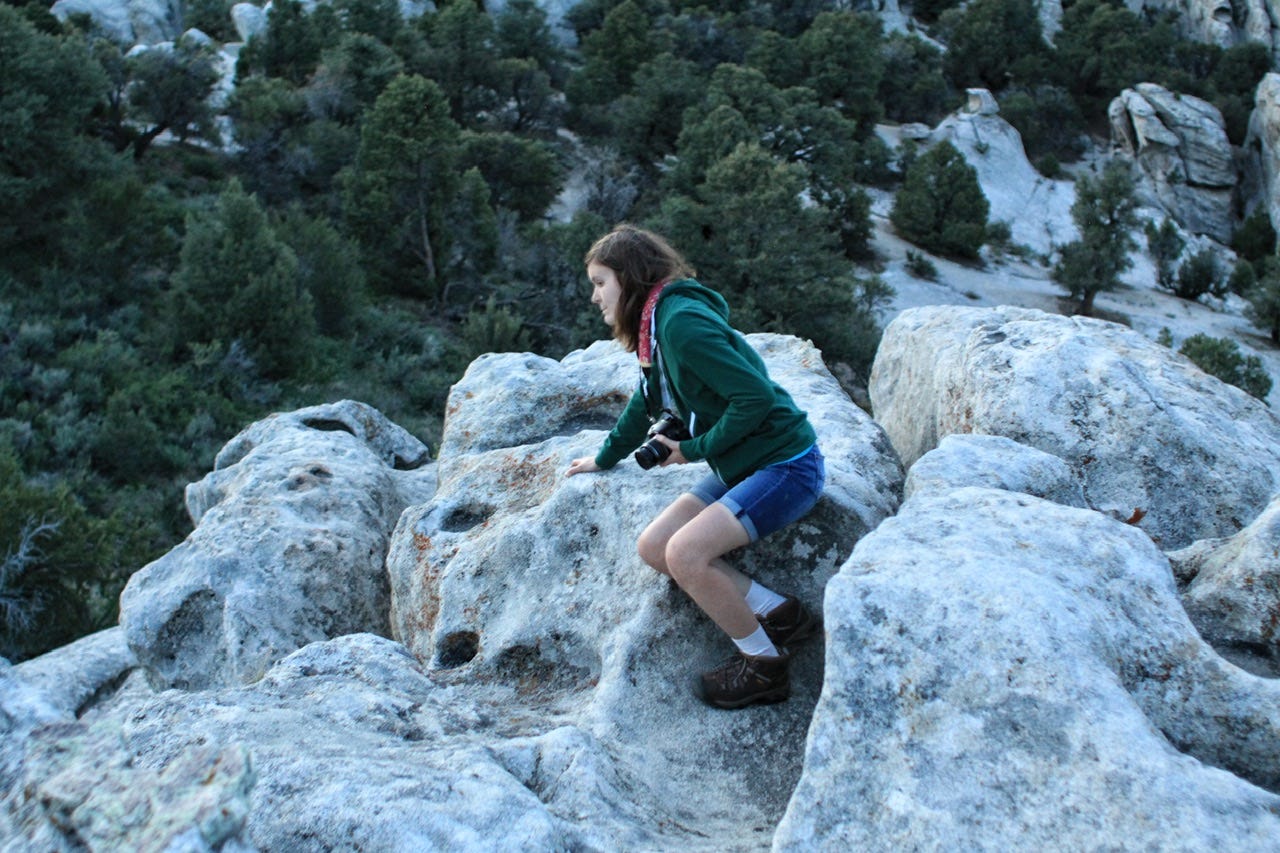
Twin Rock Turtles Approach Trail
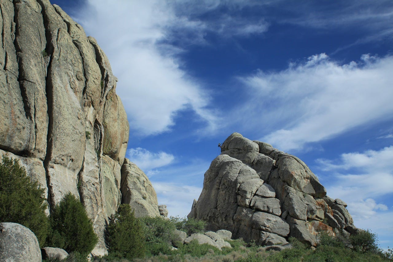
We went wandering around the rocks and found a little trail to follow. According to my Gaia GPS track, the trail was the Twin Rock Turtles Approach Trail, so apparently there was a rock climbing destination somewhere along our route. I don’t know if we saw any rock turtles.
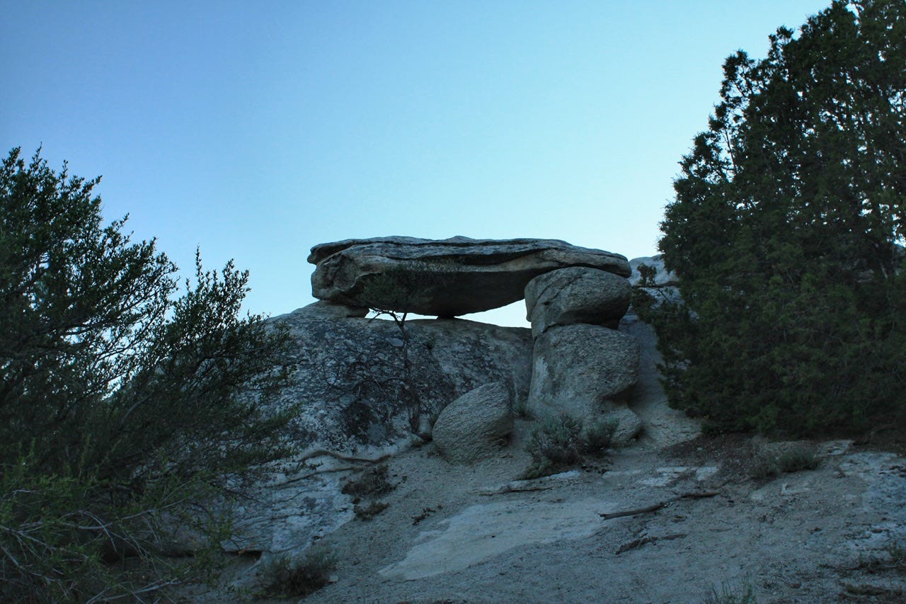
We wound our way over, around, and through the rocks until we found ourselves directly above our tent! This has to be one of my favorite tent photos ever!
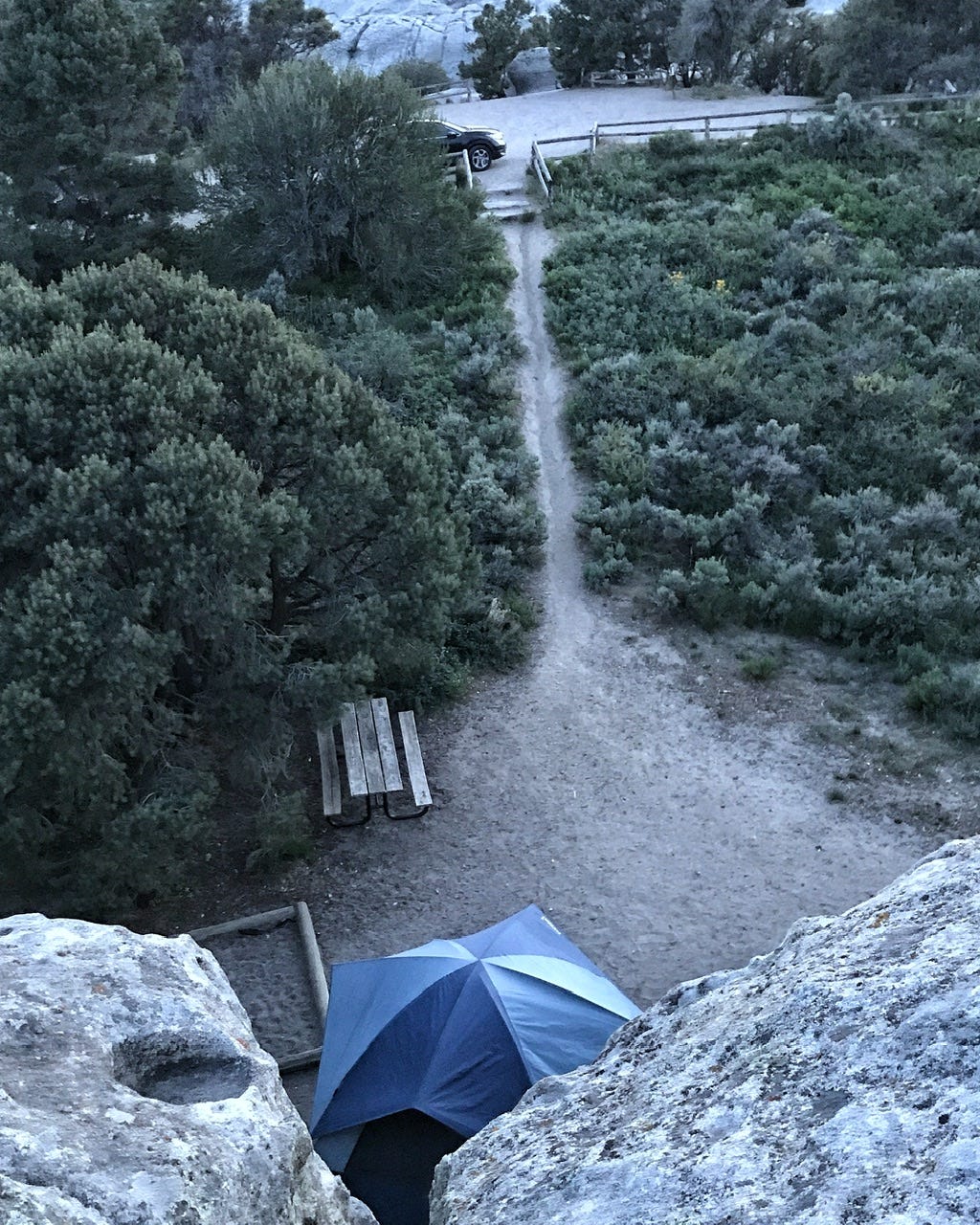
While we were on the top of the rock, a couple from a neighboring campsite must have had the same idea to explore, because they wandered through our campsite and up the trail toward our parking lot. We made our way back the way we came, but found a little bit different spot to climb down. That brought us directly back to our campsite, rather than the parking lot.
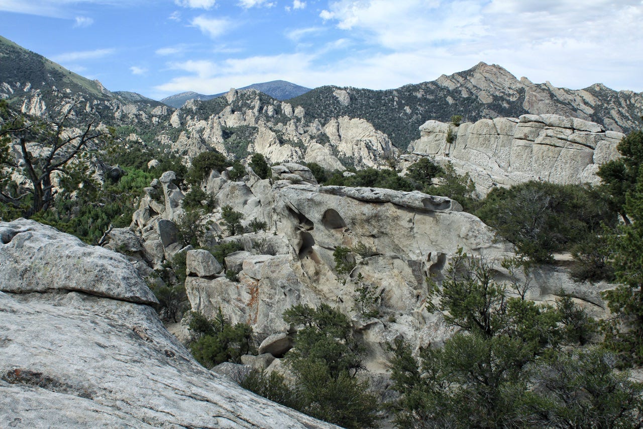
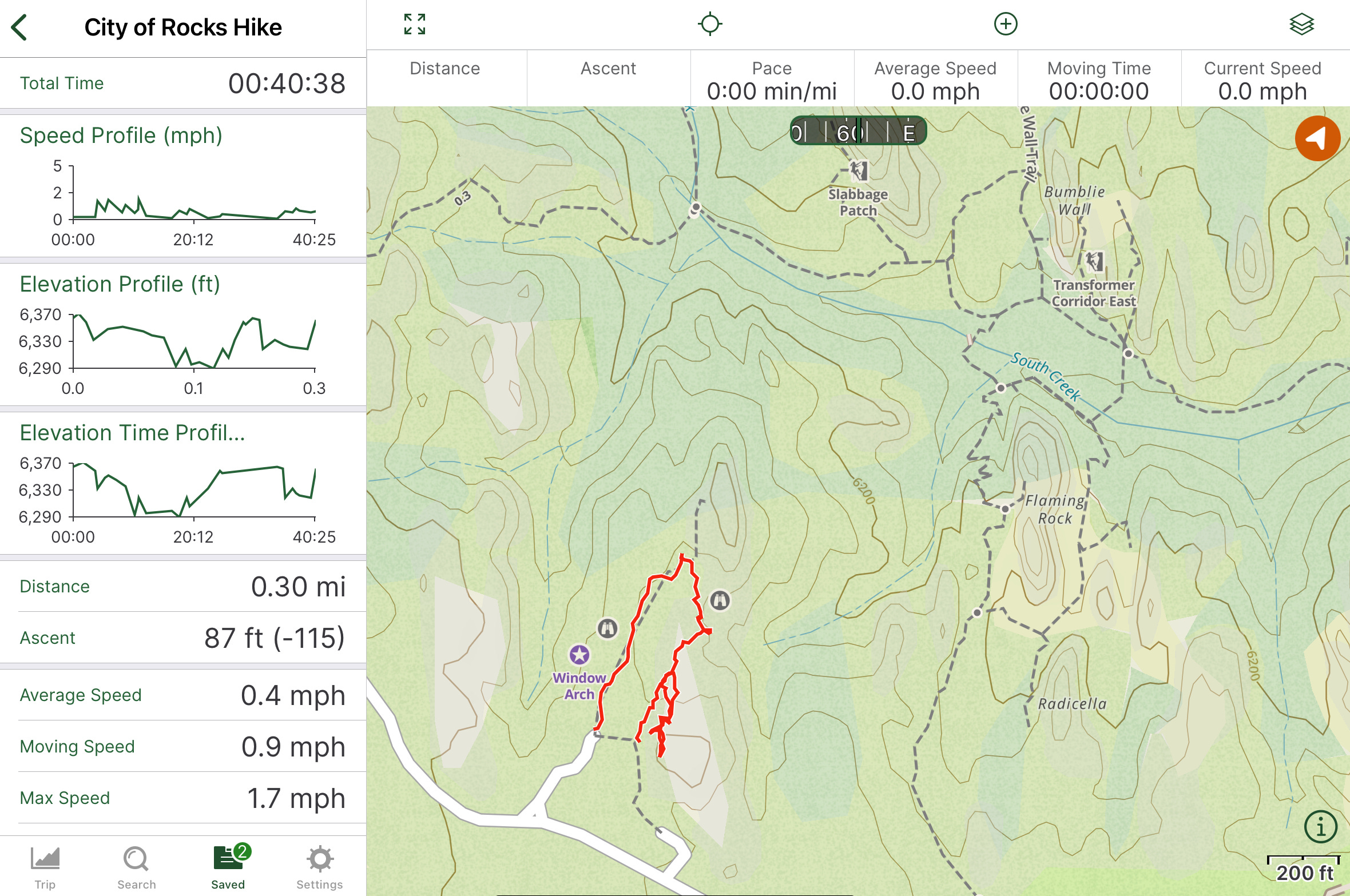
Here’s the GPS track of our little adventure. The rocks we saw off in the distance have some interesting names. It would be fun to go back again to explore more of this park.
A Night Under the Stars
We ended our day with some night photography, one of my favorite ways to end a long day. We experimented with light painting the rocks, but none of those photos amounted to anything worth sharing. We’ve had a little more practice with glowing tent photos, so those are always fun, especially in a campsite like this one! Joey hung out in the tent turning his flashlight on and off for a second or two at a time to capture just the right glow of the tent. Most night sky photographers composite dozens of photos together to achieve a super sharp image, but I’m pretty happy with what I get from playing around with one photo at a time.
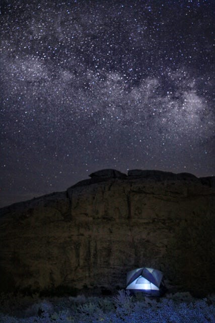
Our evening under the stars was magical. The air was still and warm and quiet. So many stars fill the night sky. It was the night before a new moon, so the sky was dark enough to capture the Milky Way Galaxy. Witnessing that never ceases to be a thrill.
This area was a spiritual place for the Native Americans, and I can see why. It’s also not surprising that the pioneers found it and used it as a waypoint on their route west. Hopefully, places like this continue to be preserved for generations to come.
We’ve got more rocks, plus rockets and trains coming up next, so be sure to subscribe!