


Day Five
Friday, June 11, 2021
Castle Rock Campground
It’s not usually cold in the desert in June, but according to the screenshot I captured, it was only 34° at 6:02 am! Brrrrr!!

More importantly, we found ourselves near another of Joey’s towns. Besides Joseph, Utah, we’ve also visited Joseph, Oregon. Megan and I have not yet visited towns bearing either of our names, but I know there is a Stacy, Texas, so I may have to put that on my to-do list for a road trip visit someday. I think Megan is out of luck, though. As far as I can tell, she’s going to have to visit Australia to find a town with her name.
Even more importantly, we enjoyed a peaceful night in our tent. If it was cold outside, we didn’t notice inside the tent. There were enough trees surrounding us that it probably wasn’t nearly as chilly where we were. It wasn’t cold outside by the time we actually got up for the day at 8am.


We packed up the tent and headed out of the campground in search of the neighboring Sam Stowe Campground to use their coin-op shower facilities. $1.25 for five minutes was a bargain compared to the shower facilities at Signal Mountain Campground in the Tetons a couple nights ago!
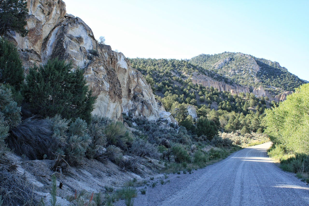
After our showers, we went to the visitor center to look around and get more information about the trails and rock art in the park.
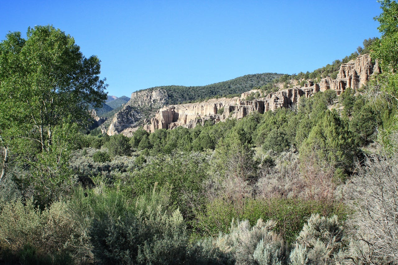
Fremont Indian State Park
A large Native American village was discovered in this area in the 1980s when work began on Interstate 70. Archaeologists excavated the site to save the ancient artifacts that can now be found in the museum, but the village itself was destroyed. Apparently, they needed the fill dirt from that spot to build the interstate. Thankfully, the rock art in Clear Creek Canyon was able to be preserved and they created a state park to protect it in 1987.
Archaeologists called the people in the area “Fremont Indians” because the site is near the Fremont River, but they do not actually know what the people who first inhabited this area called themselves. They inhabited the area for one thousand years from 300 to 1300AD and their rock art is distinct and different from other tribes in the area. The Paiute, Ute, and Shoshone also traveled through the canyon seasonally.
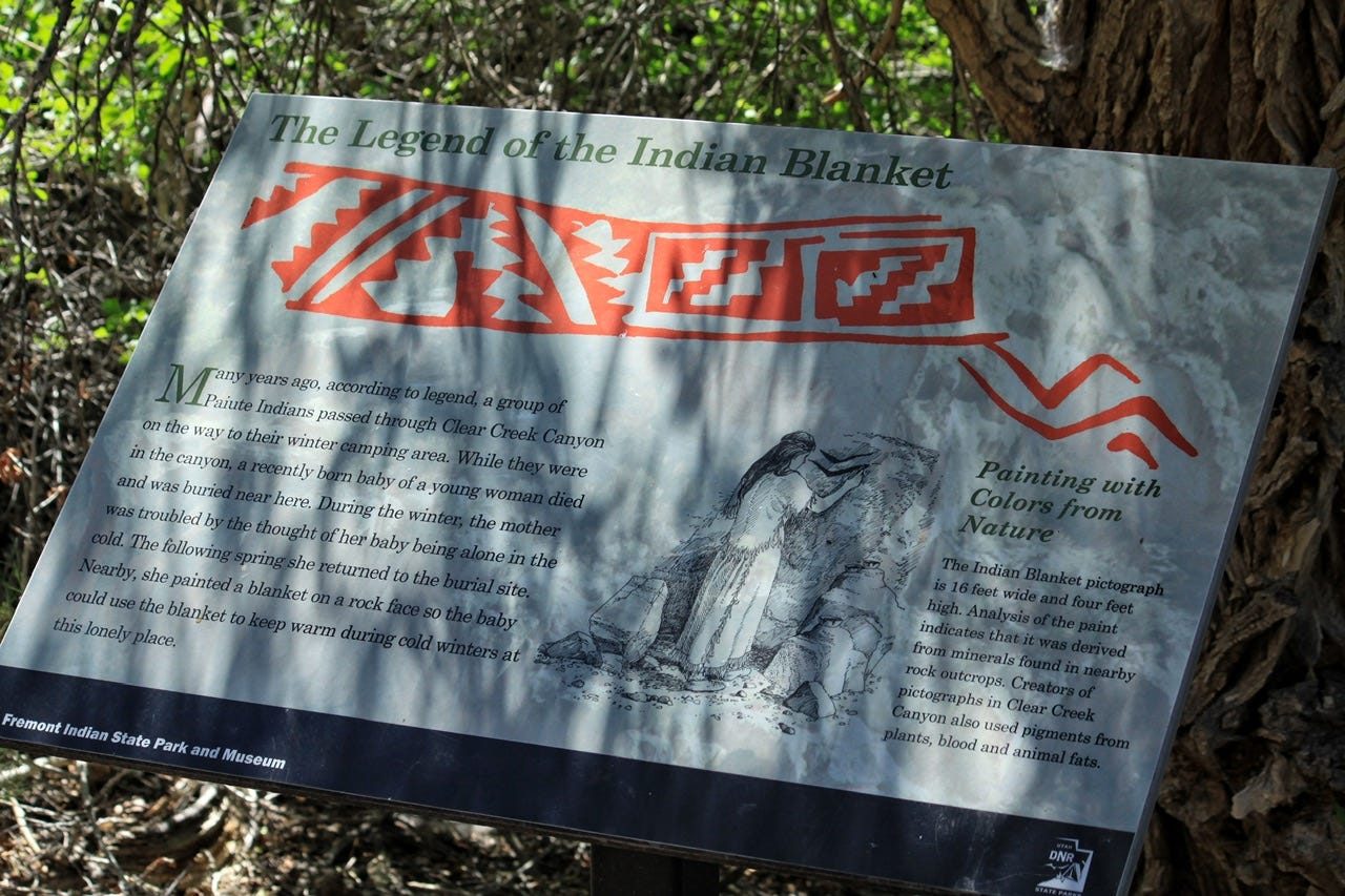
Indian Blanket Pictograph
As an occasional quilter, the rock art I was most interested in finding was the Indian Blanket. The painted design is sixteen feet long and four feet tall! Isn’t it beautiful? If you look closely, there’s another smaller design off to the right.
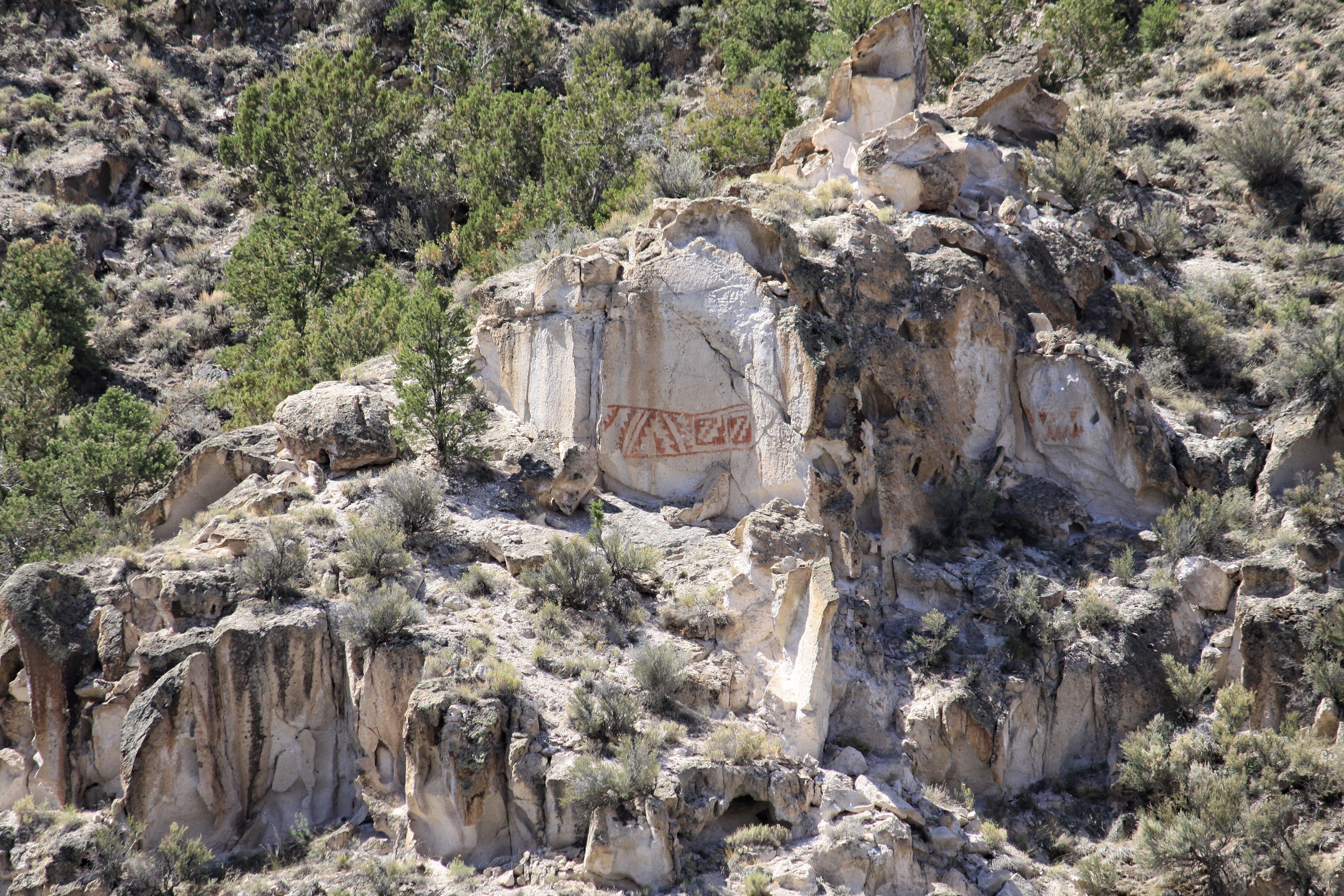
This photo is from across the interstate using a telephoto lens, but the park has a viewing tube set up at the viewpoint to help find it. It is possible to hike close to it, but we had a lot more rock art to find, so we just enjoyed it from the viewpoint.
Sheep Shelter
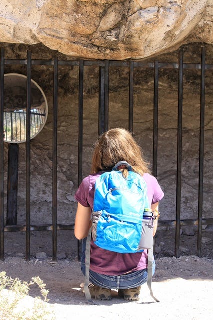
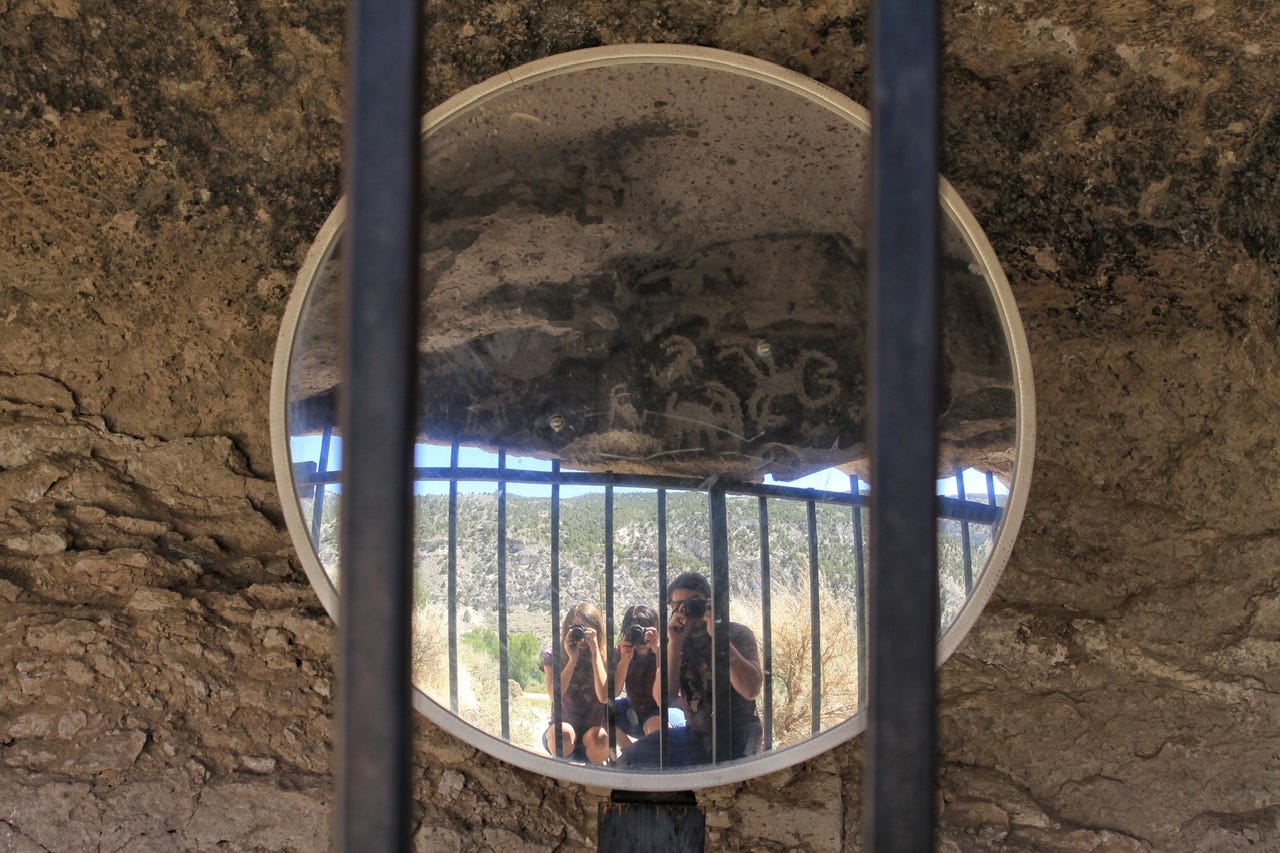
Our next stop was Sheep Shelter, which was behind bars to keep people from damaging the designs. A mirror was situated inside the cave to show the petroglyphs we couldn’t see on the back side of the rock. I was able to stick my phone in between the bars to photograph the sheep without the use of the mirror, but the mirror made for a fun group photo op!


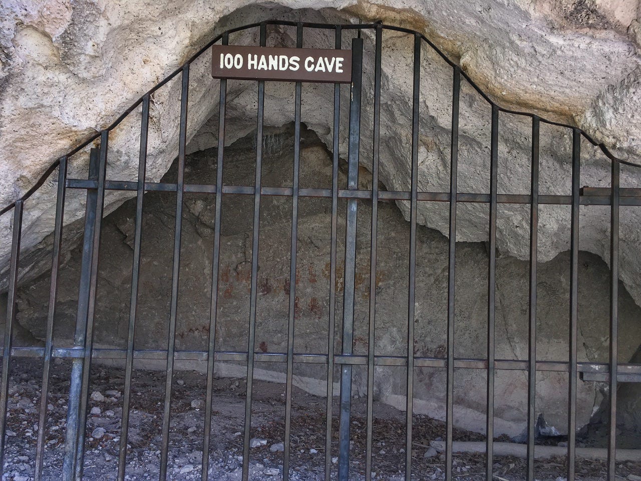
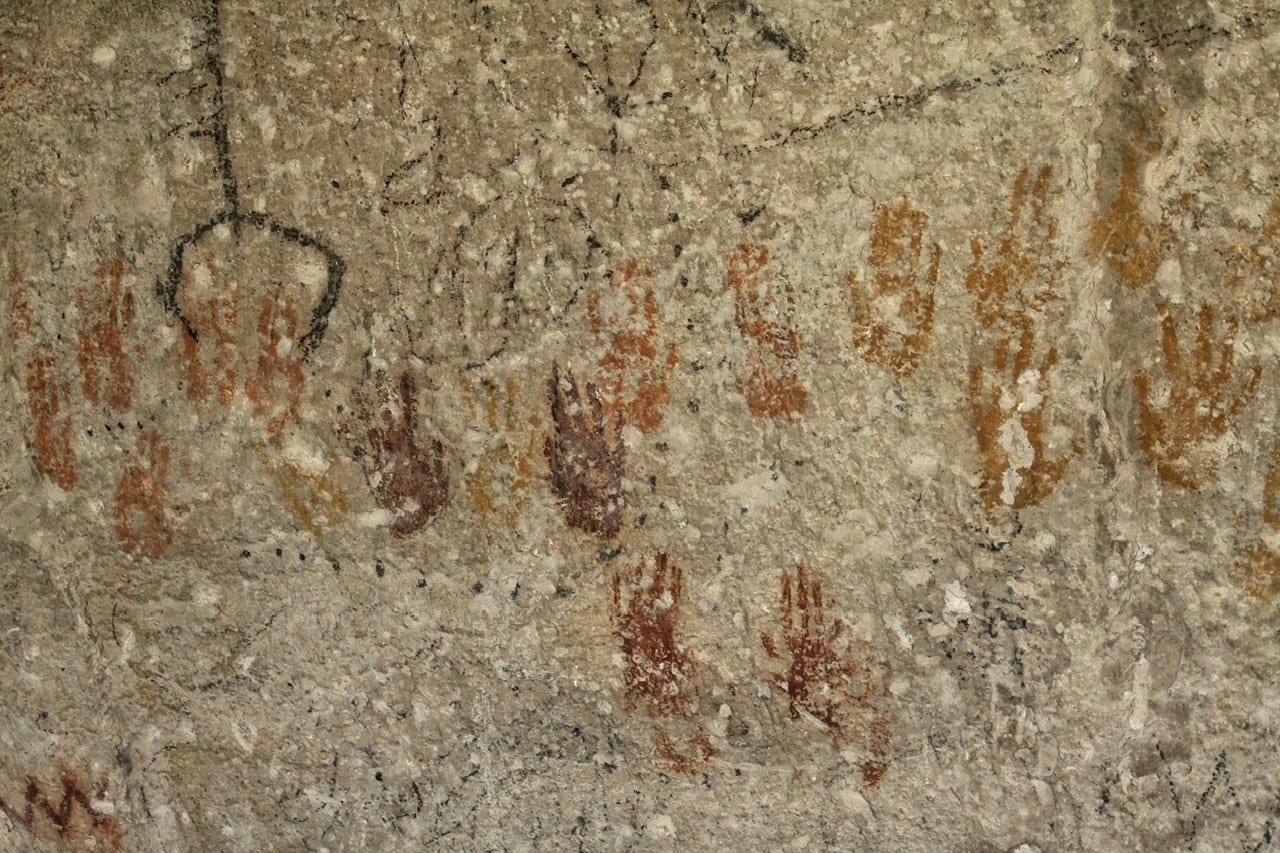
Cave of a Hundred Hands
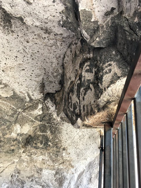
We hiked a trail that took us under Interstate 70 to the Cave of a Hundred Hands. This site was also behind bars, but we could see the hands on the back wall of the cave. I don’t know why this site has “100 hands” in the name when there are 31 hand prints in the cave.


Five Finger Ridge
We could see what was left of Five Finger Ridge on our way back to the car. This was the location of the village that was found when the interstate was built. It seems kind of crazy that they would destroy a historic place that was over one thousand years old, just to use the dirt as fill dirt for the interstate.
Parade of Rock Art Trail
Our last look at the park was the paved trail near the visitor center. There was a lot of smaller rock art along the path.


This park was just a place for us to camp for the night, but I’d like to go back again to see more of it. We spent the whole morning looking at all of the rock art that is easily accessible by car and short trails, but there are more trails we could do if we ever go back again.
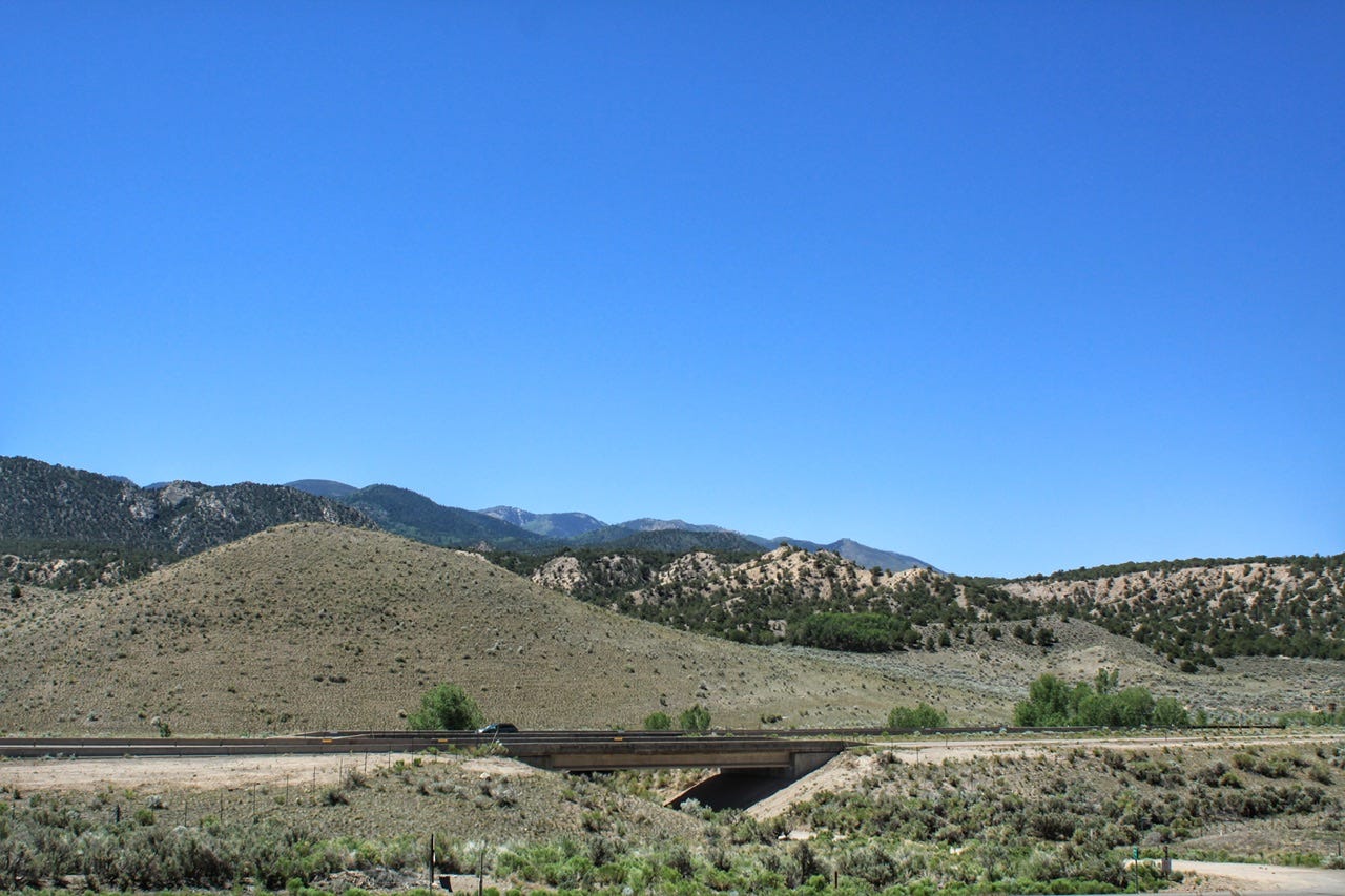
After we finished up at the park, we stopped for a resupply of snacks at the Walmart in Richfield, Utah. The gallon jugs of water that had been frozen when we left home five days ago were now back to being water, so we also picked up a couple bags of ice and spent far too long dropping ice cubes one at a time into empty gallon jugs.
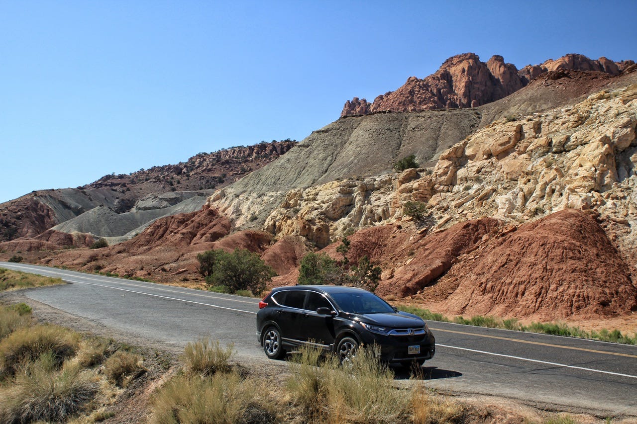
Our reward for this tedious task was Magnum ice cream bars, which come conveniently packaged with three to a pack! We headed down Highway 24 to Capitol Reef National Park. Having less than a couple hours of driving for the afternoon was great after several longer days in a row, but that’s why I do the longer days so we can have shorter days later!
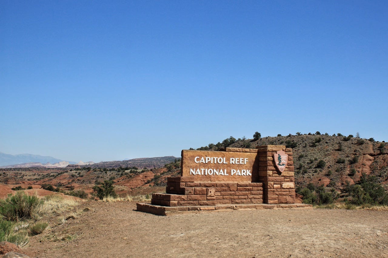
Capitol Reef National Park
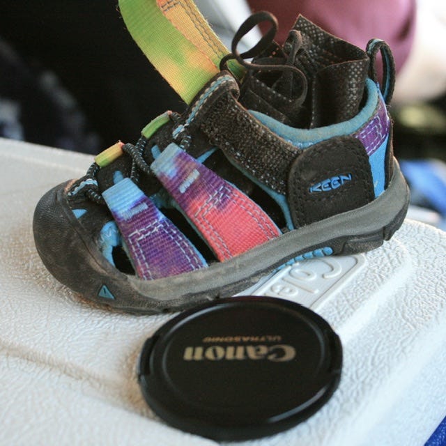
We arrived at Capitol Reef around 4:30pm. We stopped at the visitor center long enough to grab the park brochure and deliver the little bitty sandal to them in case someone was looking for it. The kids had already earned their Capitol Reef Junior Ranger badges during our last visit, so we didn’t need anything else. We had a reservation in the Fruita Campground, so we went there to set up the tent.
We didn’t stick around long because I had found us a trail with a slot canyon that wasn’t too far away, and I wanted to go for a hike before it was too late in the day. I don’t know why we’ve never actually explored the trails inside of this park when we’ve been there twice now, but that’s what’s nice about sampling parks on multiple trips. We’ll have something different to do the next time we go back.

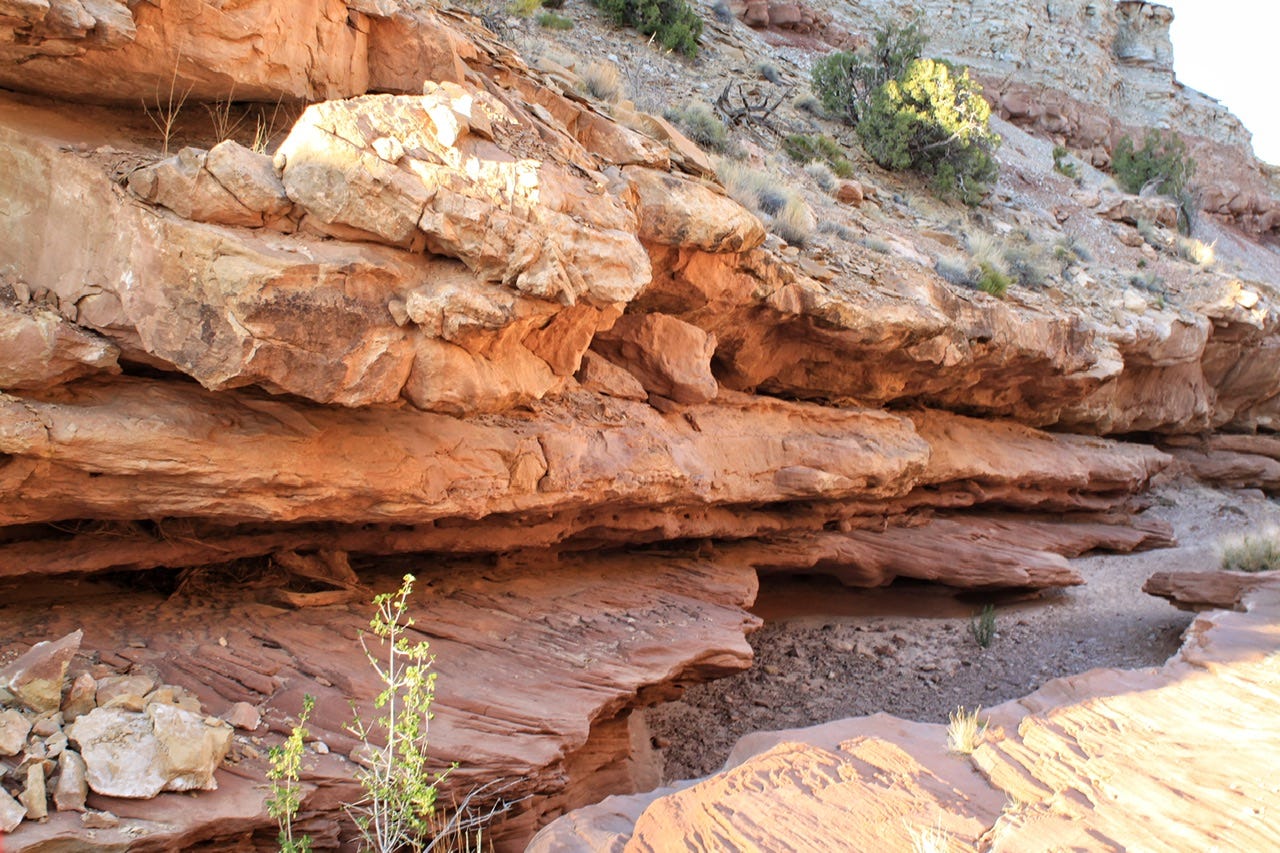
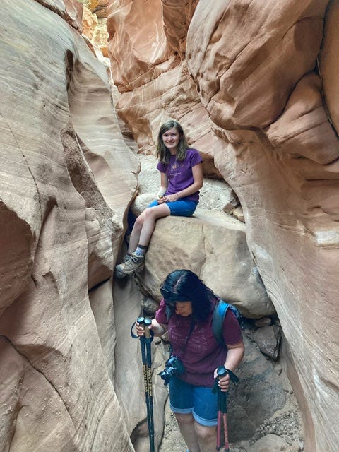
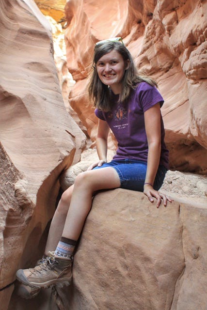
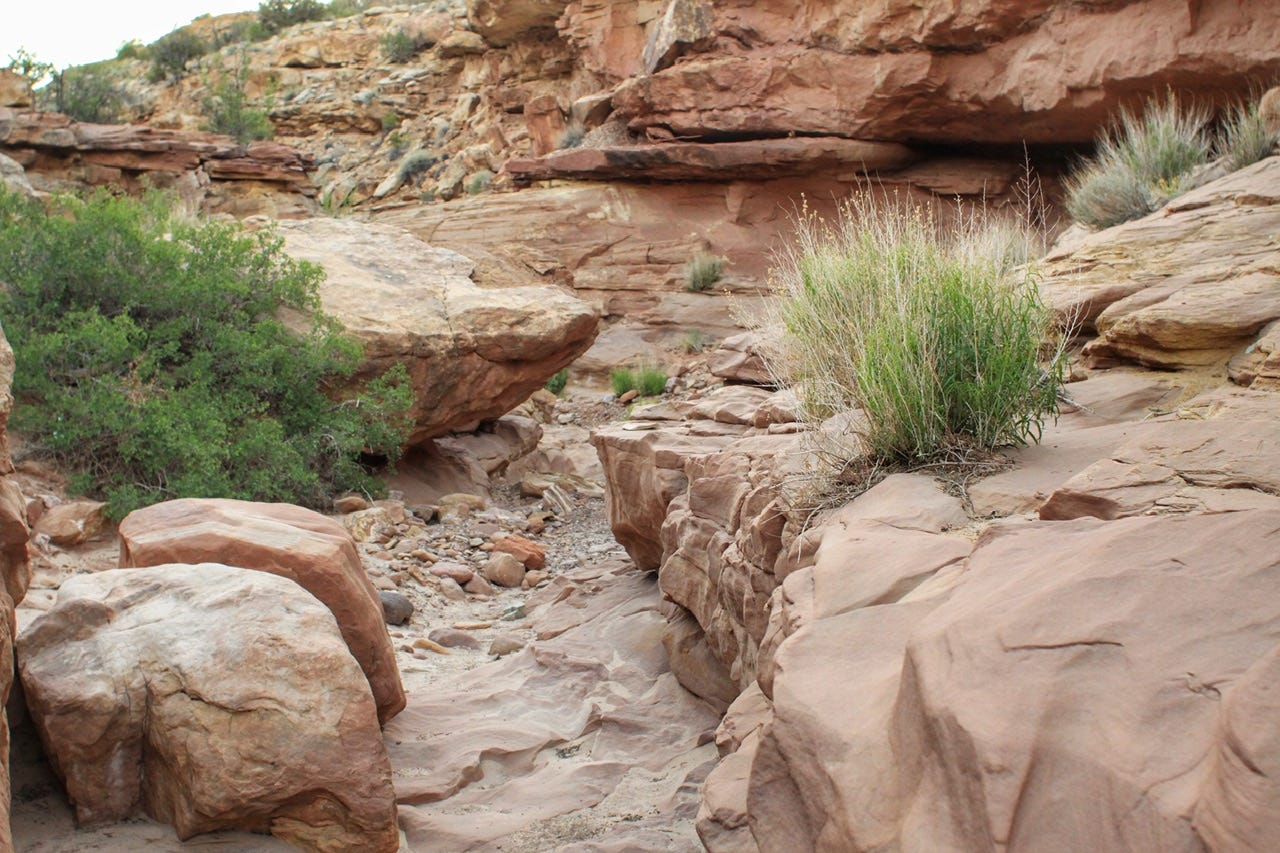
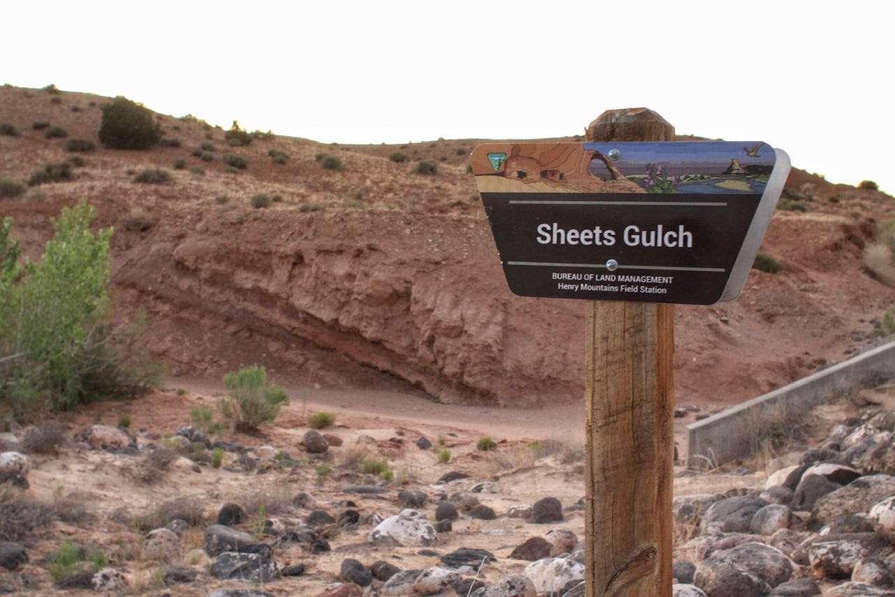
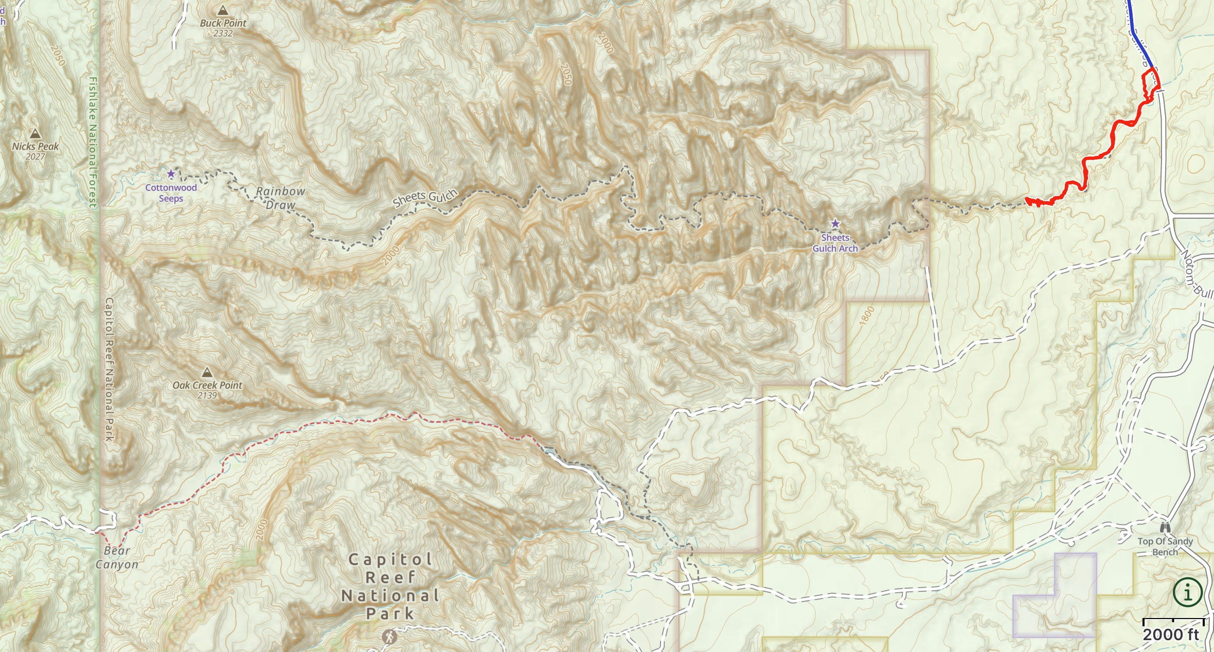
Sheets Gulch
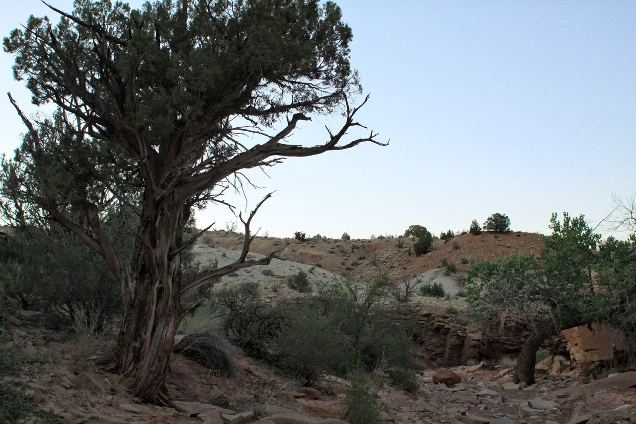
The Bureau of Land Management (BLM) trailhead for this trail is located 12.7 miles south of Highway 24 on Notam-Bullfrog Road. The trail starts out with a short trek up and over a hill and then continues on in a sandy wash. I’m not a huge fan of hiking in sand, but it’s so much easier with trekking poles! We didn’t have to go far before it started to get more interesting.
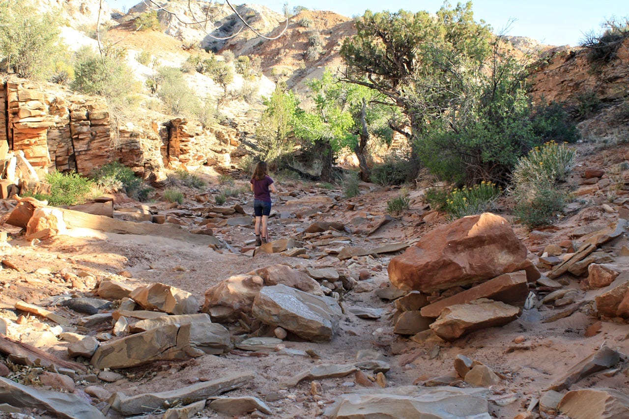
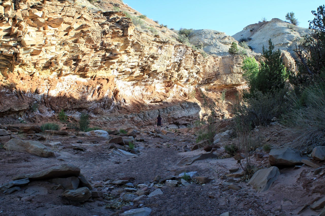
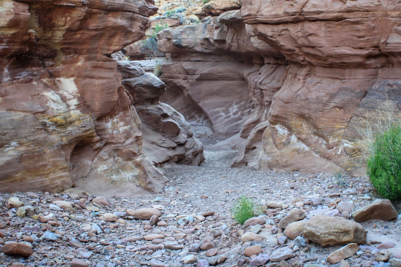
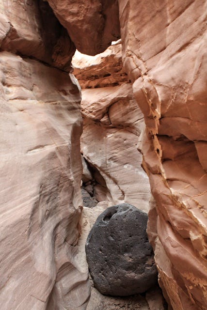
The first 1.25 miles of the trail included a lot of pretty rocks, but nothing like a slot canyon. Then we reached the canyon junction, where we continued toward the right, down into a canyon with layered walls called the Kayenta Formation.


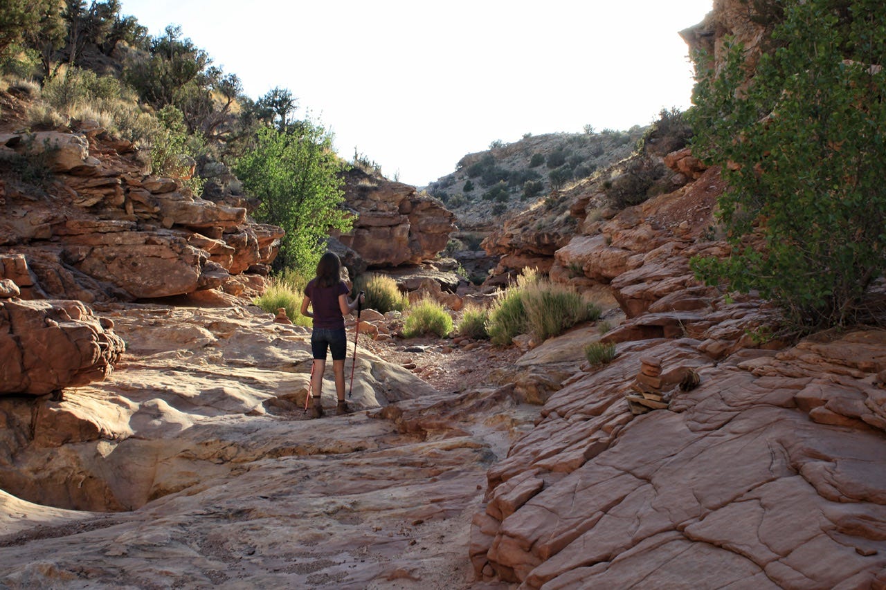
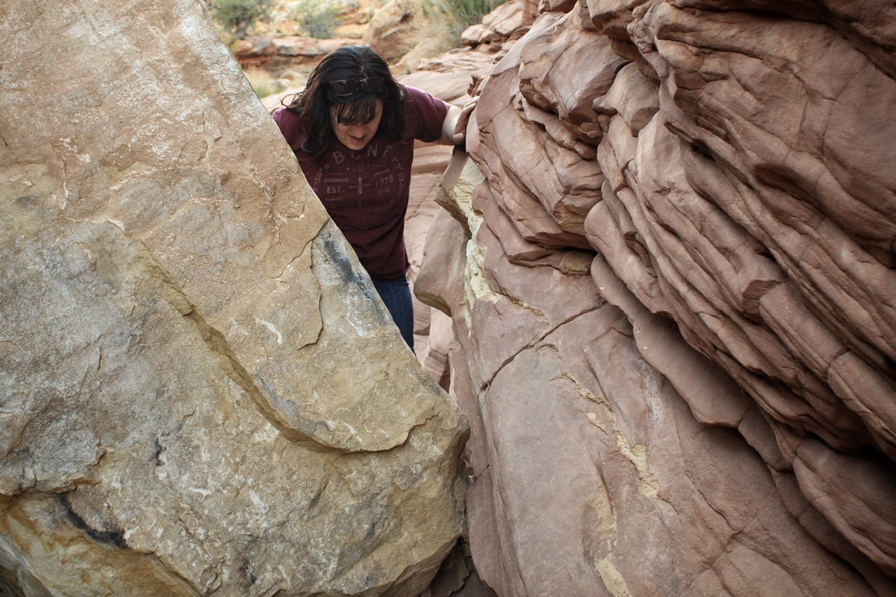
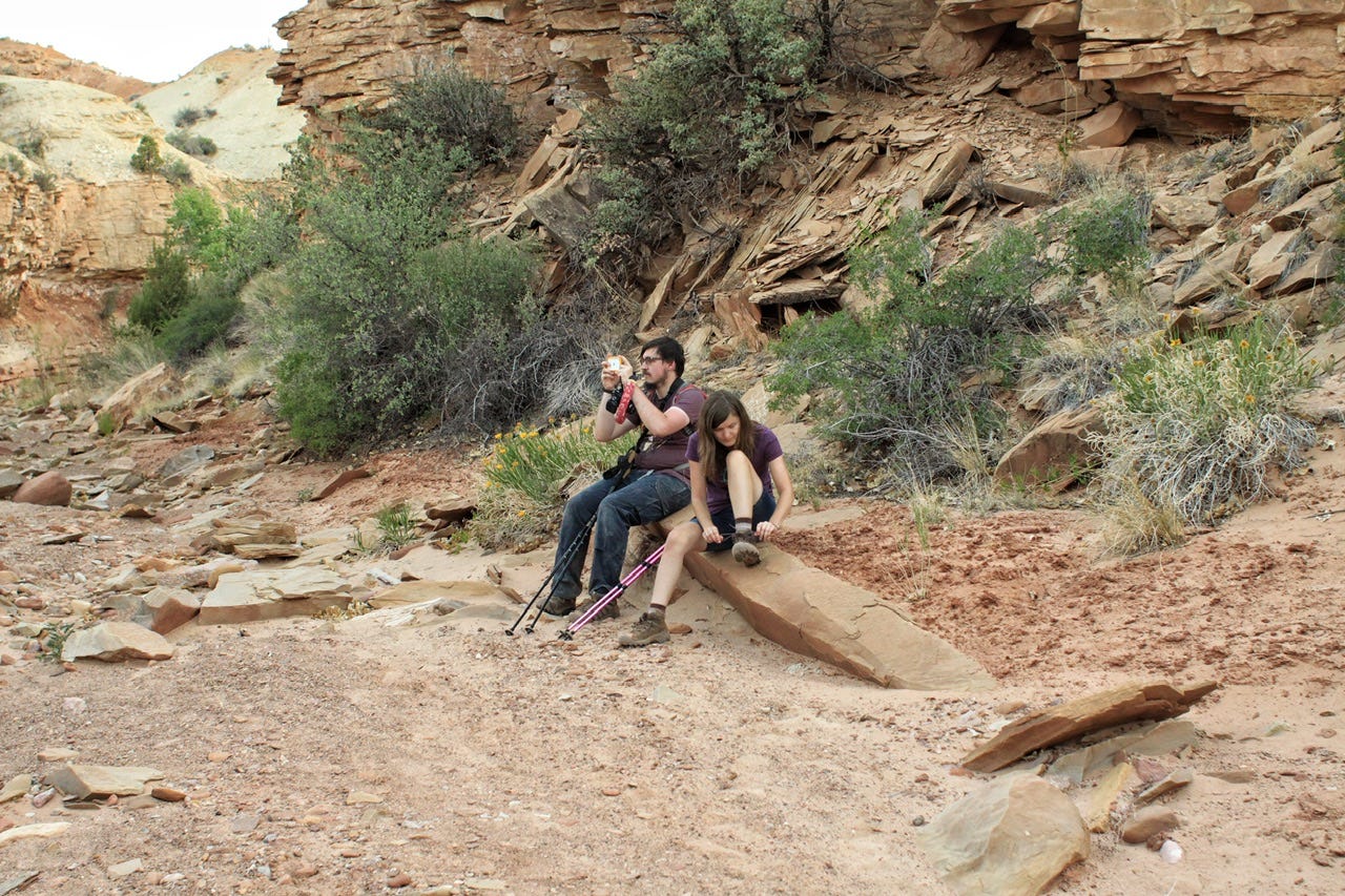
We encountered a few obstacles along the way. Flood water rushes through here when it rains and it can leave behind large boulders and rock piles. The first couple obstacles were pretty easy to climb over and continue on down the path.


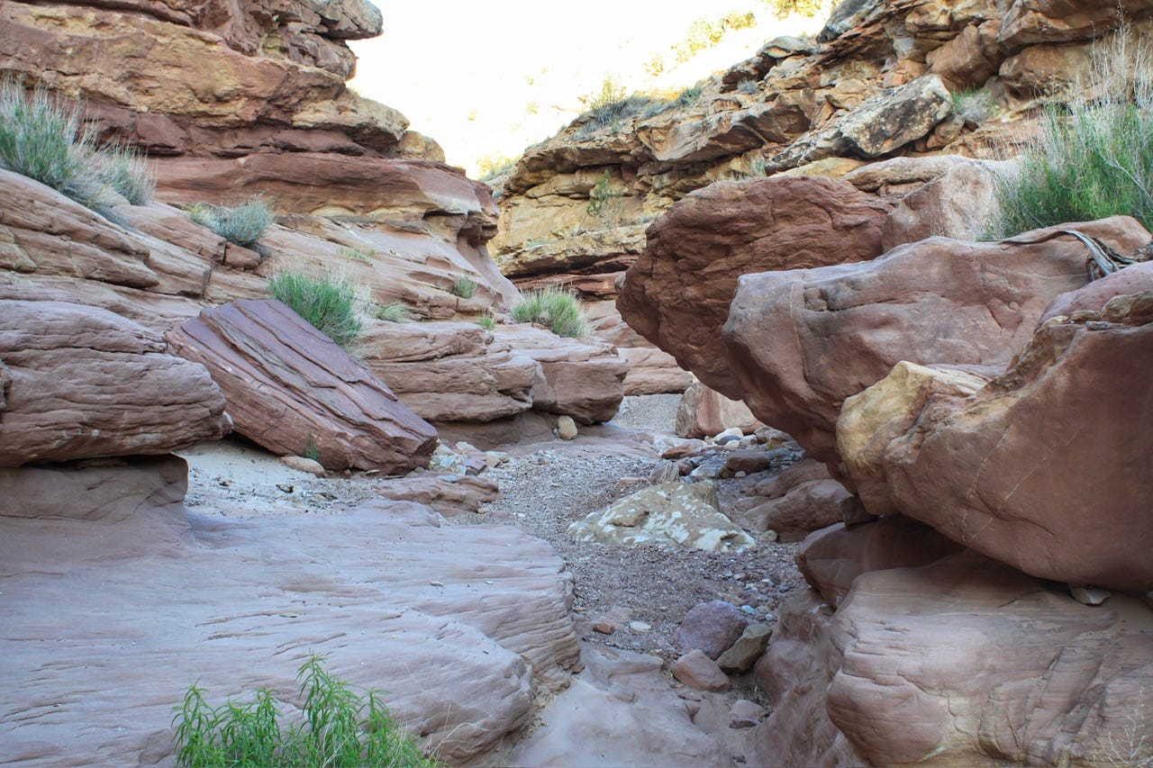


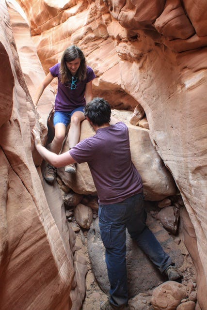
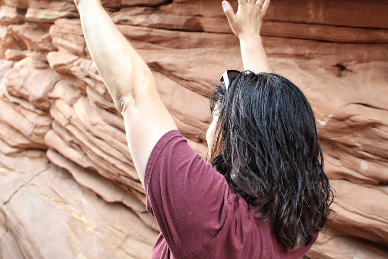
This boulder pile is where we turned around. It was at least a six or seven foot climb up, which meant it would also be a six or seven foot drop to get back down. Megan climbed up to check it out for us and reported back that there was another large boulder pile to climb not far after this one. We opted to turn around and Joey helped her get back down. This hadn’t been a fast hike for us and it was already 8pm. If it had been earlier in the day, we would’ve all climbed up and kept going, but I did not want to be out there trying to figure out how to get back down from these boulder obstacles in the dark, which was about an hour away.
I had hoped to visit Sheets Gulch Arch, which is 2.7 miles down the trail, but the first slot canyon was the more realistic goal for this hike. The slot canyon where we were starts at 1.3 miles in, so we would’ve had over a mile to go to reach the arch, but that will keep for another day.


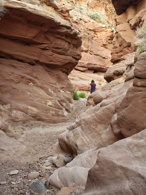


We made it back to the highway by 9pm. I’m not sure why we didn’t take the little trail over the hill, back to the parking lot, but we walked along the highway for the rest of the way back to our car.
This hike was a lot of fun and felt like a real adventure! It’s not a marked or maintained trail, just a walk through a wash with pretty scenery along the way. It took us almost three hours to do 3.6 miles. Our hiking speed is usually above 2 mph, so this one slowed us down a bit with all the climbing over boulders that we had to do. I’ve included the track and stats below. I have to chuckle at the max speed being 8.1 mph…that had to be the walk on the highway at the end because there was no way we walked that fast anywhere else on this hike! The little scribbles in the path are where we had to climb over the obstacles.
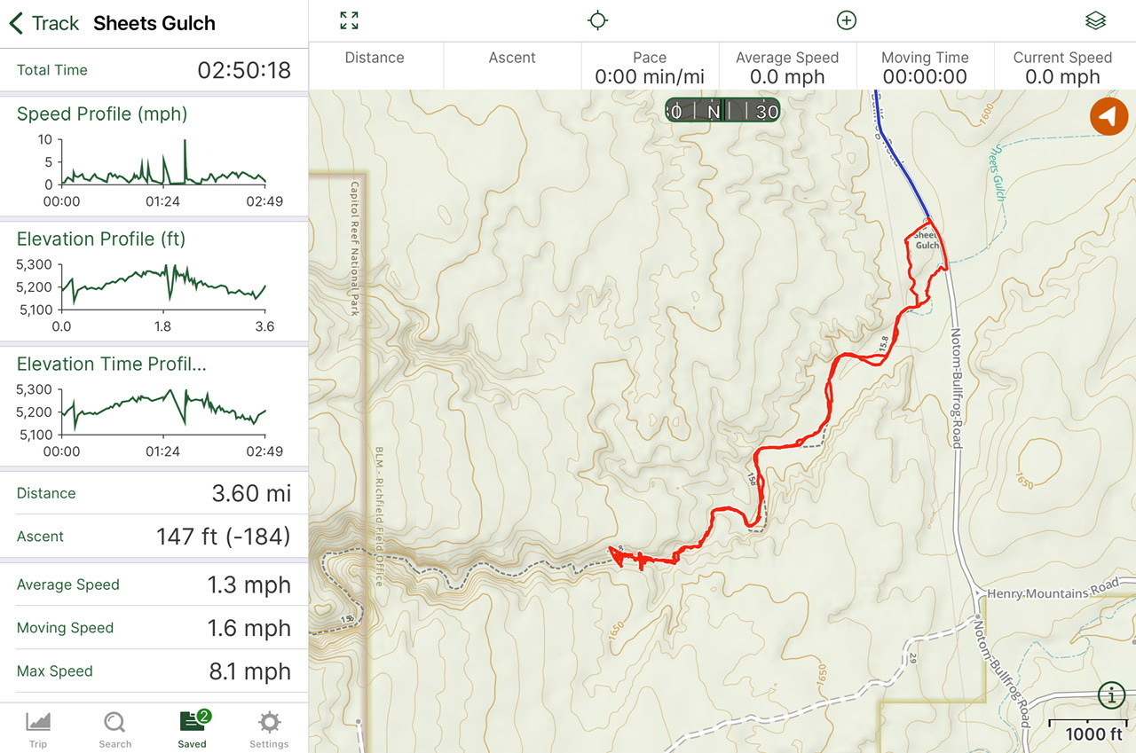
I also wanted to share an image of the full trail. I’m not sure how much further we would’ve needed to go to reach the Capitol Reef National Park boundary, but that would’ve also been a fun goal. It’s the straight line that’s to the left of where our track ends. There are three slot canyon sections on this trail and we saw the first one. I found the information for this hike on a blog I’ve had bookmarked for years, called Live and Let Hike. I’ve linked the full trail information in case anyone wants to go find out what else there is to see on the rest of this trail.
We returned to the park with enough time to find a parking spot and a spot to sit near the Gifford House, where we attended a ranger talk about the night sky. I could not tell you if we learned anything we didn’t already know, but looking at the stars was a nice way to end our day.
When the program was over, we went back to our campsite, cooked something easy for supper and ate it, and then took a walk around the campground before tucking in for the night.
This was such a nice, leisurely day after so many driving days. We’ve got another short drive coming up, so stay tuned to find out where we’re off to next!