


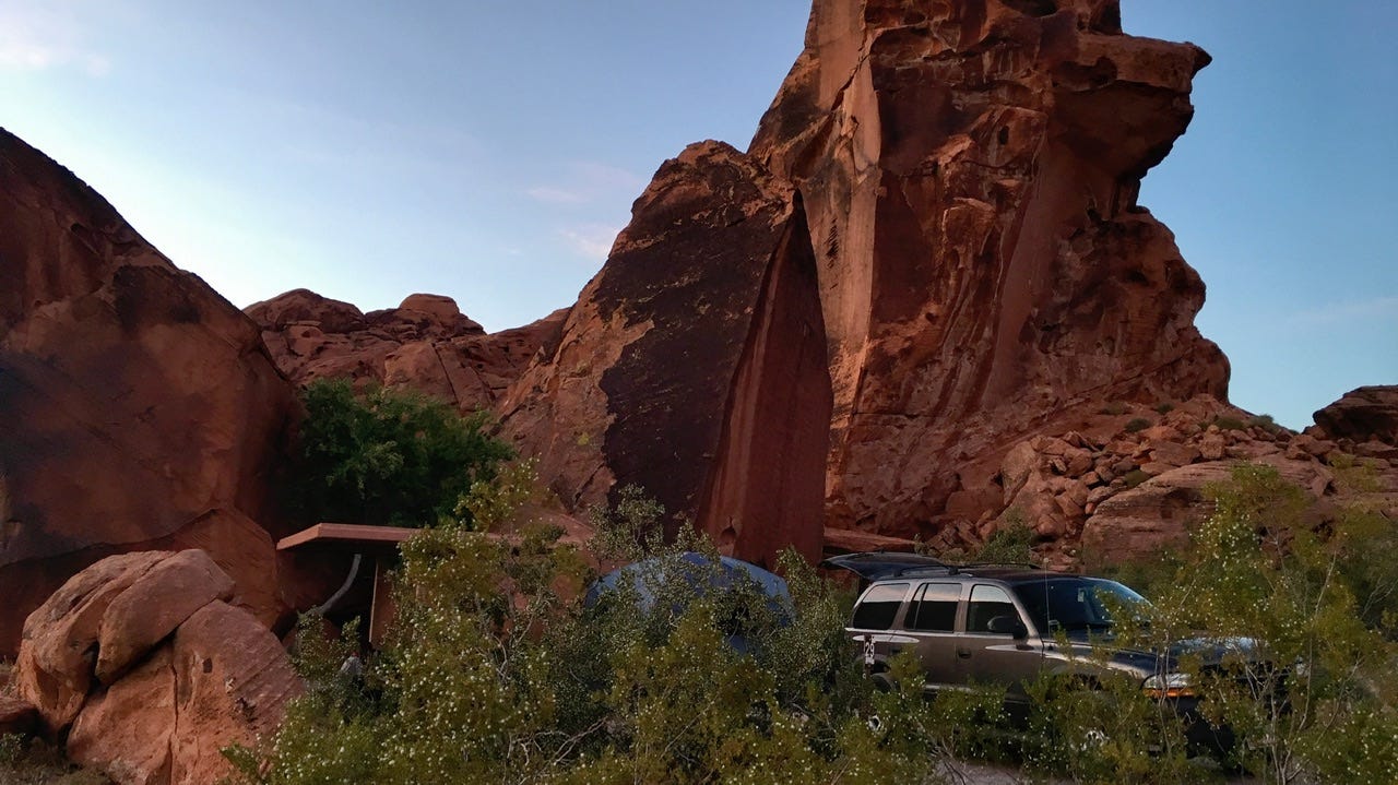
We ended the previous day happy to have grabbed the first, first-come, first-served campsite we could find in the dark, while two RVs also searched for a campsite. This is where we found ourselves when we woke up! I don’t know why I didn’t just pay for two nights right then and there.
Day Four
Sunday, June 2, 2019
Valley of Fire State Park
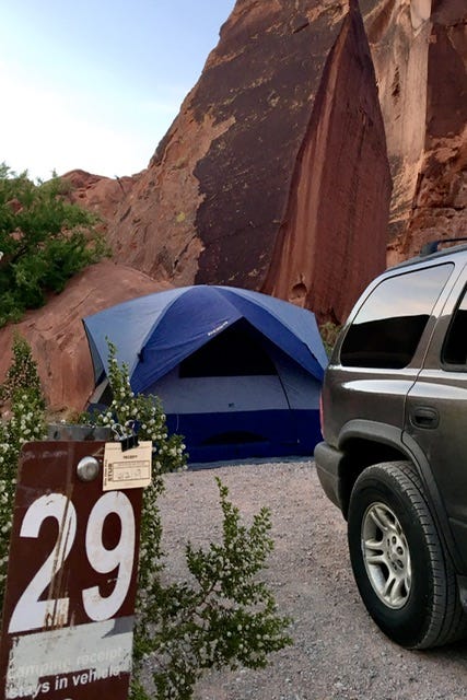
Arch Rock Campground
I remember why we didn’t. We were all tucked in the night before, feeling pretty lucky to have found our campsite before the two RVs did, when we discovered that our next door neighbors might have ate a few too many of the special brownies…if you know what I mean. The couple stayed up late, giggling in their tent, which we had not noticed was parked mere feet from ours, on the other side of a large bush. I remember drifting in and out of sleep, seeing 3am on my phone, still hearing giggling, followed by shhhh…ugh. At least one of them knew they should be more quiet in the middle of the night.
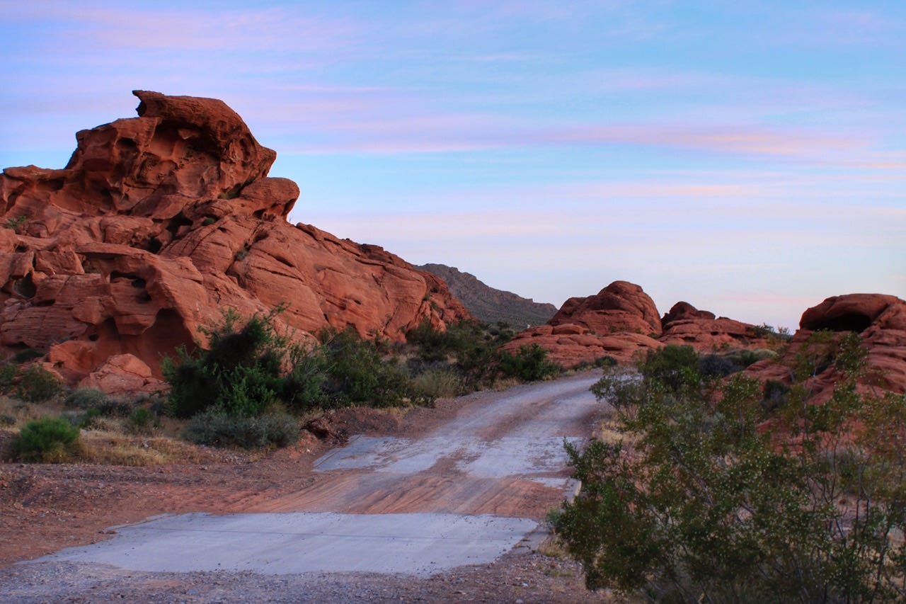
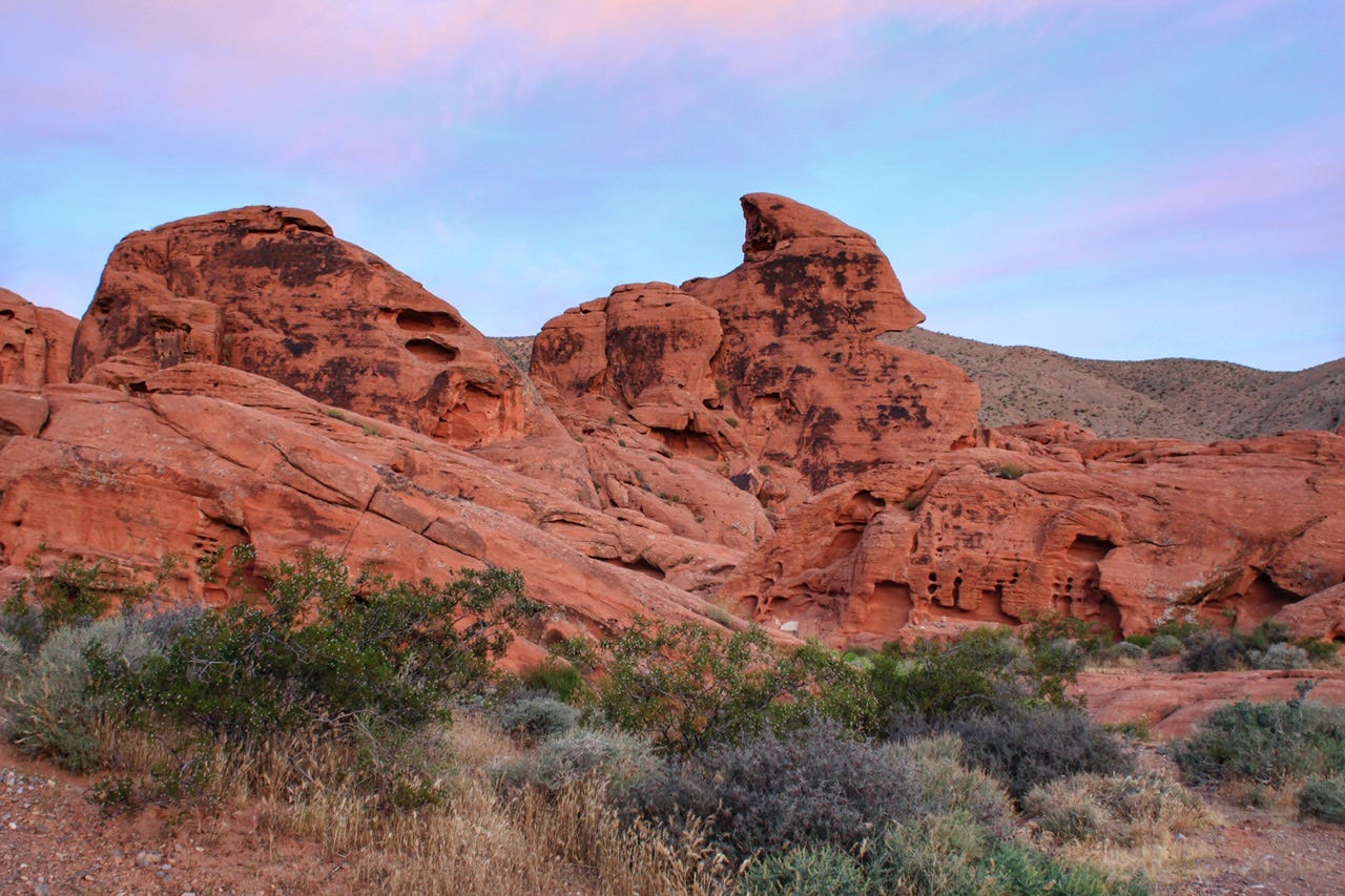
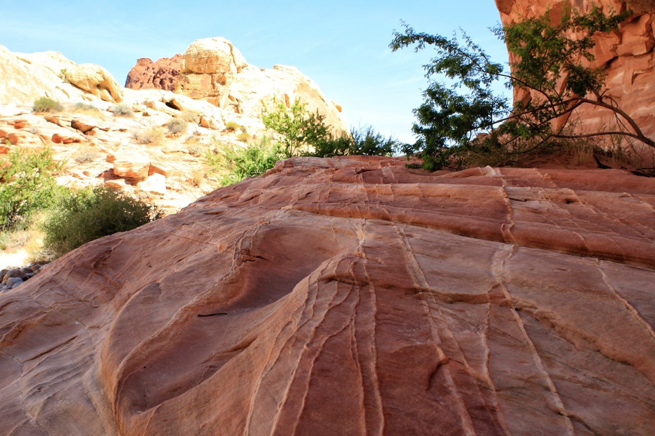
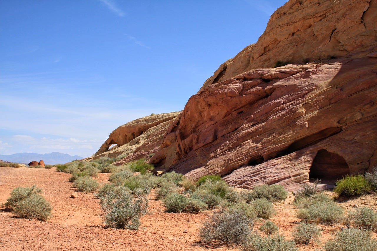
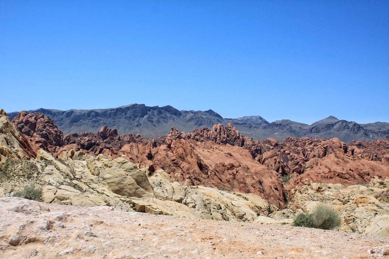
I must have slept a little because I woke up at 5am and all was quiet. 5am Pacific time is 7am at home, so I was ready to get up and find out what our campsite looked like! The cotton candy sky over the rocks was amazing.
Our campsite was also amazing. I have no idea why it was still open when we arrived. I suppose in daylight hours, it might have looked super close to the neighboring site that was already occupied…or someone else tried it and had enough of giggles and her friend and left early. Who knows?
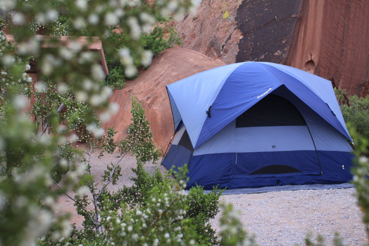

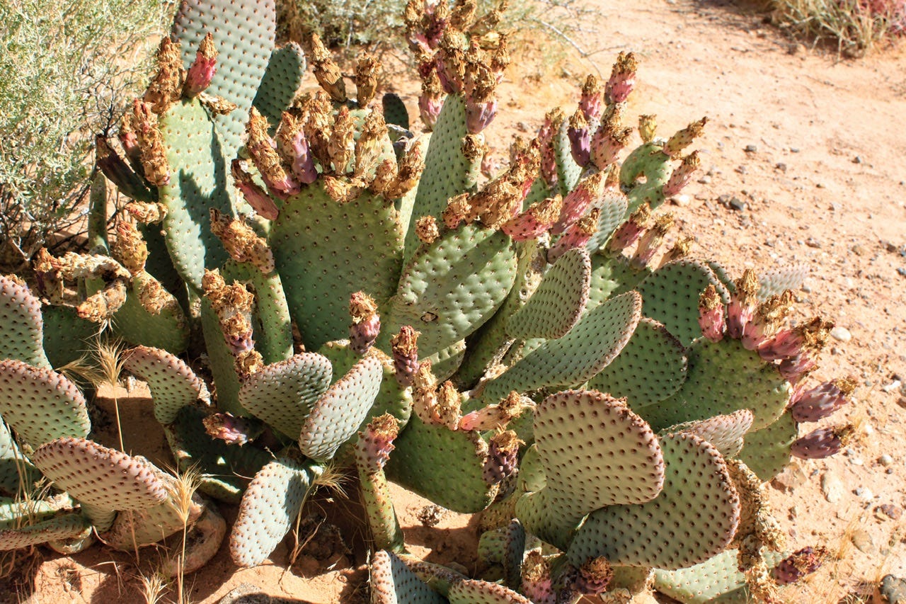
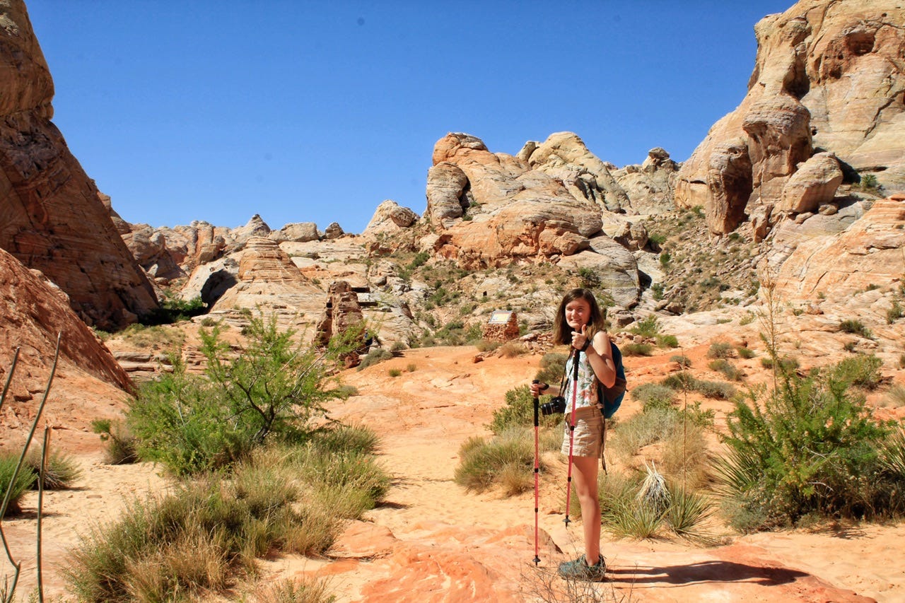
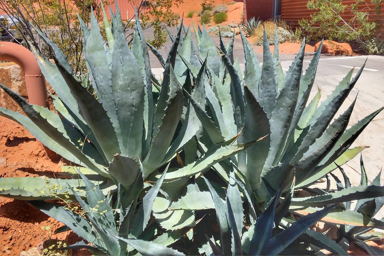
I spent a leisurely amount of time quietly photographing our campsite and the flowers around it while the kids slept in. Eventually, Megan got up and joined me with her camera, and then I woke up Joey, so we could get going before it got too hot for hiking. Our giggly neighbors were finally quiet in their tent…and we were not.
Fiberglass tent pole sections can be plenty clickety-clackety while disassembling them, if the situation warrants less care in preserving the tranquility of the early morning. If someone ignores the posted quiet hours all night long, and nobody else is within hearing range, you can bet I am not going to feel bad returning the favor at 6am when we’re packing up! Luckily, it doesn’t happen too often.
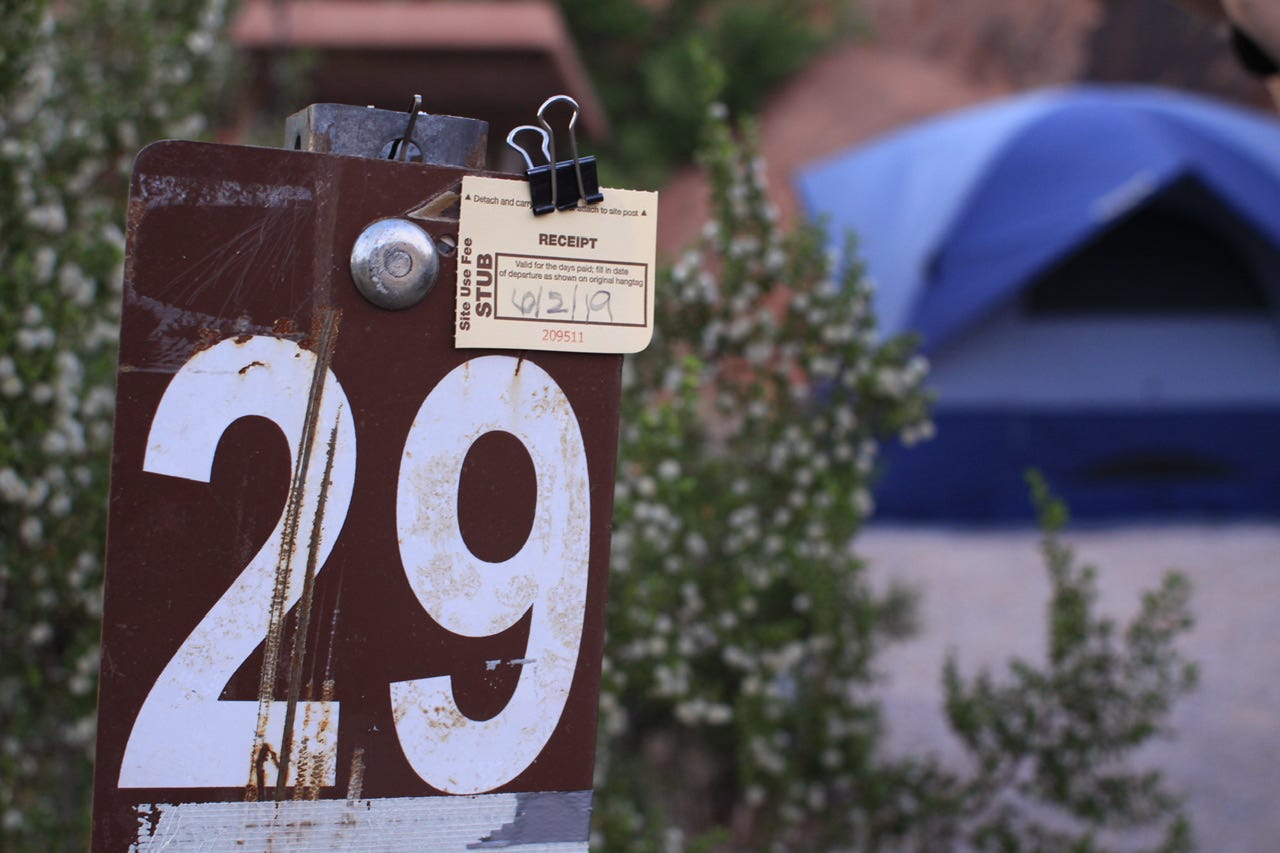
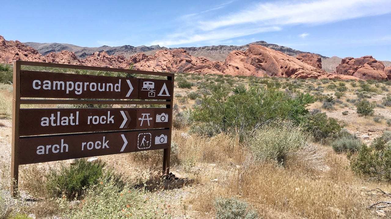
We stopped at the Arch Campground iron ranger to drop off our payment envelope before going to the shower house in the Atlatl Campground. Then we went in search of adventure.
On our way toward the scenic drive, the Durango made a little squeaking noise. I stopped to take a look…at what, I don’t know. Ha! It was coming from the vicinity of where my brother had wired up a spare key for us after last year’s incident of getting locked out. I wasn’t sure why that would make any noise since it was still firmly wired into place. A ranger stopped by to ask if we needed assistance, so I told him about the squeak. He suggested that it might be a pebble in the brakes, which seemed reasonable after our little drive up the big gravel hill in the campground the night before. We kept going and the squeak was with us for most of the rest of our trip.
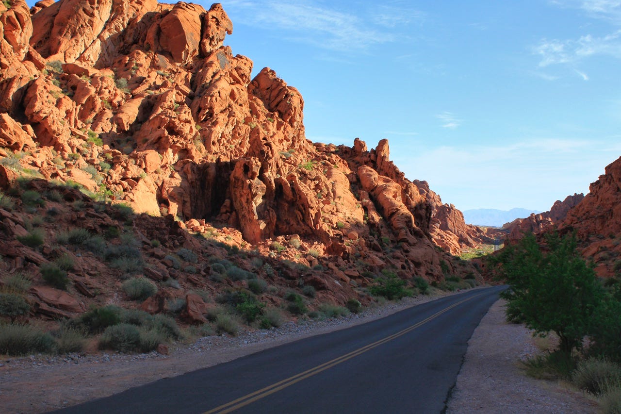
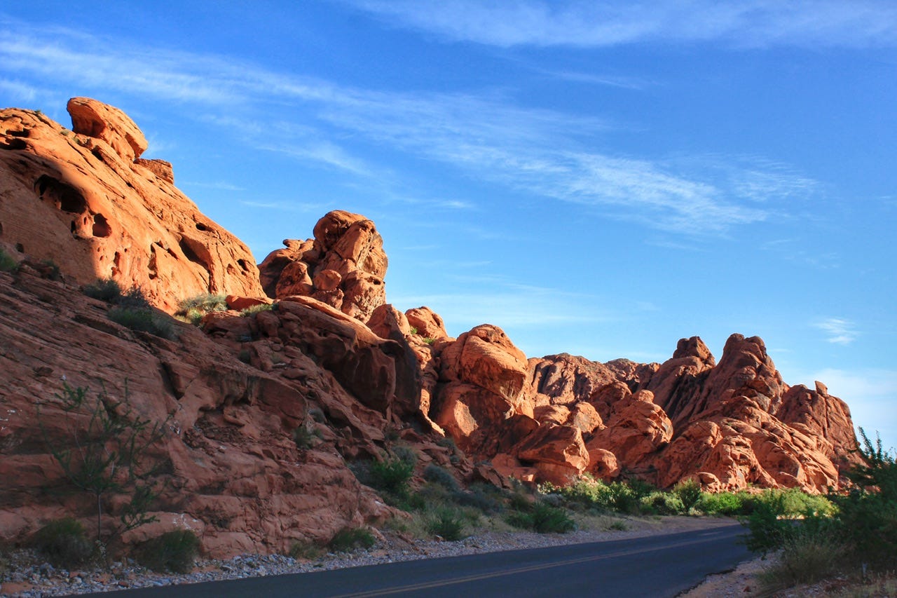
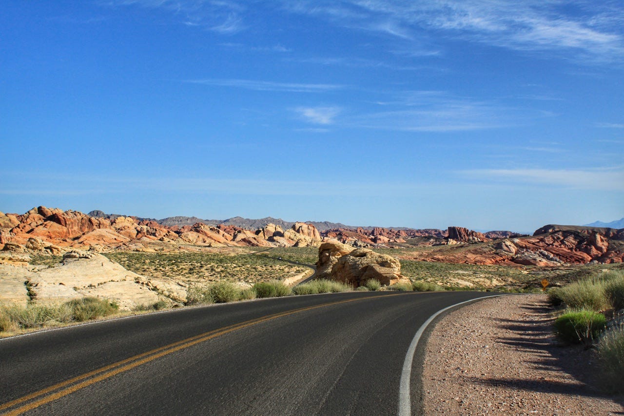
Valley of Fire Scenic Drive
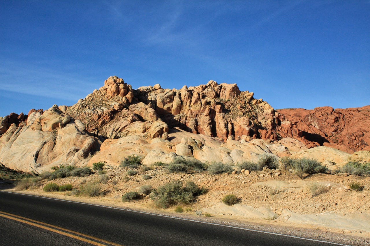
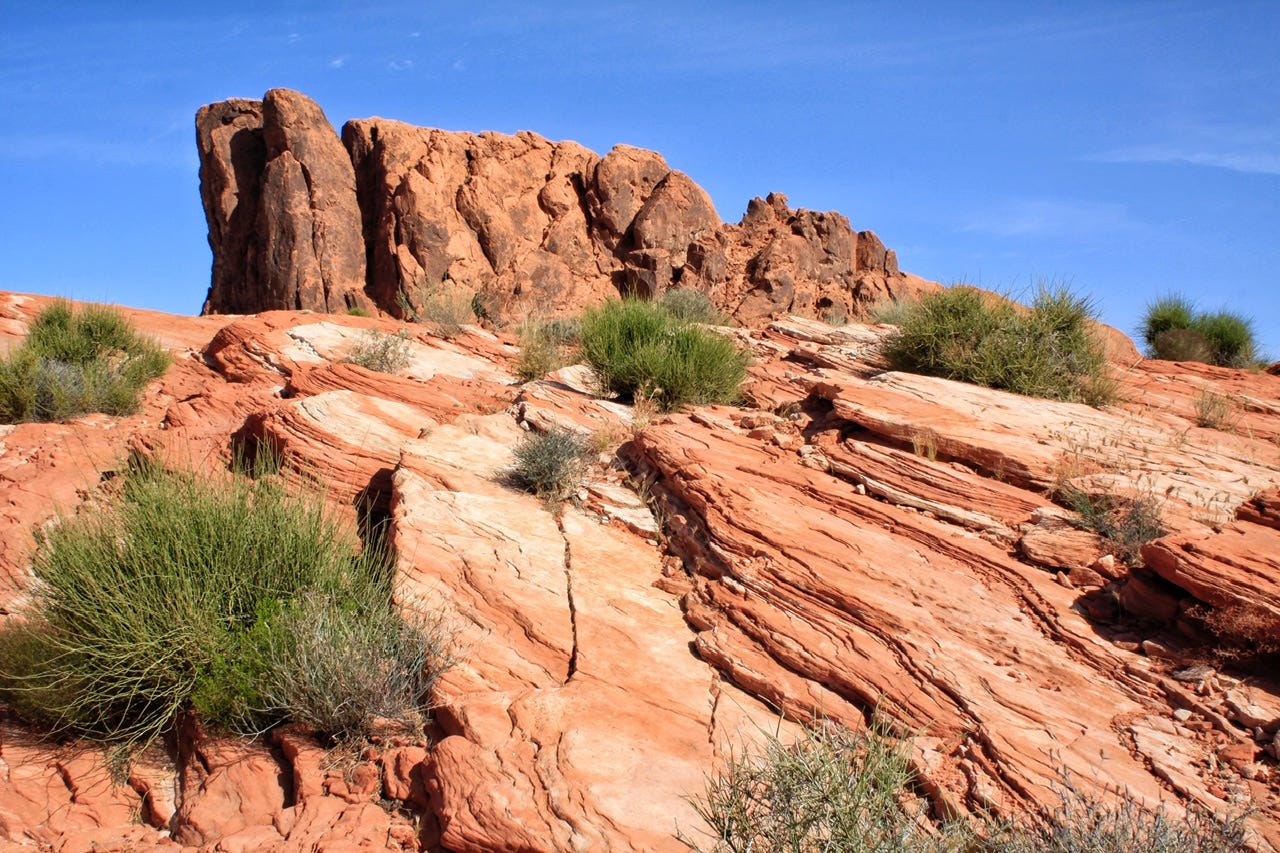
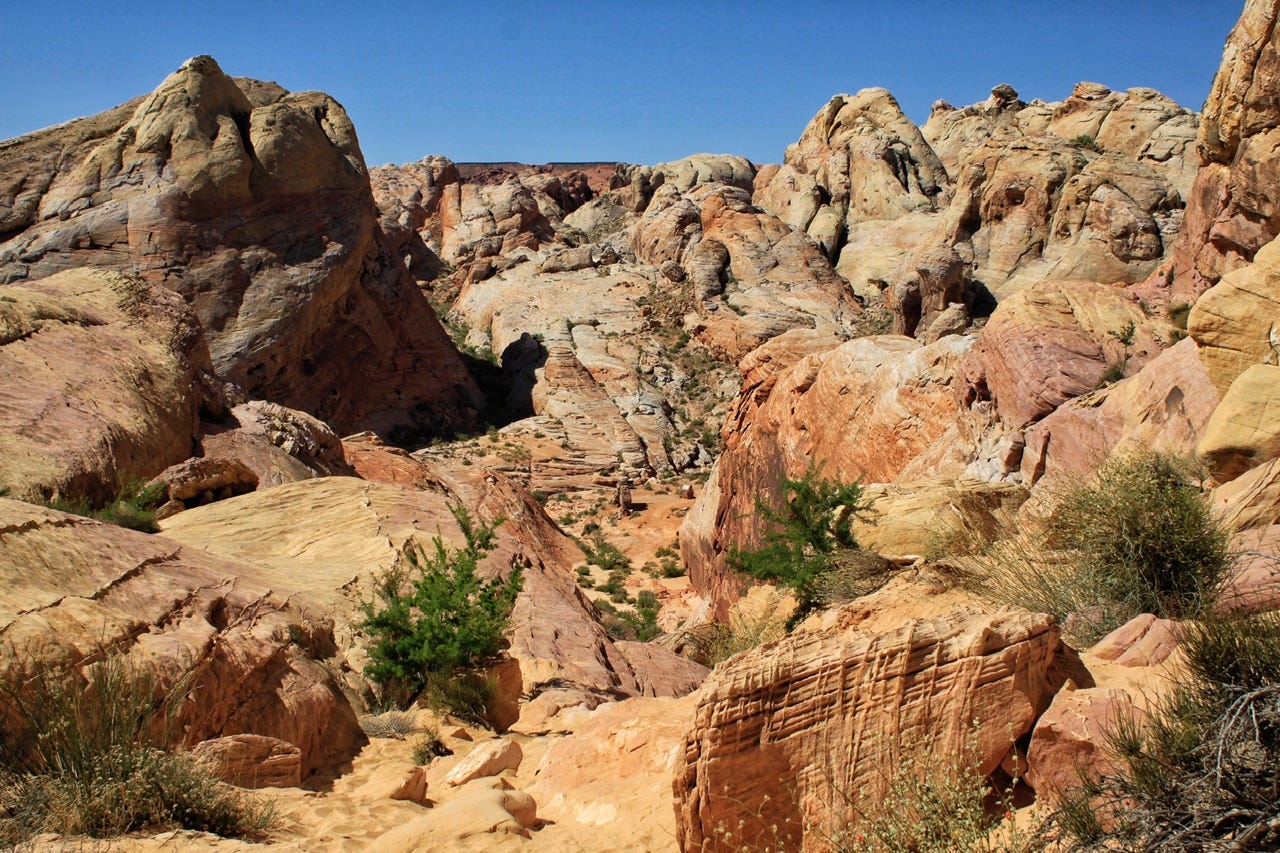
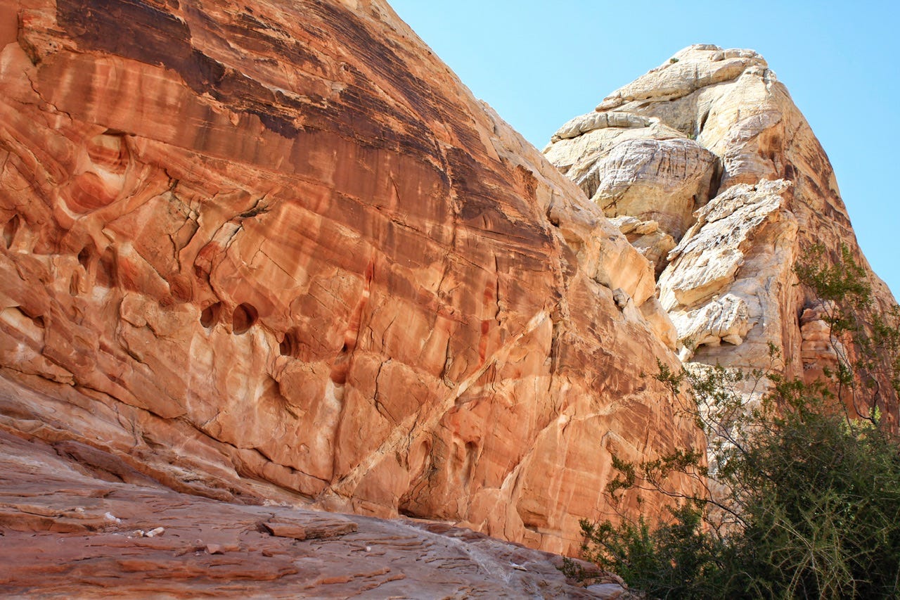
If the scenic drive had been the only thing we did in Valley of Fire State Park, we would’ve seen a lot of gorgeous scenery just from the road! The first part of the drive is like piles of red rock on both sides of the road, and then it opens up to a rainbow of rock colors.
Fire Wave Trail
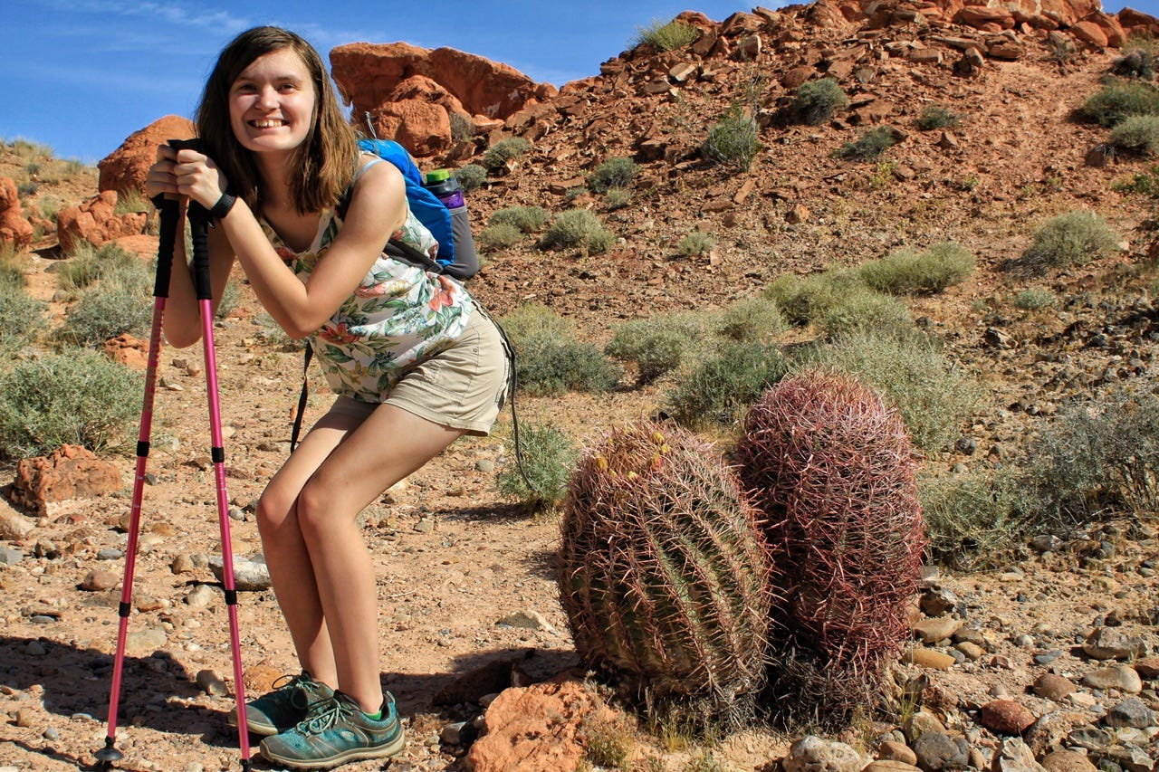
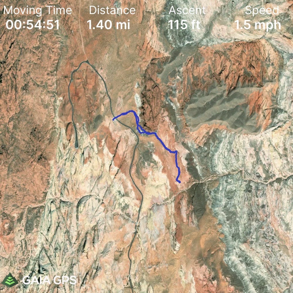
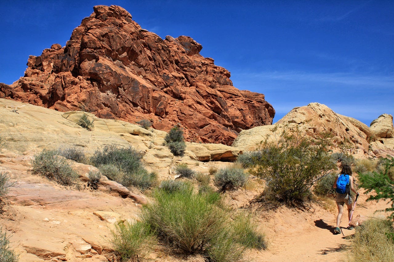
The first hike of our day was the Fire Wave Trail. According to my Gaia GPS track of our hike, it is 1.4 miles, with 115ft of elevation gain. It took us 1.5 hours, which included a half hour stop to enjoy the scenery. There is no shade on this trail. We started our hike at 7:40am with perfect temps for hiking.
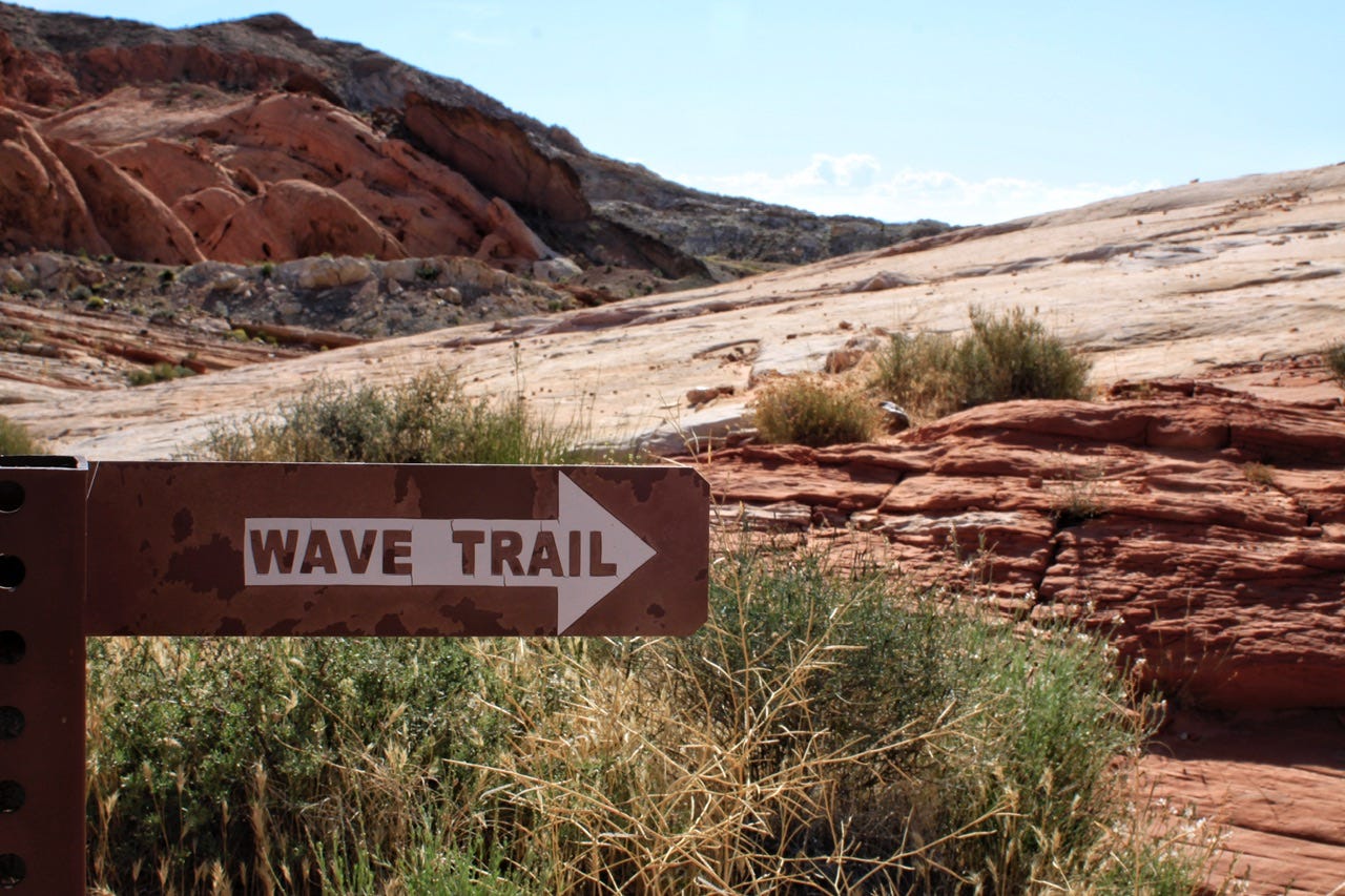
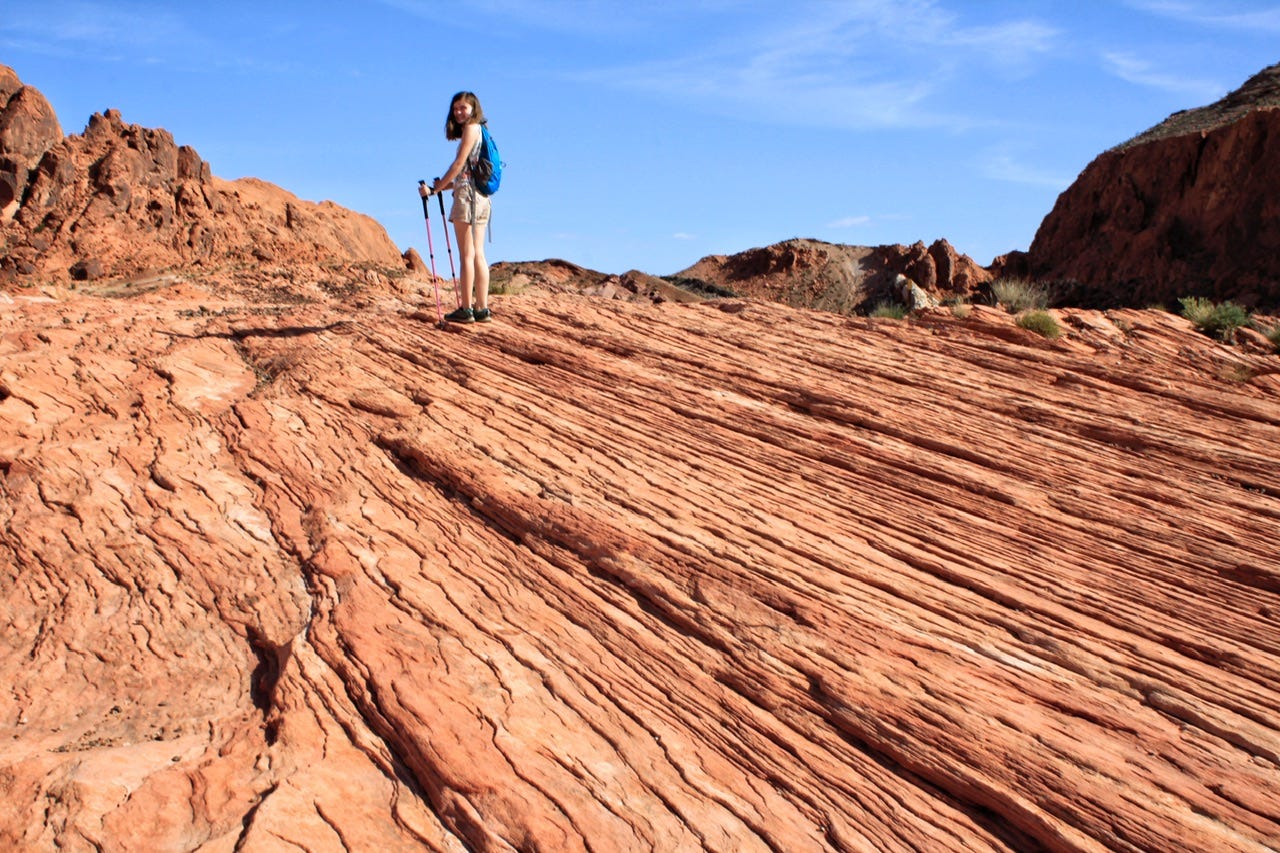
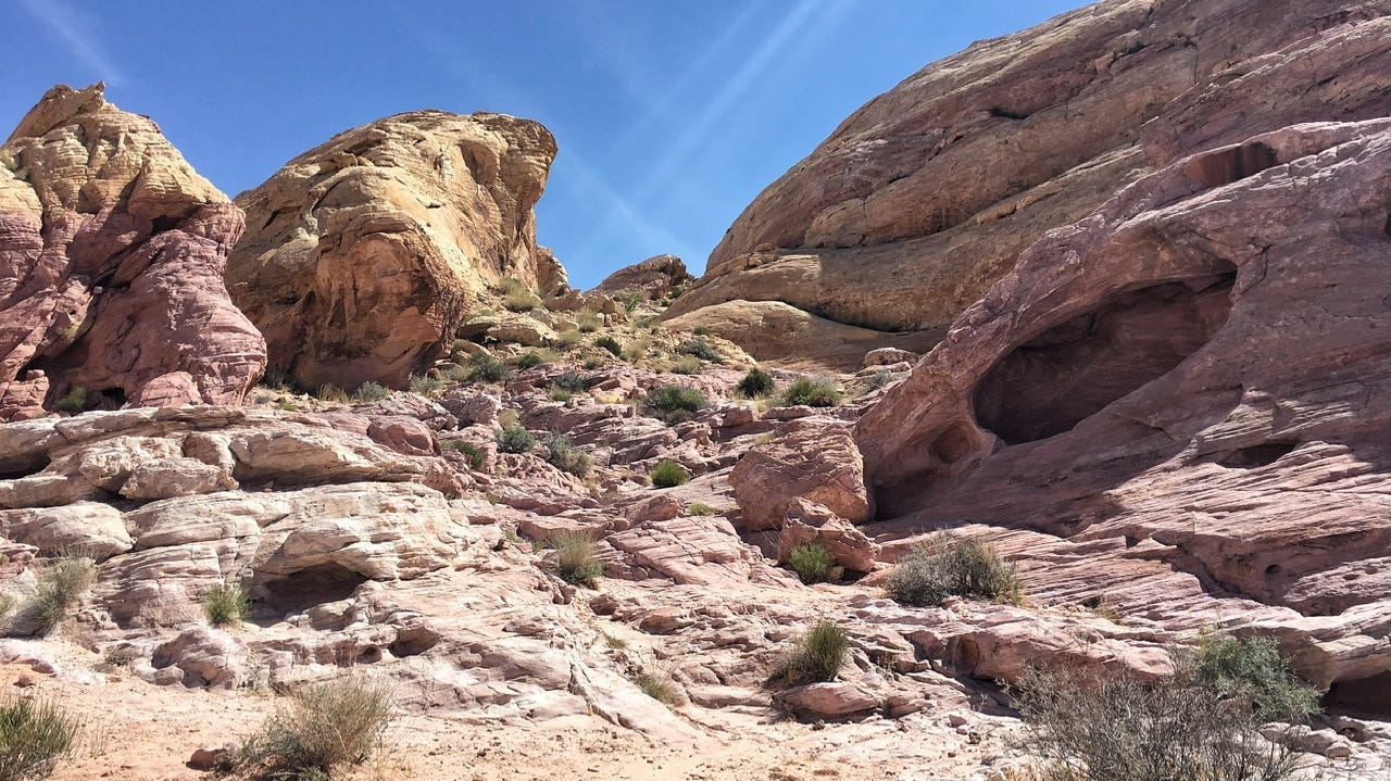
The trail was easy, with a mix of sand and sandstone to walk on. We were there early in the morning, so we didn’t have a lot of people there with us, but there were a few. I would imagine there are times when it has a lot more people, since it is such an easy hike with a pretty big payoff at the end. I had to chuckle at one of the reviews I read that said there was “not much to see here.” Even if you didn’t make it all the way to the Fire Wave, the rest of the trail is gorgeous! I took way too many photos of all the rock eye candy.
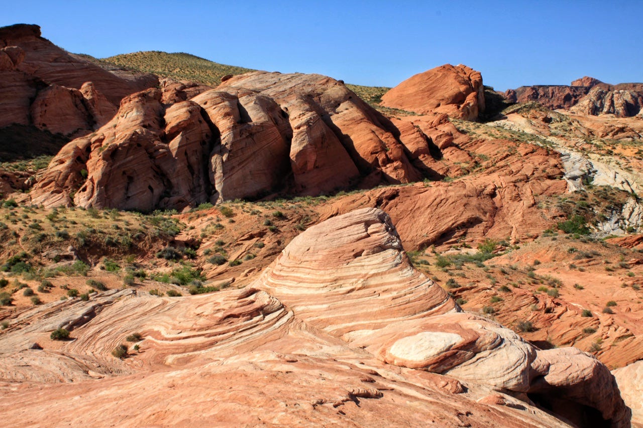
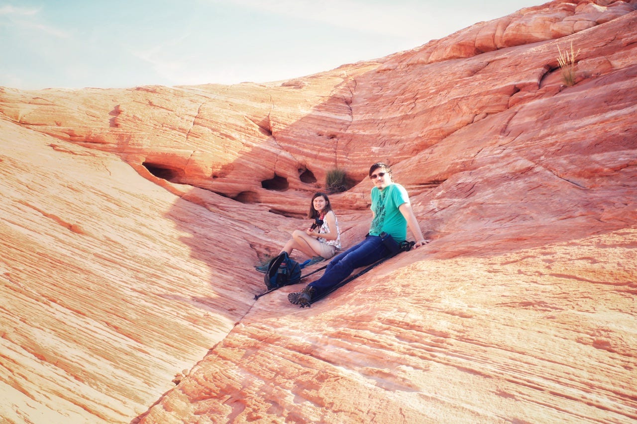
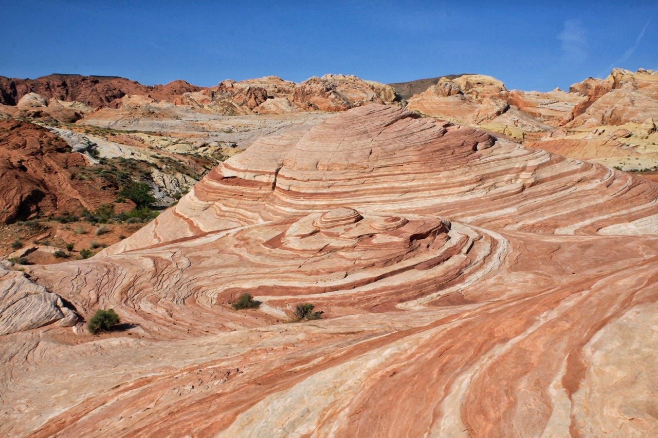


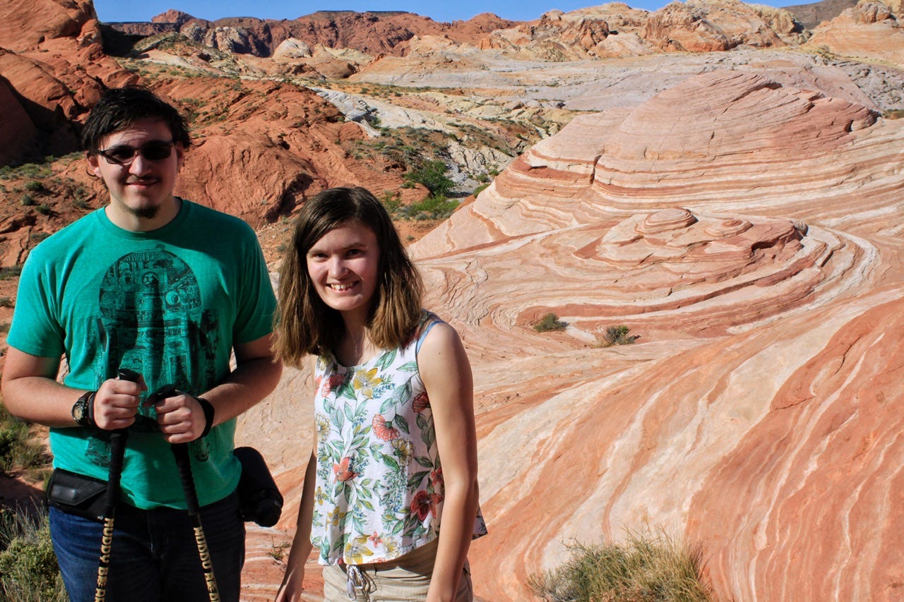
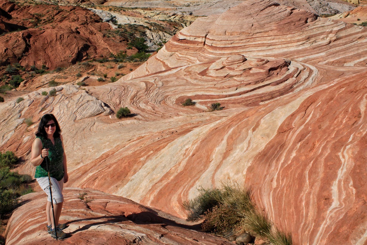
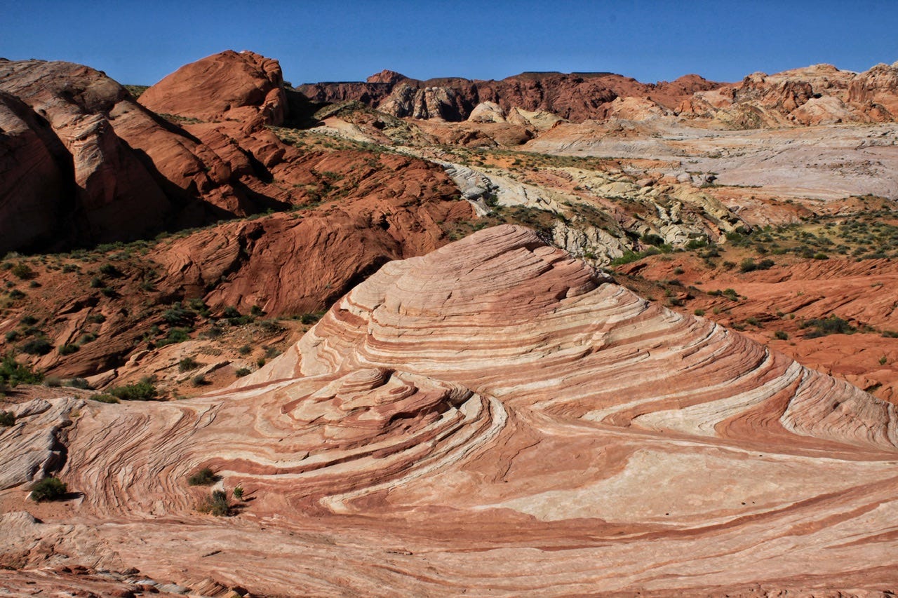
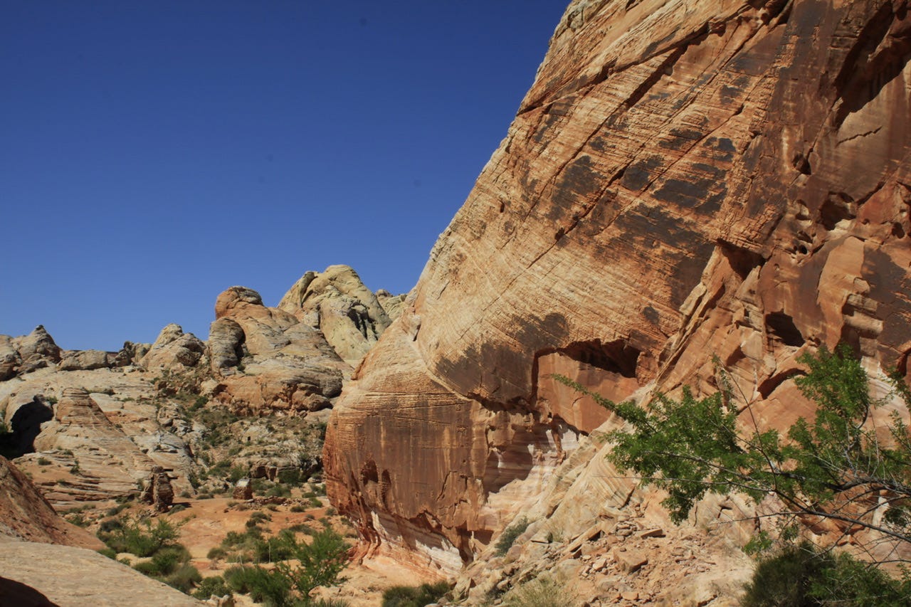
The Fire Wave is a striped swirl of sandstone, similar to The Wave in Arizona. This particular swirl of red and white sandstone, however, does not require the logistics, patience, and luck that is needed to win the permit lottery for The Wave. One can simply drive a paved road to the trailhead parking lot and take a short walk to see this wave.
I remember finding out about The Wave when planning this trip, and instantly wanting to see it, until I read about about the process for getting a permit, the high clearance dirt road to get there, and the fact that it’s a seven mile hike on an unmarked trail, with no shade in the desert…and we were going in June.
I knew I wanted to stop at Valley of Fire State Park and in researching trails, I discovered the Fire Wave Trail, which was a much more doable option for us. Obviously, the Fire Wave is not the same as The Wave, but I’m not sure that I need to go through the rigamarole that it takes to see The Wave, when this swirl of sandstone is so easy to visit. Even now that we are more experienced hikers, I remain undecided. For now, I’ve lumped it in with the other over-photographed places I don’t have on my bucket list, like Horseshoe Bend and Antelope Canyon.
I thought the Fire Wave hike was pretty amazing and I’d love to go back again to see it in the evening or earlier morning light.


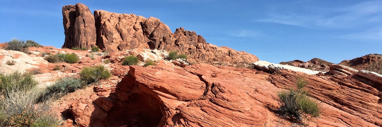


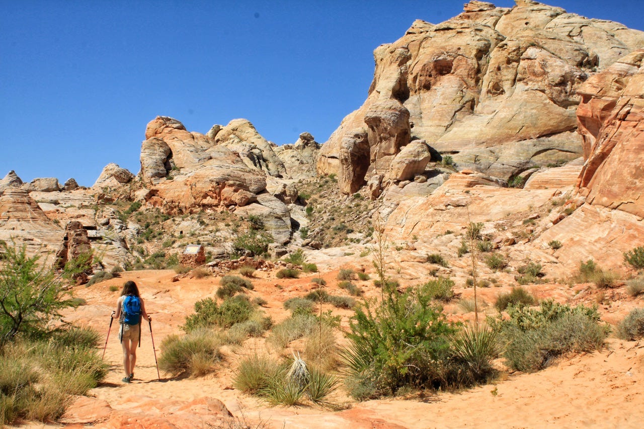
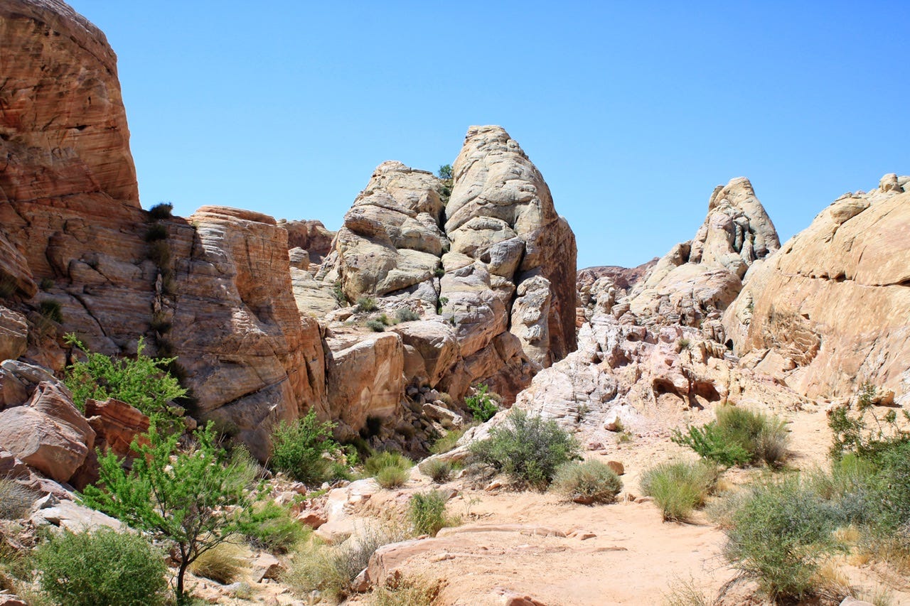
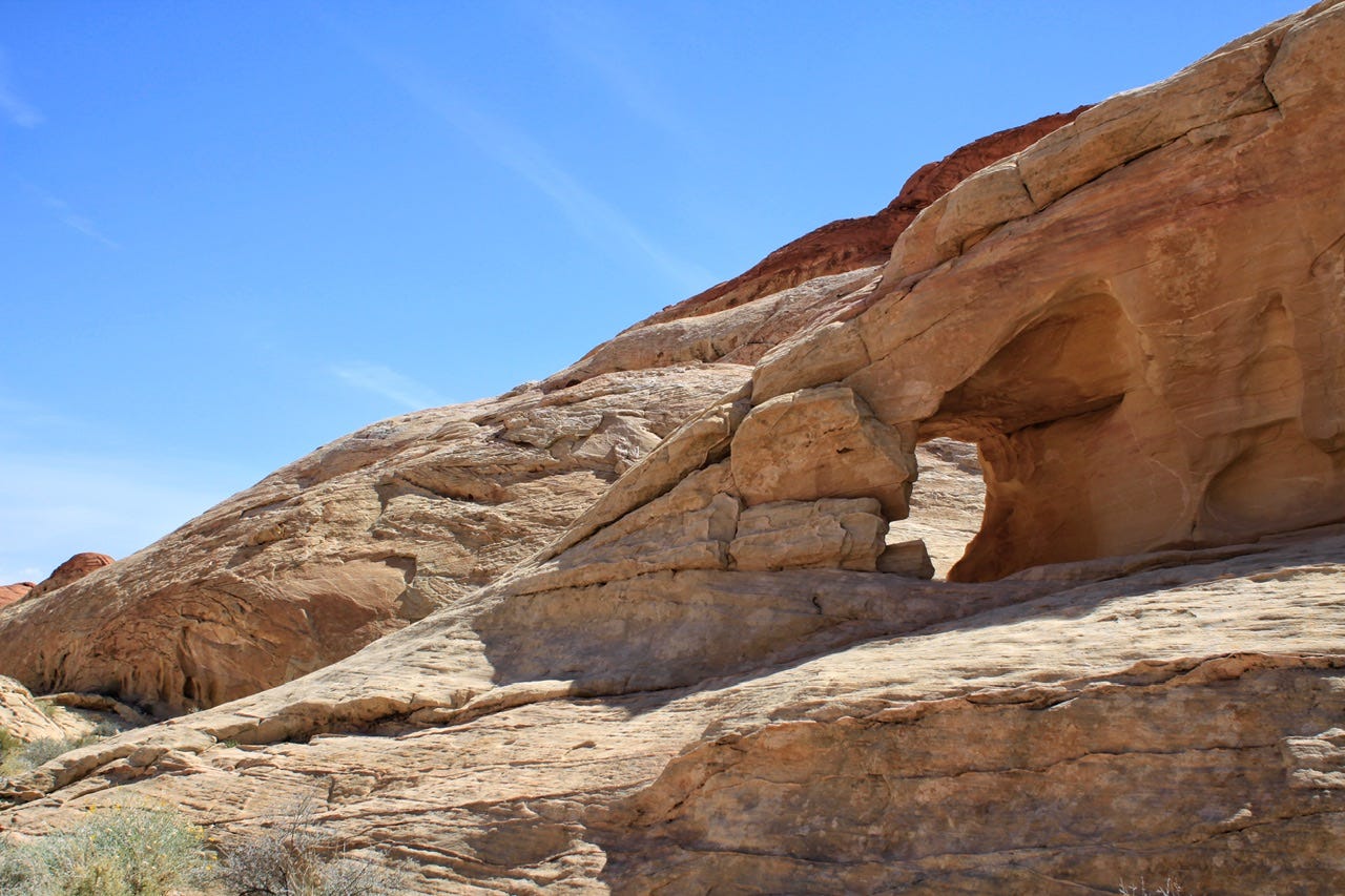
White Domes Trail
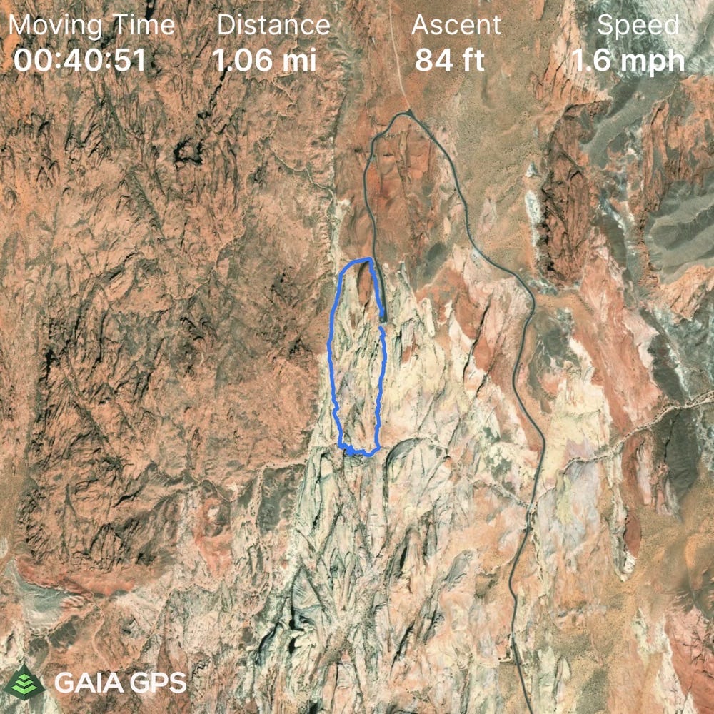
After we finished the Fire Wave Trail, we drove to the trailhead for the White Domes Trail. According to my Gaia GPS track of our hike, it is 1.06 miles, with 84ft of elevation gain. It took us one hour, with a couple short breaks in the shade. We started this hike at 9:30am and temps were still comfortable.
This trail starts off with a short walk through a lot of sand and then you reach this overlook. If you look closely in the middle of the photo, there’s an interpretive sign that is on the trail. The trail goes down there and then takes a right through a small slot canyon. I don’t think I have seen anything quite like this. Valley of Fire State Park could easily be a national park just based on these two trails alone. I’d love to go back and explore more trails someday!

Valley of Fire State Park has been home to several movie filming locations. Along the trail, there are some movie set ruins for the 1965 film The Professionals. The movie, Star Trek: Generations, was also filmed in the park, along with Austin Powers, Total Recall, and Transformers, to name a few.


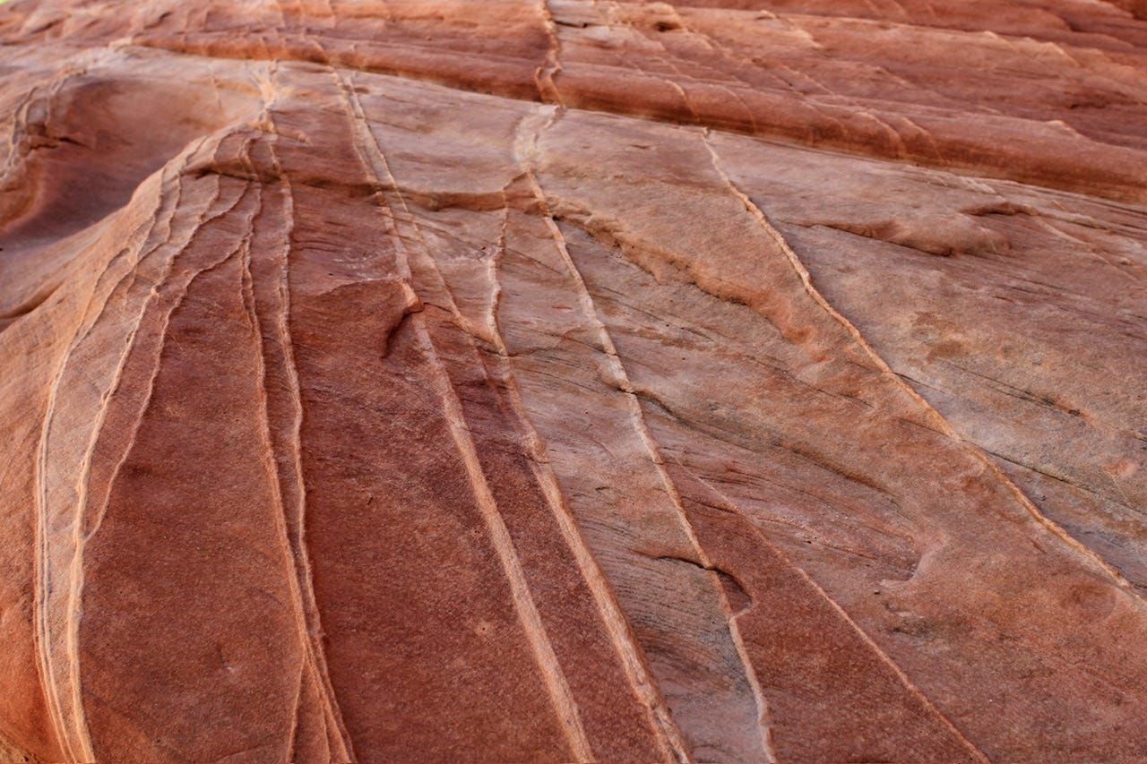
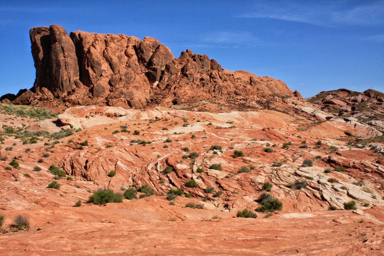
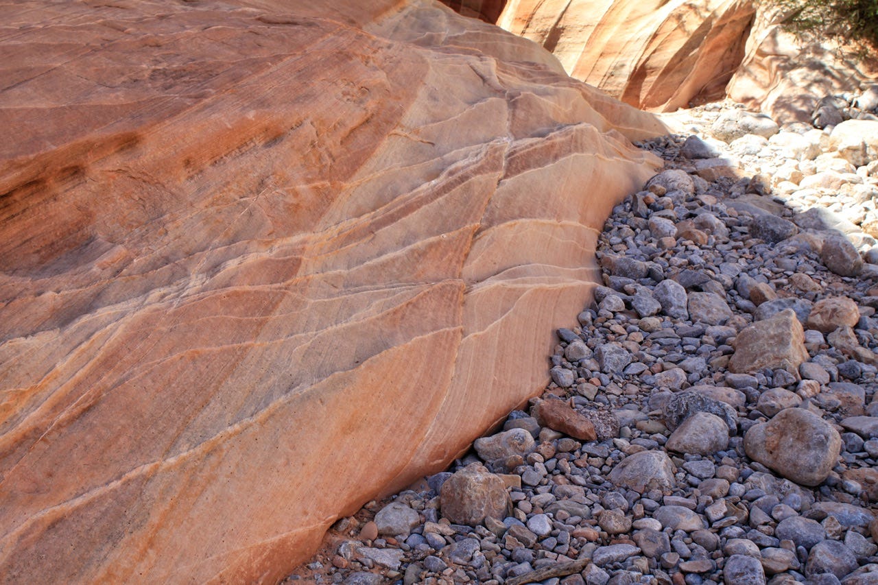
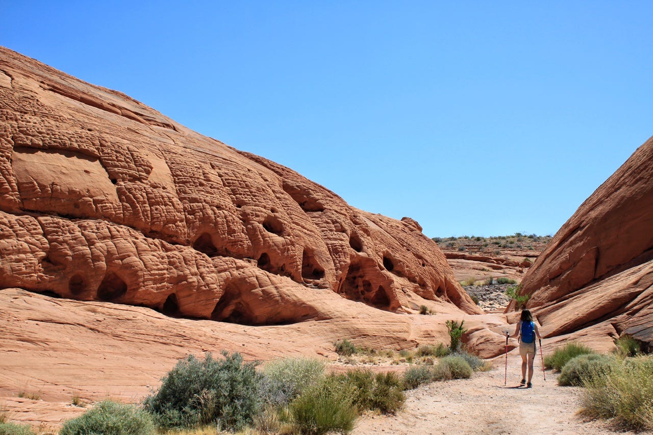
The White Domes Trail has so many colors and textures that it doesn’t look like these photos are from the same trail, but they are! Along with the usual southwest rock colors, the ground has lavender-blue gravel. You have to be in the shade to see it. I‘m not sure that we’d have even noticed it if we hadn’t taken a break to sit on the sandstone in the shade.
Fire Canyon and Silica Dome Vista
When we finished the White Domes Trail, we stopped at the Fire Canyon and Silica Dome Vista, also known as the Star Trek Pilgrimage Site. Take a look at the layers of color in this scene. I’ve never watched Star Trek…does it look like something from Star Trek? It definitely looks like it could be something from another planet!
When our tour of the scenic drive and overlooks was complete, we stopped at the visitor center to cool off and have a look around. The kids were able to do the junior ranger activities and they each earned a star-shaped, pewter-colored, metal badge with the state of Nevada engraved in the middle.
After the visitor center stop, we drove down the road we came in on the night before so we could see what we missed. We didn’t go too far before deciding we had seen enough. We turned around and headed out to the interstate, stopping for one last quick picture of the campground sign on our way by. We were done with Valley of Fire by noon and ready to enjoy the air conditioning and lunch on our afternoon drive.
We stopped for another package at an Amazon locker on our way through Las Vegas. Joey discovered that he had forgot his new red flashlight that he got for Christmas, and since I wanted one, too, I ordered another that we could pick up along the way. I’d be curious to see if Amazon is still as fast at delivering to these lockers as it was back then, because I’m pretty sure I ordered that the day before, right after we left the first Amazon locker. It’s worth looking into if you need something along the way on a road trip and you don’t want to take the time to find it in a store.
We stopped for the most expensive gas so far on this trip in Henderson, NV. It was $3.47 per gallon, compared to the $2.55 I had paid in Gillette, WY. Yikes! I knew it was not going to get any cheaper from there.
We were only twenty miles from the Hoover Dam, so it was tempting to go have a quick look at it, but I also knew we needed to keep going. We had another four hours to go to reach our destination. If you hadn’t guessed by now, based on the number of rock and plant pictures found on this blog, we were headed to Joshua Tree National Park.
I chose Highway 95 to get there, with the plan of taking Route 66 south of Goffs, over to Amboy. More on that in a bit.
Welcome to California
We crossed the border into California somewhere in the middle of nowhere. I had read up on what fruit was allowed to enter California, and knew that apples were not allowed, so we had been sure to eat the outlawed fruit in the cooler by the time we arrived at the California border. Imagine my surprise when a few signs were all we found out there. Somehow, I had pictured every border crossing having an inspection station.
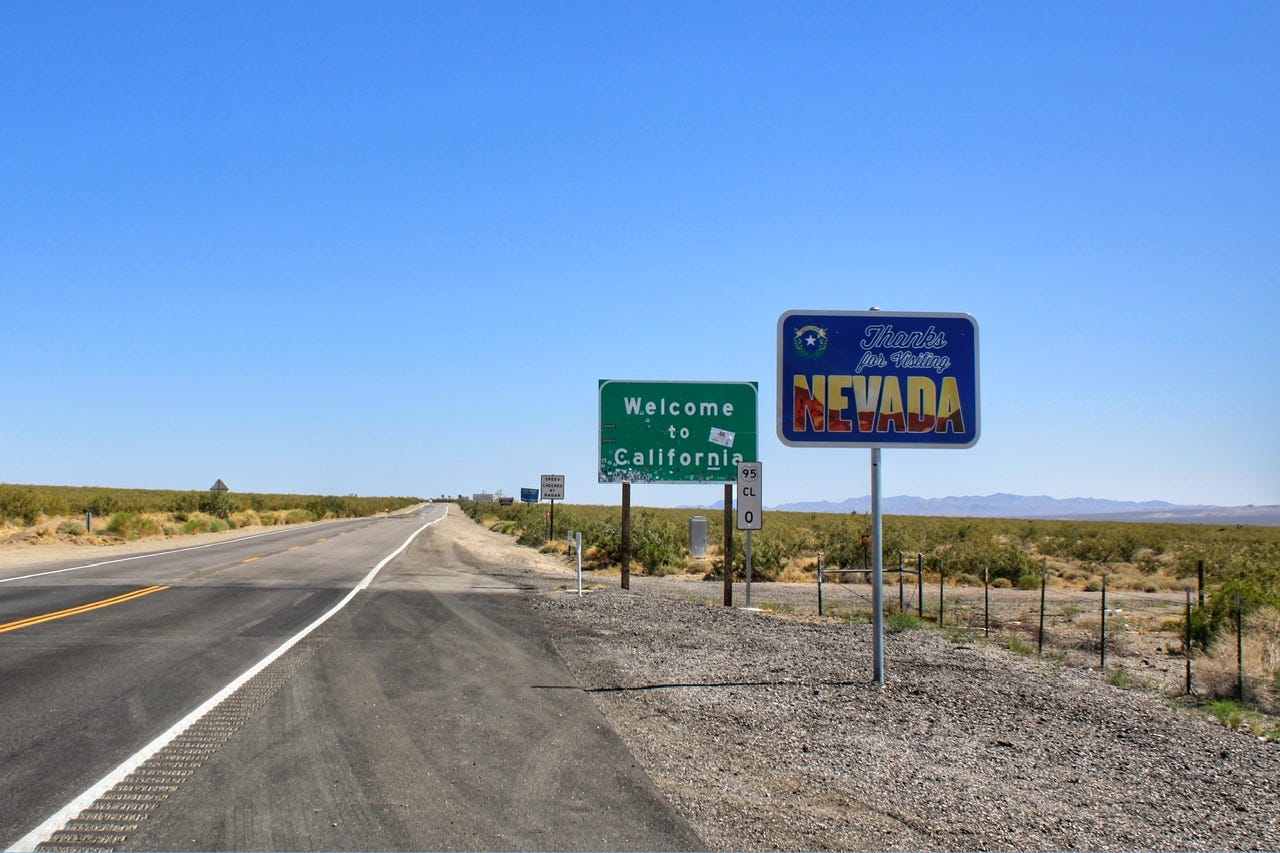
We had officially reached state number 32 for me and number 30 for both of the kids! With the addition of Nevada and California, we had now visited all of the 22 states west of the Mississippi River! Not too shabby for a single mom and a couple of teenagers from South Dakota! (Out of the 22 states west of the Mississippi, we have tent camped in 16 of them!)
Back to that Route 66 plan…
When I was planning this trip, I had read that one could cut across the desert on the old Route 66 by taking Highway 95 south out of Las Vegas. It was supposed to be a scenic section of the route. What I did not know, was that this section of Route 66 had been closed to through traffic, due to flooding that had washed out a bunch of bridges. While writing this post, I tried to find out when exactly it closed and it sounds like it may have just closed in 2019 before we were there, but it also sounds like these bridges had issues of being washed out and fixed numerous times in the past. According to Apple Maps, this road is still closed today. Route 66 celebrates its’ centennial in 2026, so perhaps they’ll be motivated to fix it by then.
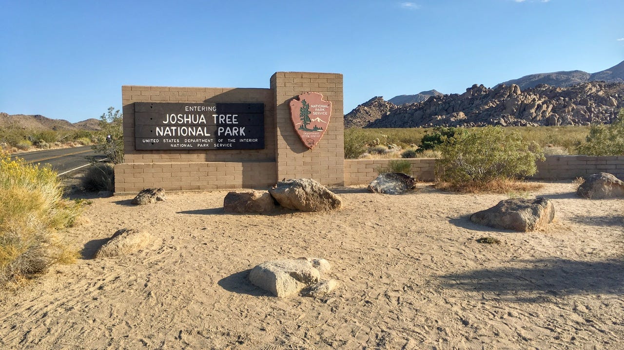
So much for that plan. We took Interstate 40 around to Kelbaker Road and took that to Amboy. We continued on through Twentynine Palms, where we stopped at the Joshua Tree National Park Oasis Visitor Center for a bathroom break before entering the national park in search of a campsite.
We made it!
Our drive had been a long drive through the land of nothing since we left Henderson, NV where we filled up with gas. We were excited to finally get to where we had been going! I had read recommendations to enter the national park through the Oasis entrance at Twentynine Palms, but I don’t know why that one. The road into the park was…less than stellar. There were no big rocks and no Joshua trees. Had we come all this way for nothing? I hoped not. Obviously, I knew we’d find rocks and Joshua trees once we got into the park more, but I was not sure why anyone would recommend this underwhelming entrance into the park. Maybe it’s the less busy entrance during peak season? I don’t know.
Jumbo Rocks Campground
We wanted to camp at Jumbo Rocks Campground. All of the campgrounds were supposed to be first come, first served, or so I thought. We drove into the campground to look for a campsite. I didn’t see a camp host, nor did any of the posts of empty campsites have any tags on them, so I asked someone about where to find out which campsites were available. They told us to pick one that was empty, claiming they had been there several nights with many empty sites. So, we drove around several times, looking for the best site out of the many, many empty sites to choose from. We finally settled on site 119 and started setting up the tent.
Before we had the tent standing, a car pulled in and its’ occupants claimed they had reserved the campsite. How? It was my understanding that Jumbo Rocks had switched over to first come, first served on June 1st. I told the guy that and asked if he had any proof that the campsite was his and he said all of the reserved sites were listed on a board at the entrance to the campground. I figured he was probably not making that story up, so we quickly gathered up the tent and the tarp, and apologized profusely for thinking the spot was open. They seemed understanding of the situation and we got out of their way.
I looked for the list of reservations on the way out and sure enough, all of the Jumbo Rock campsites were reserved. We could’ve saved ourselves a lot of time if that had been more clear to start with. Any campground we’ve ever camped in has had reservation tags with the dates pinned to the posts to avoid this sort of situation.
The Search for a 2nd Campsite
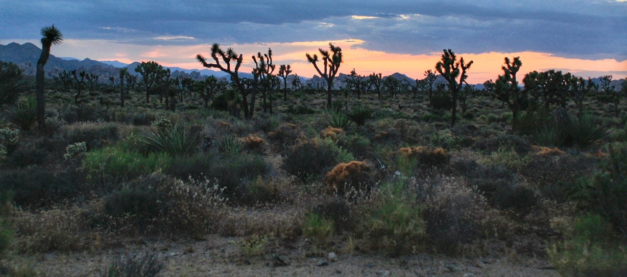
The light was suddenly fading fast and we needed to find a new campsite! We were on our way to check out the Hidden Valley Campground, when we saw this scene. The photo doesn’t do it justice, but the light was beautiful over the land of Joshua trees. We took a few minutes to take it all in before getting back to the task at hand. We needed to find a campsite.
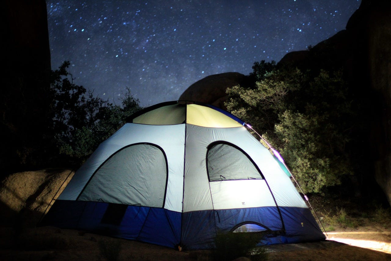
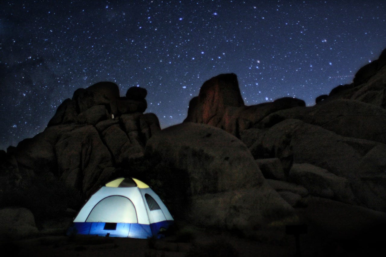
We had arrived at the park entrance sign at 6pm and this photo was taken at 8pm, so it’s not like we hadn’t tried to find a campsite before dark. Hidden Valley Campground had several open sites so we were able to drive around checking them all out before deciding on site #44. I have no idea how this particular site was not already chosen, but I remembered seeing it on a list of “best campsites” so we claimed it as our home away from home.
We set up the tent, and I’m sure we ate something, but I don’t remember what. We took a walk down to the iron ranger to pay for the campsite. It was a beautiful evening and dark enough to see the stars, so I tried my hand at some night photography. I don’t know how many photos I took, but these are a couple that I’m happy to have. I’m fairly certain the quantity of stars in these photos is partly lens dust, but who knows? I’m no expert in night photography, but I love ending the day hanging out under the stars.
We’re exploring the land of weird rocks and even weirder trees in the next one!