


A Destination Not Meant to Be
Utah Heats Up

Day Seven
Sunday, June 13, 2021
Natural Bridges National Monument
6:04 am
We had decided the night before that since it hadn’t been light enough to see the Owachomo Bridge, and we didn’t go back to see it under the stars, that we would get up early for the sunrise. We also decided that we would get up and go in our pajamas and that way we could go back to sleep later if we felt like it. (I chuckle at this theory now, but it was a nice thought!)
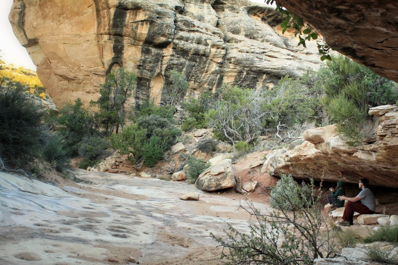
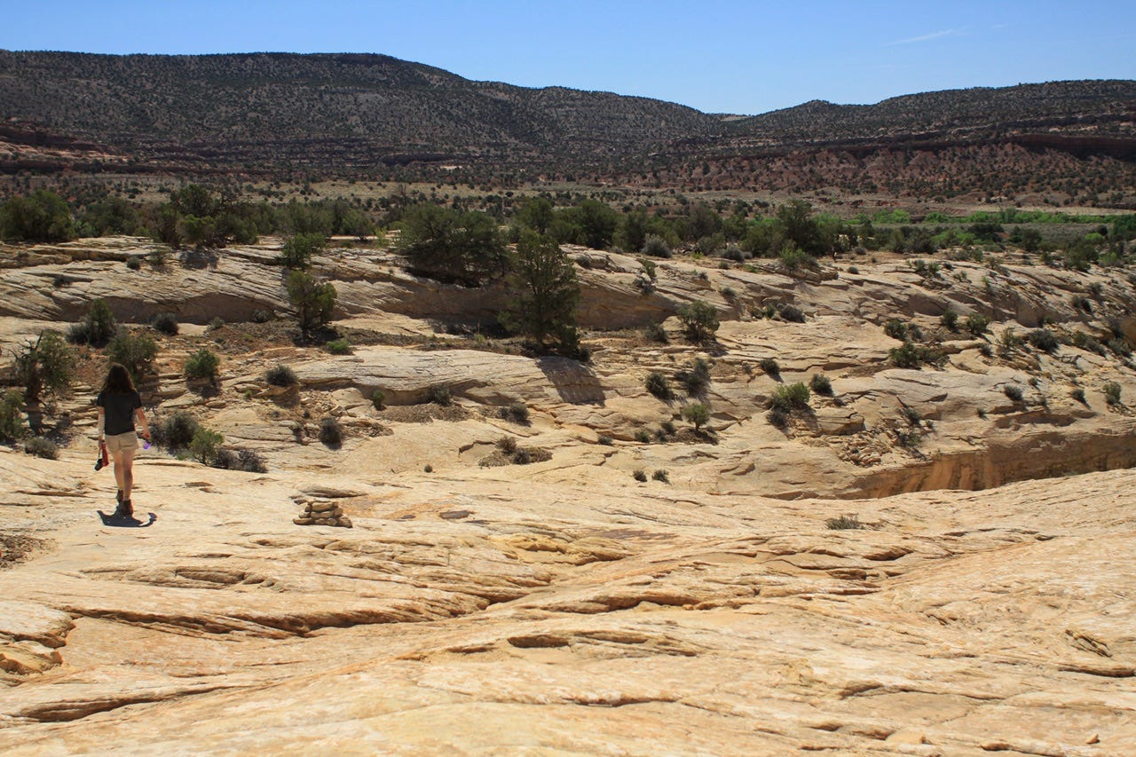
We drove all the way around the one-way loop drive to where we had left off the night before. The trail to the bottom of the bridge is only about a half mile so we didn’t have far to go. We had the place to ourselves.
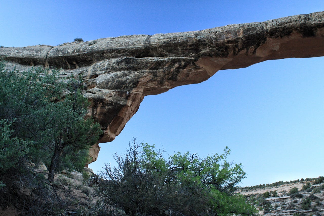
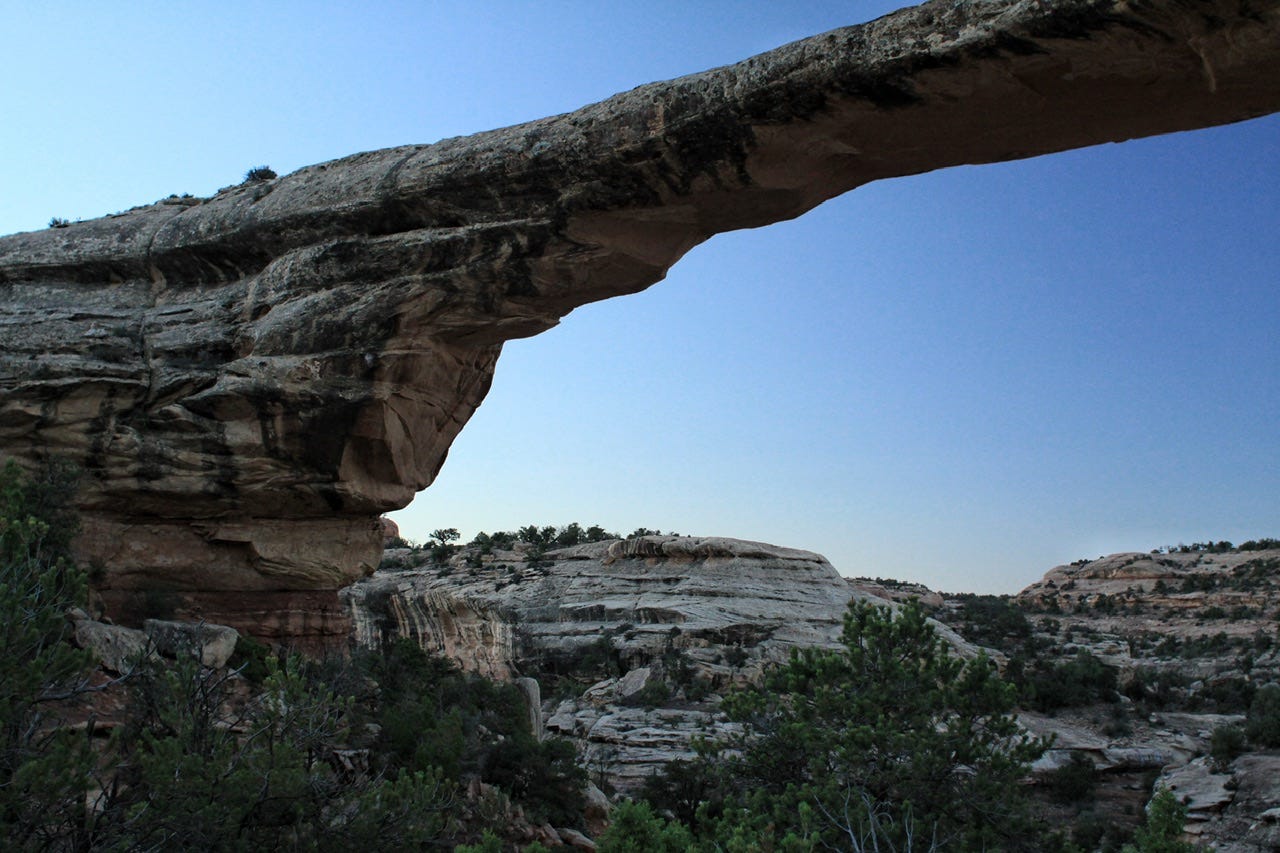
Owachomo Bridge
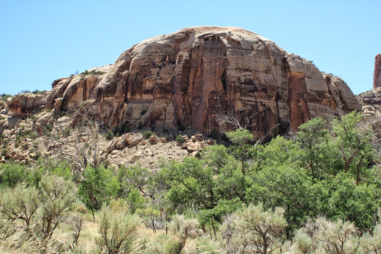
The bridges in National Bridges National Monument are Cedar Mesa Sandstone, which is the remains of coastal sand dunes deposited 270 to 300 million years ago. The bands in the rock are sediment carried in during flooding from the mountains.
Owachomo Bridge would’ve had rivers flowing in the curvy canyons on both sides of the sandstone. The flooding created more force on the outsides of the curves in the river, which eventually gave way and formed the bridge. Since bridges are formed from water erosion, they are not the same thing as arches, which are created from wind erosion.
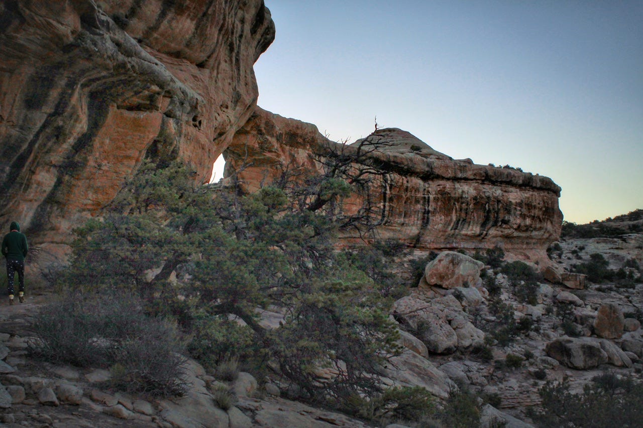
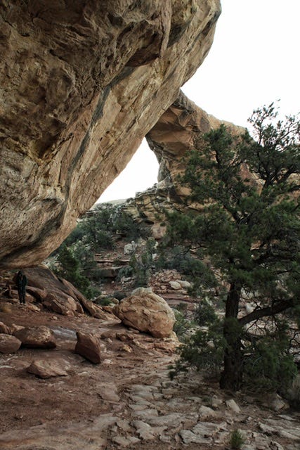
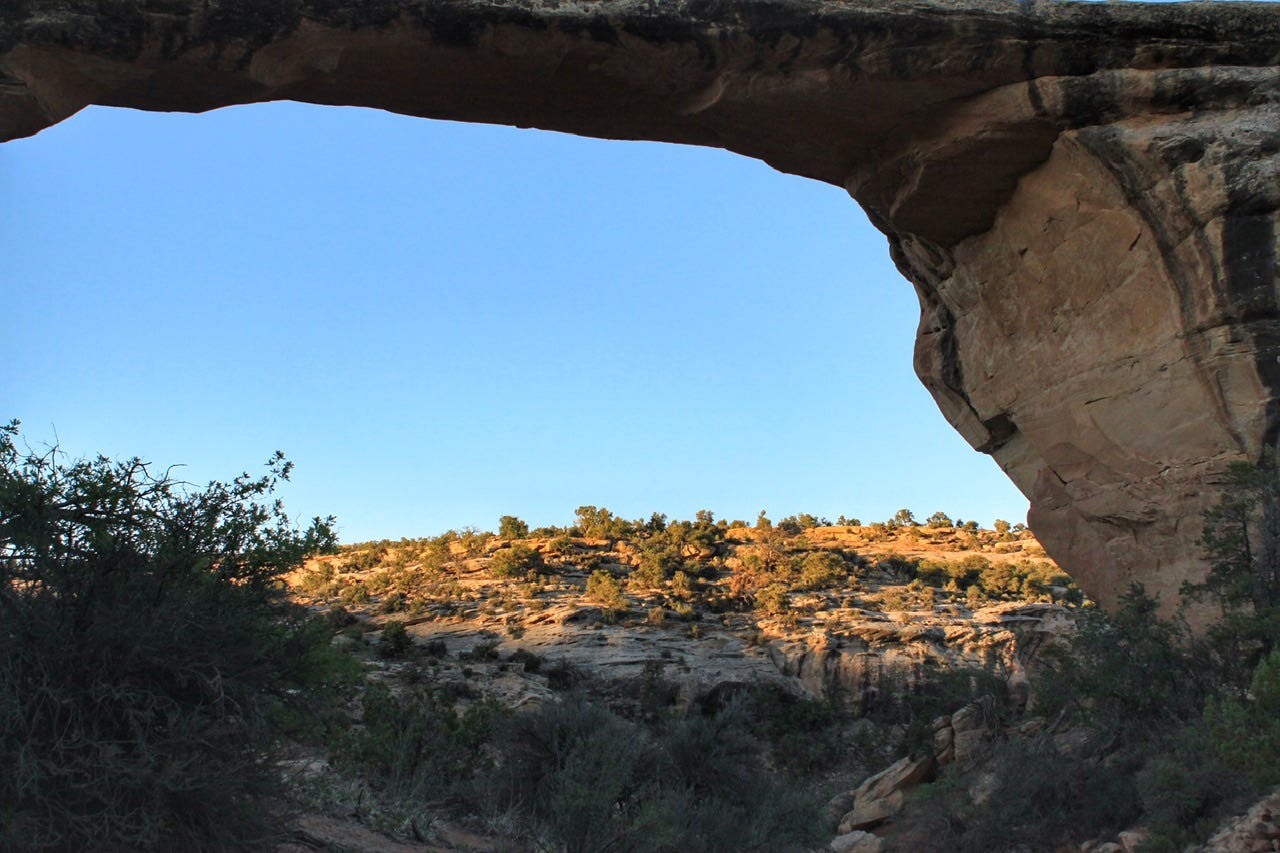
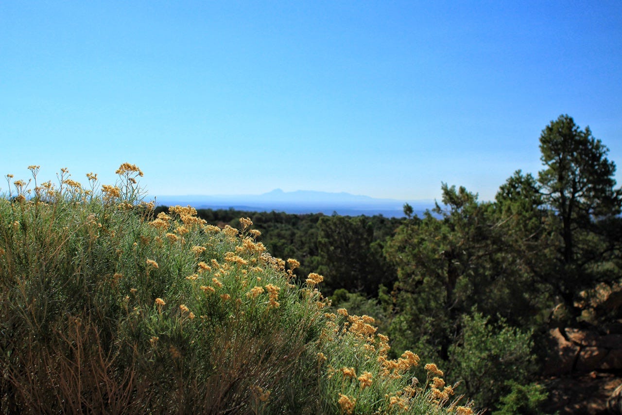
This was our view from below Owachomo Bridge with the golden glow hitting the sagebrush at the top of the hill. We were not in a spot to see the sun peek over the horizon, but it was neat to watch the colors of the rock change with the rising sun. It was so pretty and peaceful. This was such a lovely way to start the day.

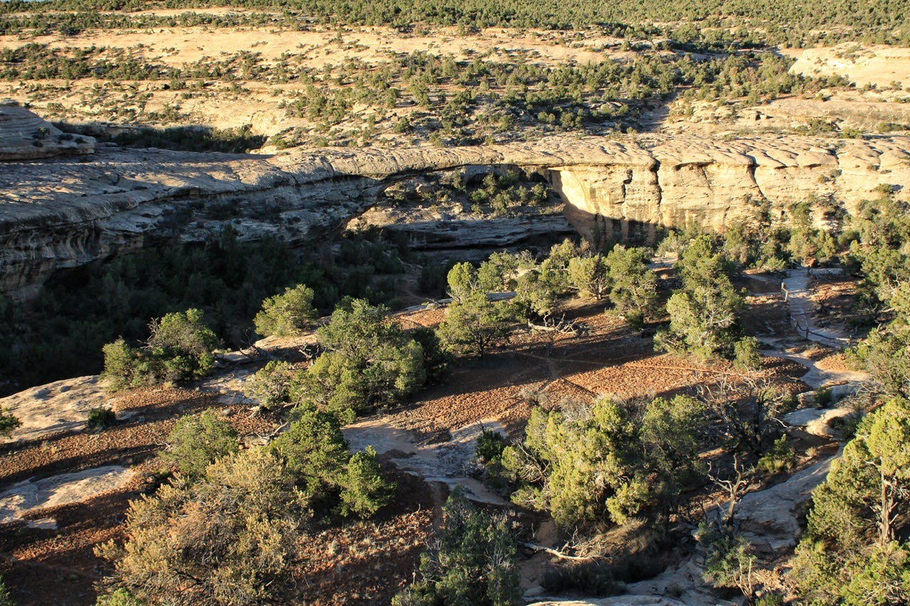
By the time we hiked back out, the whole Owachomo Bridge was in the sunlight. This is the thinnest of the three bridges at just nine feet thick, so I am glad that we chose this one to spend some time at in case it should crumble someday.

Back at our campsite, it was just after 7am and the sun was shining bright already. There was no way any of us was going back to sleep with this much sun hitting the tent, plus, we had places to be! We got dressed, packed up, and headed to the visitor center so the kids could earn their Junior Ranger badges. We couldn’t go inside, but they had a table set up outside with a couple of rangers who took a look at the books, handed out badges, and then we were on our way.
Salvation Knoll
We stopped at a roadside exhibit called Salvation Knoll. The Mormon Pioneer Hole-in-the-Rock expedition visited this area in 1879 to 1880 on their way from Escalante, Utah to the Four Corners area. While the pioneers worked to build a wagon road, four advance scouts traveled through the area, searching for the most feasible route. By the time they reached here, they were lost and out of food. They climbed to the top of this knoll to see if there was a recognizable landmark and discovered the Blue Mountains were about ten miles away. This was the landmark they had been looking for and eventually, they succeeded in plotting a wagon route through the most rugged terrain in North America.
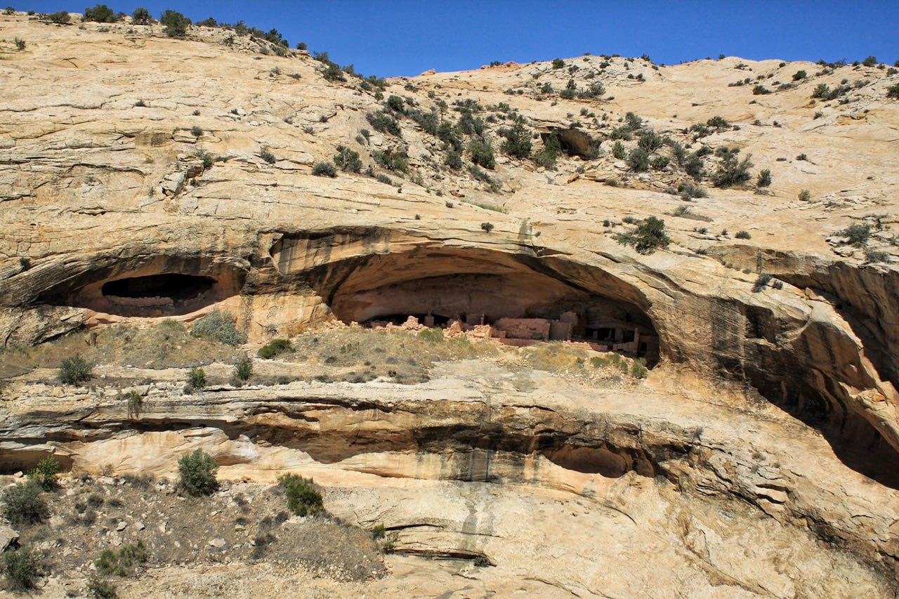
Butler Wash Ruins
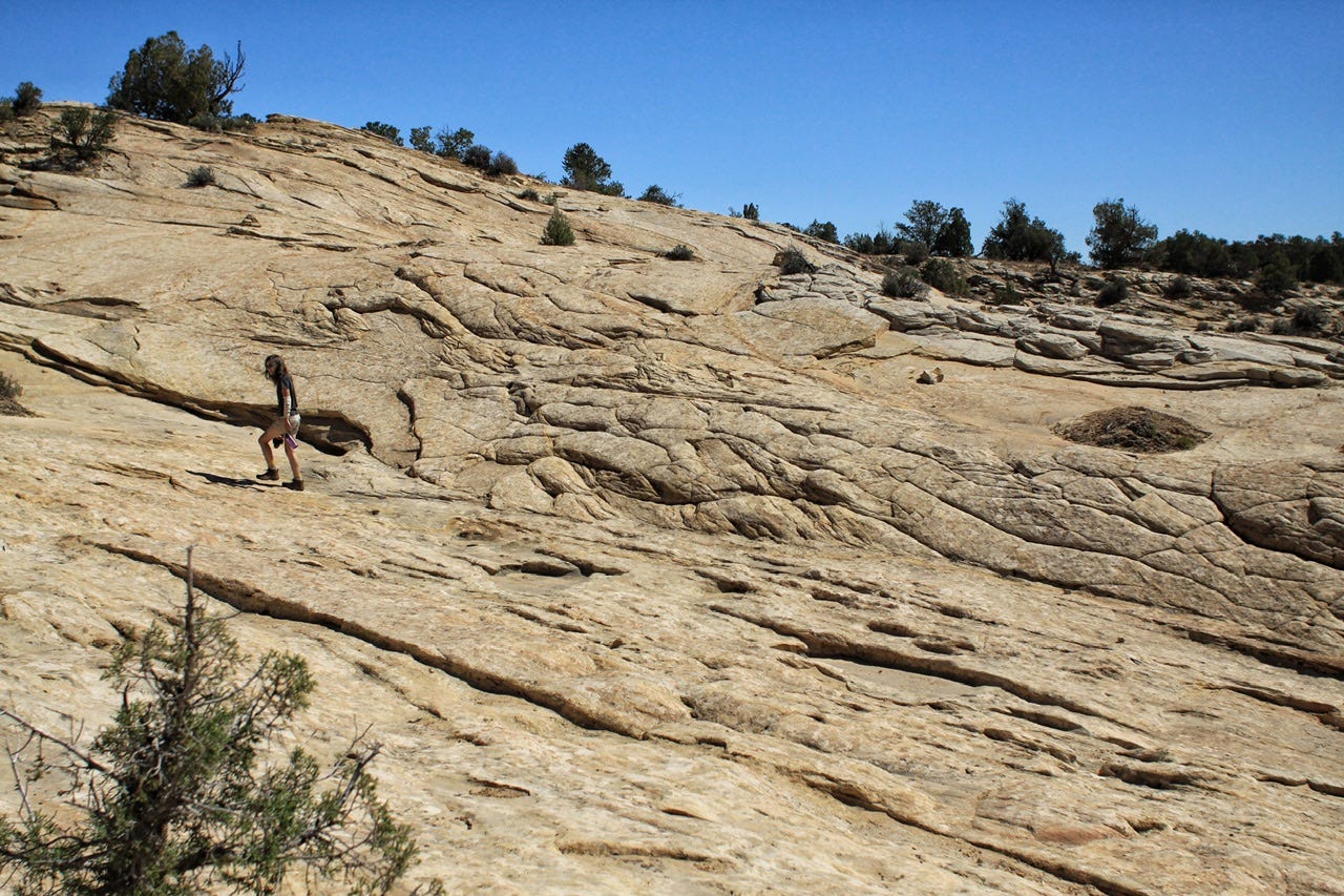
Our next stop was the Butler Wash Ruins, which are cliff dwellings built by the Ancestral Puebloans around 1200 AD. The site includes four kivas, along with habitation and storage spaces. Dwellings like this are sprinkled all over this area, which is within Bears Ears National Monument. The hike to see the dwellings is a one-mile round trip over sandstone.

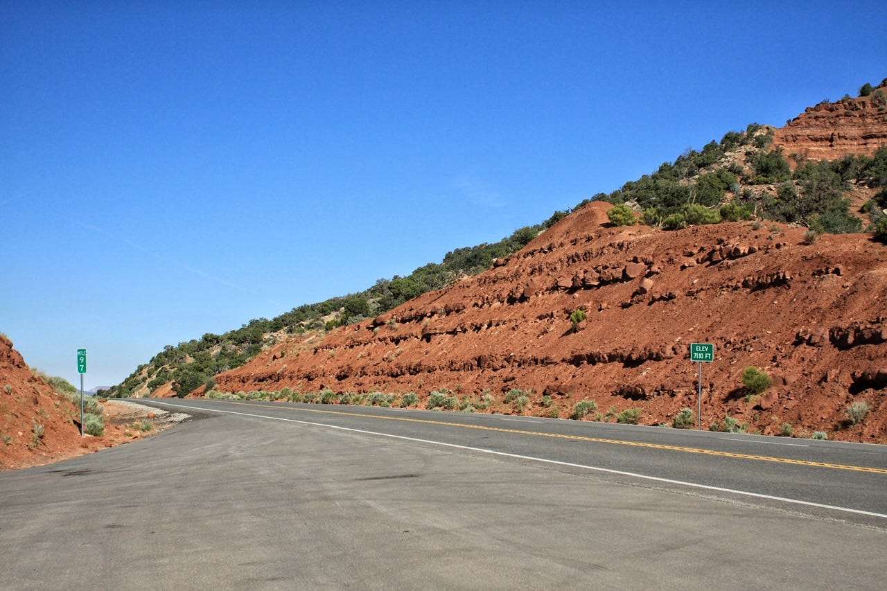
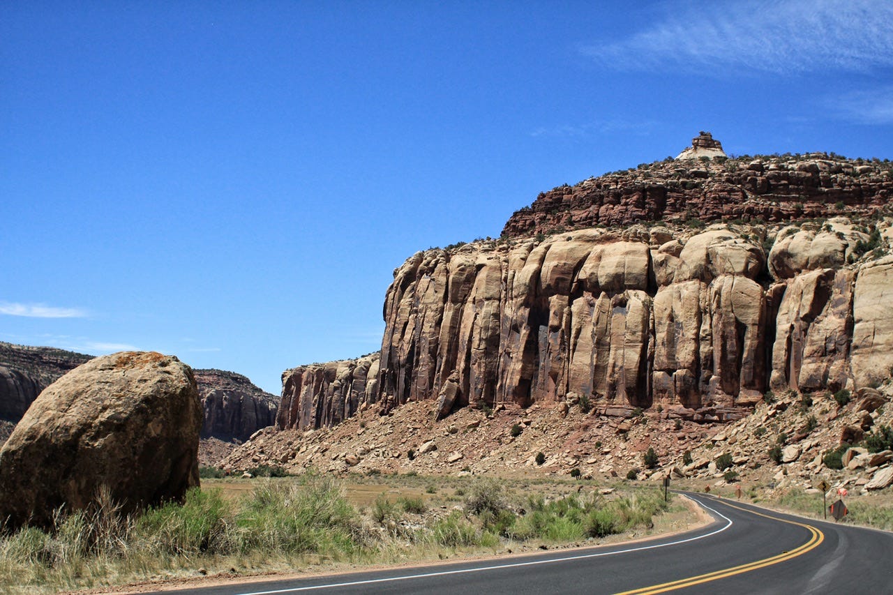
That was the last stop on our Highway 95 adventure. This is such a rugged area of Utah! It’s hard to imagine the Native Americans making their homes and communities on this land. It’s also hard to imagine the pioneers scouting routes to build wagon roads through the area later on. We certainly have it a lot easier now with a paved highway.
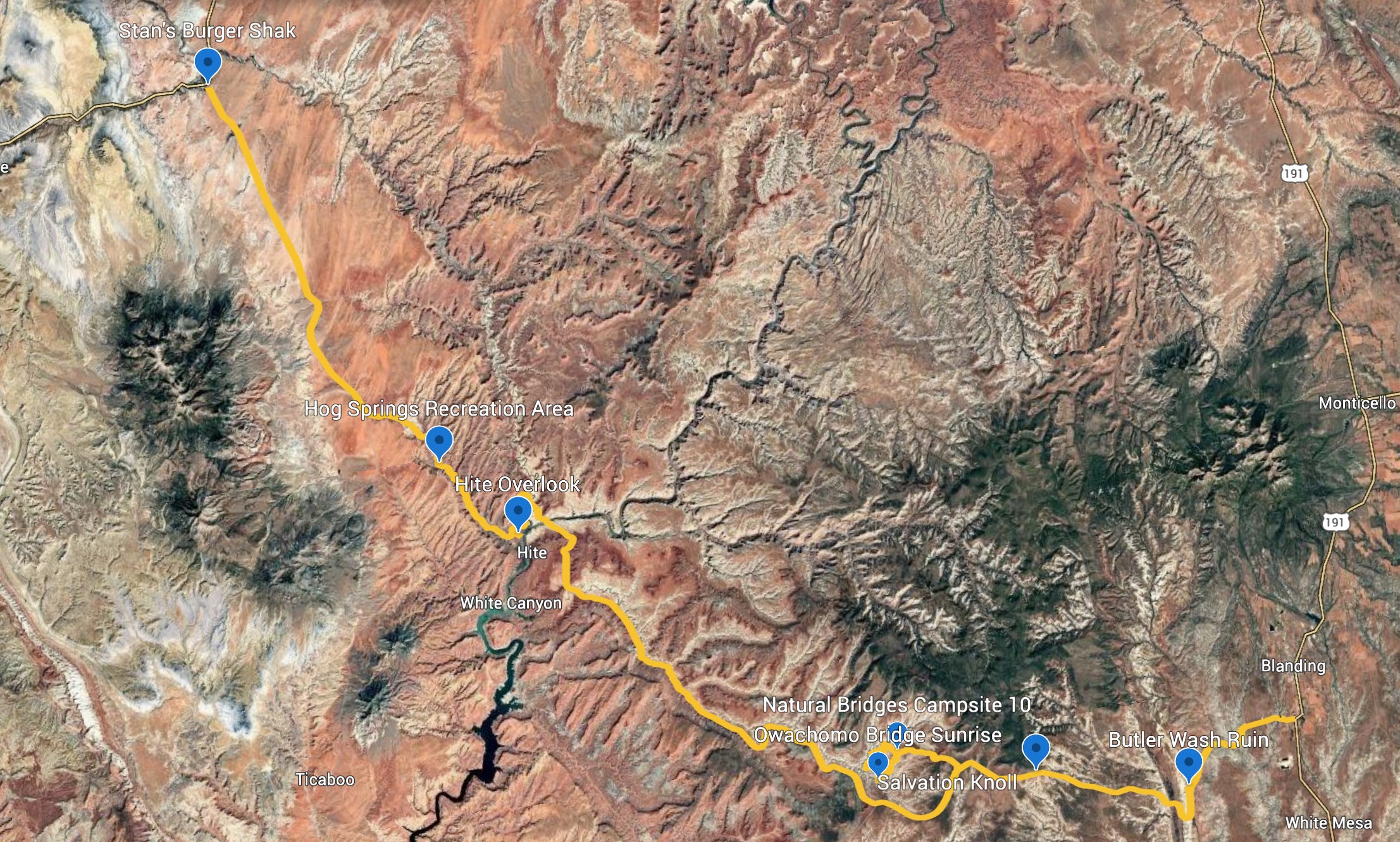
There’s a lot more we could see and do in this area. We barely scratched the surface with the stops we did that were along the highway. I thought it would be fun to show a map of our route and stops, so I made this project in Google Earth. All those squiggles and feathery looking areas are canyons and there are so many colors! I don’t know how many months it took those pioneer explorers to plot their route over this terrain on foot in 1880, but it took me about 45 minutes of playing with Google Earth to plot and label our route on a Sunday afternoon in 2025.
Big Four Tractor
We decided to stop at the Monticello Welcome Center and Frontier Museum for a bit of civilization before heading out to our next campsite. It was your typical small town museum, but next door to it, they had a little building with huge glass windows and inside was a Big Four Tractor.
This tractor is a 1907 model that was purchased in 1913 to remove sagebrush and plow land for dryland farming. The Big Four was manufactured in Minneapolis, Minnesota, shipped by rail to Colorado, and was then brought to Utah. The Big Four was used from 1913 to 1915 and the Monticello Chamber of Commerce purchased it in 1961 to display and to use in parades. Being from a family of tractor fans, it was neat to see this unique tractor on display! The land that was cleared by the Big Four is still used to grow wheat.


Harts Draw Road
When we were in the visitor center in Monticello, I asked about the best route to take and was told that we should take a drive through the Manti-La Sal National Forest over the Abajo Mountains. They also suggested checking out Foy Lake along the way. We triedthat, but the area around it was so packed full of fishermen and their vehicles that we didn’t stop any longer than it took to get turned around and out of there. Apparently, they sent everyone to Foy Lake!
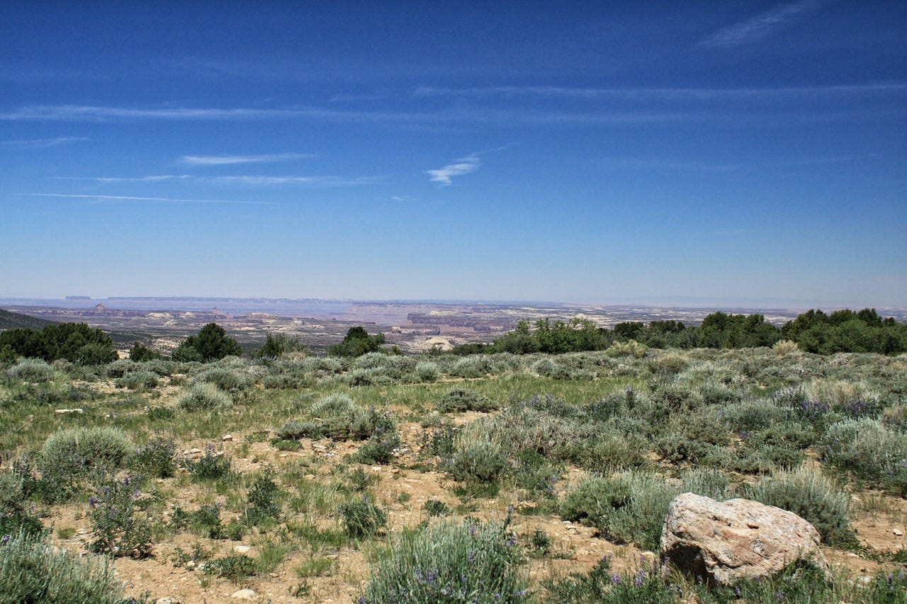
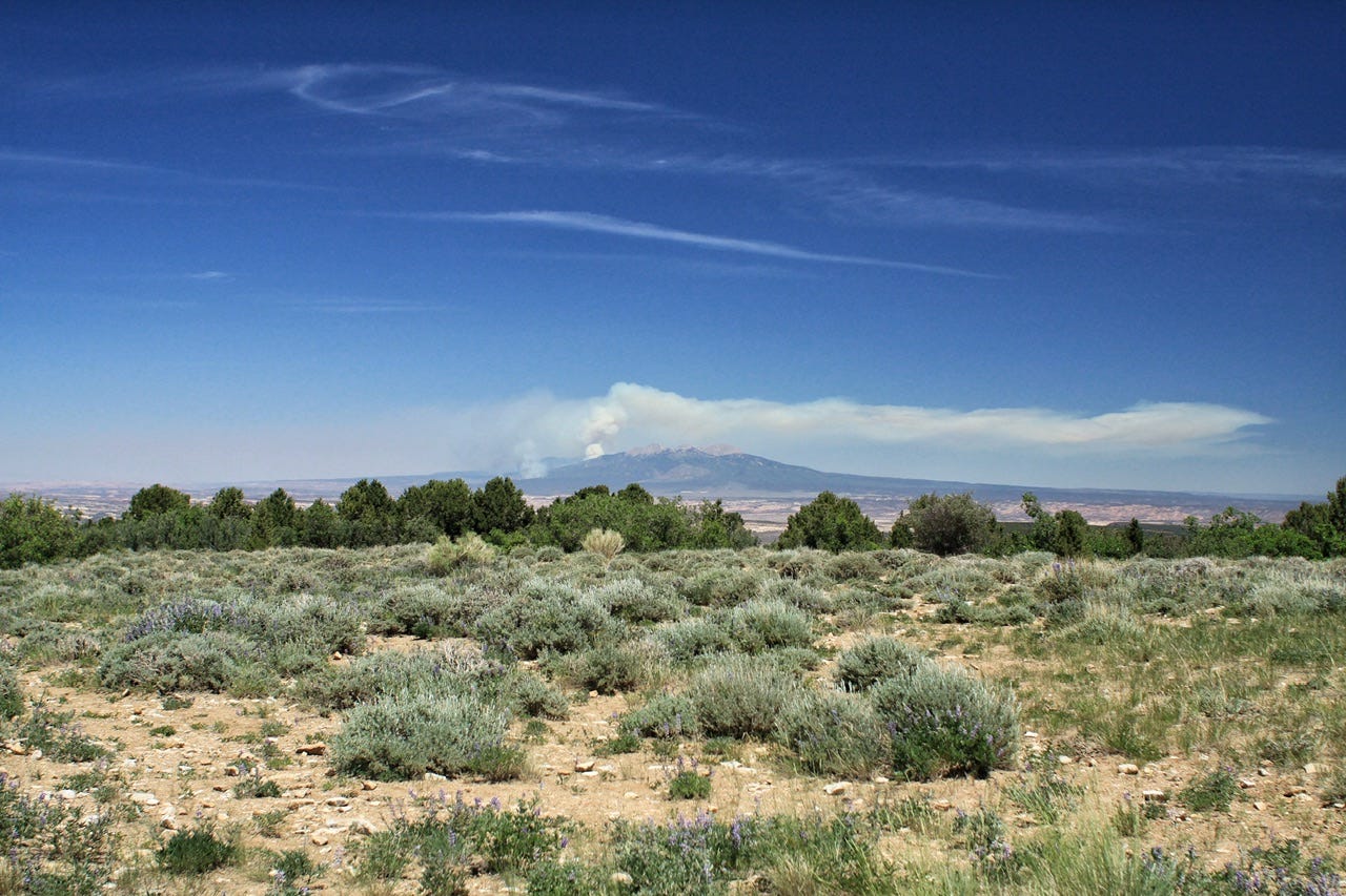
The highlight of this scenic drive was the Harts Draw-Canyonlands Overlook at the summit of the road. We could see for miles in all directions, including our first peek at Canyonlands, our destination for the night. To the east, we could see the La Sal Mountains, which had a good-sized plume of smoke on the top of them.
Abajo Mountains or Blue Mountains?
When I looked up the name of this area to write about it, the National Forest Service refers to these mountains as the Abajo Mountains on the map, but earlier, when I found the info for the Salvation Knoll, the Bureau of Land Management referred to them as the Blue Mountains in the story about the pioneers.
I had not put two and two together that these were actually the same mountain range until later on when I read something else that referred to them as “the Abajo Mountains, also known as the Blue Mountains.” At that point, I had to do a little more digging to find out which one it should be so I could change the one I had wrong.
It is thought that the Spanish named them the Abajo Mountains in the 1700s because “abajo” means low. I couldn’t find who named them the Blue Mountains, although that name seems like the type of name that pioneers would’ve come up with. They are indeed blue from a distance. There doesn’t seem to be a Native American name, at least none that I could find, so I don’t know if they also had a name for these mountains.
Mostly, it struck me as a little odd that two neighboring land management agencies referred to the same mountain range with different names. With the different names, and a lot of miles covered in between, I had no idea that these mountains were the same mountains we saw in the distance earlier in the day. I decided to leave the names as I had written them, since both names are apparently correct.
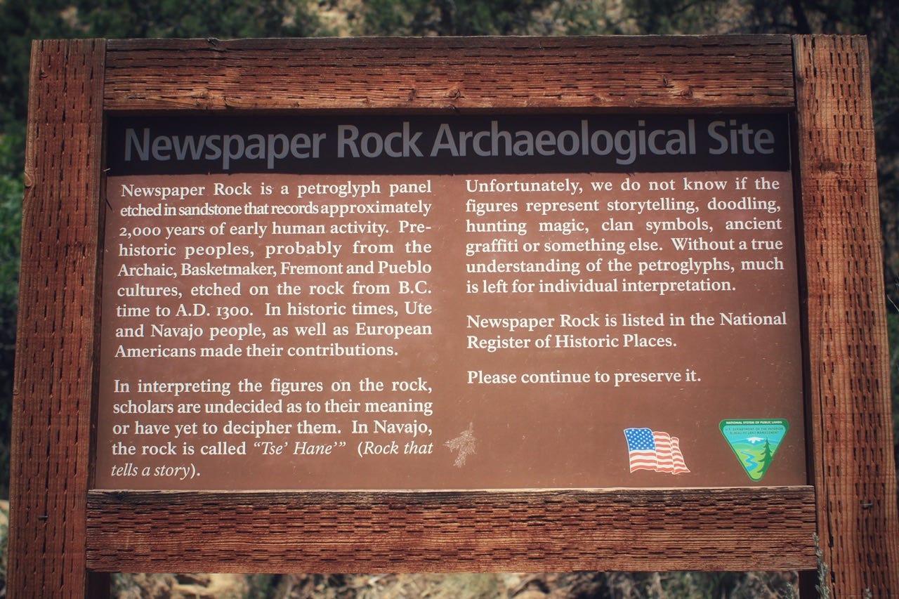
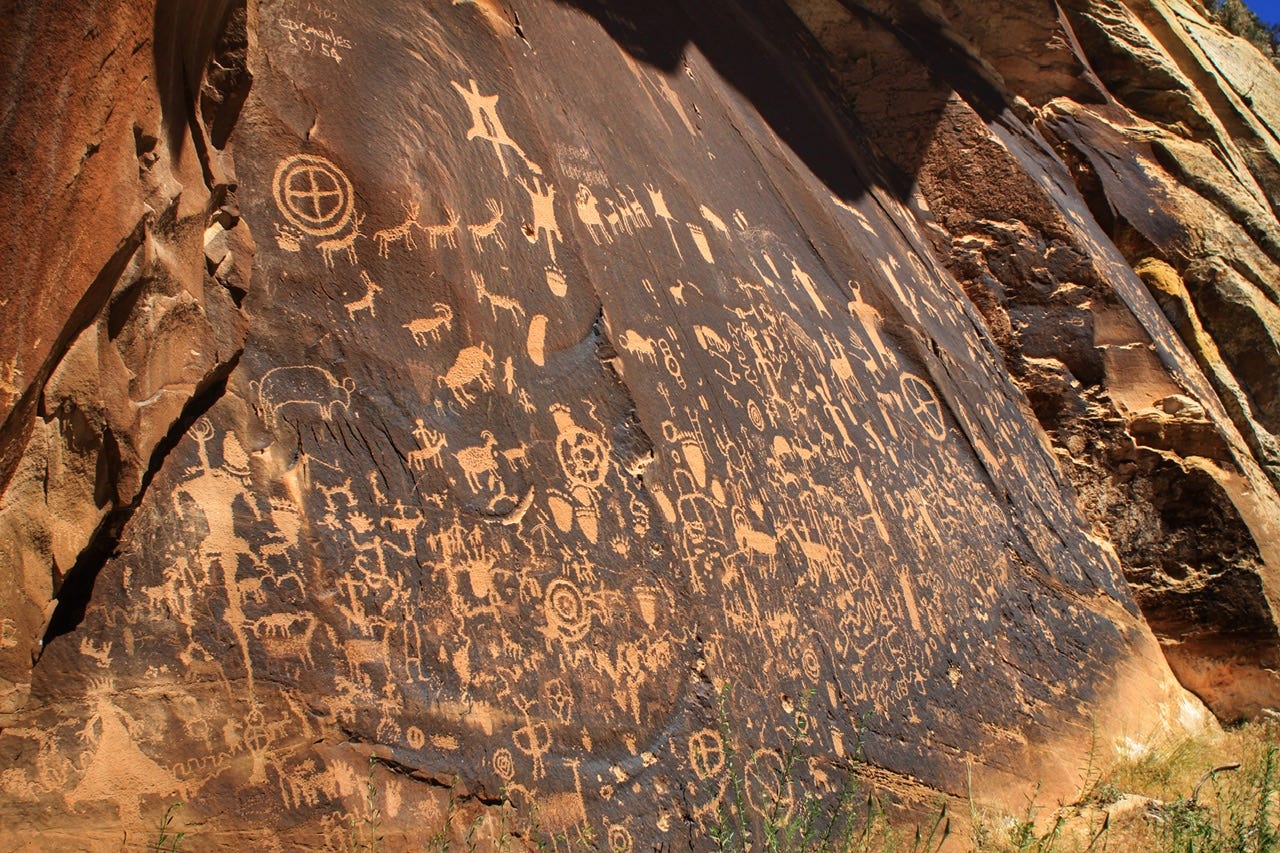
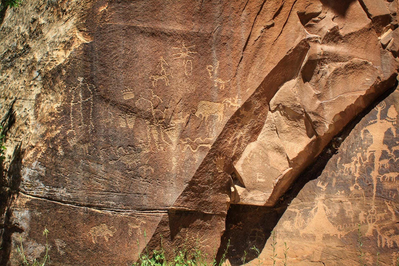
Newspaper Rock
Newspaper Rock had been high on my list of places to visit and it did not disappoint! There are more than 650 petroglyphs carved into this rock! The Navajo name for this site is Tse’ Hane’, which means rock that tells a story. This rock seems to tell a lot of stories!
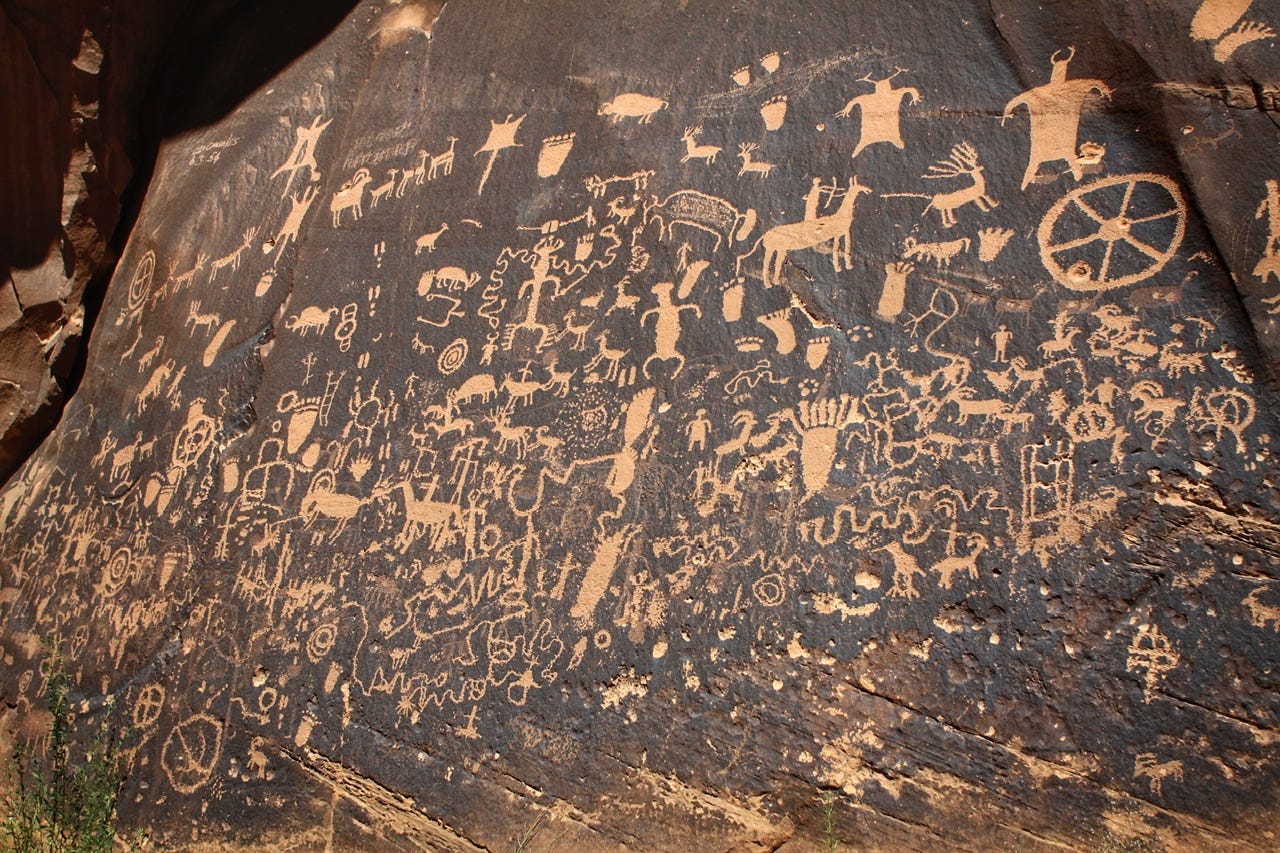


Sometimes rock art sites like this end up with so much modern graffiti that it ruins them, but this one is well-preserved. It has a fence around it, which probably helps, but at least it doesn’t have to be behind giant bars or a chainlink fence like other places we’ve visited. I wish I had taken a photo of the whole place, but I just have these close-ups of the rock art panel itself.
Somewhere around this area, we got stuck in a road construction project and had to wait for a pilot car. Personally, if I’m not in a hurry, I don’t mind the wait when there’s pretty scenery to look at. One nice thing about this particular road construction is that we got to drive on the smooth, new portion of the road that they had already finished.
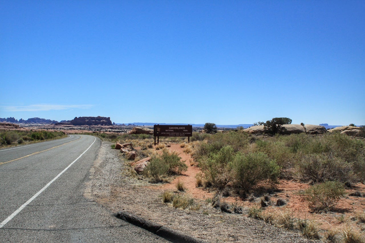
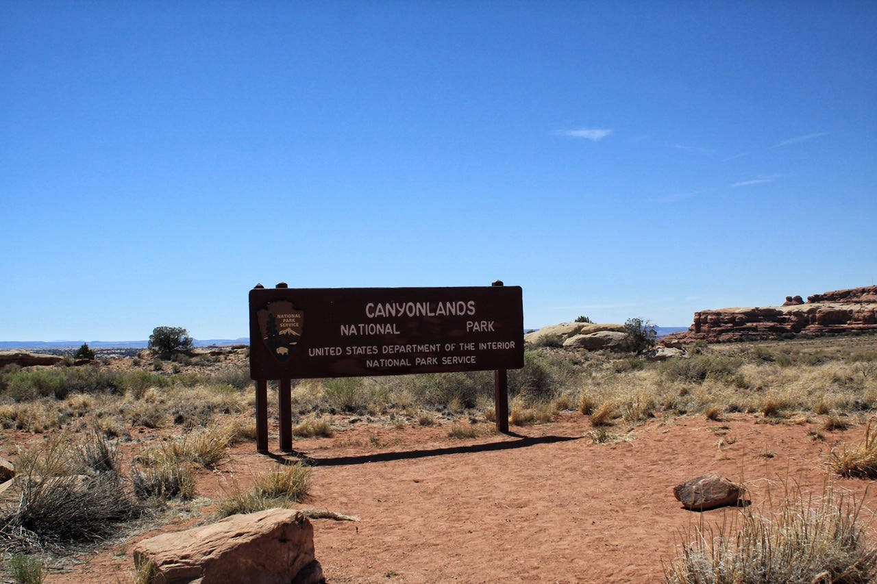
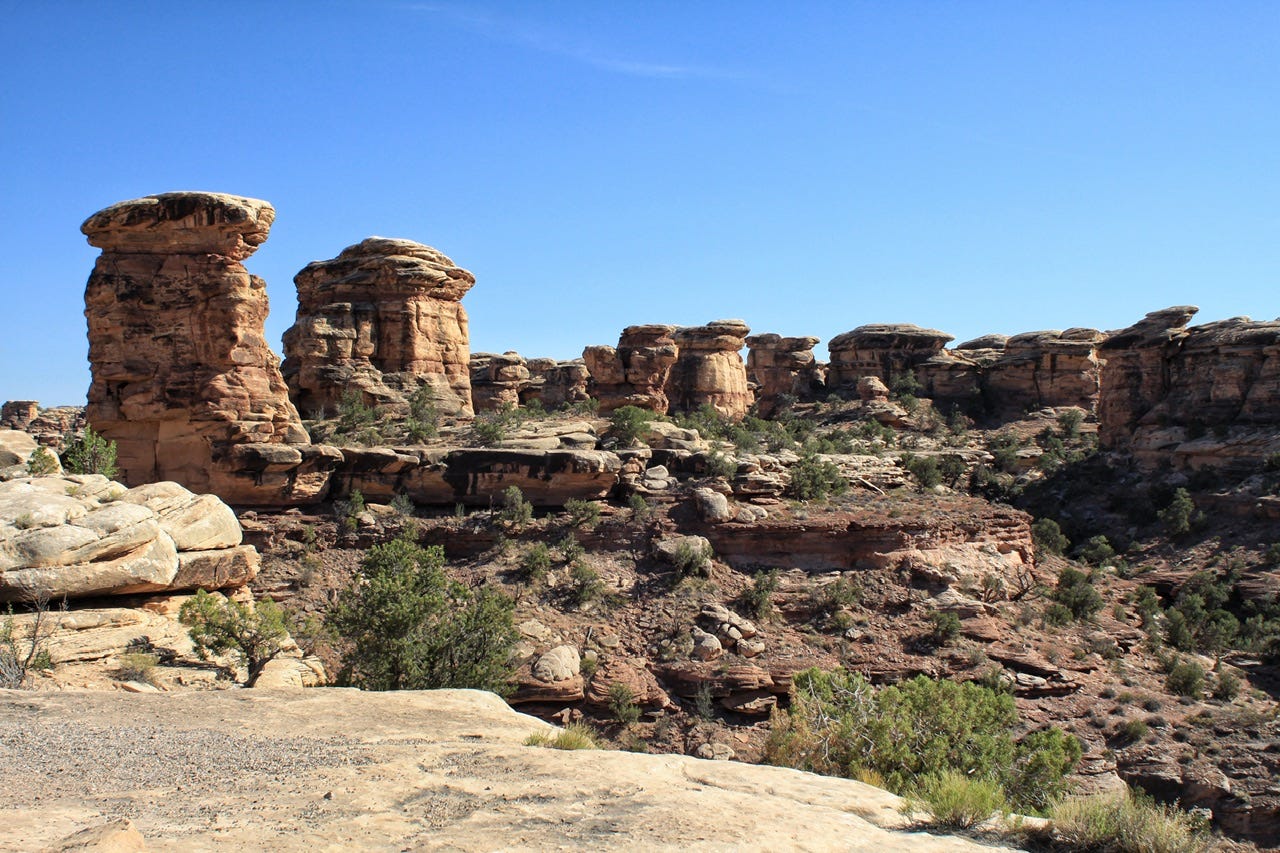
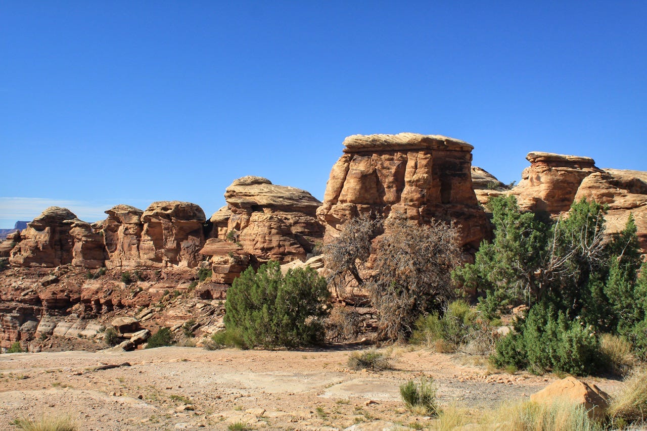
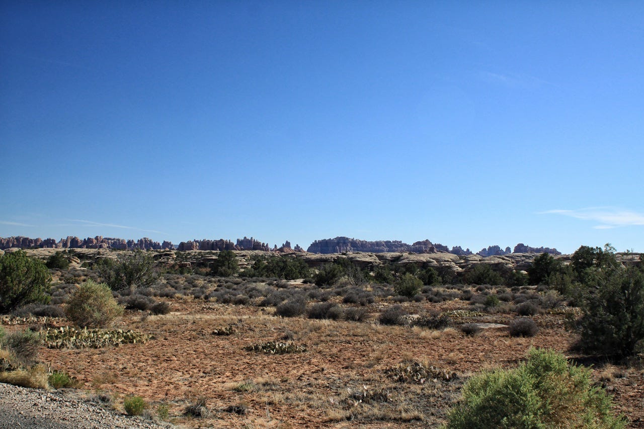
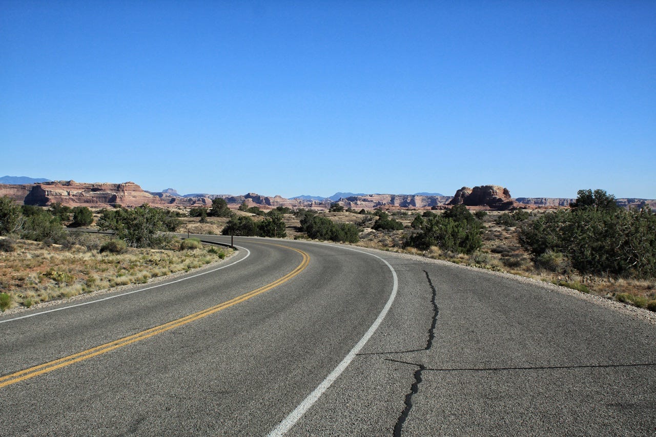
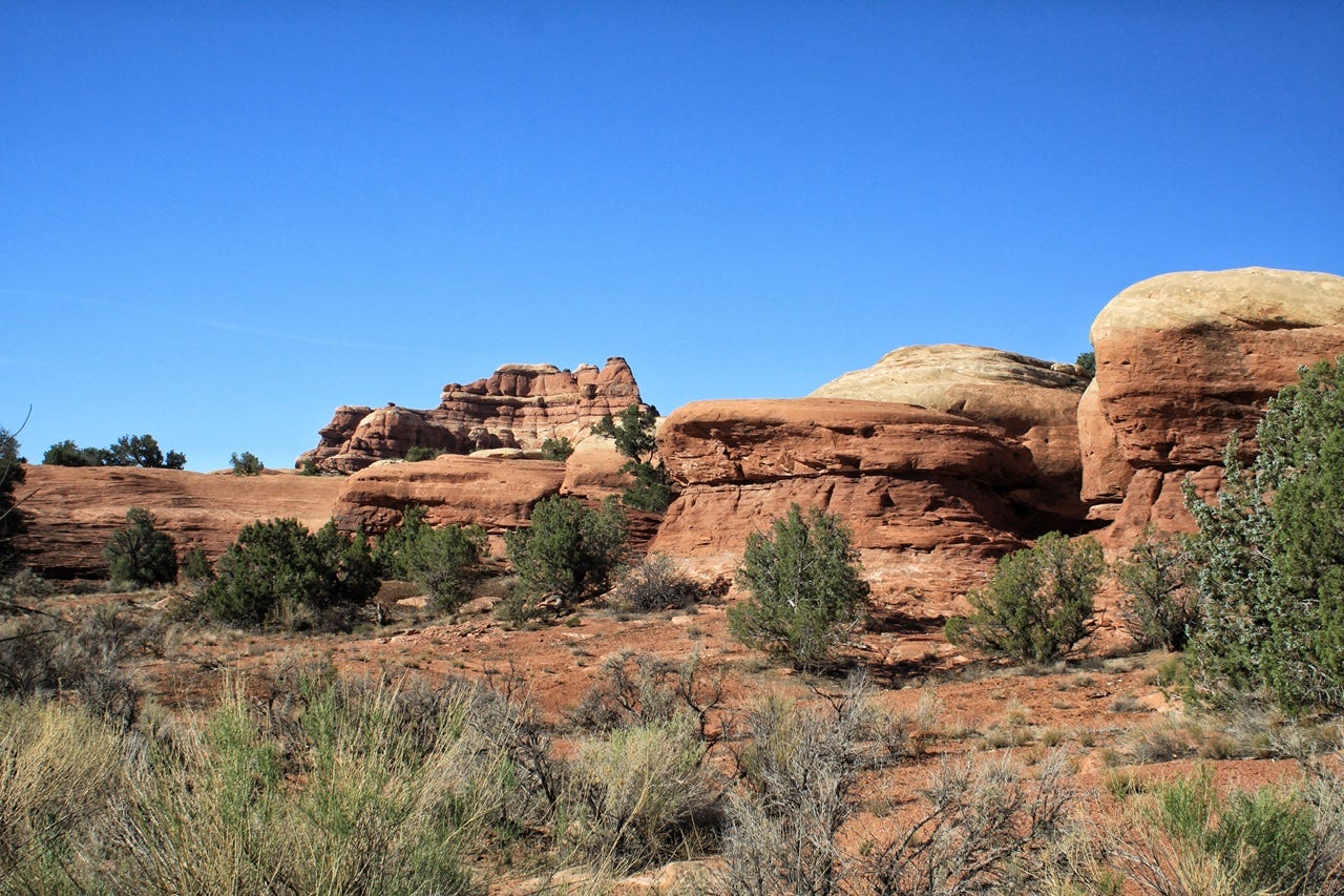
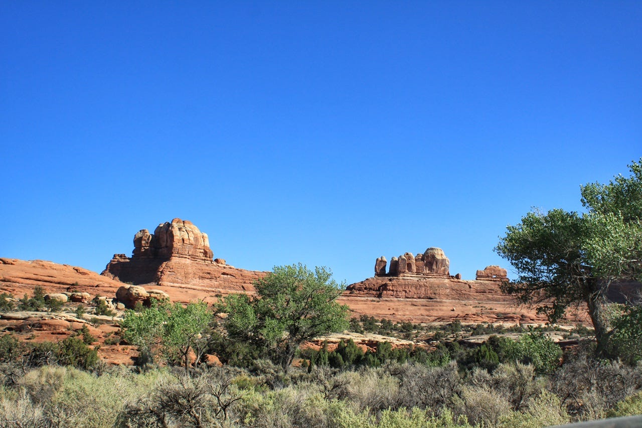
Canyonlands National Park: Needles District
We finally made it to the Needles District of Canyonlands! I had been planning this visit since December of 2019 when I reserved a campsite for June 2020. Then covid hit and I debated if we should still go or not, but about a week before we were supposed to leave, our campsites were cancelled and refunded, so that was the end of that debate. Somehow, I managed to reserve the same campsite for two nights in 2021! It was super exciting to finally visit the place I had had on my bucket list for so long!
It’s a Dry Heat
Our usual plan for desert traveling in June is that we hike in the morning and drive after lunch when it gets hot. It wasn’t a surprise to learn that it was 102° by the time we made it into the park at 3:30pm, but we had been enjoying the mid-eighties all week, so it felt like an oven when we stepped out of the car.
We stopped at the visitor center for Junior Ranger books and the rangers warned us that the high for the next day would be 108°. That was not the news I wanted to hear when I had an all-day hike planned!
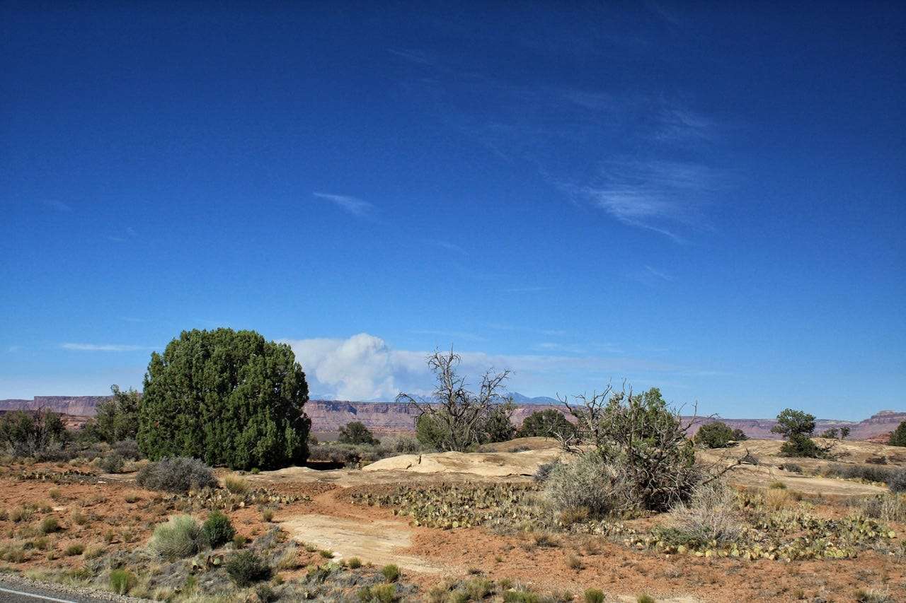
A waft of forest fire smoke was also in the air.
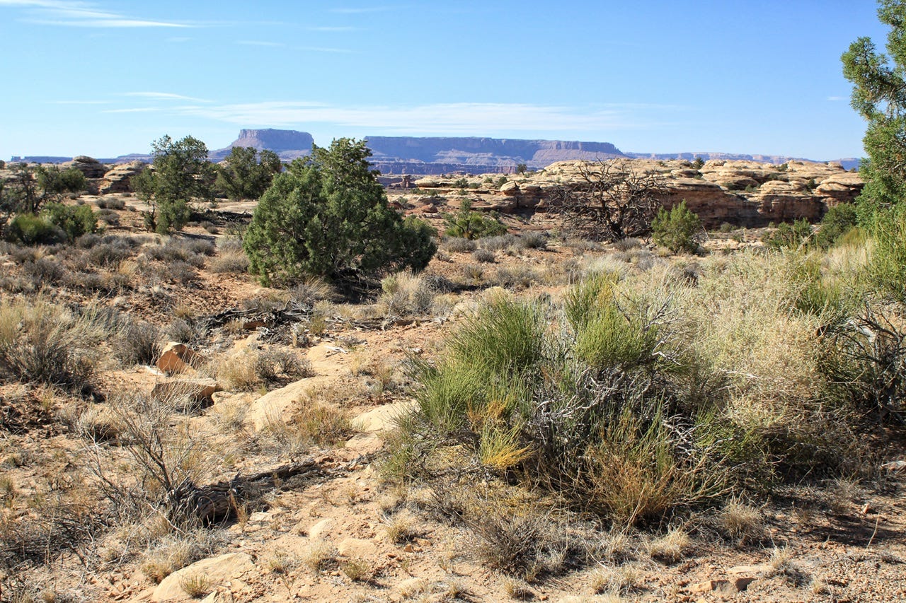
Since it was way too hot to set up our tent or go for a hike, we drove around and looked at pretty rocks…one of our specialties. That gave us something to do for a while, but eventually, we needed to figure out a plan for the next day and night. The wildfire wasn’t anywhere close to where we were, but the air quality was not great with the waft of smoke in the air.
None of us relished the idea of hiking all day with a high of 108° on the forecast. The visitor center had wifi so I went back there to do some research while the kids worked on their Junior Ranger books.
The Needles District is very much a hiking destination, so there wasn’t going to be anything we could do in the park for a full day if we didn’t hike. It’s also very remote, so going somewhere else for the day and coming back for the second night was out of the question.
When I checked if I would be able to get a refund for the second night, I discovered that I could do that with no penalty. After much agonizing over the what to do, I decided that our only option was to cancel that second night and get the refund while I still could.
With the wildfire in the La Sal Mountains, just outside of Moab, I was also concerned for the night I had reserved in Arches National Park a couple nights later. At that point, it seemed best to reroute the trip and skip the Moab area completely to avoid the smokey air. That campground would not give me any refund for cancelling two nights in advance, so I kept the reservation. (This is why half the campsites in national park campgrounds are “full” but empty, because there is zero incentive to actually cancel your campsite if you don’t get any money back for it! That, however, is a rant for another day.)
Evening Ranger Talk
We ended our adventures of the day by attending the ranger talk in the amphitheater in the other loop of the campground. I don’t remember exactly how the ranger tied his story to Canyonlands, but he introduced it as being something a little different, a scandal and a mystery. It was the story of Effigy Mounds National Monument in Iowa.
I think maybe he had worked a season or two at Effigy Mounds before coming to Canyonlands. The National Park Service filmed a video documentary series in 2018, called In Effigy, so perhaps he was involved with the making of that. I discovered the series as I was trying to figure out why he had talked about Effigy Mounds in Canyonlands. The full story in the documentary was so fascinating that I had to stop writing this post and watch that instead.
Effigy Mounds is a sacred Native American burial site that had been severely mismanaged for many years. Park rangers had desecrated some of the burial sites they were supposed to protect by installing vehicle-sized boardwalks throughout the park. If that wasn’t bad enough, while investigating how the boardwalks had been built without the proper historical site studies, it was discovered that one of the previous superintendents had taken home two boxes of human remains and stored them in his garage for over twenty years! The hour-long ranger talk, as well as the expanded version of the story in the documentary, was fascinating, yet horrifying.
What’s kind of crazy is that we could’ve stopped at Effigy Mounds National Monument on our 2014 road trip to Iowa. That would’ve been after the investigation of the boardwalks, but before they located the missing remains. The park superintendent who hid the remains in his garage was sentenced in 2016.
I’ve had Effigy Mounds on my list of places to visit someday since it’s a one-day drive from home, but so far, we haven’t made it there.
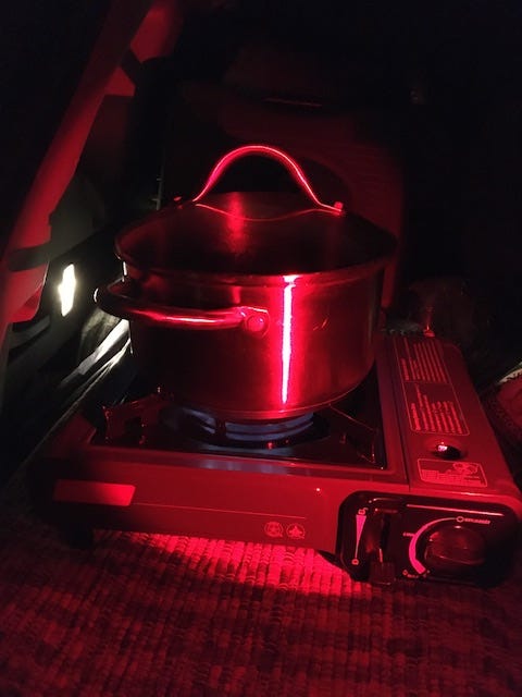
After the ranger talk was over, we went back to our campsite, set up the tent, and cooked supper in the dark. I’m thinking there were hot dogs in this pot, since that’s pretty much the only camping food I cooked in a pot back then. Our picnic table was placed at a horrible angle for doing pretty much anything, so I had to set up my cooking spot in the back end of the car.
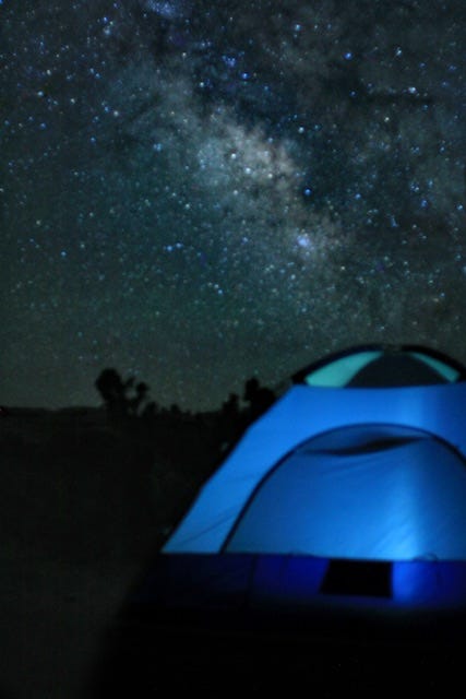
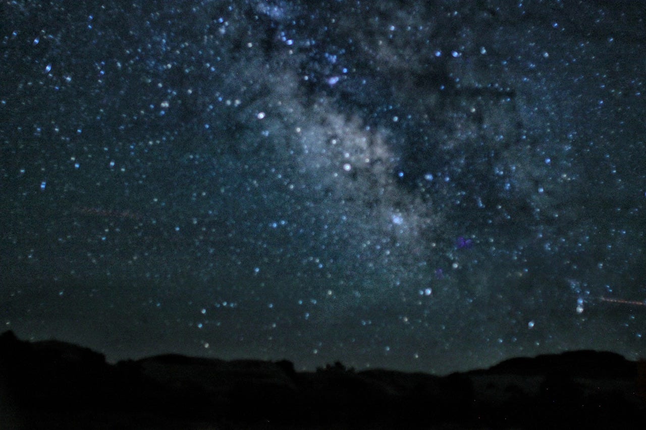
It was still over 90° outside and there was a new moon, so we stayed up past midnight attempting to capture the Milky Way. None of us got anything great for night sky photos, but we had fun trying and that’s all that really matters.
It was kind of disappointing to go to sleep knowing that we would not get to do the big hike I had planned on doing for so long. I wanted to hike to Chesler Park to see the Needles up close, but it just wasn’t meant to be. We still haven’t made it back to the Needles District to try again, but as with many places in Utah, it’s on the list.
Find out what we do to keep cool next time!