

A Day on the Oregon Trail

Day Two
Friday, May 31, 2019
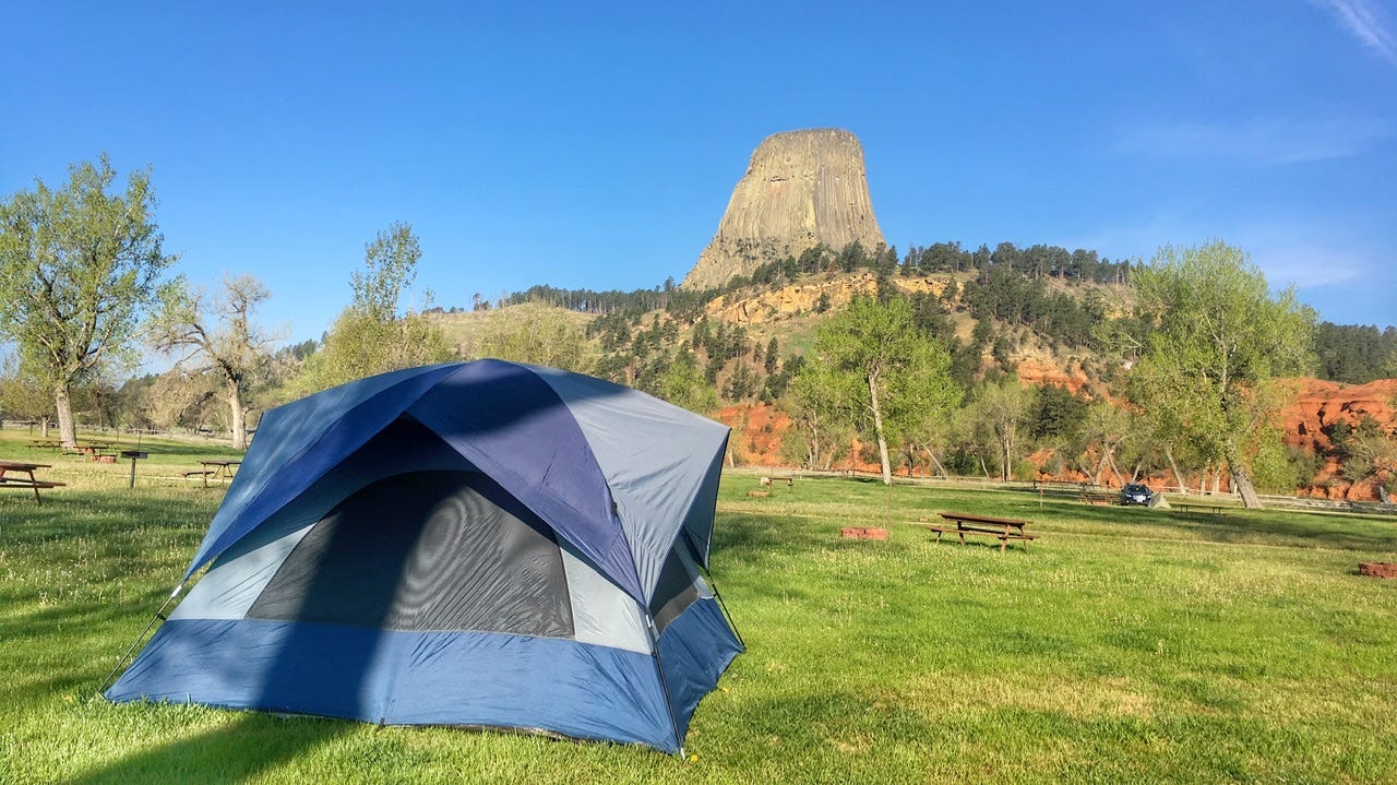
Devils Tower KOA
The KOA at Devils Tower has a great tent camping area. I have yet to run across another KOA that I’d want to tent camp in. Usually, the KOA tent sites look like little fenced corrals, but in this particular KOA, the tent area is a large open grassy area that is separated from the RV area by the shower and laundry facilities. It also has the best views of Devils Tower. We enjoyed a very quiet night, similar to what you’d expect from camping in the boonies, but with showers just a short walk away. At the time, I wasn’t sure it was worth the $32 they charged for a primitive tent site, but cheaper locations don’t usually have showers…and take a look at that view!
Since the office was closed when we arrived the night before, we paid for the site in the morning, after we were all packed up and ready to go.
We did not enter the national monument on this trip. I needed to buy a new America the Beautiful pass, and I didn’t want to get that on the last day of May. The annual park passes expire in one year, on the last day of the month in which they are purchased. I wanted to wait until June 1, so I would get an extra month the following year, when it would expire on June 30. It’s a nifty trick that has allowed us to get two big trips out of one park pass. Sadly, that meant we could not visit the park that day, but all of us had visited before, and we had a busy driving day ahead of us.
My notes say that we paid $2.79 for a gallon of gas in Rapid City and topped off the tank for $2.55 per gallon in Gillette. Wyoming is one of those states where if you see a gas station, it’s best to top off the tank while you can. There can be a lot of nothing between gas station locations.
National Historic Trails Interpretive Center
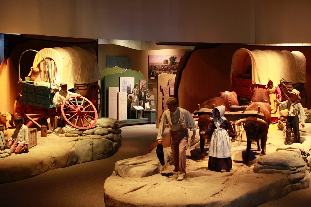
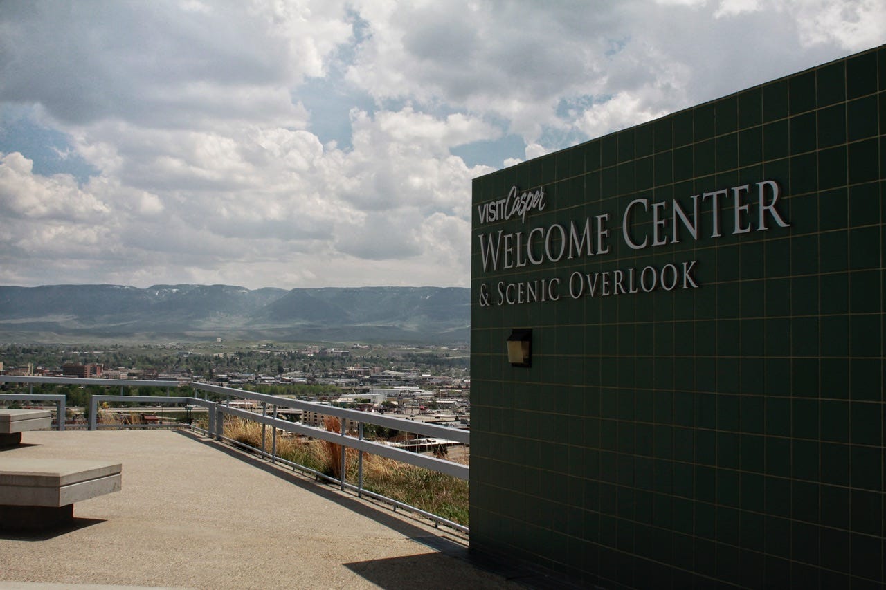
We arrived in Casper, Wyoming before noon and went straight to the National Historic Trails Interpretive Center. This museum is managed by the Bureau of Land Management and houses exhibits about the Oregon Trail, Mormon Pioneer Trail, California Trail, and the Pony Express Trail, all of which travelled through the state of Wyoming. We enjoyed this museum a lot! They had a lot of interesting hands-on exhibits that did a good job of demonstrating what life was like for the pioneers on these trails.
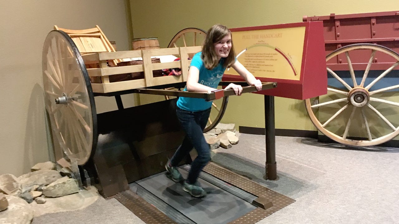
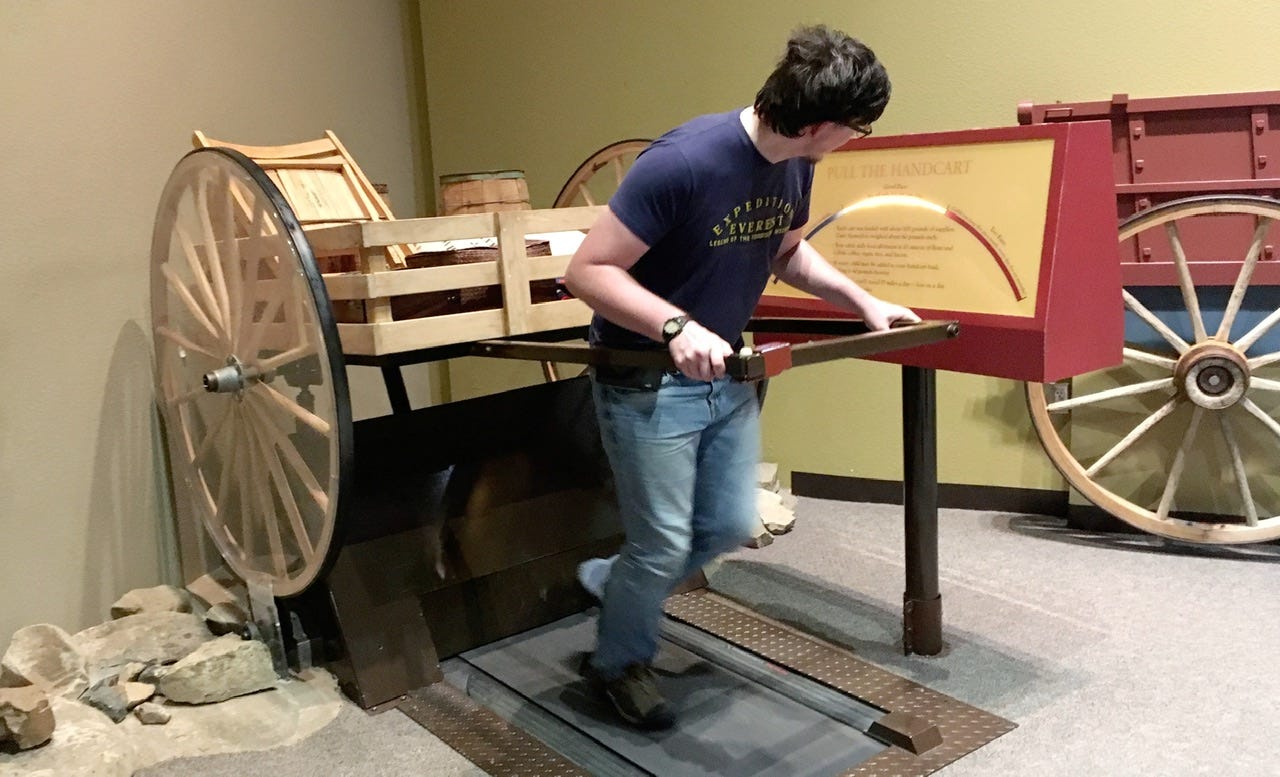
The kids had fun walking on the handcart simulator that demonstrates how fast you have to go with a loaded cart...too slow and you fall behind, too fast and you’ll wear yourself out! We also rode a covered wagon simulator to cross a river. It felt just like you would imagine it should as it bumped along and then floated a bit while it was on water and then bumped its’ way up the river bank. The scene was like you would see it out the front of the covered wagon and included voices speaking to the oxen pulling the wagon. There was also a stagecoach simulator with a view out the side like you were actually on a stagecoach. All of those were very cool!
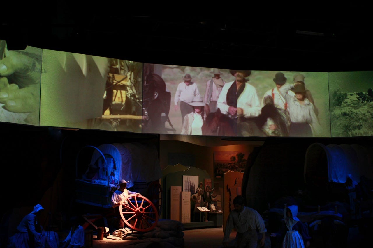
The film was also pretty neat. Several scenes were set up below the wide screens and they would light up to depict various parts of the story. Everything was well-thought out and interesting. We spent over an hour looking around. The kids were able to do their Junior Ranger program, which earned them some stickers and a pin.
Independence Rock
After learning about the trials and tribulations of Oregon Trail travelers, we continued down the trail. I had memories of visiting Independence Rock as a teen on a family road trip, so I had been looking forward to taking the kids to see it on one of our family road trips. It finally worked out with our route!
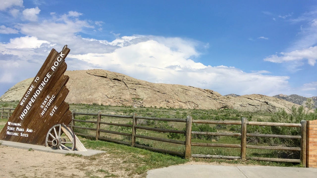
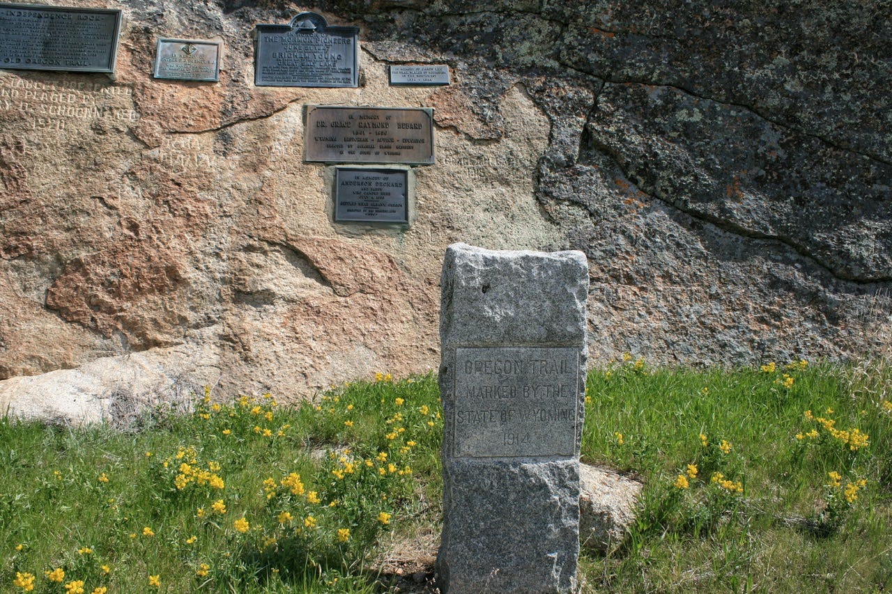
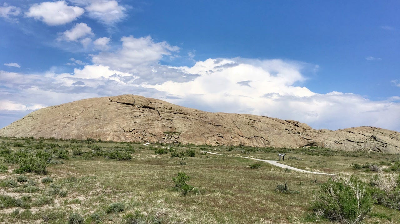
I’m not sure the Independence Rock site was as impressive as I had remembered it. The history is fascinating, and the historic names carved into it are worth preserving to tell the story of the trail. It was even nicknamed Register of the Desert because around 5000 pioneers carved their names into the rock on their way by. However, when you get up close, there is a fenced area with plaques cemented into the rock. The inscription under the plaque in the top corner is from 1920, and it makes sure you know the plaque was presented and placed by whomever decided it needed to be there, as if the added plaque wasn’t enough.
Apparently, the fenced area with the plaques includes the largest concentration of historic inscriptions, while the rest of the rock has more “modern” graffiti mixed in among the historic names. I guess I can understand having a fence to protect the inscriptions from additional graffiti. What seems odd to me is that if this particular area contained the most historical inscriptions, and people wanted to preserve the memories of those people, why would they add the plaques directly to the rock with cement? Why not put the series of markers on the ground in front of it or on some sort of monument displayed near it, rather than defacing the space with so many historic inscriptions?
I suppose preservation methods were different back in the day, but the entire rock is like a memorial of all the people who traveled west. Thankfully, there’s not a plaque next to every inscription. It might have been a better experience to walk the path that goes all the way around the rock, rather than just visit this fenced area that was closest to the parking lot. It was chilly that day, though, so we viewed it from this area and from further away at the rest area.
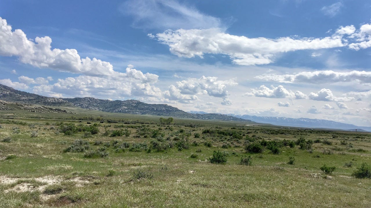
I enjoyed viewing Independence Rock more from a distance. You can imagine the pioneers coming upon this large rounded rock outcropping, relieved that they had made it this far on their journey. Many of them believed that if they made it to Independence Rock by the Fourth of July, that they would have enough time to make the rest of their journey before winter. This was the halfway point on their way to Oregon and California. It seems fitting that Wyoming turned it into a rest area.
Devil’s Gate
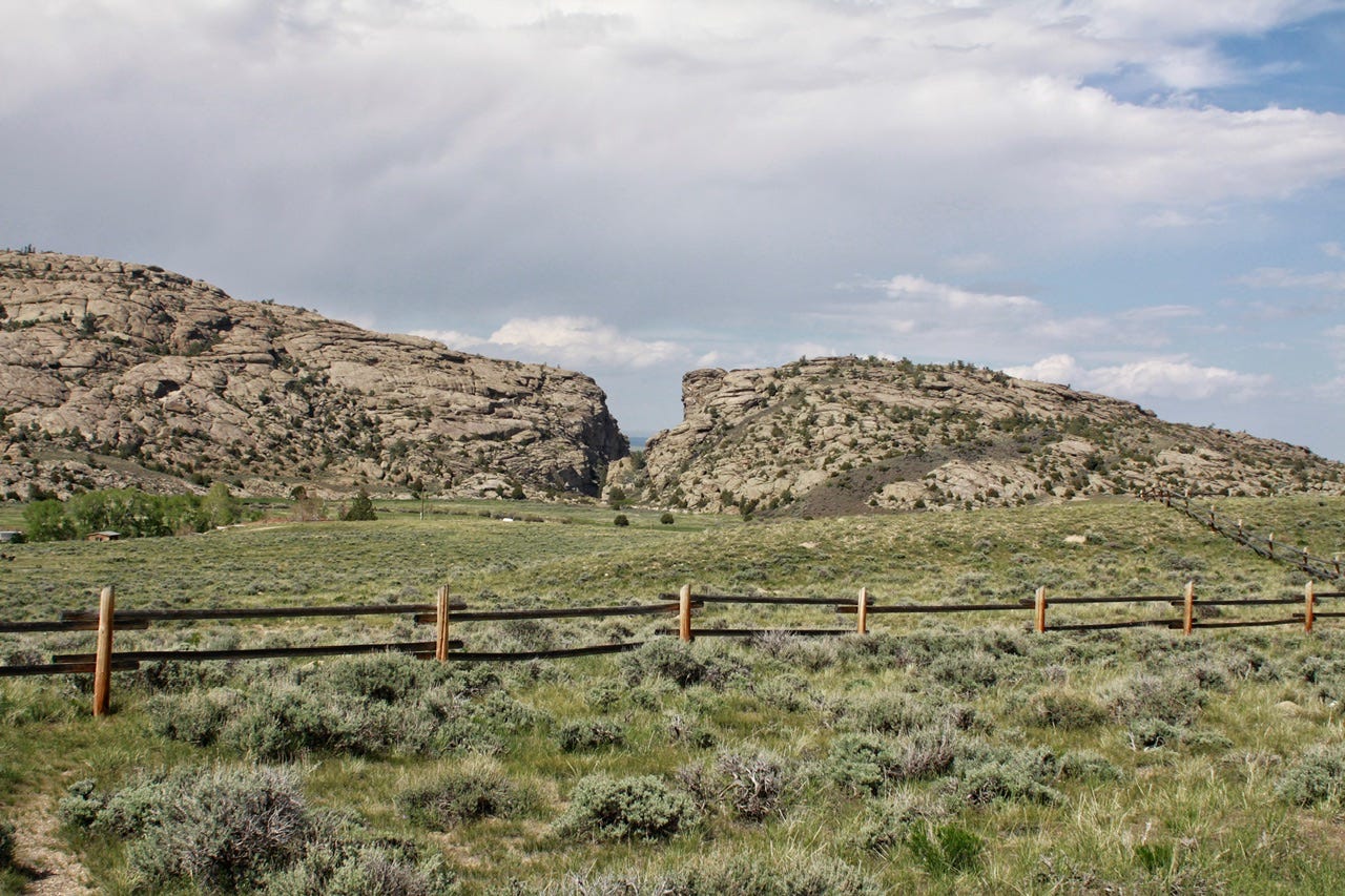
Five miles down the road is Devil’s Gate, another historic landmark along the Oregon Trail. This gorge was formed by the Sweetwater River. The covered wagons were too wide to fit through the narrow gorge, so they went around it. There was once a trading post nearby for supplies. It also has names carved into the rock, but we didn’t go up close to see them.
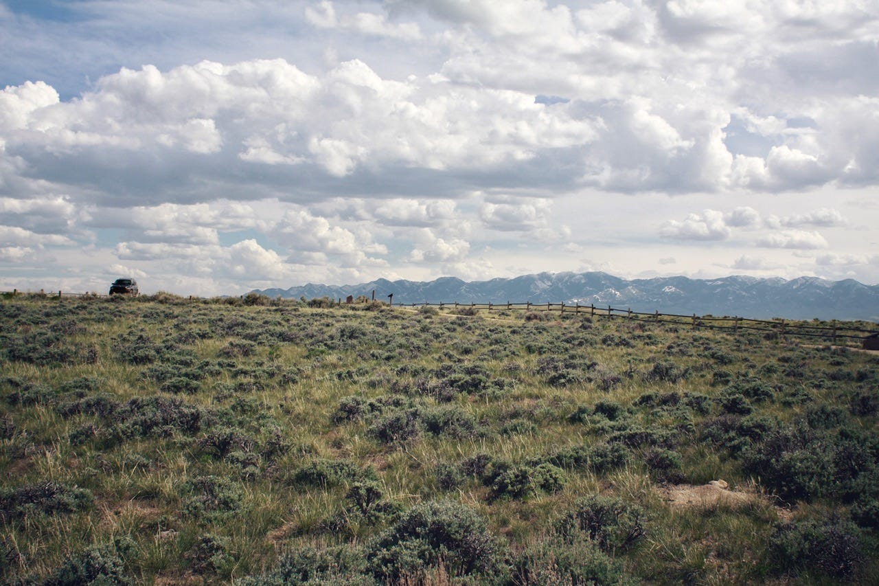
Our Covered Wagon
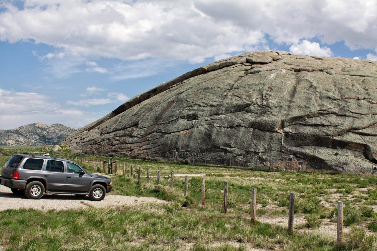
This photo of our Dodge Durango is one of my favorite photos. We did not go far down the trail before deciding it was too chilly to go any further. This was the view when we turned around. I’ve always thought it was a neat photo. Can you imagine it being a covered wagon sitting there among the sagebrush, on a hill overlooking Devil’s Gate?
Our Durango has been with us since 2002…so almost as old as a covered wagon. At this point, it’s like one of the family. I wish it could still go on road trips with us, but it has over 270,000 miles and has to stay home with the cats.
Our covered wagon continued down the Oregon Trail until we needed to turn on the road that took us to the interstate. I had a hankering for pizza, so Joey checked our options and found us a Little Caesars in Rock Springs. I hadn’t had a Little Caesars pizza in a while, but it was cheap, so we decided to try it. Joey placed the order online right before we stopped for gas, which gave us just enough time. We also ordered breadsticks, but I had to take the first batch back to trade for new ones because there was a hair on one of them. Yuck! I looked the pizza over, as well, but thankfully, it appeared to be fine. Despite the mishap, we decided that pizza for the road was a pretty good idea!
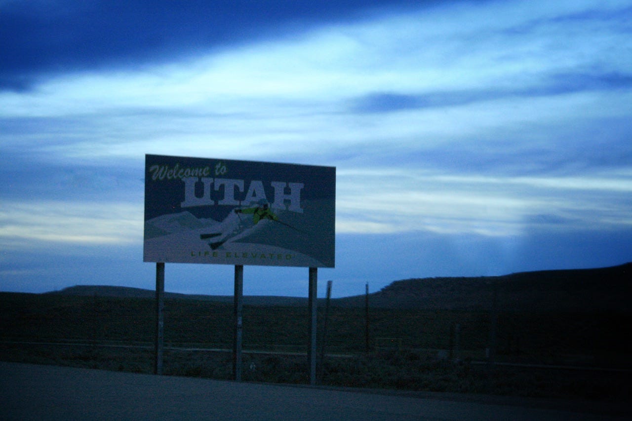
Welcome to Utah
With food and gas out of the way, our next task was locating a campsite for the night. I can’t remember what state park I had originally planned to camp at, but since our morning drive to Casper was a three hour drive from Devil’s Tower instead of a 45 minute drive from Ayres Natural Bridge, we needed an earlier spot to stop. I called the original campground, but they were full, which was probably just as well. Joey searched the camping apps on my phone and found Rockport State Park, which was only an hour away at that point in the drive. I called them and they had several open primitive campsites, so that’s where we went.
Rockport State Park
When we arrived, the guy in the fee booth put us in the Twin Cove Campground at site 24. I don’t know why the he gave us that site when I said we had an eleven foot square tent. There was no tent pad, which wasn’t a big deal, but the paved driveway was the only flat spot on the entire campsite. With a park road up the hill on one side, and the campground road down the hill on the other side, plus a very noisy family behind us in the next campsite, we decided to just set up the tent a bit kitty-corner on the pavement. We could only stake down three corners and then used the rainfly guy lines to stake the rest of it. Had it been earlier in the evening, I probably would’ve went back and asked for a different site. I really wished I would have at about midnight when the folks next door were still being noisy neighbors.
I was just glad to be parked for the night. Somehow, we had managed to travel over 500 miles that day, even with all of the stops!
We’ll cover some beautiful Utah scenery, and we all gain a new state on the next day of this trip, so be sure to subscribe! If you know anyone who enjoys a tent camping, road tripping tale or two, send them my way!