


A Day of Transportation History
Idaho and Utah

Day Four
Thursday, June 10, 2021
2:30am
We woke up to the unmistakable sound of tent fabric frantically flapping in the wind. The tent walls were billowing and leaning with the force of every gust. I didn’t want to get out of the tent to stake out the guy lines, but I figured I wouldn’t get any sleep if the tent continued swaying back and forth. Luckily, I always keep the hammer in the tent with us, just in case I ever have to chuck it at a bear or something.
Joey came along with me to shine a light on the project, and within a few minutes, we had battened down the hatches. It’s amazing what four pieces string can do to tighten up a tent so it doesn’t move. Eventually, we went back to sleep listening to the ebb and flow of the wind rustling polyester, sometimes frantically…sometimes just a slight breeze.
8:30am
It was still windy. Super windy. It was the kind of wind that makes me wish I owned a gadget to tell me how windy it was! I was glad I had already photographed the tent while it was calm the night before.
Normally, the kids each get dressed and take their stuff to the car. Then they take down the rainfly and pull up the stakes while I get dressed. I had no desire to go for a ride in the empty tent, so we skipped that part of our routine. We had hoped for a lull in the wind, but our tent was now empty and we needed to get it dropped to the ground so we could pack it up.
Our rainfly is like a giant twelve foot kite. Even the slightest breeze can make that thing feel like it wants to fly away. We unhooked it on two corners and left the other two corners attached as it slid off the side. We kept all the stakes in the ground until we were ready to fold the tent and then we only took out enough stakes to fold it over, picking the side that would fold with the wind, rather than against it. When we got down to the last stakes that needed to be removed, Megan had to lay down on the tent to keep it from blowing around while I rolled it up. Taking down the tent never seemed like as much of an accomplishment as it did that day!
The night before, I wished I had booked two nights, but I was really glad we only reserved one night by the time we were all packed up.
9:15am
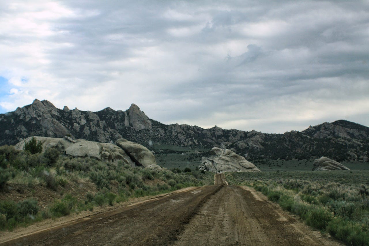
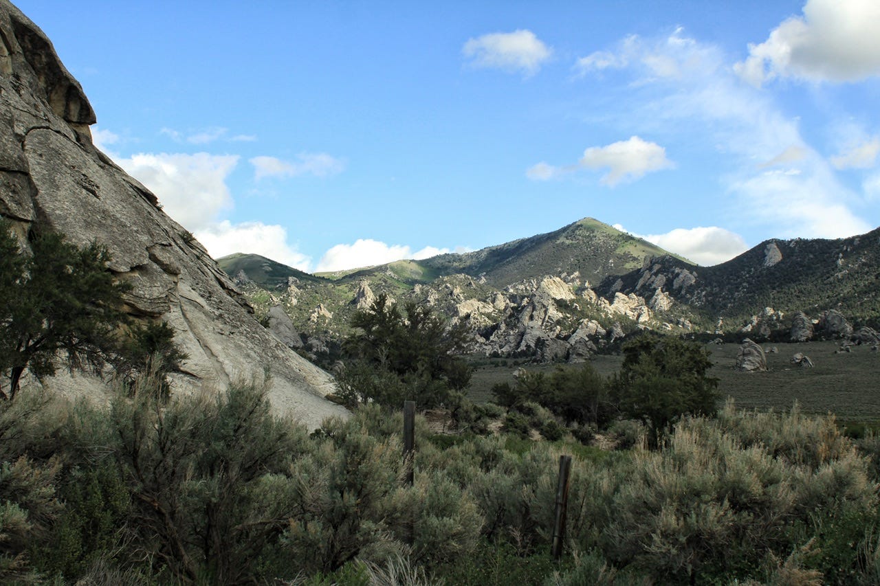
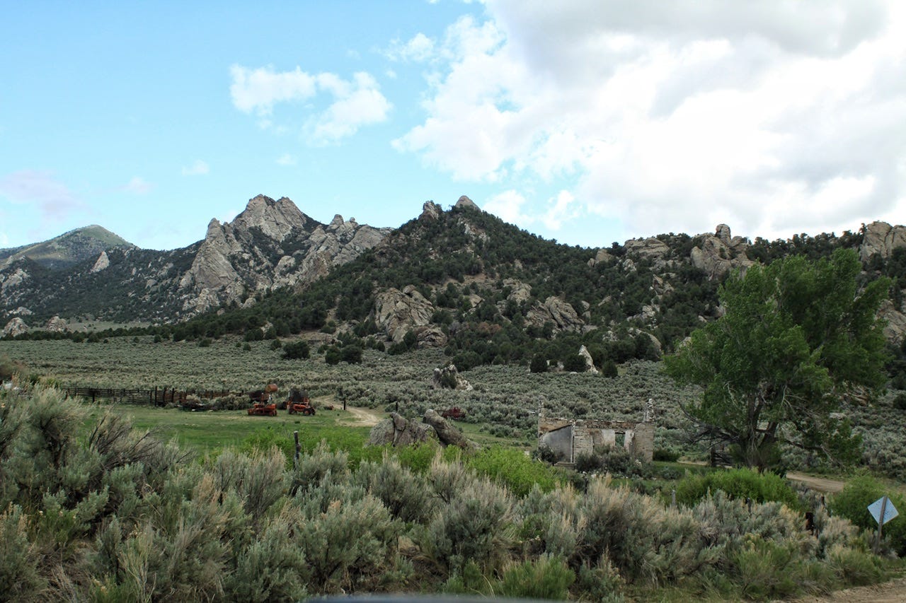
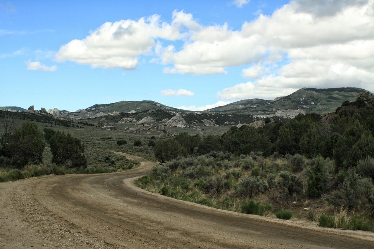
The wind wasn’t at all pleasant enough for a morning hike, so we took our time driving out, stopping for photos along the way. The sky looked like it could rain any minute in one direction, and we could see blue skies in the other direction. A road construction crew was working on the campground road as we made our way out of the park.

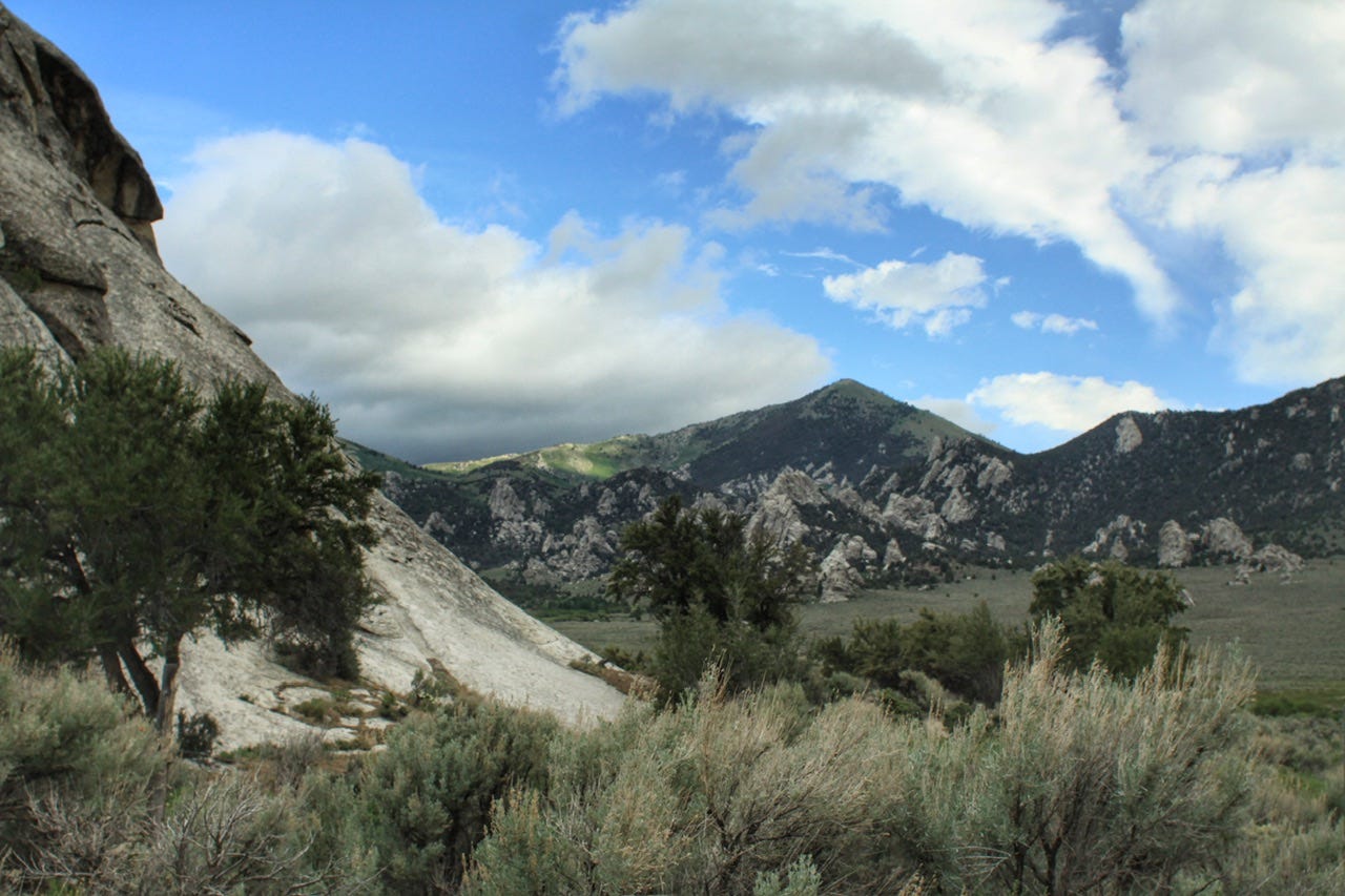
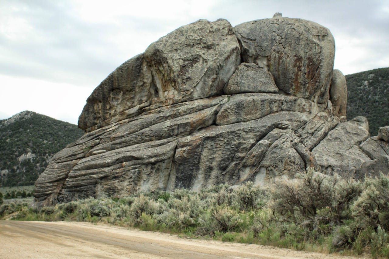
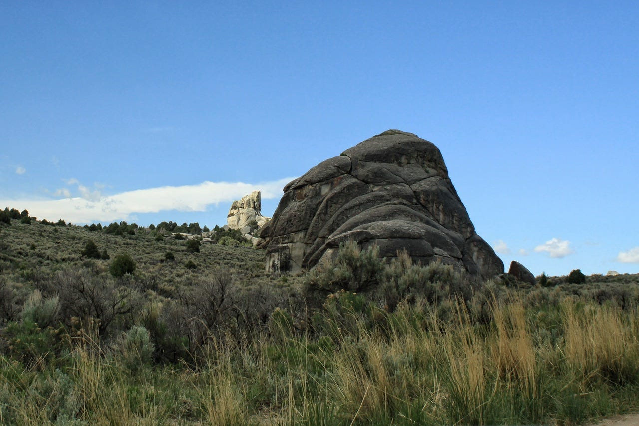
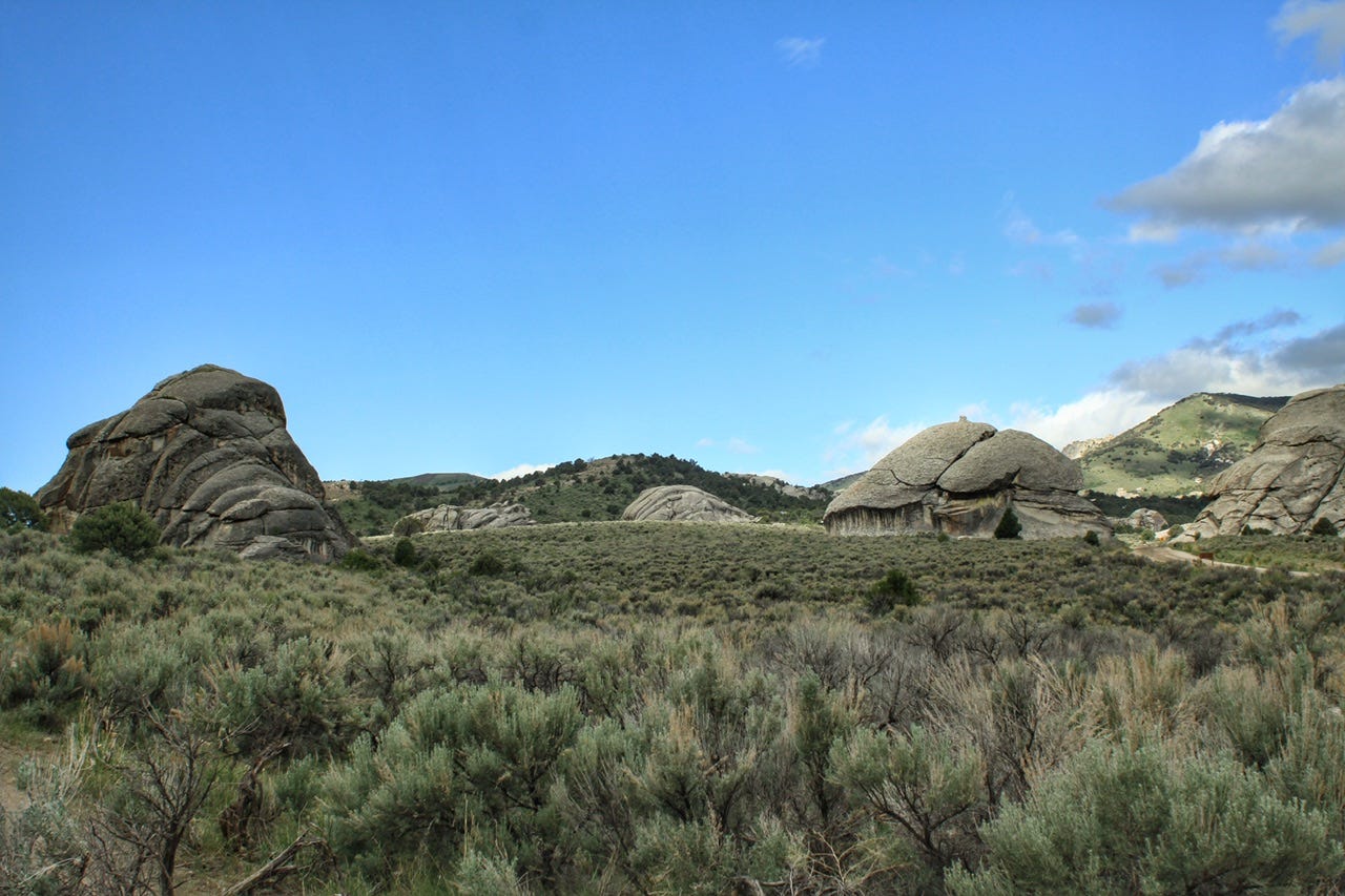
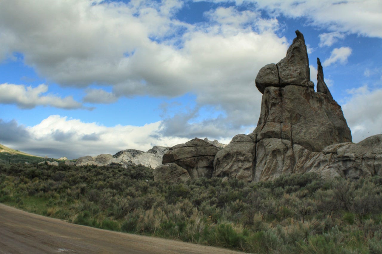
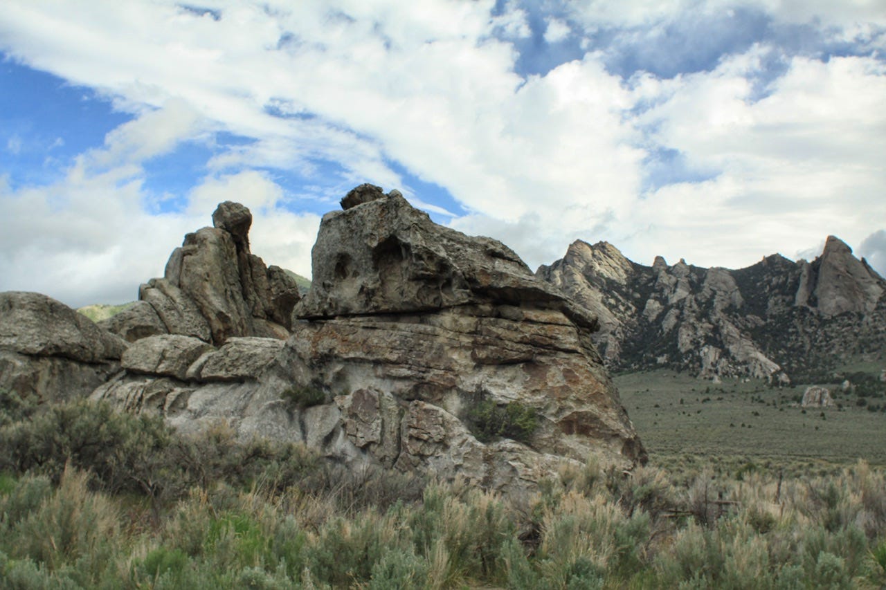
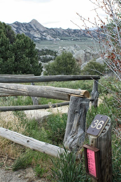
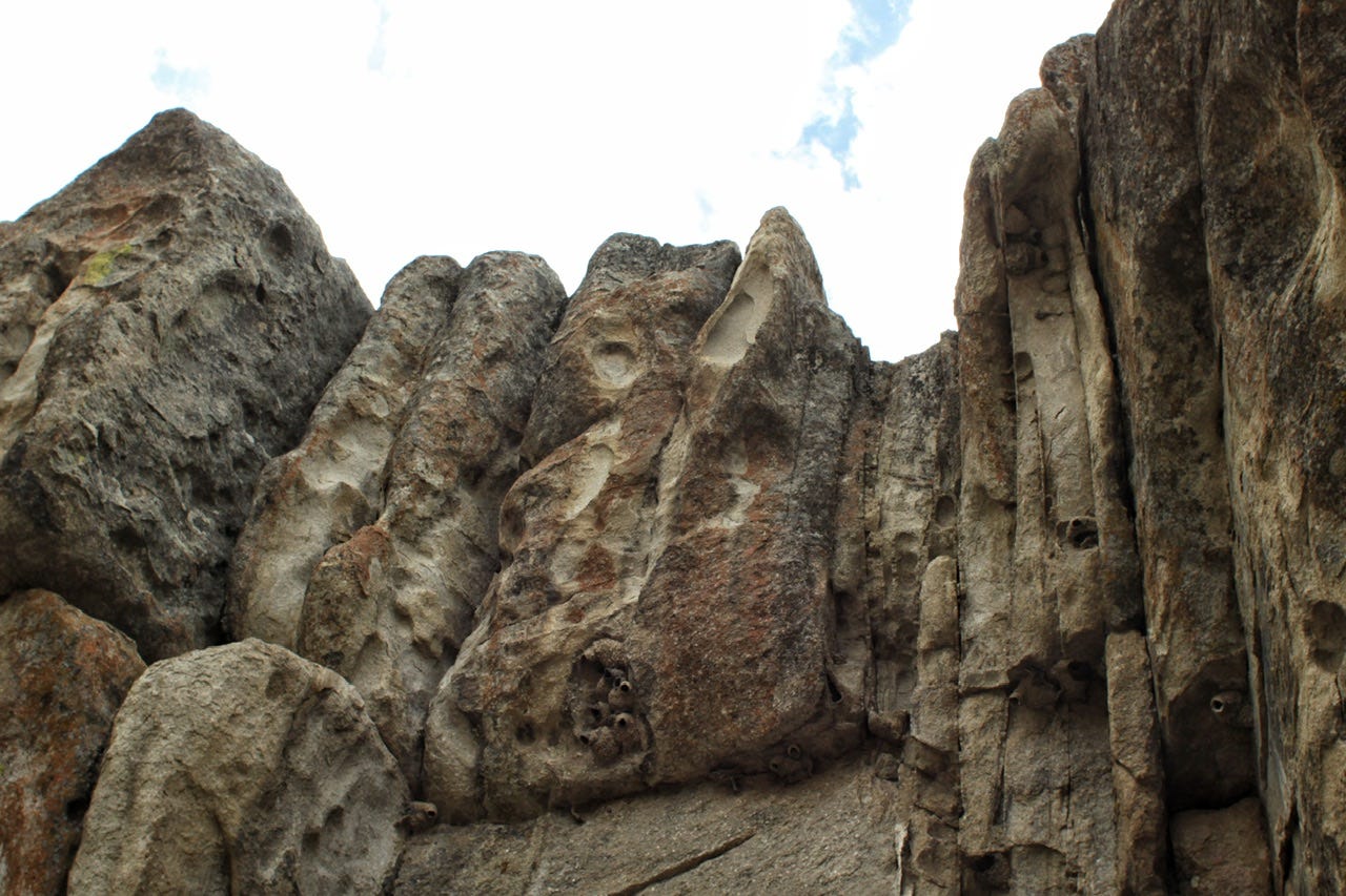
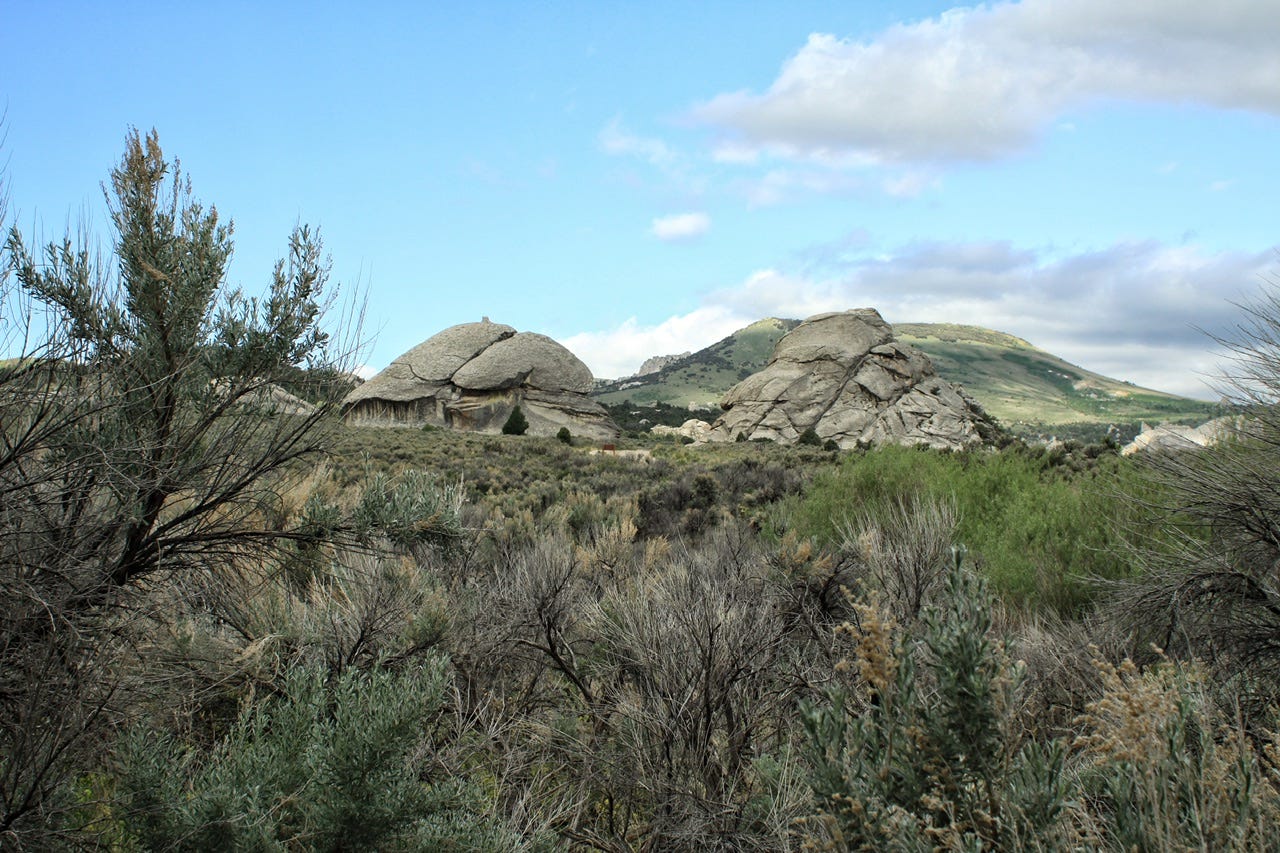
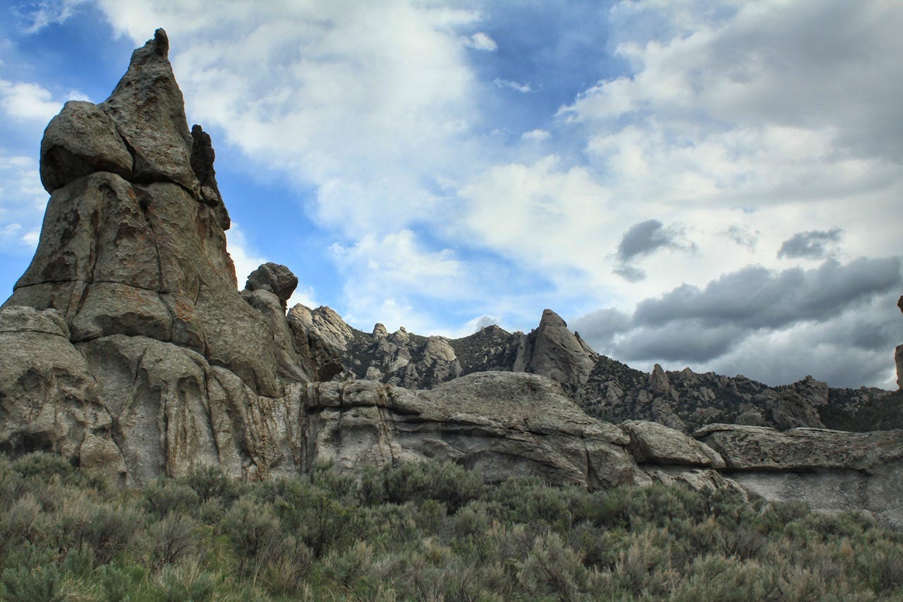
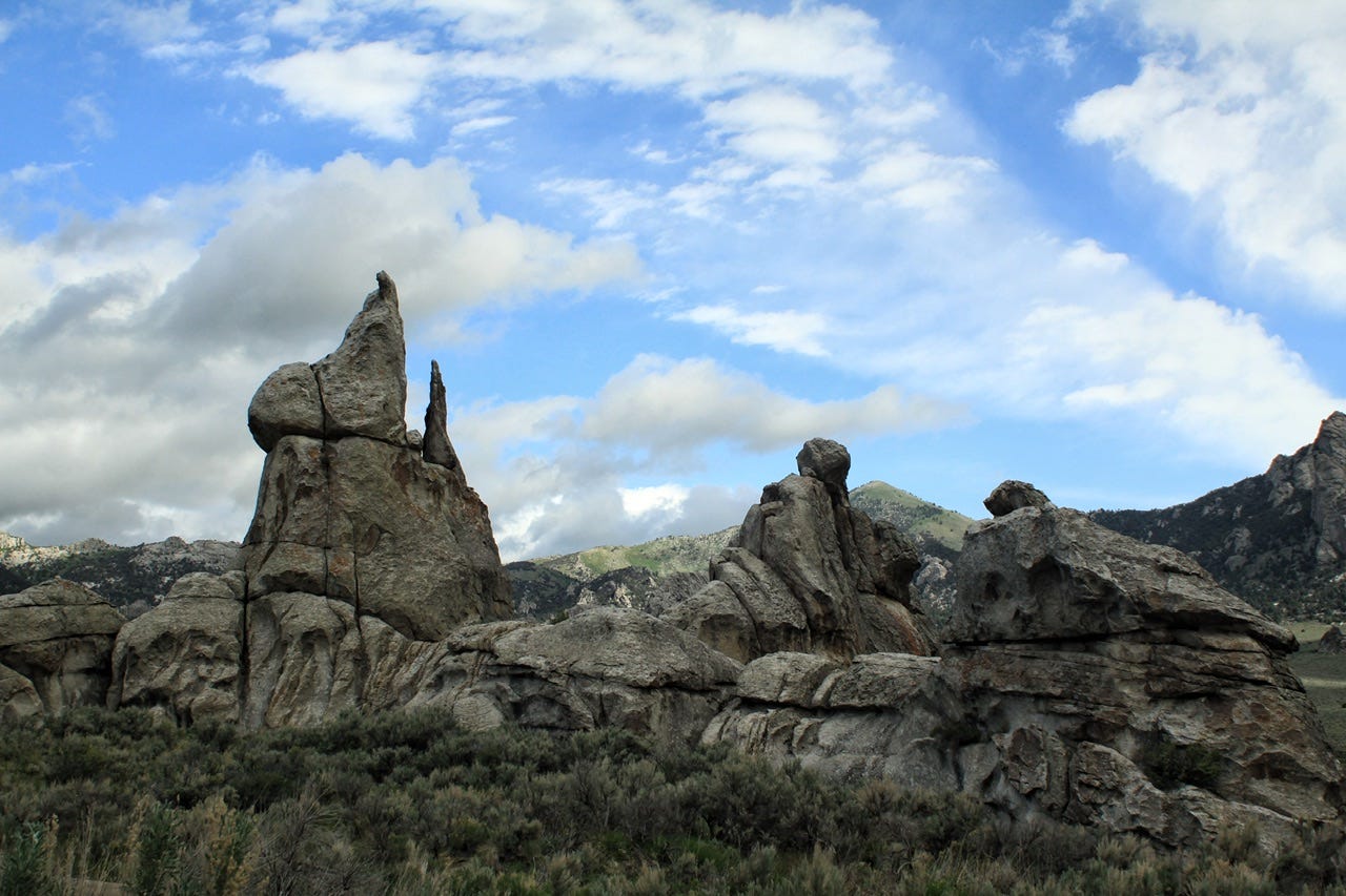
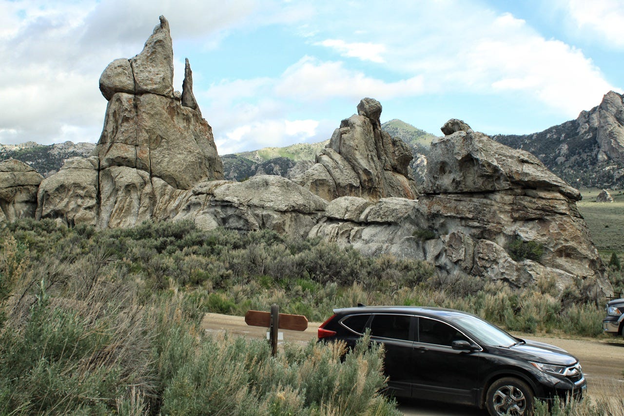
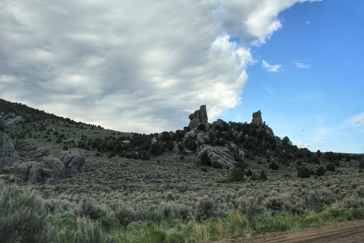
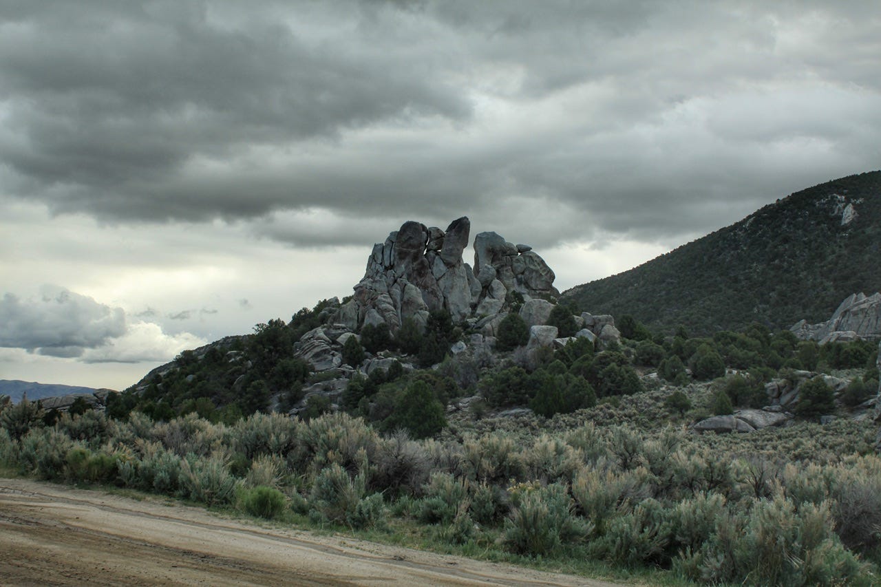
Camp Rock
We’ve camped in campgrounds all over the west. I’m not sure how many of those campgrounds hold the same history of camping as City of Rocks. People have been camping in this location for centuries before us. The Shoshone and Bannock people camped in the area while gathering pine nuts each fall. Their ancestors still go to the park to gather pine nuts each year.
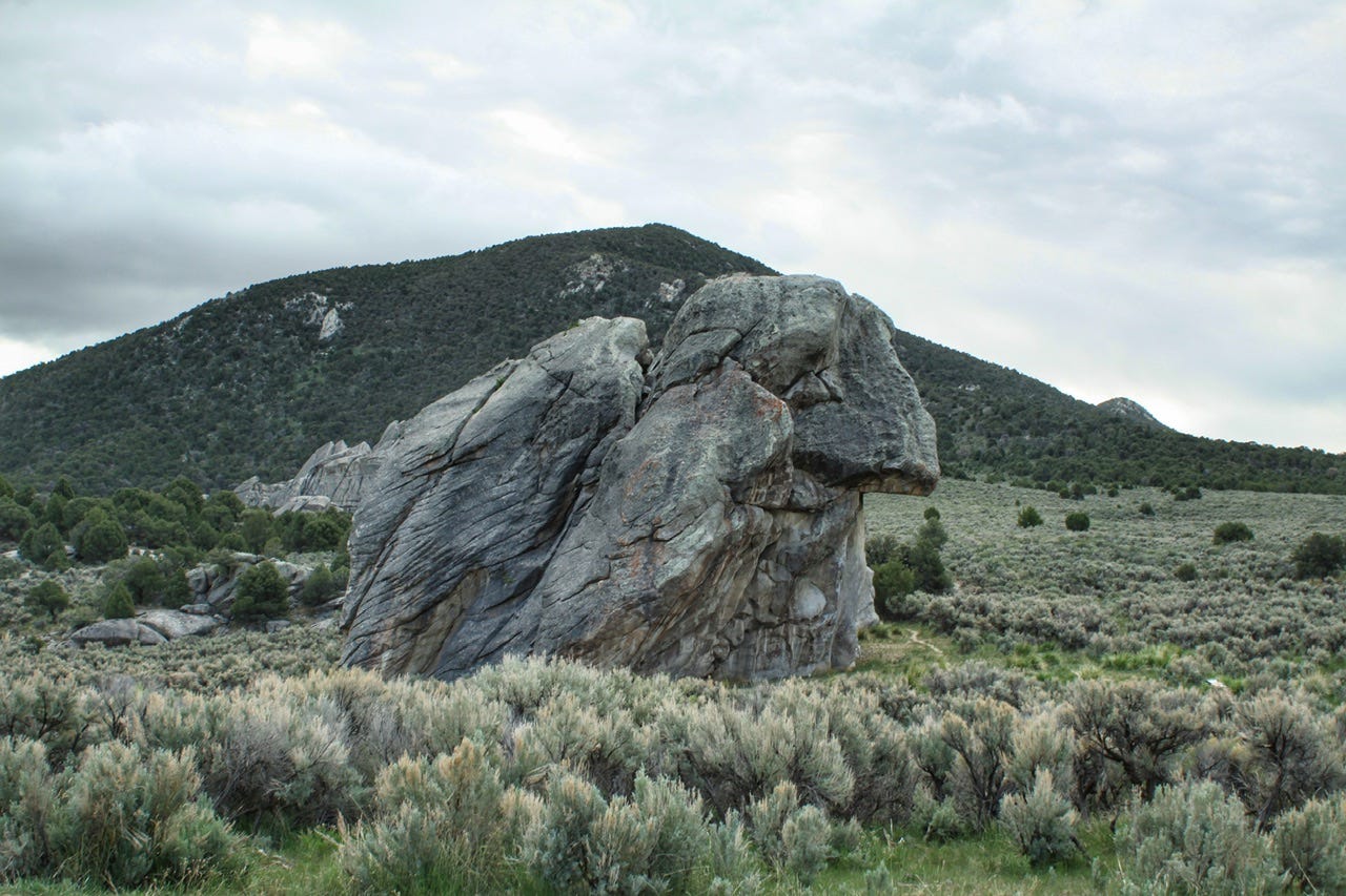
Approximately 240,000 emigrants crossed this land in hopes of a better life and the belief in “Manifest Destiny.” City of Rocks was one of many places they camped on their journeys west. I would imagine that all of these people found the same spots next to the various rock formations to be just as appealing as we did. Perhaps the same high winds prevented them from sticking around the area for long.
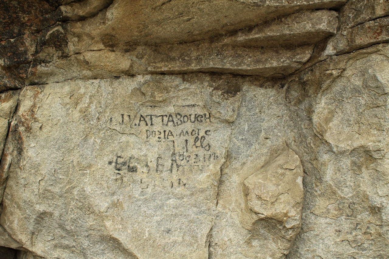
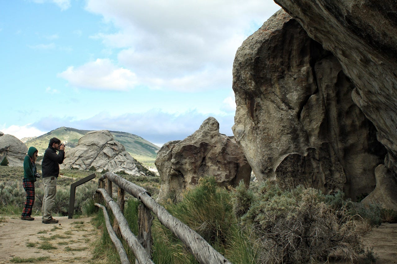
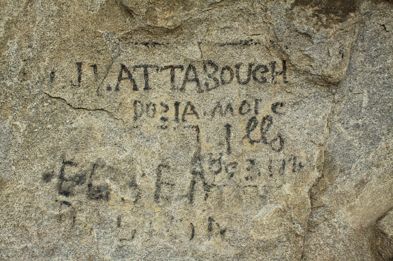
The pioneers marked their names on the rocks with axle grease from their covered wagons. We’ve stopped at several places like this, where the historic graffiti helps tell the stories of the people. I often wonder what folks will find in another 175 to 200…or even 1000 years that will tell the stories of our days. Will storage units of people’s unwanted crap be the clues future historians have to work with? Did these people ever imagine that their signatures on the rock would be viewed as clues to American history so many years later?
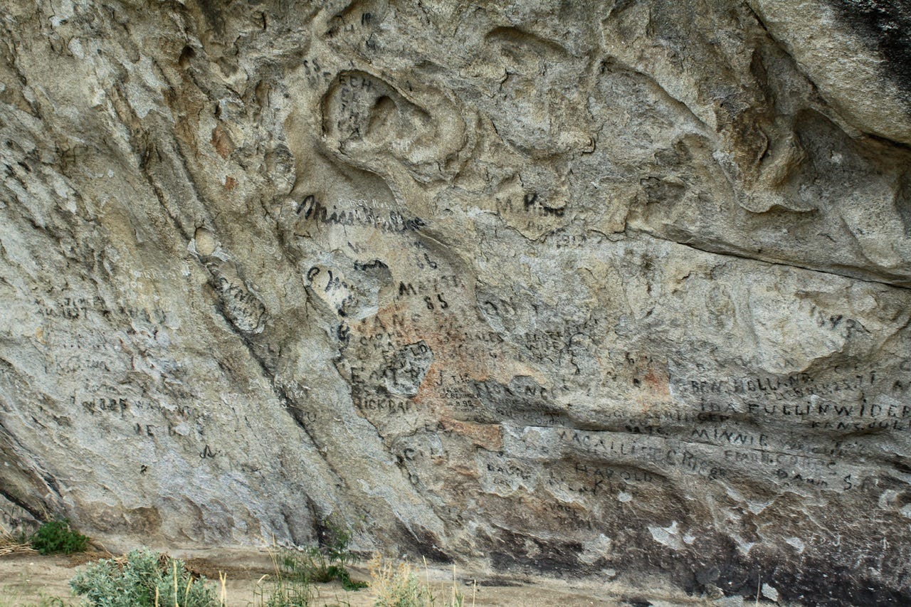
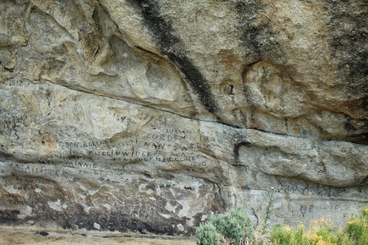
While researching the names of the rocks in my photos, I ran across two publications that I thought were interesting:
Geological Interpretive Trail - This one is all about the nitty gritty of the different types of geology you can find in the park. There is a trail associated with the examples, so it would be fun to download it for a hike on that trail.
Geologic and Historic Sites - This one identifies the most prominent rock formations and tells the stories of how they were named.
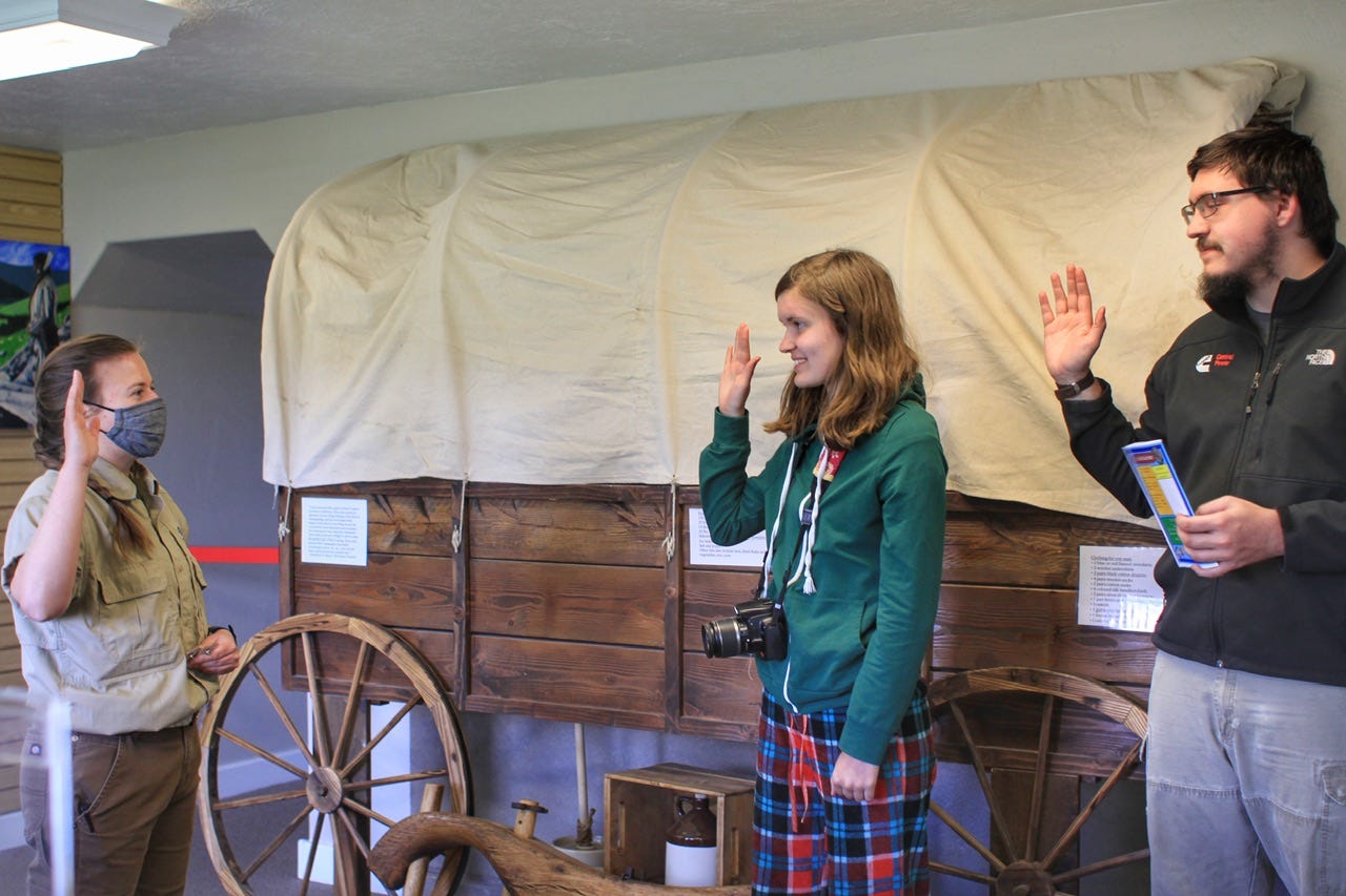
Camp Rock was our last stop in the park, and then we went back to the visitor center. We watched the park film while the kids worked on their junior ranger books. Megan chatted with the ranger about how she had become a park ranger and we learned that the park was run by the Idaho Department of Parks and Recreation, rather than the National Park Service.
We mentioned our windy night and the ranger informed us that the wind had been blowing 25 mph, gusting to 45 mph overnight and into this morning. It’s a wonder we didn’t fly away in our tent!
We also asked her for the best way to get back to the interstate. The shorter route included 20 miles of gravel and the longer route was 15 miles out of the way. There was no way I was taking 20 miles of gravel when there was a paved option, so we took the long way. We had a two hour drive to our next destination.
Northern Utah
A couple years earlier, I had debated if we should’ve tried camping in the east to check off more states, but after planning the entire route, I scrapped it. We liked camping in the desert and there was more of Utah that we had not yet seen. We had never visited northern Utah.
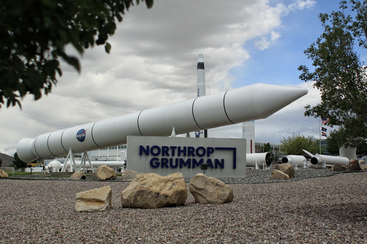
I really wanted to see the Spiral Jetty, which is a land art installation on the Great Salt Lake. We had also visited many of the National Park Service sites in Utah, and we’d be going right past the northernmost Utah park, Golden Spike National Historical Park. While I was studying the map, though, I ran across the words, “Rocket Garden.” A quick look at Google Earth confirmed that there were indeed rockets on display right along our route!
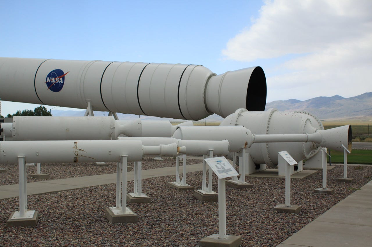
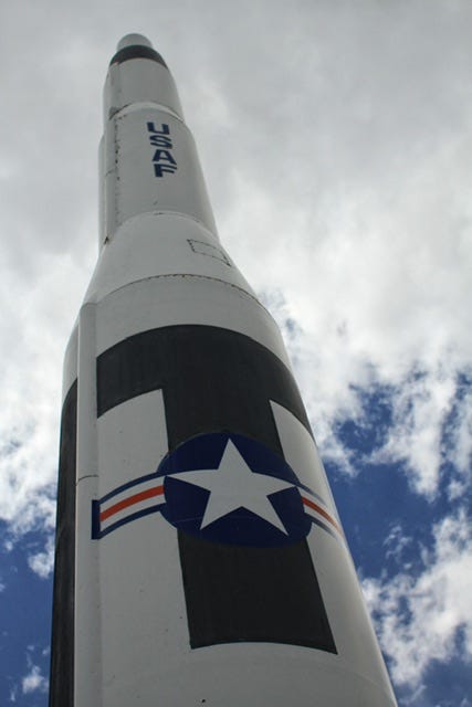
Northrop Grumman - ATK Rocket Garden
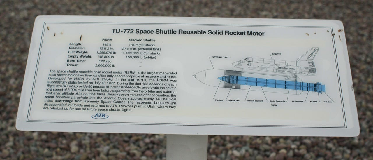
The outdoor museum originally opened in 1986 and it features examples of rockets and missiles from the 1950s to the 2000s. It also houses a used solid rocket booster that was recovered from a space shuttle mission. The plant itself was built in the 1950s during the Cold War, to be used as a rocket proving ground. The test facility is still in use today. If you enjoy snooping around on Google Earth, take a look at this place; it looks like quite the operation!


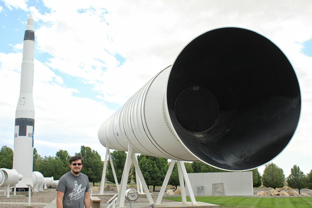
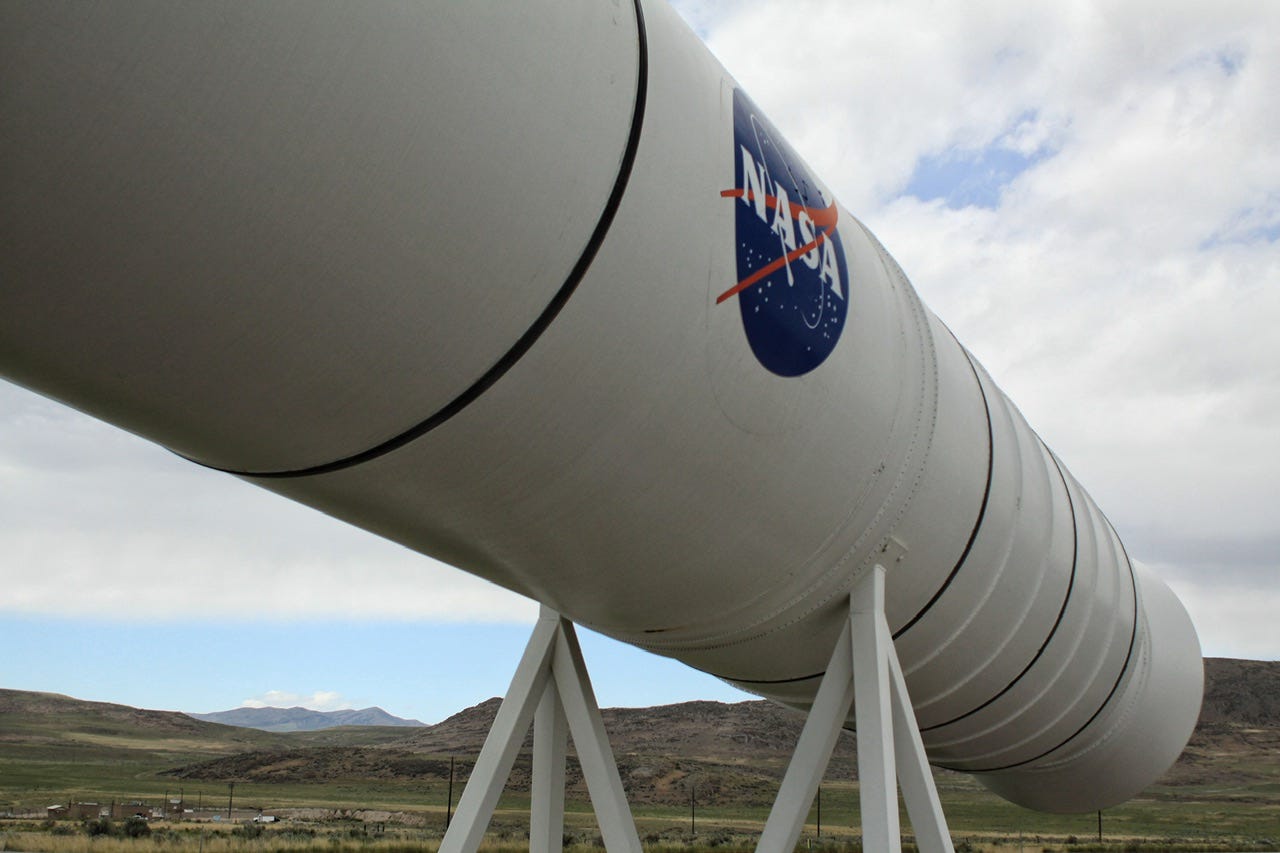


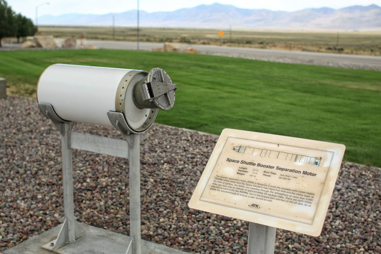
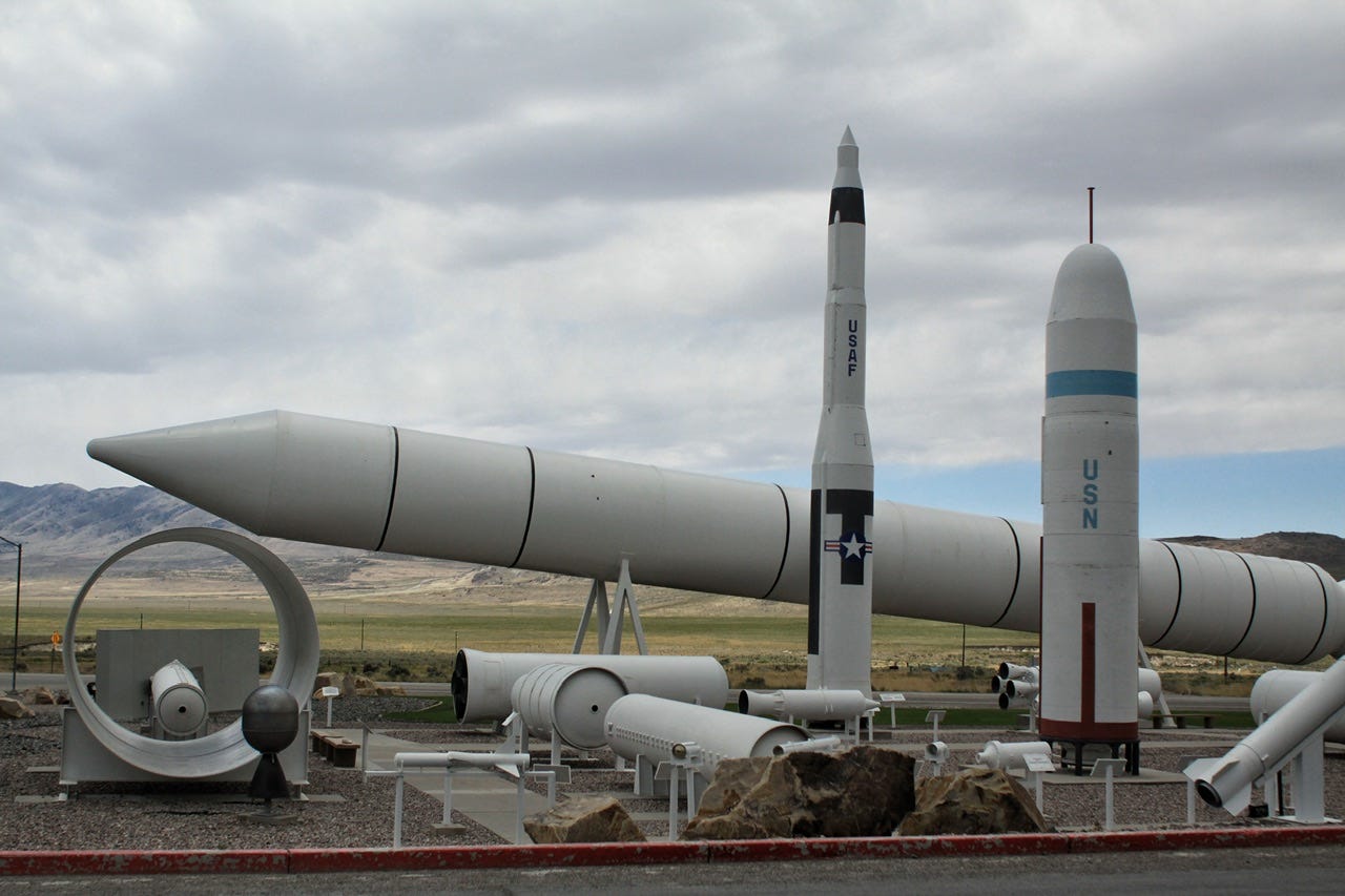
This was an interesting stop! Joey and I have always been interested in the space shuttle, so it was really neat to see one of the solid rocket boosters in person. We’ve visited several minuteman missile locations in western South Dakota, so it was also interesting to visit the location where those were assembled. We maybe only spent twenty minutes here, but it was well worth the stop!


False Alarm
Our next stop was just a few miles down the road, but along the way, the low tire pressure light came on in the Honda CRV we were driving. We were in the middle of nowhere, so I was not excited about the prospect of having a flat tire out there. I stopped on the side of the road to survey the situation. None of the tires were flat that I could tell. I asked Joey to look at them for a second opinion and he agreed, so we kept going. When we had a signal again, Joey looked it up and apparently, this warning light is known to just randomly turn itself on with changes in temperature and elevation. He found the directions to reset it, and we didn’t have any more trouble with it after that. At least it was an easy fix!
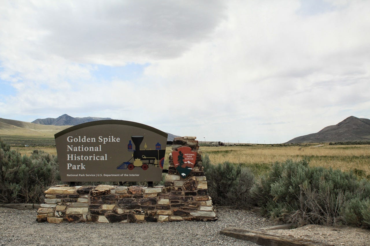
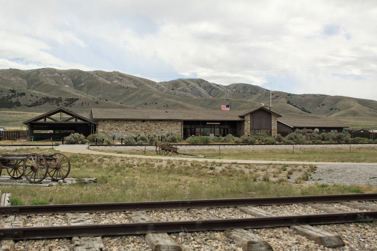
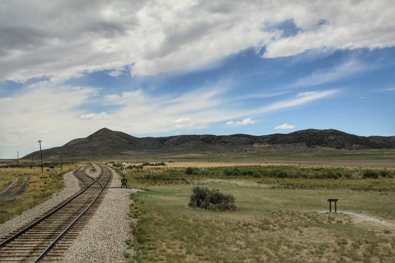
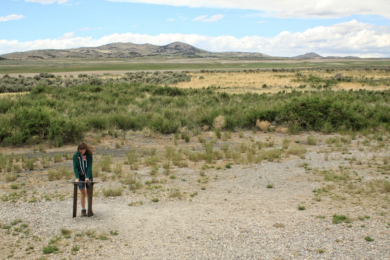
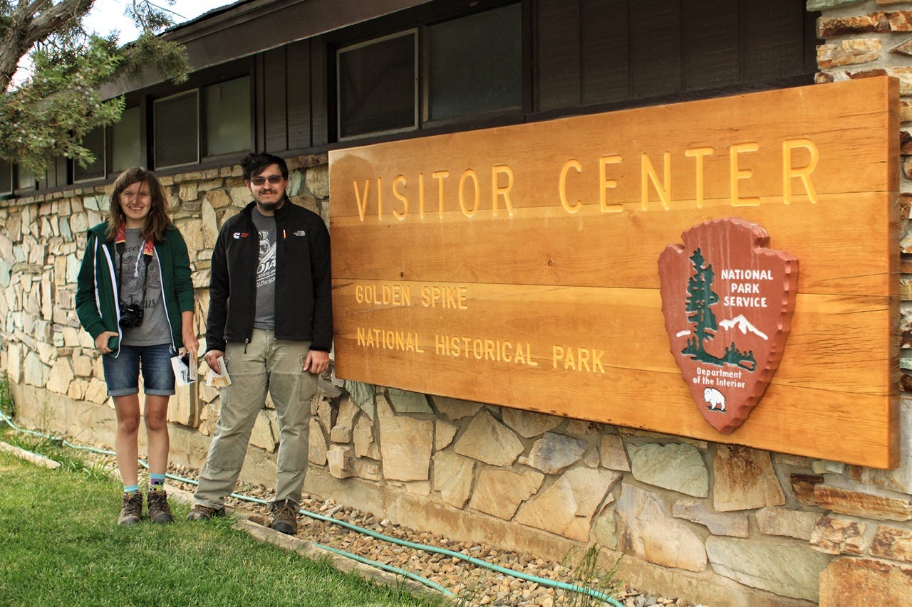
Golden Spike National Historical Park
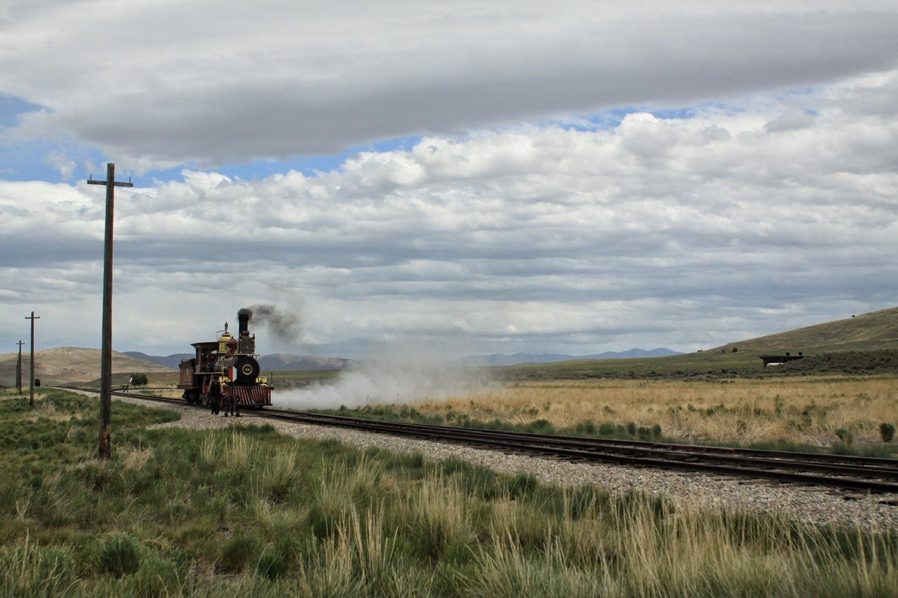
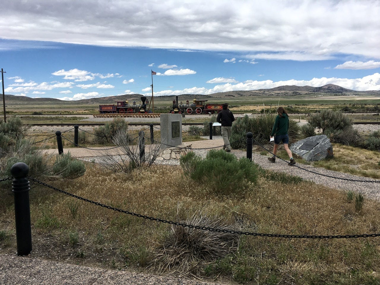
Our next stop was Golden Spike National Historical Park near Promontory, Utah. As we were pulling up to the park sign, we could see a locomotive puffing its way along the tracks ahead! What a great time to show up! We had front row seats to our own personal train demo!
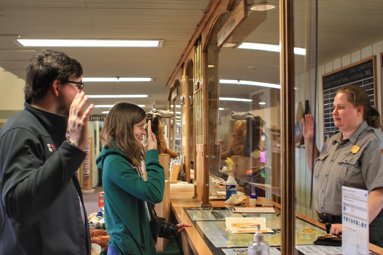
We went inside the visitor center for junior ranger books. I don’t remember watching a park film, but we looked around inside and then went out to look at the trains.
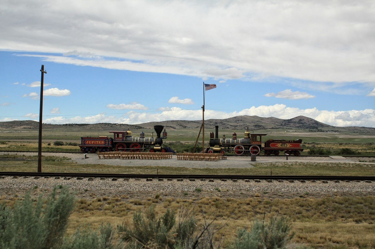
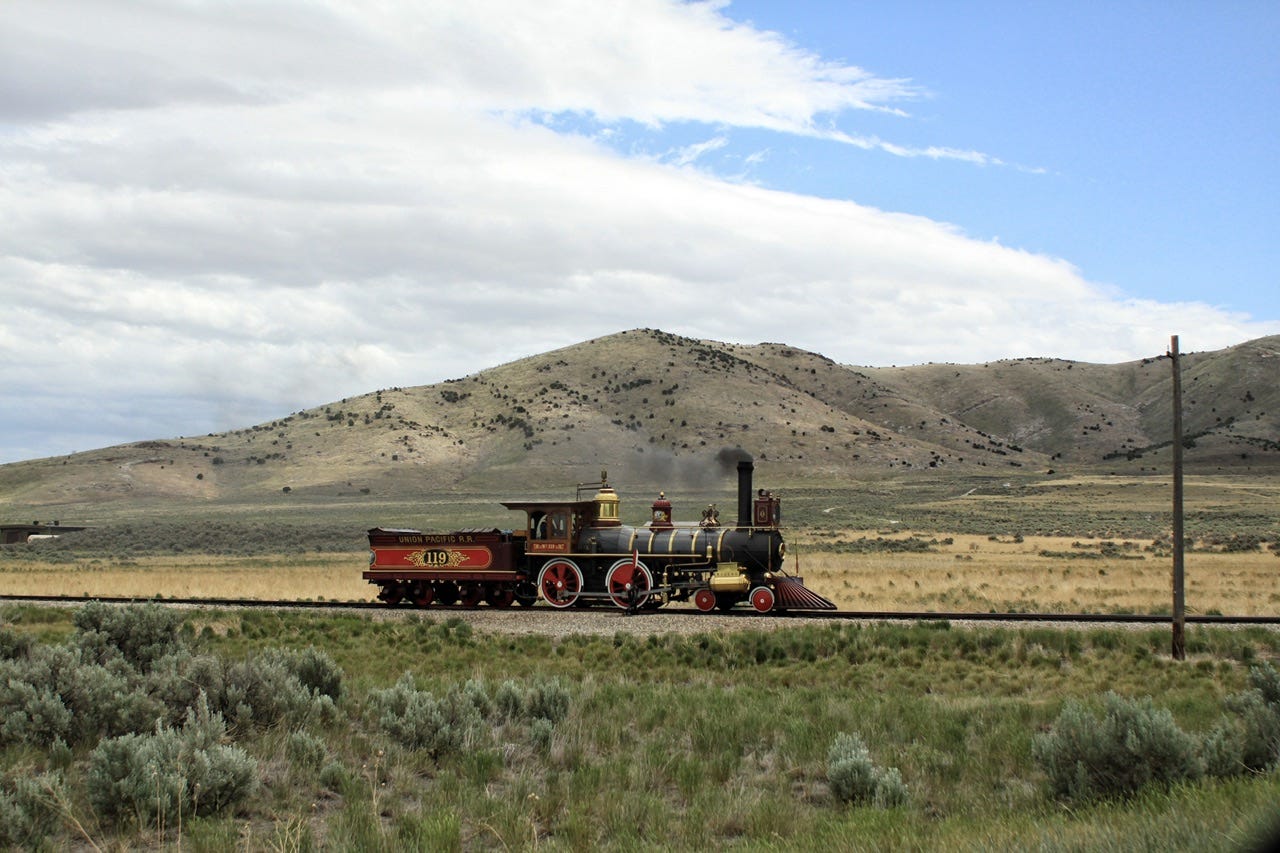
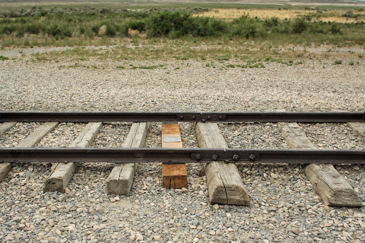
Golden Spike National Historical Park became a National Park Service site in 1965, nearly 100 years after the last spike had been set, completing the Transcontinental Railroad. The original trains that met in this historic location were both sold for scrap for $1000 each in the early 1900s. In 1975, a company in California, took on the job of recreating the locomotives for the park. They did not have the original blueprints, but they used a locomotive design engineer’s handbook from 1870, along with enlarged photos of the two locomotives as they looked in 1869. It took two years to create the drawings and another two years to build the locomotives before they were finally delivered to the park in 1979.
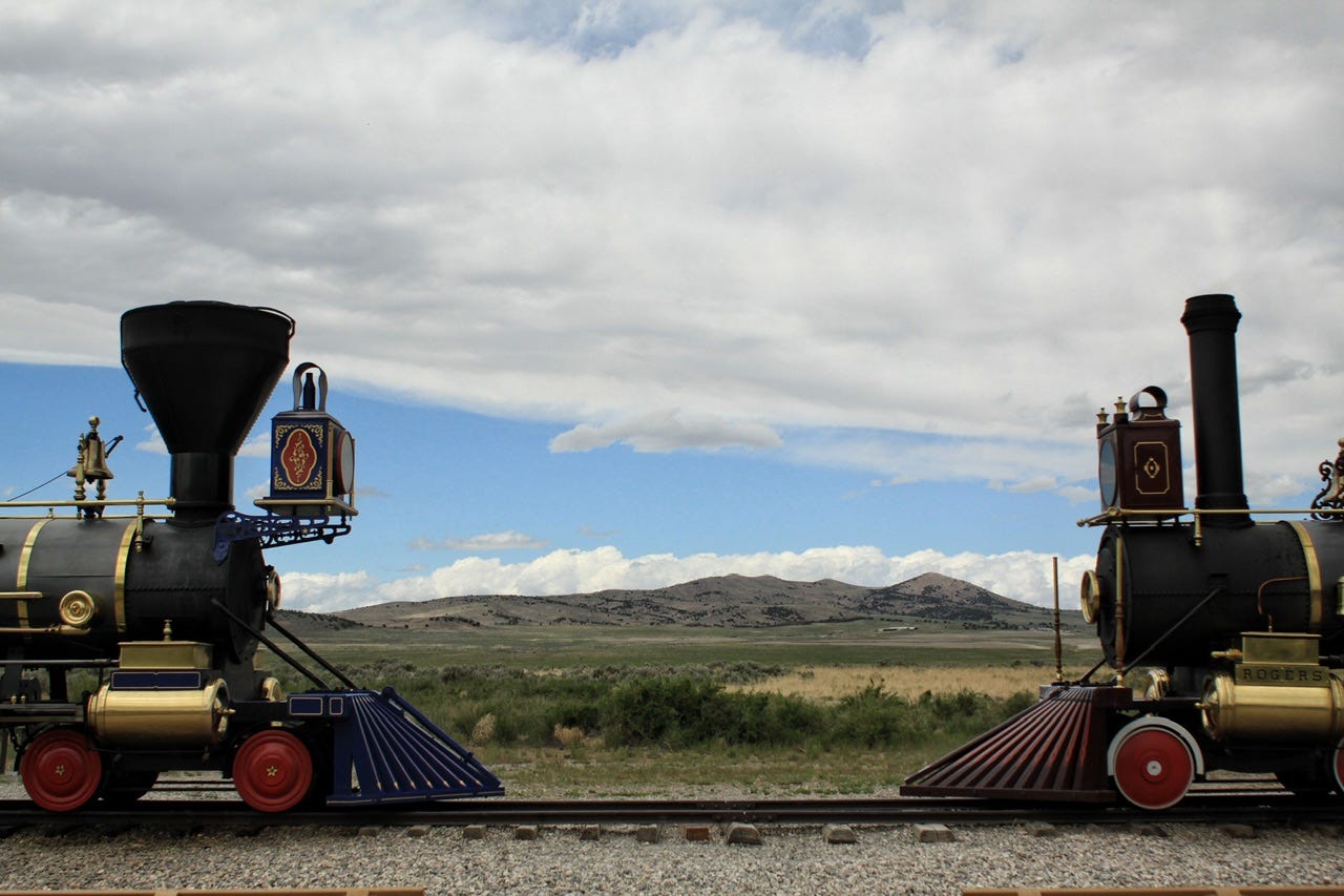


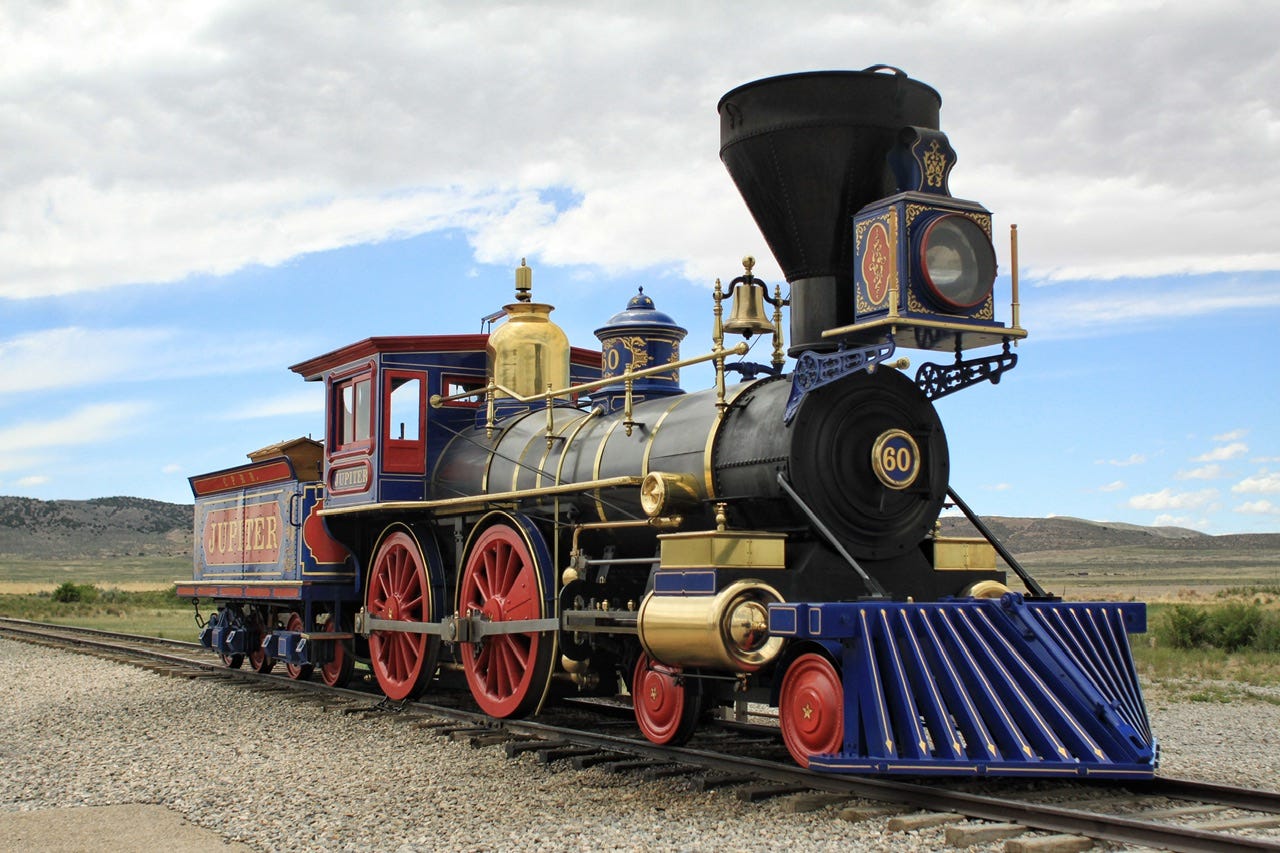
Jupiter
The original Jupiter locomotive was built in New York for the Central Pacific Railroad. In order to move the locomotive to California, where the route began from the west, Jupiter had to be dismantled, loaded on a ship that sailed around the southern tip of South America, and then it was unloaded in San Francisco. From there, it was loaded on a barge and towed upriver to Sacramento, where it was reassembled and put into commission.


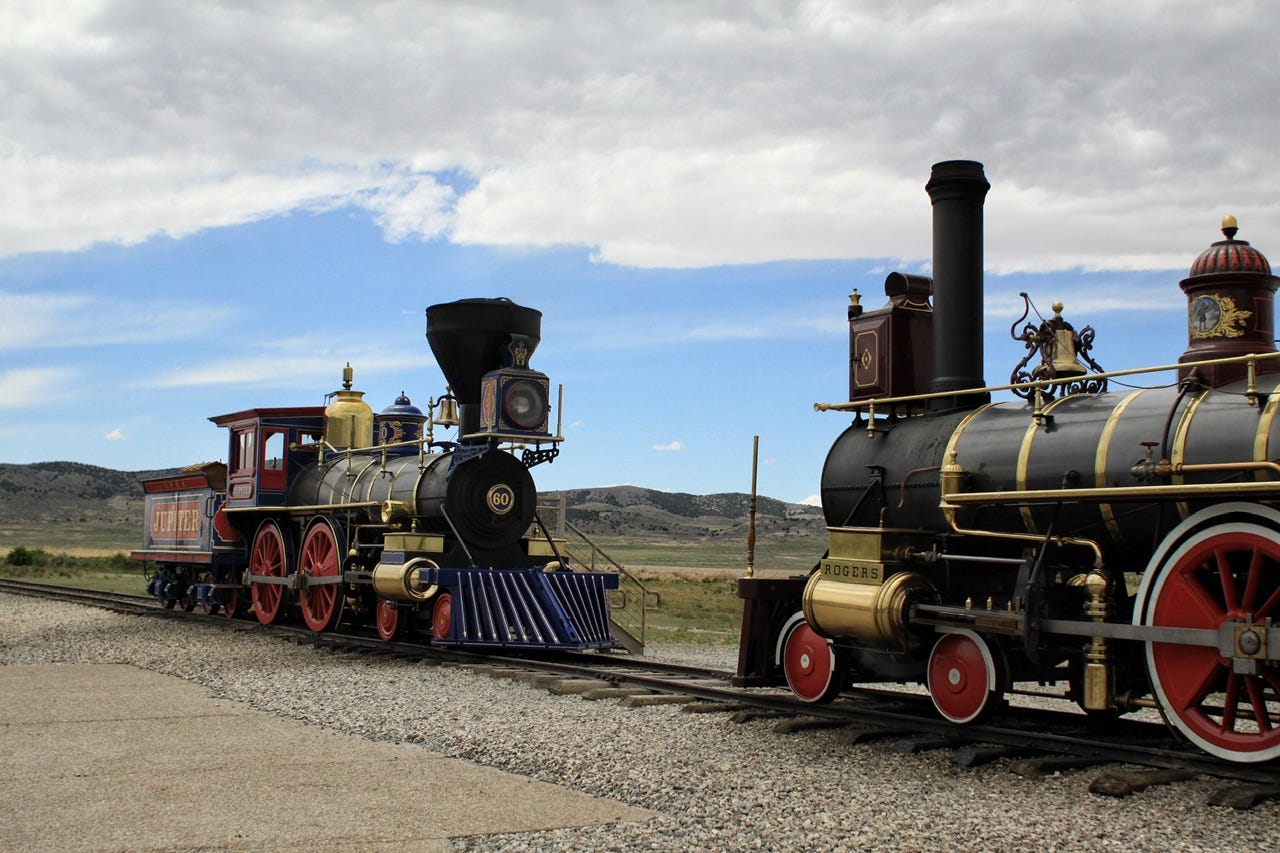
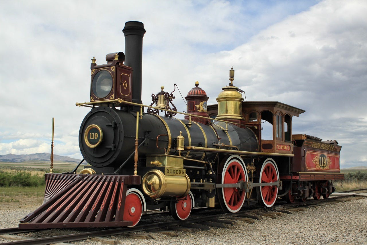
Locomotive No. 119
The original Locomotive No. 119 was built in New Jersey for the Union Pacific Railroad. It set out across the country from the east and was stopped along the way to the golden spike ceremony by workers in Wyoming who had not been paid. They chained it to the tracks until they received their money, which caused a two day delay in the ceremony.
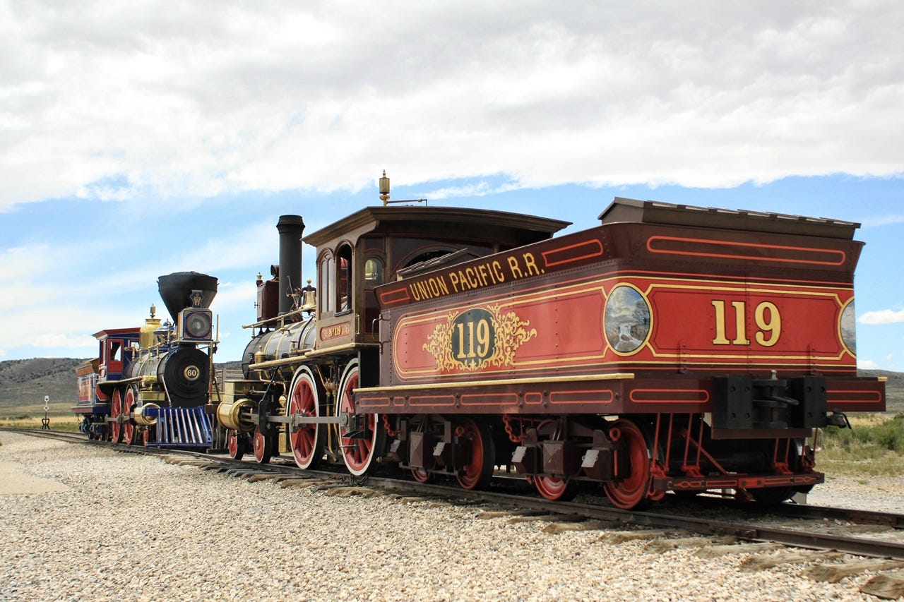


We spent about an hour at Golden Spike NHP and I think it was worth the visit, especially combined with our stop at the rocket garden. Both places were such a stark contrast in historical eras that were about 100 years apart. The nation celebrated the ability of passengers to travel from one side of the country to the other via railroad in 1869 and by 1969, a rocket took astronauts to the moon. We have another 45 years to go until 2069…what significant changes in transportation might happen by then? It’s pretty crazy to think about.
Speaking of transportation…it was time to get back into ours for a four hour drive to our campground for the night…at least that was the plan!
2:45pm
I had originally wanted to visit the Spiral Jetty after this stop, but going there involved traveling down 16 miles of gravel road in the middle of nowhere. There were probably enough people out there that it would’ve been fine, but it was already 2:45pm and there was no way that much gravel was going to be a quick drive. I still want to see it someday, though.
The original route I had planned next would put us into Salt Lake City right around the beginning of rush hour. I’m not crazy about city driving to start with, much less doing it during rush hour, but I decided to give it a try. We could always bail out if the going got tough. Interstate 84 would’ve been our first bail-out point, but traffic wasn’t bad so I kept going. Not long after that, I found myself in bumper to bumper traffic four or five lanes across. I wanted out of there! Joey found me an alternate route that would take us out around the city. We would take Interstate 80 over to Highway 189. It was extra miles, but that seemed way better than five lanes of cars zipping around me.
It Happened So Fast!
I regretted that decision almost immediately after getting on Interstate 80, which also had multiple lanes of traffic. I saw a large white SUV all of a sudden whip around 180° not too far in front of us. I’m not sure what that driver was doing, but she came to a stop facing us. Several people stopped along the side of the road to help her, but everyone else squeezed into the remaining lanes, slowing traffic down. It was rather terrifying to think that if we had been a little closer, this lady would’ve spun around and probably hit us. It happened so fast! She was maybe a half mile ahead of us in the same lane. The adrenaline put me on high alert for the rest of the drive toward Highway 189, but after that incident, the traffic thinned out for a peaceful two-lane drive until our exit.
It Gets Worse!
Our drive on Highway 189 was peaceful until it wasn’t. We came to a standstill in a very long line of cars, most of which were turning around and going back the way they came. We couldn’t turn around. We needed to continue going the way we were going. Eventually, enough cars turned around that we ended up at the beginning of the line.
We saw a helicopter fly in and land. That didn’t seem good.
A motorcycle rolled up next to me even though there was not an extra lane for him. I rolled down the window to ask if he knew of any other way to get to Orem, Utah from there. He told us this was the only route through Provo Canyon. We had been studying the map and knew that already, but I had hoped maybe there was a side road that wasn’t on the map.
He asked how long we had been sitting there. I told him it had been a good hour since we first stopped, and that I was pretty sure it had been at least 30 minutes since we had seen the helicopter land…and that it had not taken off yet. He thought that was going to take a while and told us he could get us around the accident if we wanted to turn around and follow him. He said to stay close, so I did, and the next thing I knew, we were headed down a very dusty gravel road. Some poor soul was out for her afternoon jog in the cloud of dust we were traveling through.
I wondered if this was how we’d be kidnapped, but there was a line of cars behind us and a few miles later, we returned to civilization. When we reached a stop sign, our motorcycle escort pointed in the direction we needed to go next and off he went. We had made it around the helicopter and multiple ambulances and assorted emergency vehicles that were all blocking the road. Again, I was thankful for our luck with timing because this one was definitely worse than the last!
A Quick Pitstop
We had an Amazon package to pick up in Orem, Utah. Joey needed something to charge his camera batteries on the road, so I had ordered a couple options, just to make sure we got one that would work. One of our packages was ready for pickup at Mrs. Cavanaugh’s Chocolates. The gal had a lot of trouble scanning it, but she gave us chocolate samples to eat while she tried to figure it out. Eventually, she gave up and we left with our package. I don’t know what happened to our other package, but I reported it lost a couple days later and got a refund for it.
I had chosen this location for pickup because there was a Bricks and Minifigs store just up the street. However, with all the time we had wasted along the way, there would not have been enough time to dig through the parts bins and fill a bag before the store closed at 7pm.
At this point, our arrival time was pushing past the sunset time of 8:53pm. We took Interstate 15 south and by the time we exited that to take Interstate 70 for a few miles, the sun was gone. Thankfully, we didn’t have far to go in the dark, but it was pitch black in the canyon where our campground was located. Somehow, our four hour drive took us more like six and a half hours.
Castle Rock Campground.
I had reserved Site 17, which looked great in the photo on Reserve America. However, we’d have needed to set up the Eureka! Sunrise in a rocky bowl. There wasn’t anything flat about that campsite, at least not that we could see in the dark. Luckily, there were many open campsites to choose from, so we took a couple spins around the campground loop, evaluating our various options. We chose Site 10 outside of the main loop. This site had trees and bushes on three sides and most importantly, it had a flat space big enough to fit our 11x11 tent.
We set up our tent by the light of the headlights…probably chuckling to ourselves about how much easier it is to set up in the dark like we always do. Ha! We walked down to collect our reservation ticket from the Site 17 sign post and clipped it on the post for Site 10.
10:00pm
I know that I did not cook anything that night, nor did I stop for fast food. We snacked along the way, so my best guess is that we ate chips and salsa for supper.
We took our usual walk around the campground before we settled into our tent for the night. What a long, long day this one had been! We started off battling the wind, looked at a rock with axle grease signatures, checked out rockets and trains, saw a spinning SUV and a helicopter landing in the middle of the road, and received a motorcycle escort around it. It seems like we covered a lot of transportation history in one day.
We definitely covered a lot of miles! Our route from City of Rocks in southern Idaho to Fremont Indian State Park in the middle(ish) of Utah was 416 miles. We had covered 1560 miles over the last four days, but now we were set up to spend the next six days exploring southern Utah at a more leisurely pace! Subscribe to find out where we are off to next!