Day Nine
Tuesday, June 26, 2018
Goblin Valley State Park
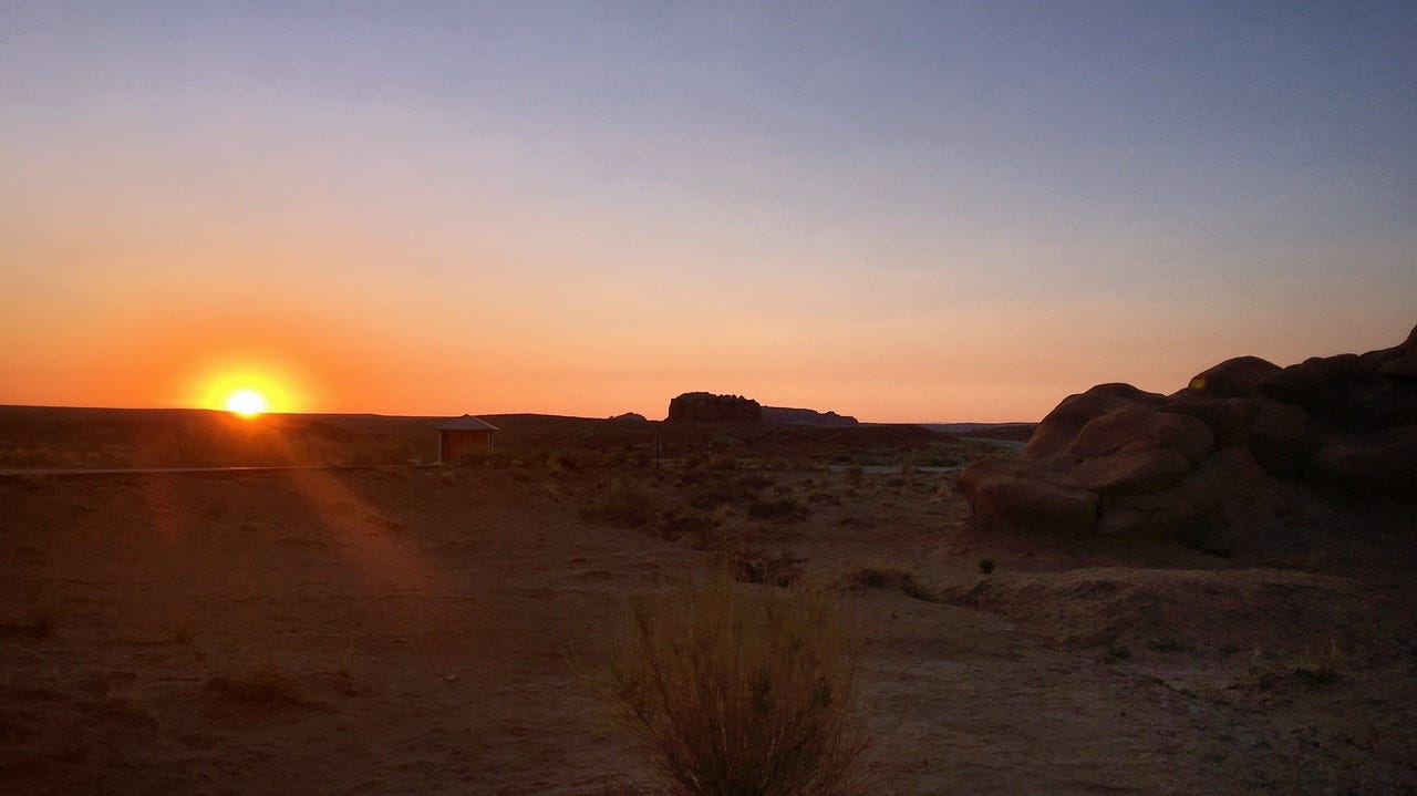
After three nights of wind billowing our tent, it was nice to have a peaceful night under the stars. As far as campgrounds go, Goblin Valley State Park has to be one of my favorites for sleeping conditions: perfect temps, dry, a slight breeze, a bazillion stars, and a stellar backdrop behind the tent. I woke up just before sunrise, which was beautiful coming up over the horizon.
I must have been so mesmerized by the sunrise that I never thought to take tent pictures of this campsite. Below is a screenshot of what I found on Google Earth. We camped in site 3, which is the first shade shelter in the picture. Our site was a walk-in tent site with parking spaces near site 5. Our campsite choice was a good one, with nothing but rocks on one side of us.
Little Wild Horse Canyon
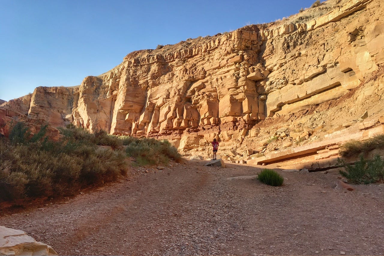
We discovered Little Wild Horse Canyon last year after spotting a photo on a postcard in the Goblin Valley Visitor Center. It looked fascinating, so I had asked the ranger about it and learned that it was just down the road a bit. We went there and even started hiking down the sandy wash to go see it, but there were a LOT of people and it was quite hot already in the day, plus we really needed to get to Timpanogos Cave later that day…or so we thought. We did not get to see Little Wild Horse Canyon that day, but vowed to return when we could plan our day around an early morning hike.
Let’s Try This Again
Back to this year, we were the first ones at the trailhead parking lot. A young gal in a camper van pulled in while I was packing some snacks to take along. We chatted with her for a bit while we all studied the trail map on display. We set off on our hike and she went back to her van.
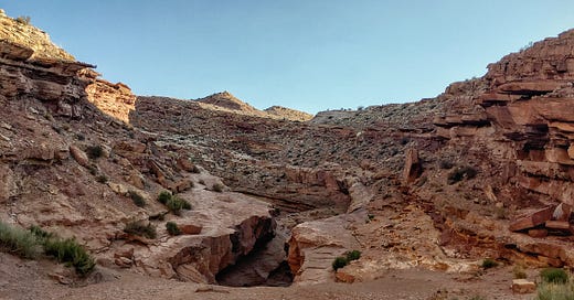
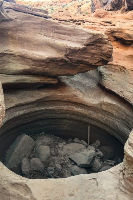
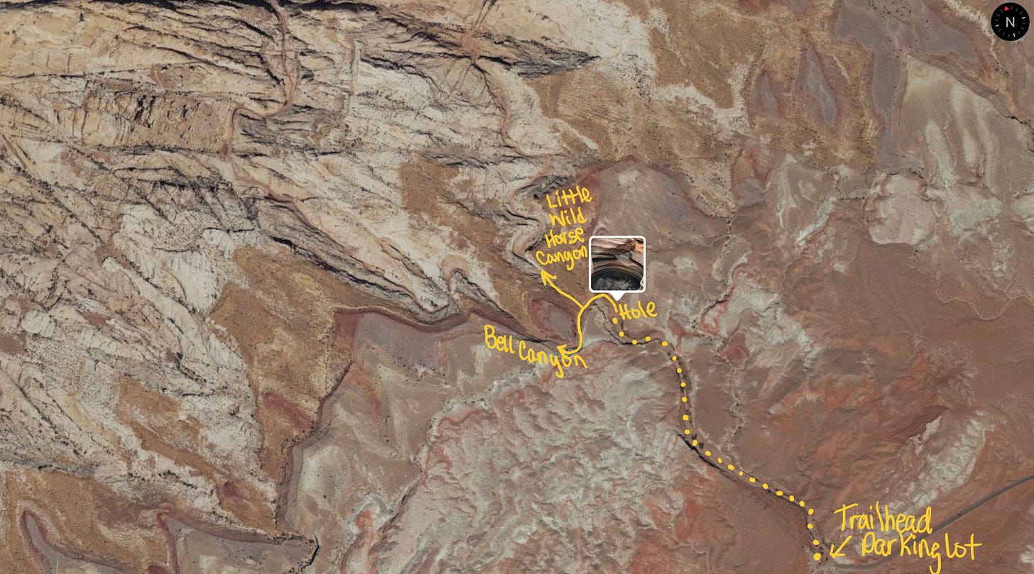
The walk through the wash didn’t take long and we arrived at a spot we thought was going to be the start of the slot canyon. Instead, it was a giant, perfectly round hole in the ground. Now what?
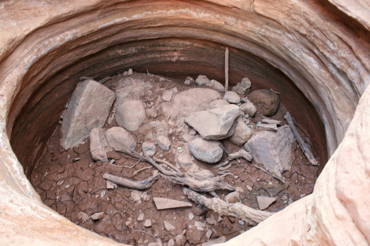
There were footprints down inside the hole, but no easy way out, especially for those of us with short legs! We saw an arrow made out of rocks next to a cairn, but I also knew that we were looking for the trail to split, with one way going to Bell Canyon and the other leading to Little Wild Horse Canyon. What I did not know, was if this was that split in the trail. I also knew that we did not want to accidentally go through Bell Canyon because that would be the long way around to visit Little Wild Horse Canyon. It also did not look like a path that would get us down into a slot canyon.
We had no cell signal, so there was no way to look up the route. No other people had shown up yet, so we turned around and walked back out. By that time, the camper van gal had changed into hiking clothes and appeared to be ready for a hike. We debated following her to see if she knew where to go, but we elected to move on with our day.
I love snooping around on Google Earth, but never found the location of the hole, even with some street view images. As I was working on this post, I remembered that I had taken the vertical photo of the hole with my phone, so that had the location built into the metadata. Apple Photos can show the satellite image with the photo as a pin, so I was able to figure things out from there. We were indeed supposed to follow the arrow up around the hole and then the split in the trail would’ve been shortly after that. We were so close!
At the time, I didn’t think I wanted to go back for a third try, but I think enough time has passed that I might want to try again. The third time has got to be the charm, right?
What Is It About This Area?
I am usually pretty good with knowing what direction we came from versus the direction we need to go, but this particular area of Utah has given me trouble twice now. Last year, I went the wrong way from the Goblin Valley road and ended up at the Hanksville airport before I realized I had not seen that on my way in. This year, while I thought I was being careful to go the right way, I managed to turn on a road that I could’ve swore would lead to I70. Instead, the road narrowed and soon after, a sign indicated that the pavement would end.
I was sure it was the right direction, so I kept going, but it was pretty bumpy and I knew that could not be right. Obviously, that’s why they put the sign there about the pavement ending. I checked our paper map and it was easy to see where I went wrong. We came in from a different direction this time and I knew I needed to take a left to get to the interstate, but I took it one road too soon. That turned out to be a lucky mistake because we were able to stop at an amazing pictograph location before heading back to the road we needed to take. Had I not taken the wrong turn, we would’ve missed it!
Temple Mountain Pictographs
These pictographs are known as the Temple Mountain Pictographs, which represent two styles: Fremont and Barrier Canyon. They are estimated to be several thousand years old. The interpretive sign in the parking area said that these pictographs are six feet tall, but that they might have been around eight feet tall when they were made. The panel has been crumbling over time, due to crystals forming between the layers of rock. At one time, this gallery might have been over 100 feet in length. Knowing that this is what is left of a larger panel, really made me thankful we were able to see these pictographs. This was a cool site to visit!
Goodbye, Utah…
I had decided we would take I70 to Colorado National Monument and then decide from there where to camp and how to get home. I70 may be a fast route, but the section of it between highway 24 and the state line is definitely not the most exciting part of Utah. We arrived in Grand Junction around noon.
Civilization at last!
We had not visited a major city since Flagstaff, AZ and that had been four national parks, a national monument and two state parks ago! I had been without charged camera batteries since Capitol Reef, so I wanted to stop at Target to buy an inverter to charge them in the truck. We also needed some new snacks, which we found, but no inverter.
There was a Cabella’s near the Target, so we checked there for a replacement section for the broken tent pole, but none of theirs were thick enough. Cabella’s are always fun stores to wander around in, though. We checked for an inverter at the nearby Best Buy, with no luck, and then we went to Walmart, where we found one for $10. Yay!
On our way to Walmart, we had spotted a sign for REI, which is an outdoor store we don’t have at home. They did not have the replacement pole sections either, but a helpful salesman gave me a website to check for replacements. I found some heavy duty steel tent stakes meant for use in hard ground, so I bought four. Time for more adventures!
Colorado National Monument
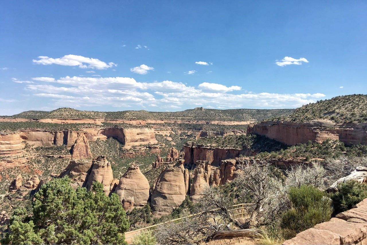
We entered from the Fruita entrance, and were amused that we had visited Fruita two days in a row…in different states. The campground was just before the visitor center, so we drove around noting the good looking campsites to check in case we decided to camp there. The campground looked awesome, so it was tempting to set up camp there, but mid-afternoon seemed too early to quit for the day. I wanted to keep going so we’d be further down the road for the next day. Our dilemma was solved when we discovered the hantavirus warning about the spread of the disease though mouse droppings on the ground. We’ll pass, thanks.
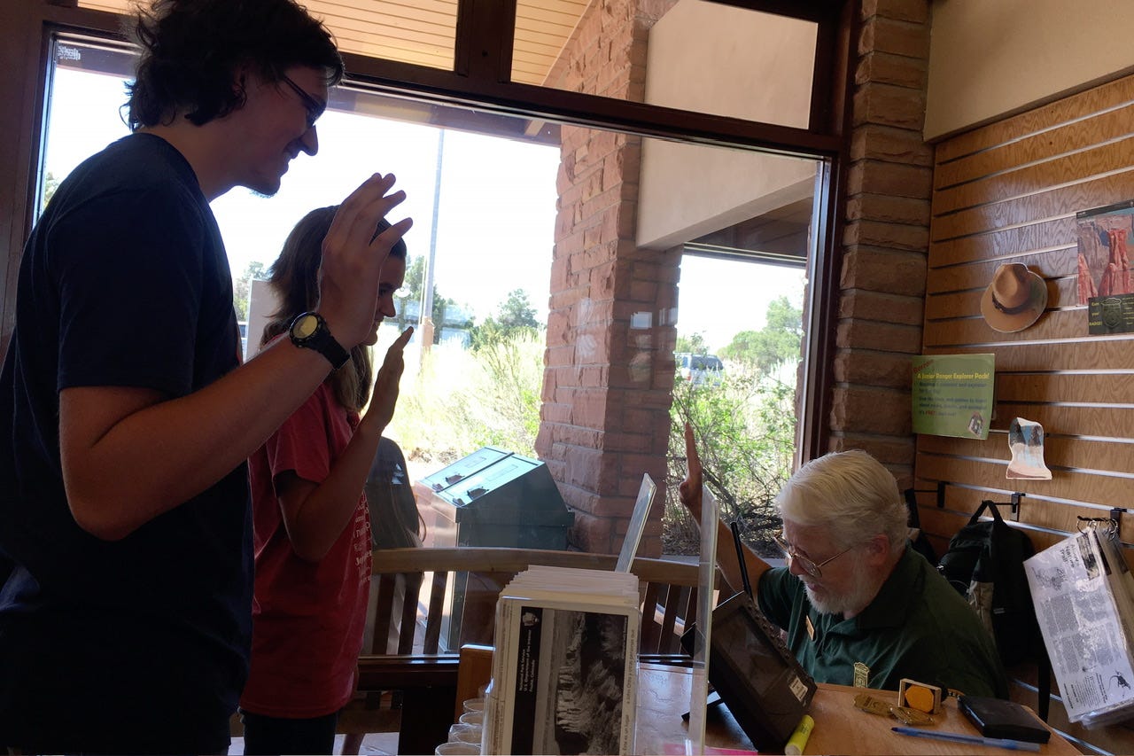
We stopped at the visitor center and upon entering, friendly rangers greeted us. This was more like it after our Capitol Reef experience! The volunteer ranger was really excited that the kids wanted to do Junior Rangers. He took out the books and told them what they needed to do and crossed off a few questions, stating that it was too hot outside to hike to find those answers. Gotta love a sensible ranger!
He invited us to watch the park film as credit for the ranger talk and we happily accepted. (Again, why was this not allowed at Capitol Reef on our visit?) I asked when the next showing started, but he said that since they have so few visitors, they only turn it on when someone wants to watch it. He must have thought I was planning to take a nap because he teased that there would be a pop quiz afterward. He wouldn’t have been wrong about that nap idea, but I stayed awake and we passed the pop quiz.
The kids finished up the Junior Ranger books shortly after the park film was over and the volunteer ranger who had started the video was the one to check through the books. When I said previously that the rangers are what make the parks special, this guy took the cake! The other ranger on duty warned us that his coworker had been a former teacher, and that “retirement hadn’t taken the teacher out of him yet.”
He was quite the hoot, going through each page and talking about various topics, making fun of some of the oddball drawings that could’ve been interpreted differently. He told us stories about a girl from Sweden and what she had thought some of them meant. I’m sure it appeared like we were having quite the party over in his corner of the visitor center. He was fun and I would imagine it was a sad day at his school when he retired. He found the perfect place to volunteer, though, and we enjoyed our chat with him!
Before we left, I inquired about visiting Black Canyon of the Gunnison since it was not far from Colorado National Monument. The ranger attempted to call to find out the availability of campsites, but could not get a signal. He gave us their park brochure and a phone number to try again later. We continued along the scenic road, but by the time we finally reached a signal, the Black Canyon visitor center had closed for the day. That was probably just as well since Black Canyon of the Gunnison was not exactly in the direction of home.
We stopped at Subway for supper and checked campground availability. We could make it to Rifle Gap State Park before dark and it would put us another hour closer to home, so we hopped back on I70 and headed for Rifle, CO.
Rifle Gap State Park
It was not long before we arrived at Rifle Gap State Park. Rifle Falls State Park was also nearby, and had availability, so we decided to check that one out before deciding which one to pick. We turned around after several minutes because the road was so heavily wooded and curvy that I thought it would take forever to get there. It also looked a lot more like bear country than I wanted it to be. (It turns out my hunch was right because I read later that Rifle Falls was prone to bears in the campground! I was also curious how far away it was and apparently, it was only three miles away.)
We went back to Rifle Gap to study the campground map at the entrance. We were on our way into the campground when we ran across a park ranger waiting at a junction. Since there had been no fee envelopes, I waved her down to ask if she had one. I explained that I had not paid the park fee yet because there were no envelopes. She told me to go pick out a site and get set up and she’d go put some envelopes in the box.
We met her again later and told her we had chosen site 84, which she said was an awesome site…and it was! She also said there were fee envelopes now, so we went back to pay. She had only filled the campsite envelopes and not the state park entrance ones, so I had to improvise. I also discovered that I needed change for a twenty dollar bill, but the park ranger had disappeared for the night. We dug around in the console to find enough change for the park fee, plus the campsite fee so we wouldn’t need the twenty. Once we found enough money, I had to squish it all into the wee little fee envelope. Then…I had to figure out how to stuff that fat envelope into the thin little slot in the iron ranger. I had to start over with a new envelope so I could stack the coins neatly and evenly in the envelope to finally make it fit.
Seriously, if it’s not one thing, it’s another!
By this point, it was dark, but I had seen a shower house on the map, so we set off to find that. Unfortunately, it turned out to be a coin-op shower…and…we had just used up all of the coins I had! So much for that plan! We had taken showers for the last three nights of camping, so it really wasn’t a big deal. We went back to our campsite and settled in for the night.
I studied the map again to decide on the route home. We could go north from Rifle and then across northern Colorado or across southern Wyoming. Or…we could go across I70 through Denver. I really did not want to drive on I70, but I kinda wanted to take the kids through the Eisenhower Tunnel, just to say we did it. The tunnels and the interstate itself are engineering marvels, after all, and the scenery is actually pretty good for an interstate. Not that I’d get to enjoy it much while white-knuckling my way through the mountains at 70 mph. With our next day’s plan figured out, we turned off the lantern and went to sleep.
Be sure to subscribe to find out where we go next on our way home.
Please share if you know anyone who likes to read road trip reports. This road trip only has two days of stories remaining, but then it will be on to the next adventure, which was our longest road trip yet!

