


The Great American Eclipse Adventure
South Dakota and Nebraska

Posters and coffee mugs announced The Great American Eclipse when we visited Grand Teton earlier in the summer. It sounded like the dates had been booked up forever in advance by people who knew more about eclipse viewing than I did, so I never considered going anywhere to view the eclipse.
Fast forward to mid-August.
The local news media could hardly contain themselves during their non-stop coverage of the big event happening the next week. Apparently, this was a bigger deal than I thought! Our area would be above the 90% band which seemed close enough to 100%. Wrong! I had no idea what made this eclipse so special that it warranted special glasses and so much news coverage, but I was intrigued. I leaped down a rabbit hole of research and soon learned that we needed to experience the eclipse at 100% totality for the full experience, not just 90%…but where to go with only a few days’ notice?

I considered various possibilities. The Tetons were too far and probably booked up. I thought about going to Homestead National Monument of America (now Homestead National Historical Park) in Nebraska, but I feared the crowds visiting from Omaha and Lincoln would be huge. I studied the map of the path of the eclipse and after calculating the mileage, I decided on Agate Fossil Beds National Monument in western Nebraska. I hoped that park’s relative obscurity and distance from civilization would mean everyone else in the area would be viewing the eclipse from the Tetons or even the nearby Carhenge.
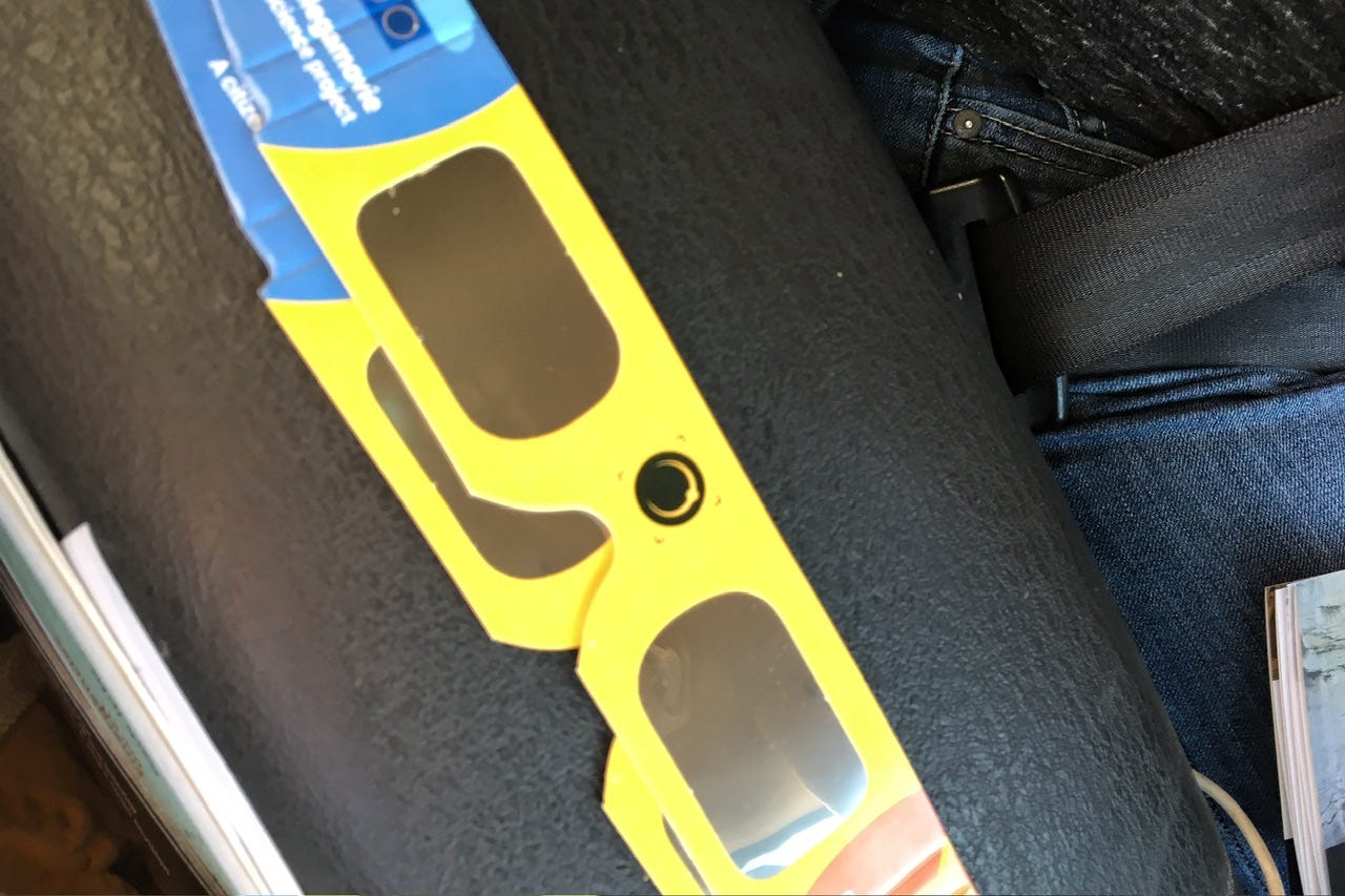
We didn’t have time to get real viewing glasses, so Joey came up with a couple of homemade eclipse viewers to try. We had no campsite reservations, but I hoped to get a site at the campground in Wind Cave. I had called to inquire about it and the ranger assured me that it rarely fills up. With our destination decided, we packed up all of our camping gear on Saturday and were ready to go on Sunday morning.
Day One
Sunday, August 20, 2017
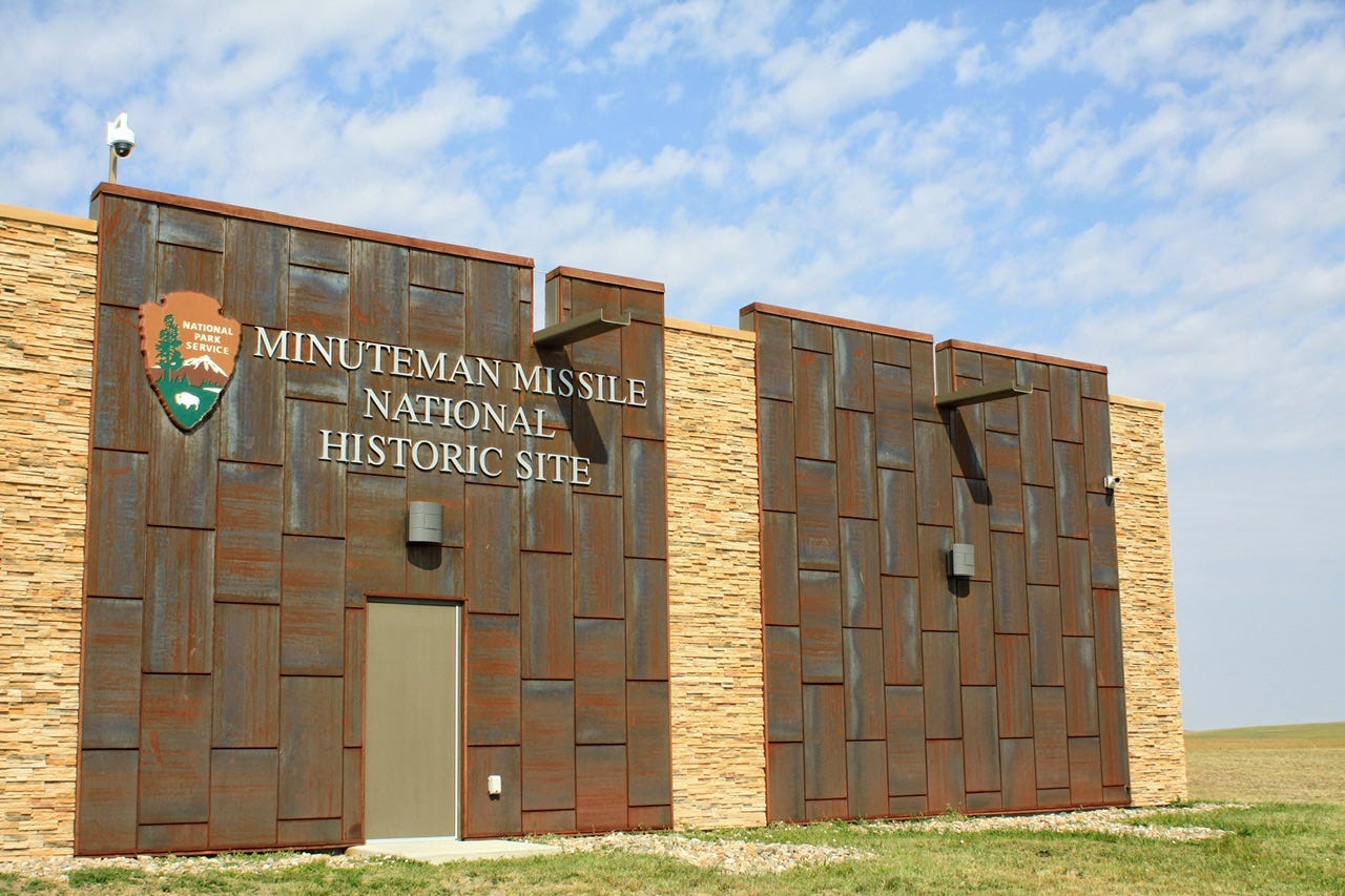
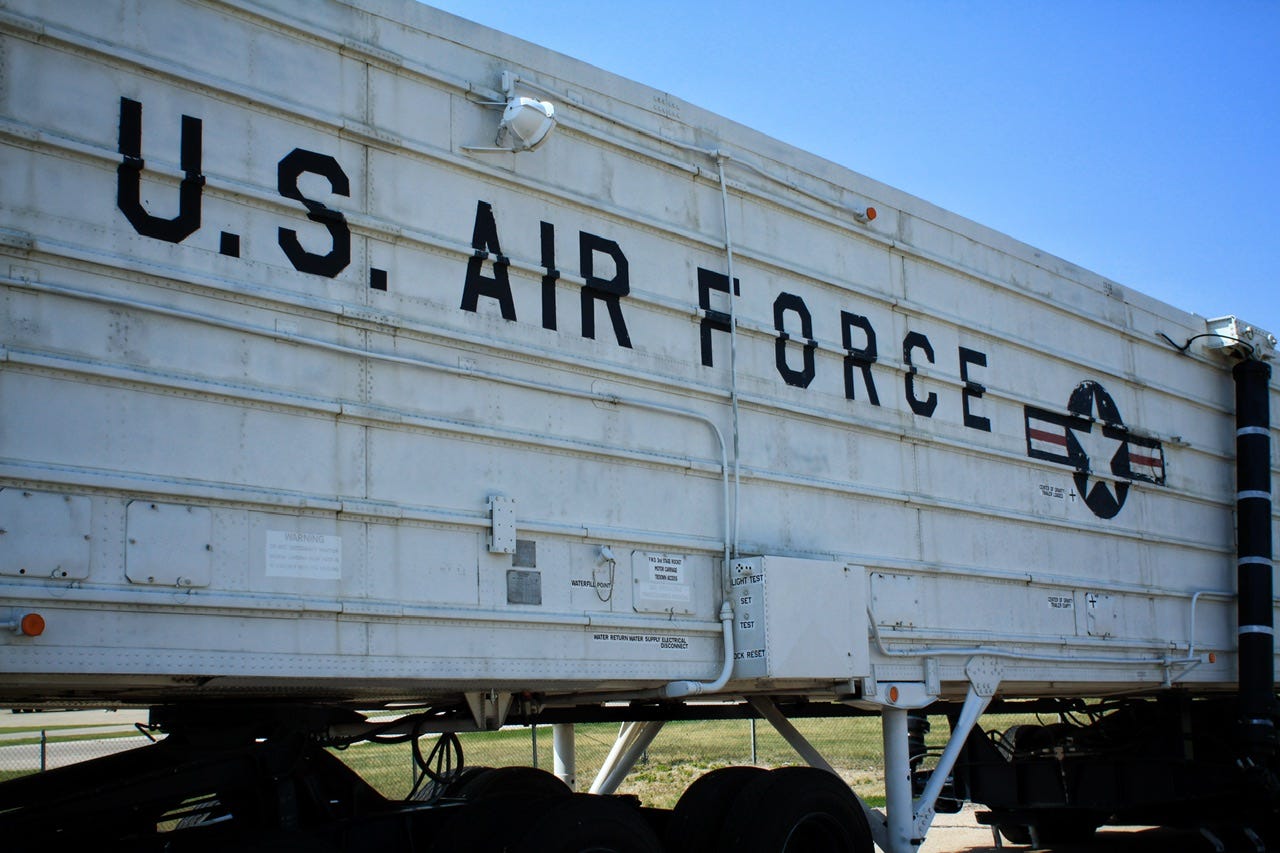
We had plenty of time to make a few stops along the way, so our first stop was the new visitor center for the Minuteman Missile National Historic Site. Joey and I had toured the underground bunker in 2011, but back then the visitor center was just a tiny little building with not much for displays. The new visitor center really highlights how big of a part South Dakota played in the Cold War. Bunker tours are limited so it was interesting to see scenes set up to resemble parts of the bunker. The kids were able to work on and finish the junior ranger booklets pretty quickly.


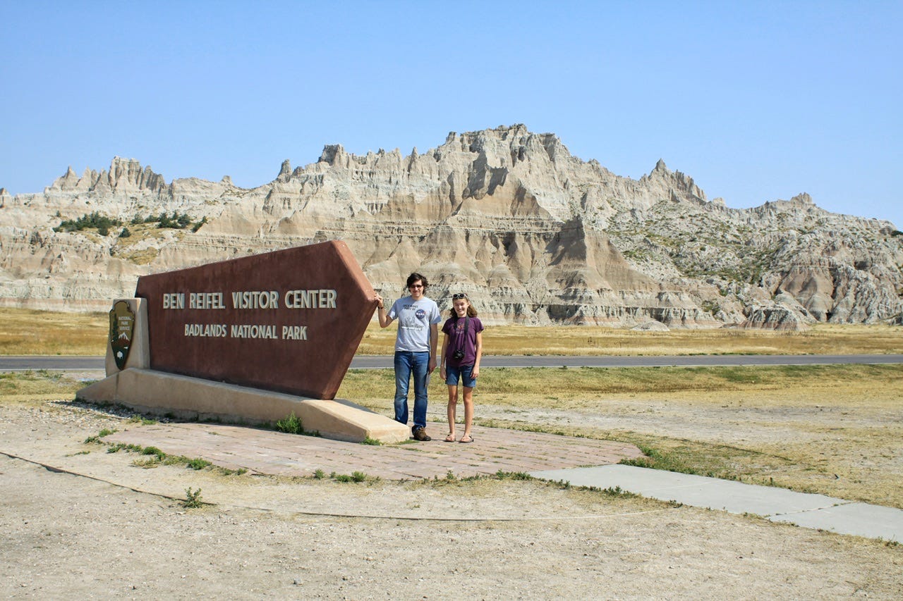
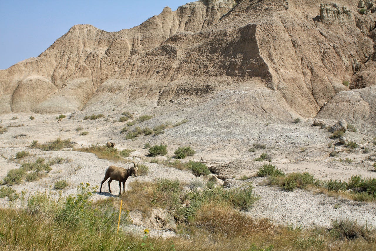
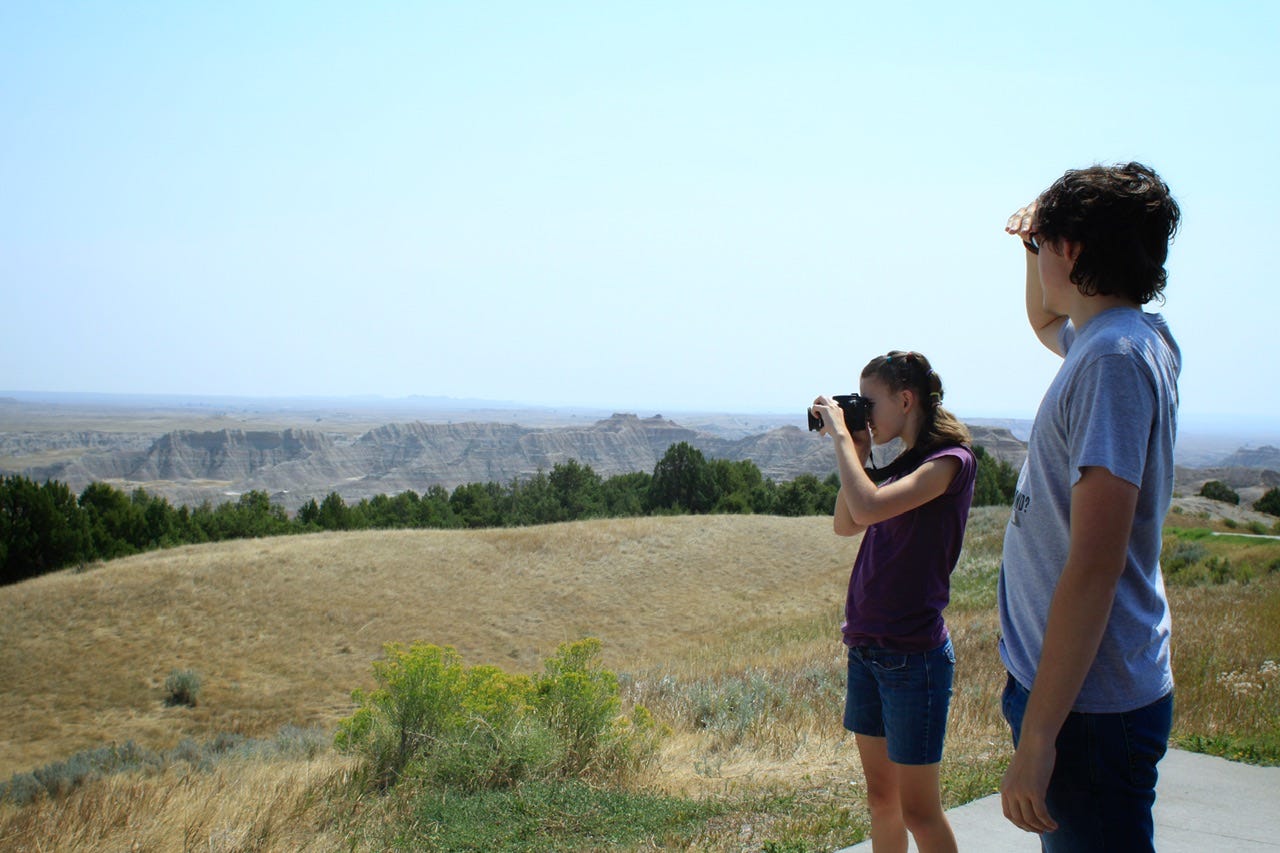
Badlands National Park
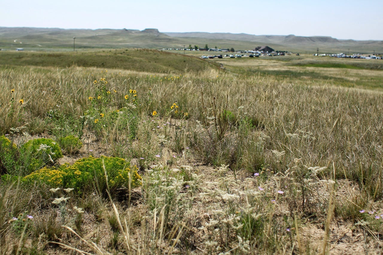
Even though we had just driven through the Badlands in June, we had the America the Beautiful pass already, and wanted to explore a trail this time. After a quick consultation with the park rangers to determine which trail would be best for the hot morning sun, we decided on the Cliff Shelf Trail, just to the east of the visitor center. The Cliff Shelf Trail is considered a nature trail and features a boardwalk to a viewpoint and then you can take a little dirt trail from there. It’s probably the only trail in the park that offers some trees for shade, so it’s a great choice for a quick mid-day walk.
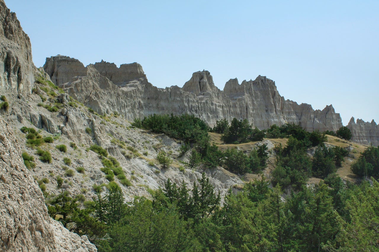
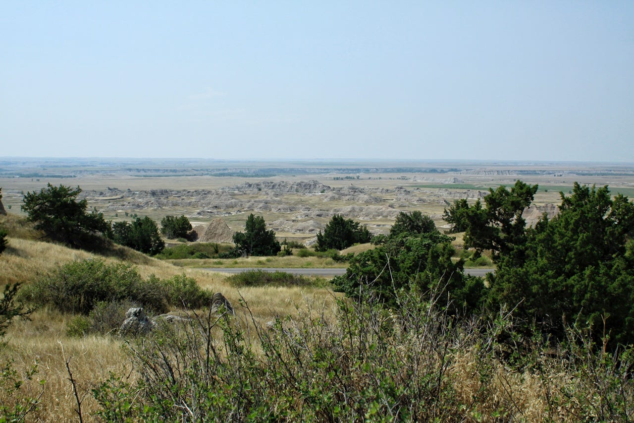
If you compare the photos of the Badlands in this post with the ones from my last post, you can see why I highly recommend visiting the Badlands in the evening, rather than in the morning. It’s not that it isn’t still beautiful, but evening is more beautiful.
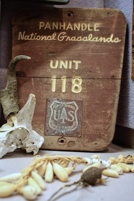
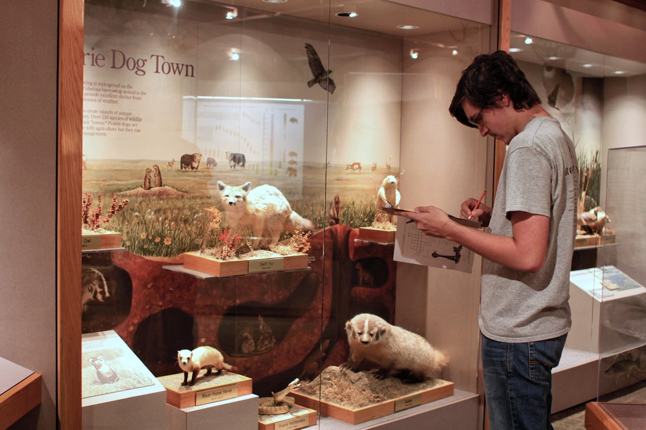
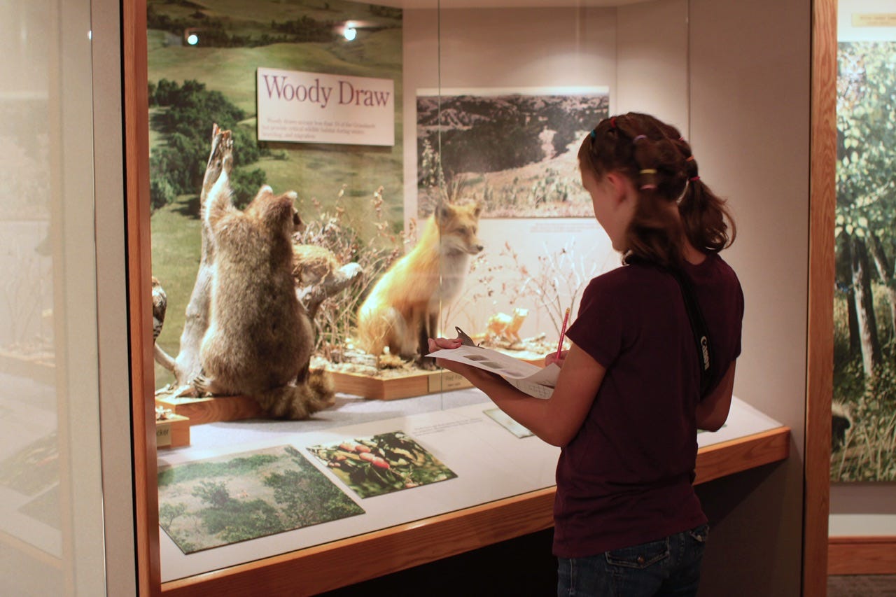
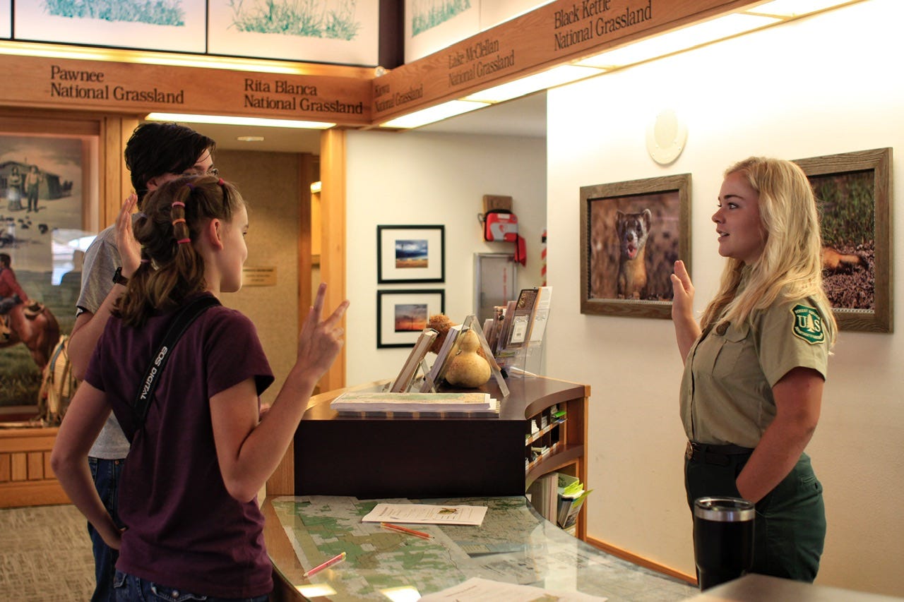
National Grassland Visitor Center
The National Grassland Visitor Center is located in Wall, SD so we stopped to check it out and do their Junior Ranger program. The visitor center features information on the twenty national grasslands in the United States, as well as mounts of the wildlife that call the grasslands their home. It’s not a very big place, so it didn’t take long to look around and complete the books.
South Dakota Air and Space Museum Base Tour
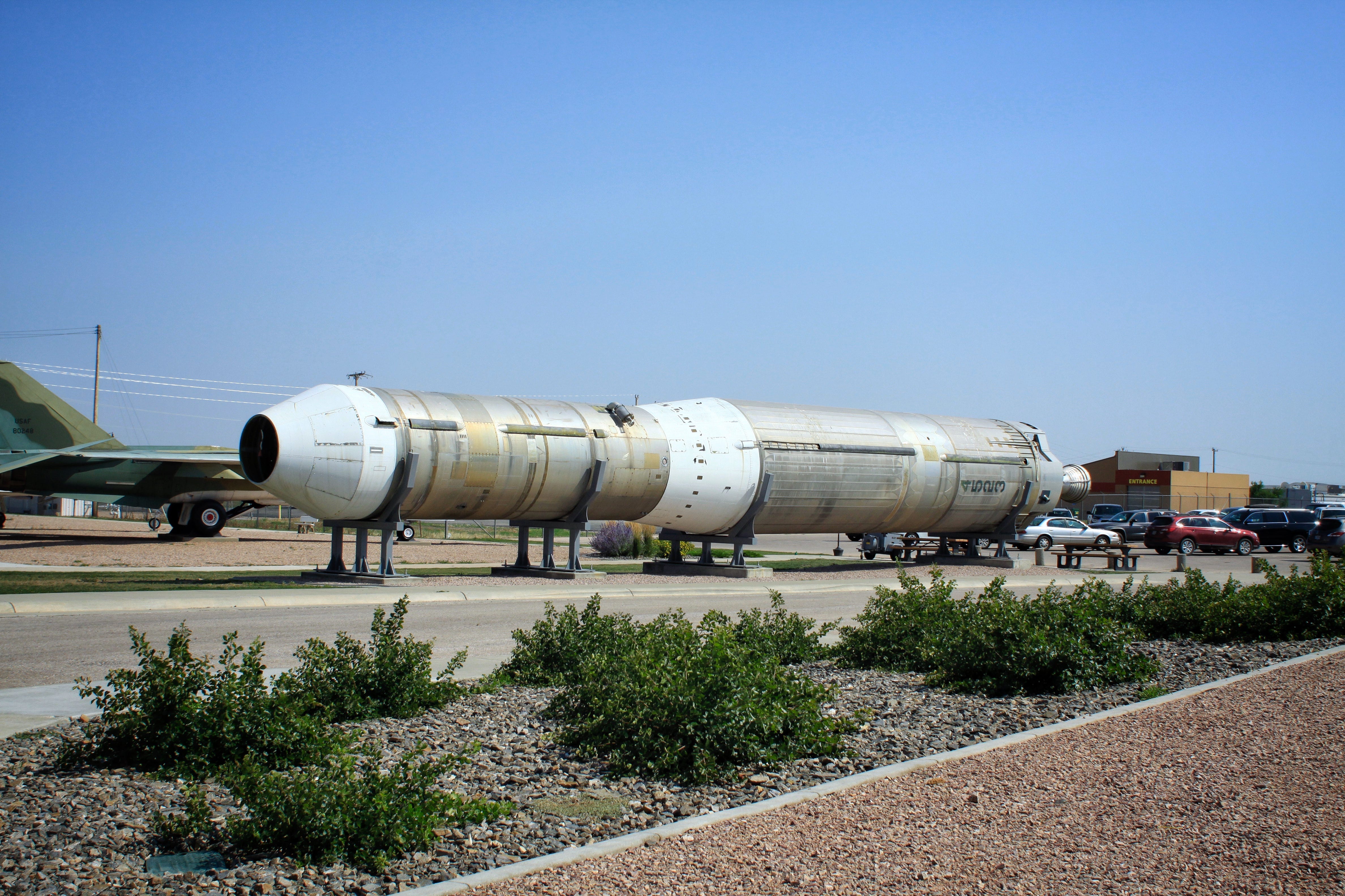
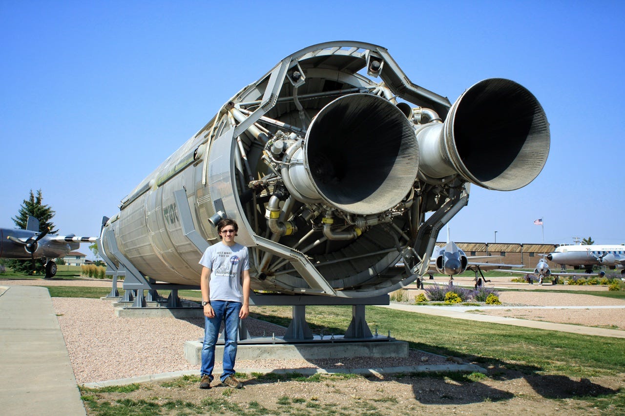
We had already visited the SD Air and Space Museum in June, but we had not went on the base tour of Ellsworth Air Force Base, so that was next on our agenda. I was not sure what to expect from a base tour, other than I had hoped maybe we’d see some of their B-1B planes. We loaded on a bus at the museum for the ride onto the base. At the gate, the bus stopped and base security came on board to collect our IDs. I don’t remember how long that process took, or what we did while we waited, but it took a while for them to run a busload of IDs. We must have all checked out okay because eventually, someone came out and handed the driver all of our IDs and the bus could enter the base. The driver pointed out several points of interest around the base and then stopped at a small collection of military vehicles and equipment.
As it turns out, our tour did not include any planes, not even from a distance, but it did include a tour down into a training facility for a missile silo! South Dakota was home to many missile silos during the Cold War. They are represented on a giant map hanging in the stairwell to the bottom of the silo. Each color block is a different squadron that had several launch control centers. Each launch control center controlled ten missile silos.
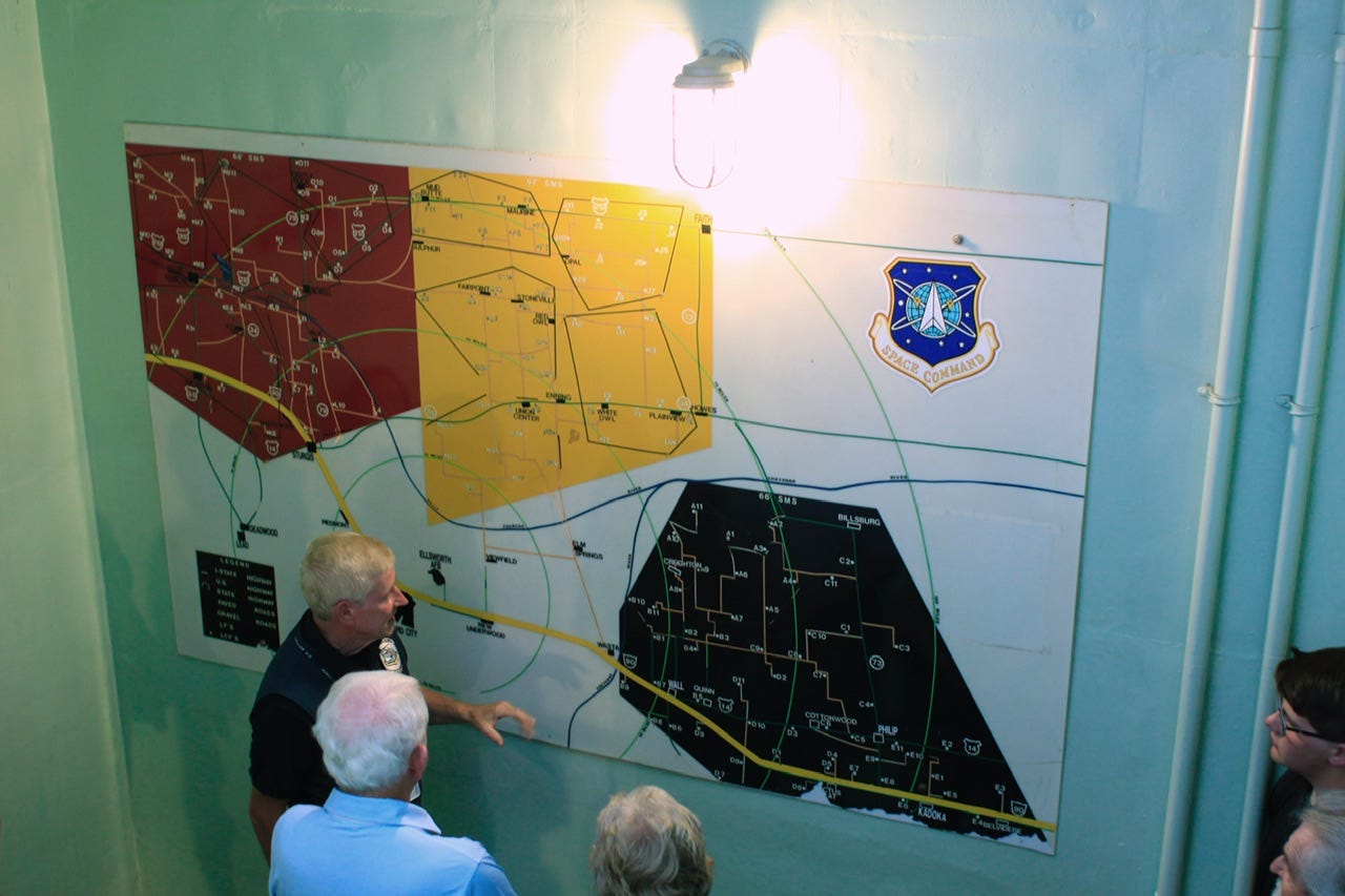
Side note: I love a behind the scenes look at anything, so as I was working on this post, I had to wonder what those sites looked like now that the silos no longer exist. That led me down quite the rabbit hole of research, ending in a Wikipedia page that contained a list of all of the coordinates to each of the silo sites, as well as the launch control center sites. I did a little snooping around on Google Earth, and as it turns out, many of the launch control sites are still exactly as they had been back in the day. The silo sites were imploded when they were decommissioned, so the only thing to see on those sites are the fences. I was surprised to learn that almost all of them still have the fences standing and they have been put to use housing things like hay bales, bee hives, and old vehicles/junk. Many don’t have anything inside the fences and only a handful of them no longer have the fence. I can see why the whole operation was considered to be “hidden in plain sight.” Many of the sites are right next to major highways, while others are off in the boonies. I pinned a bunch of them in Apple Maps, so we can go on something of a scavenger hunt/scenic drive next time we’re out that way. Subscribe for that gem of a trip report! Haha!


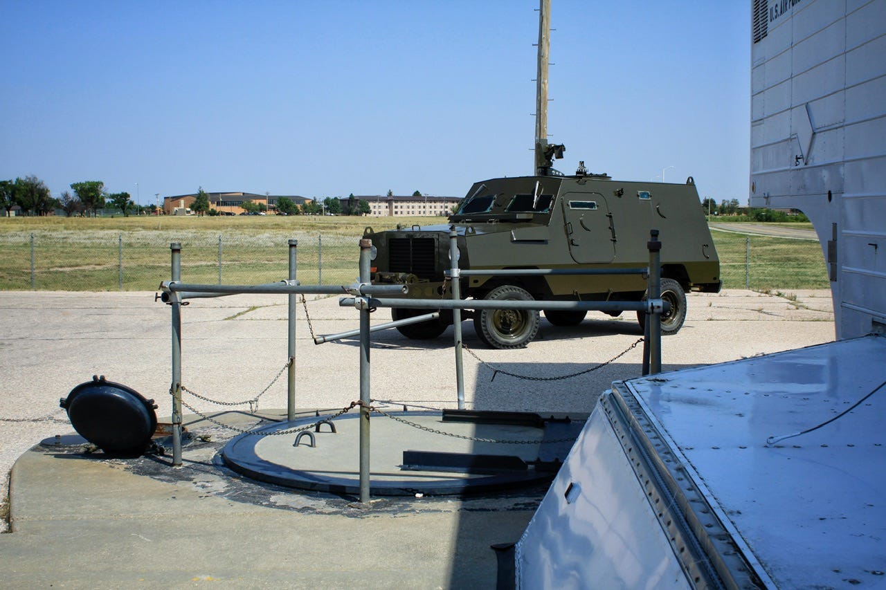
The missile silo we visited was the training site for practicing repairs that needed to be carried out at or in the actual missile silos scattered around the area on the map. The interior of the silo was a much bigger space than one would imagine since a large group could all fit inside in a circle around the training missile. I’m not a history buff, but I enjoy learning about behind-the-scenes operations of pretty much anything, so this tour was great in combination with the Minuteman Missile National Historic Site.
Finding a Campsite
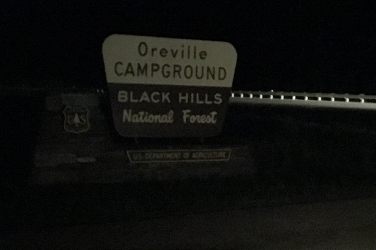
Once our tour was over, it was time to find a campsite. I called Wind Cave National Park, since I wanted to make sure they had sites available before going all the way down there. They claimed to have no sites left, so we went to my next choice, which was Oreville Campground, a Black Hills National Forest campground. When we arrived, Oreville had two sites left and we chose site 5.
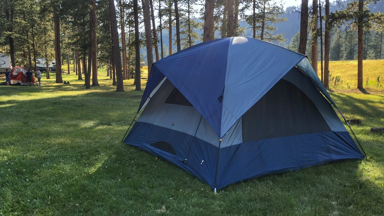
I chuckle at this photo every time I see it. Those three grown men in the background had started setting up their tent as we pulled into our site and were still working on it when we left the campground with our tent all set up. To be fair, we wanted to run down to Wind Cave before they closed, so we hustled, but I was proud of us that a mom and a couple of teenagers could get our tent set up in less time than it took three grown men to work on theirs.
In the end, we didn’t make it to Wind Cave before the visitor center closed, but we were able to take a walk to the natural entrance to check that out. On our way out of the park, we took a drive through Elk Mountain Campground, which would’ve had plenty of campsites open. That was pretty disappointing to find out, but not much we could do about it with our tent already set up a half hour away. We drove back to Oreville Campground, ate whatever I had packed for supper, and went to bed by 9pm.
My alarm was set for 4am.
Day Two
Monday, August 21, 2017
Rise and Shine, Up and At ‘Em
It was still dark outside when the chirping birdies on my phone signaled that it was time to get up. We were not the only soles awake in the wee hours of the morning. Another couple was using the vault toilet when we walked over to use that and we saw lights bobbing around at another campsite in the distance. We quickly got dressed in the dark and packed up the sleeping gear so we could take down the tent.
Having extensive experience setting the tent up in the dark did not do nearly enough to prepare us for taking the tent down in the dark. We always check our campsite to make sure we don’t leave anything behind and that was tricky to do without disturbing our neighbors, who were hopefully still asleep in their tents. I swear fiberglass tent poles make twice as much noise clapping together in the dark, but we worked as quietly and quickly as we could.
We departed Oreville Campground at 4:52am, right behind a fellow camper whom we imagined had the same mission in mind for their day: find a location to view the eclipse! Nobody else in their right mind gets up and takes down a tent at 4 in the morning!
On the Road Again
There were a surprising number of cars out on the road at that time of day. We amused ourselves by trying to decide which of them were on their way to view the eclipse. Probably all of them…or so it seemed! Apple Maps gave us a choice of three routes, all of which were about the same amount of time, so I chose the one with the least miles.
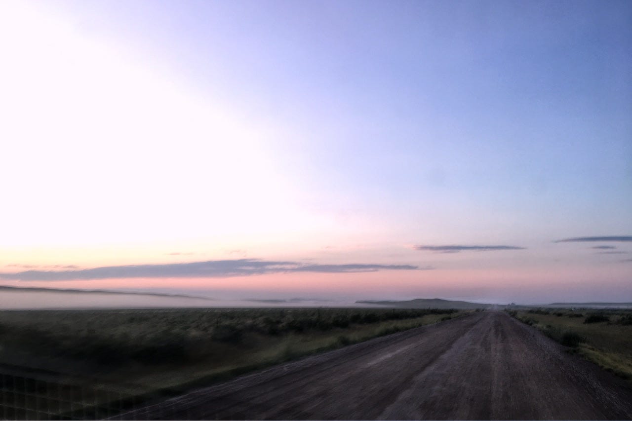
Of all the mornings to be frugal on miles, this was not the one. Our shortcut included eleven miles of gravel road that was somehow labeled as Highway 471. It might have had pavement at one time. I could see bits of it here and there, along with highway signs and 55mph speed signs. (Even my atlas indicates that it’s a paved highway, so deciding our route the old-fashioned way would not have helped.) I’ve lived on gravel roads almost my entire life and rarely have any of them been in good enough shape to do 55mph. This one was no exception.
Time was ticking and we were crawling along at 35mph. We were not the only ones to make this mistake. I’m fairly certain the lone white car we saw that looked like a rental, was also regretting their life choices at the time. The only consolation for this seemingly endless portion of the drive was the sunrise over the prairie. There was a misty layer of low hanging clouds and a beautiful pink glow. I wish I had stopped for a better photo, but we had places to be. I snapped this one through the windshield with my cell phone. It’s not a great photo, but it instantly brings me back to that morning drive.
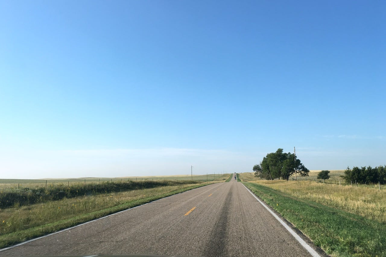
After eleven miles of gravel, the pavement of Highway 71 was a welcome sight and that took us into Nebraska. Traffic was picking up, or at least it seemed that way. We were back to imagining every vehicle we saw was on their way to view the eclipse from the same location we were headed. This is not exactly a highly populous corner of Nebraska, so it seemed like a legit thought. Along the way, we saw field approaches loaded with folks hanging out on truck tailgates and lawn chairs. Were we already too late to find a spot to park for this thing? I’m not normally one who gets too excited about passing folks, but I passed a few cars on this road.

When we reached Harrison, NE, it was clear that this tiny little town in the middle of nowhere had prepared to capitalize on an influx of visitors. We could’ve stopped for food at numerous painted plywood signs propped up around the town, but there was no time for that! We found our turn and headed south, noting the signs warning of no services for the next how many miles. This was it! We were almost there!
We knew the line of cars ahead were all on their way to Agate Fossil Beds. It was fairly obvious that this was otherwise a very remote, and not well-traveled road, so where else would that many cars be going? Would we get in? Would there be a place to park? I was imagining thousands of people already there ahead of us and it was only 7:30 in the morning!
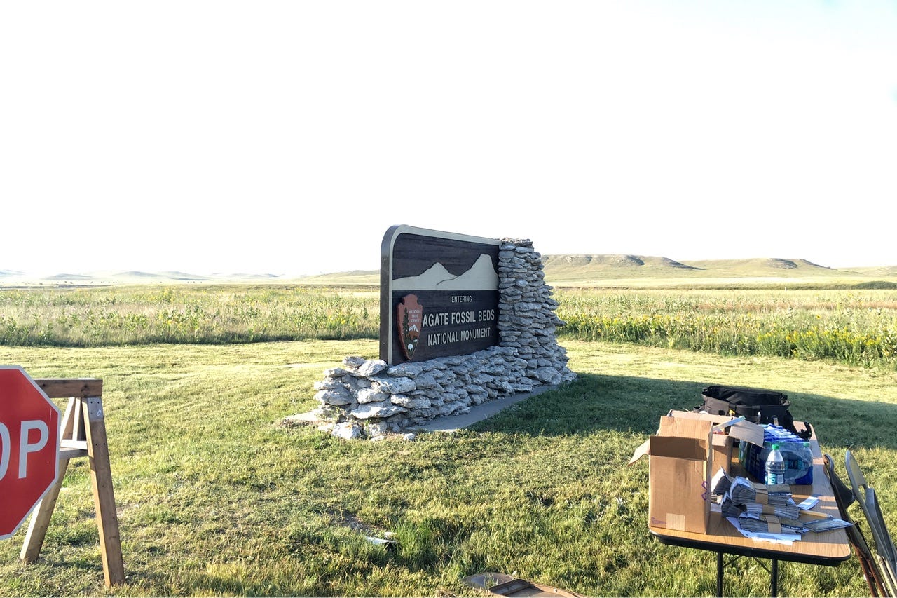
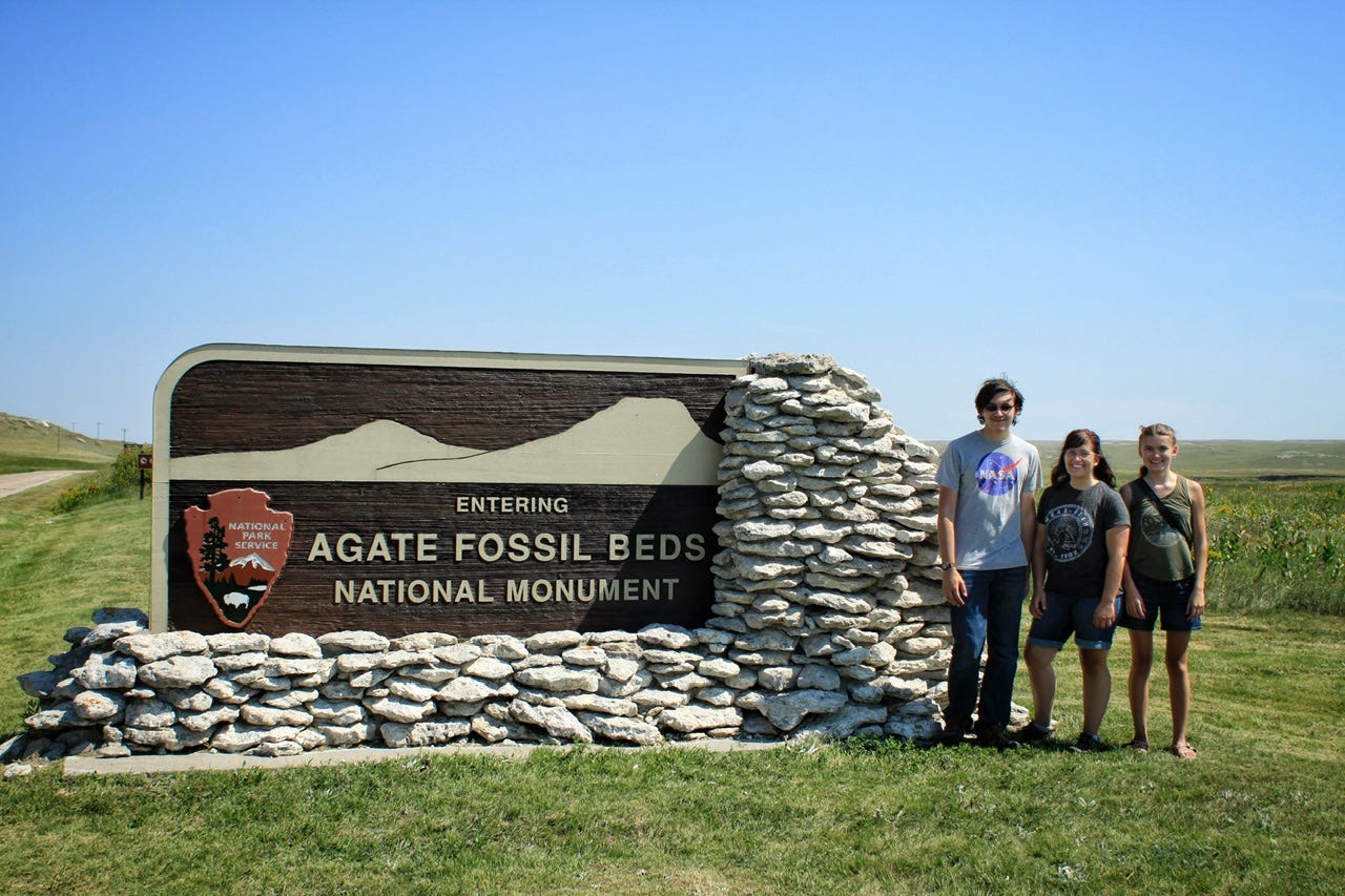
Agate Fossil Beds National Monument
Agate Fossil Beds National Monument does not have a fee booth at the entrance, so several park rangers were set up along the side of the road next to their entrance sign, efficiently spaced several paces apart so they could greet three cars at a time. We received parking instructions, a park map and cardboard eclipse viewing glasses! Score!
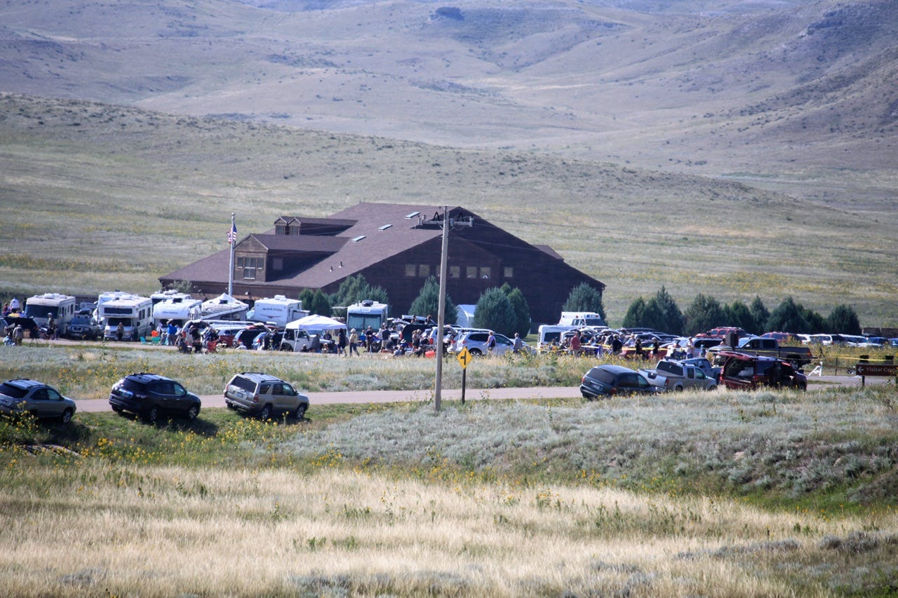
We followed the line of cars going into the temporary parking area made of freshly mowed grass across from the visitor center. Somehow we managed to score the second to the last parking space in the lot! Good thing I passed a few cars back when I did or we’d have had to backtrack to the next mowed lot that was further away. Now it was time to check out the visitor center and scope out a spot to sit.

As we walked along what is normally the driveway to the visitor center, we saw folks set up with giant telescopes and lenses, hanging out next to their giant RVs. These had to be the folks who had planned this outing several years in advance, rather than deciding the day before like we did! Lots of people were scattered all over the lawn in front of the visitor center, which made it easy to decide this was not where we wanted to watch the eclipse!
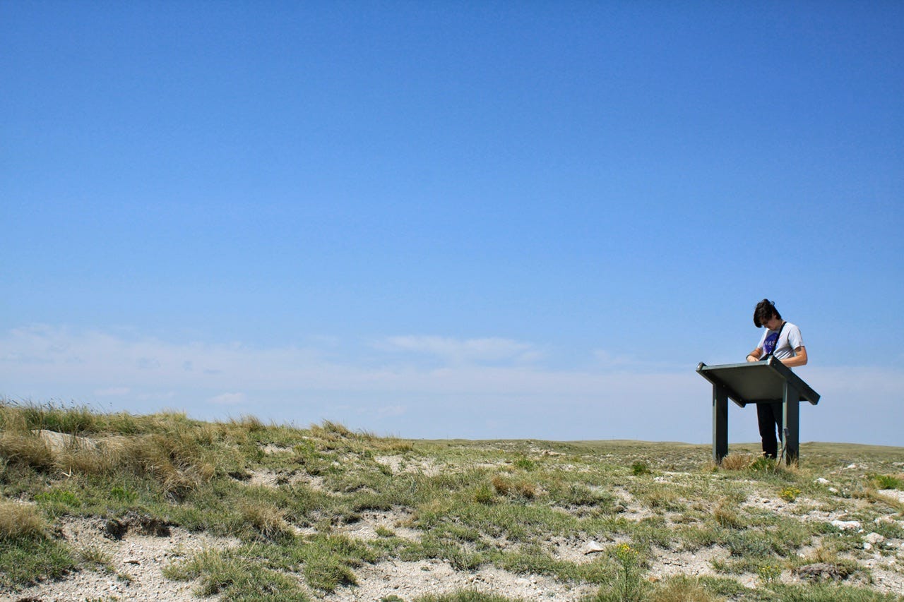
As expected, the visitor center was crowded, but we were able to use the restrooms and pick up Junior Ranger booklets. They had the regular book for the park itself, plus a Junior Paleontologist, and a special one for the eclipse, called the Junior Ranger Eclipse Explorer! The ranger gave the kids their books and handed me all of the badges in case we couldn’t make it back inside to be sworn in by a ranger. I suspect they also did not want to swear in that many Junior Rangers in one day!
With the 4am chirping birdies and three hours of driving under my belt, I decided we’d go back to the Durango so I could rest my eyes for a few minutes. The kids worked on their many Junior Ranger books until I decided we better go claim a spot to sit before we didn’t get one, not that the place looked to be in danger of filling up.

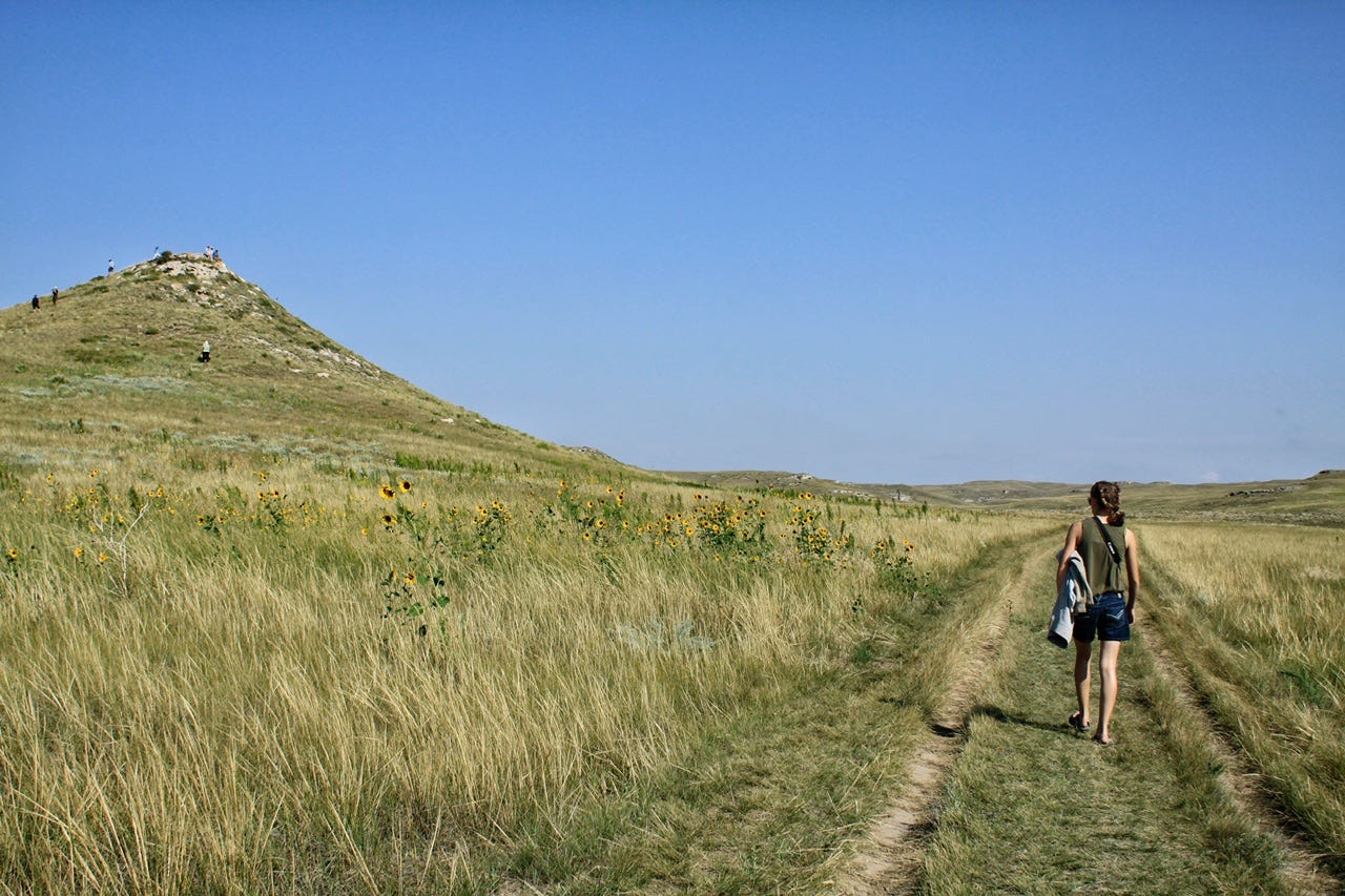
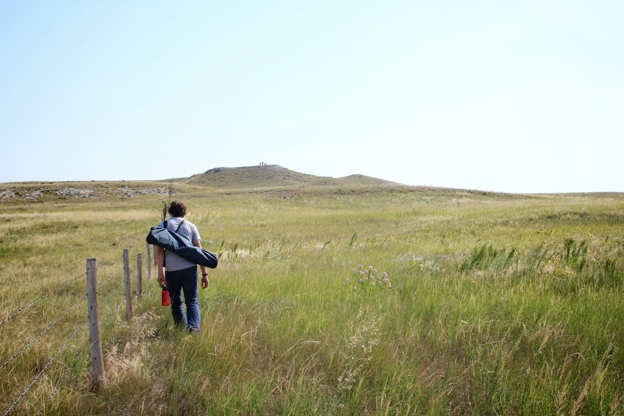
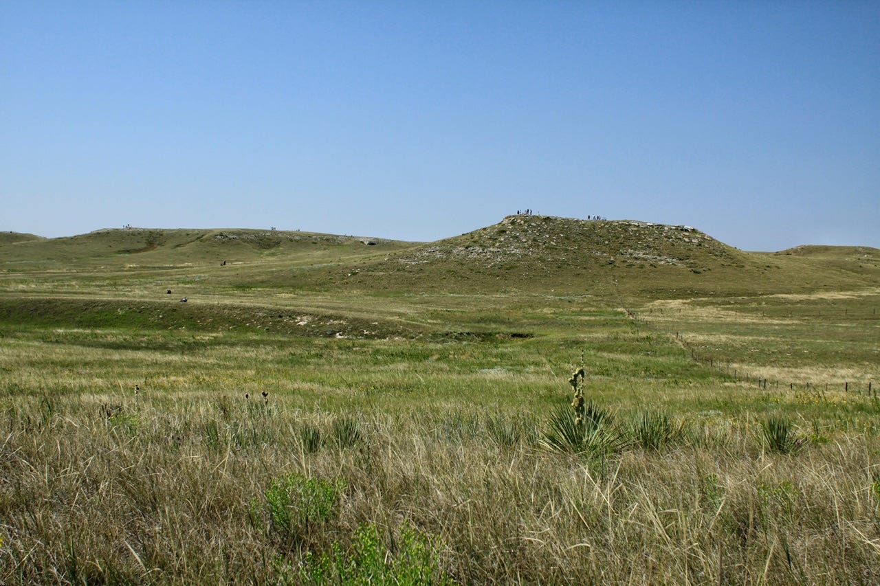
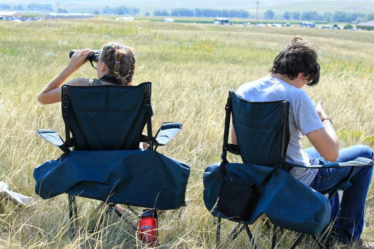
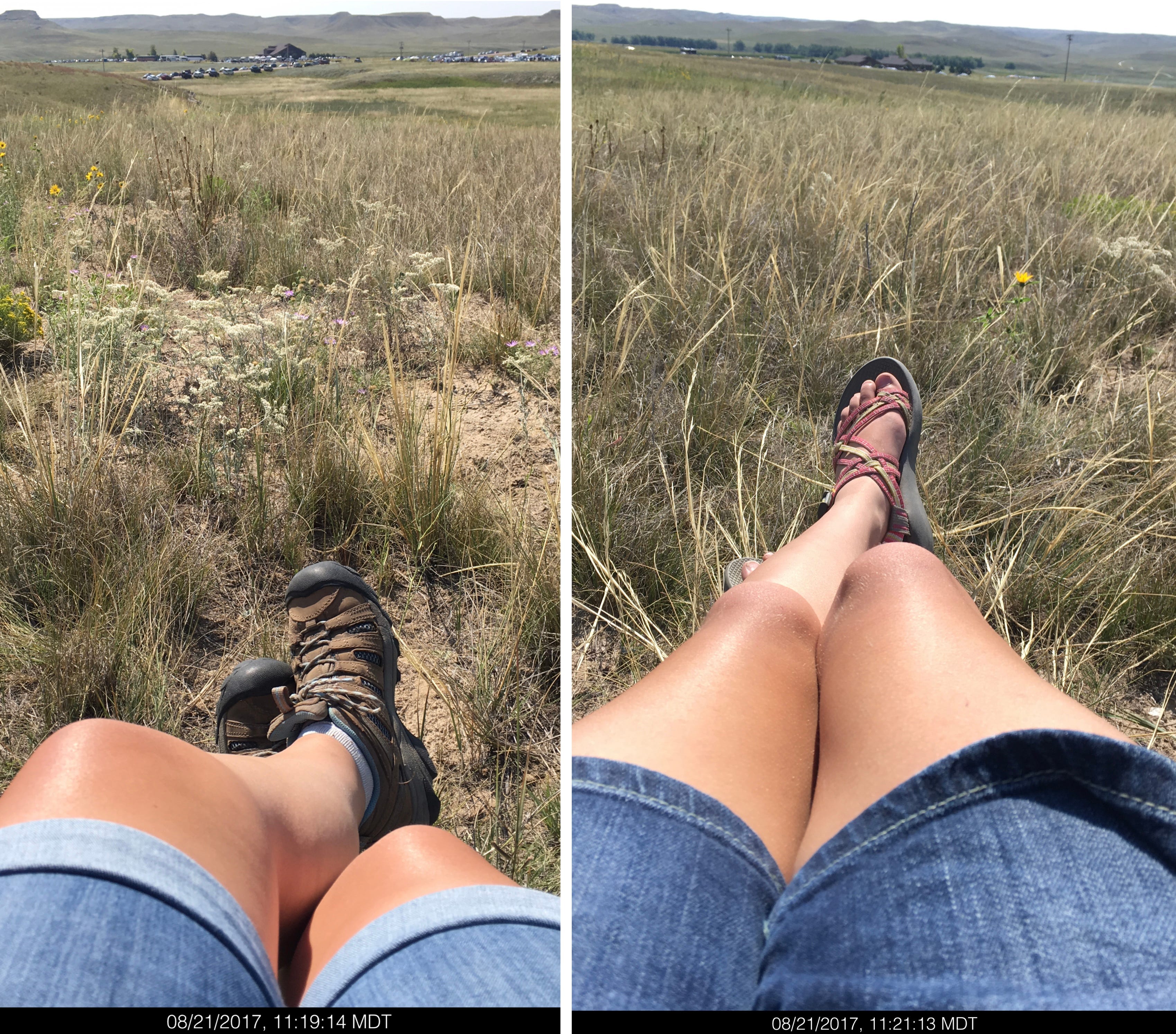
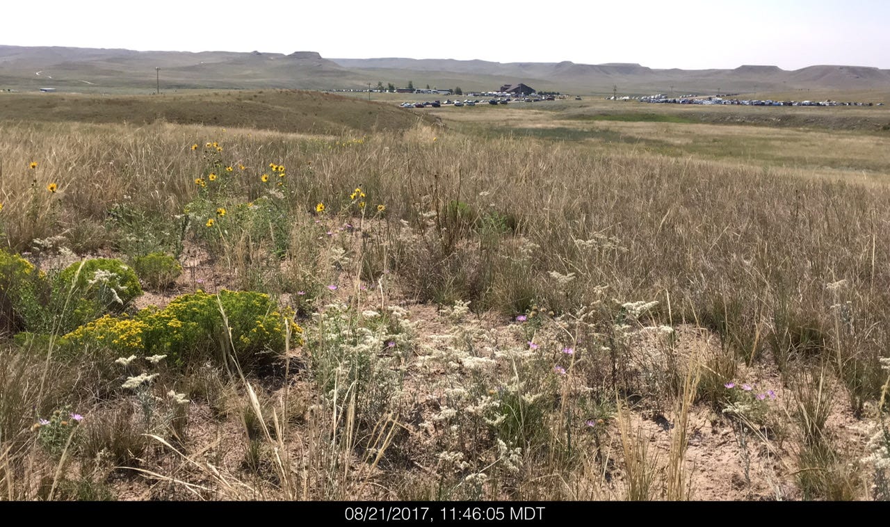
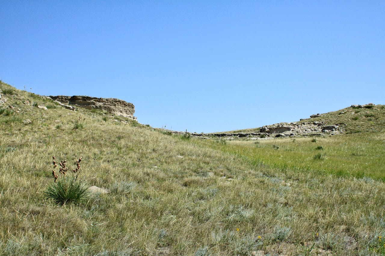
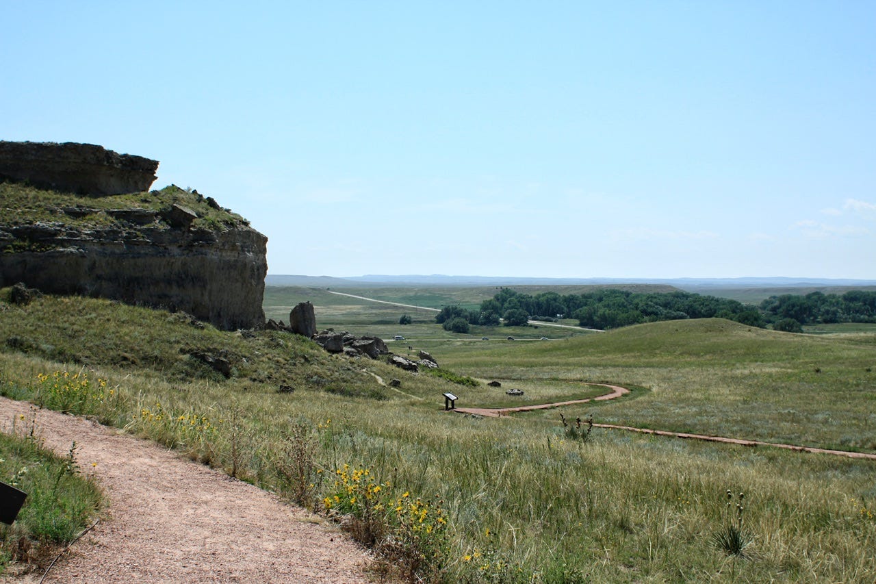
Everyone else had claimed spots that were perched high on top of the sandhills so we chose a much shorter little hill in an empty spot in the valley between two taller hills. We walked in the tracks all the way back to the park boundary fence line and then cut across to our chosen spot. Nobody else was out there and everyone else was far away! This was certainly not how I had imagined our eclipse viewing location would be, but it was amazing!
Now We Wait
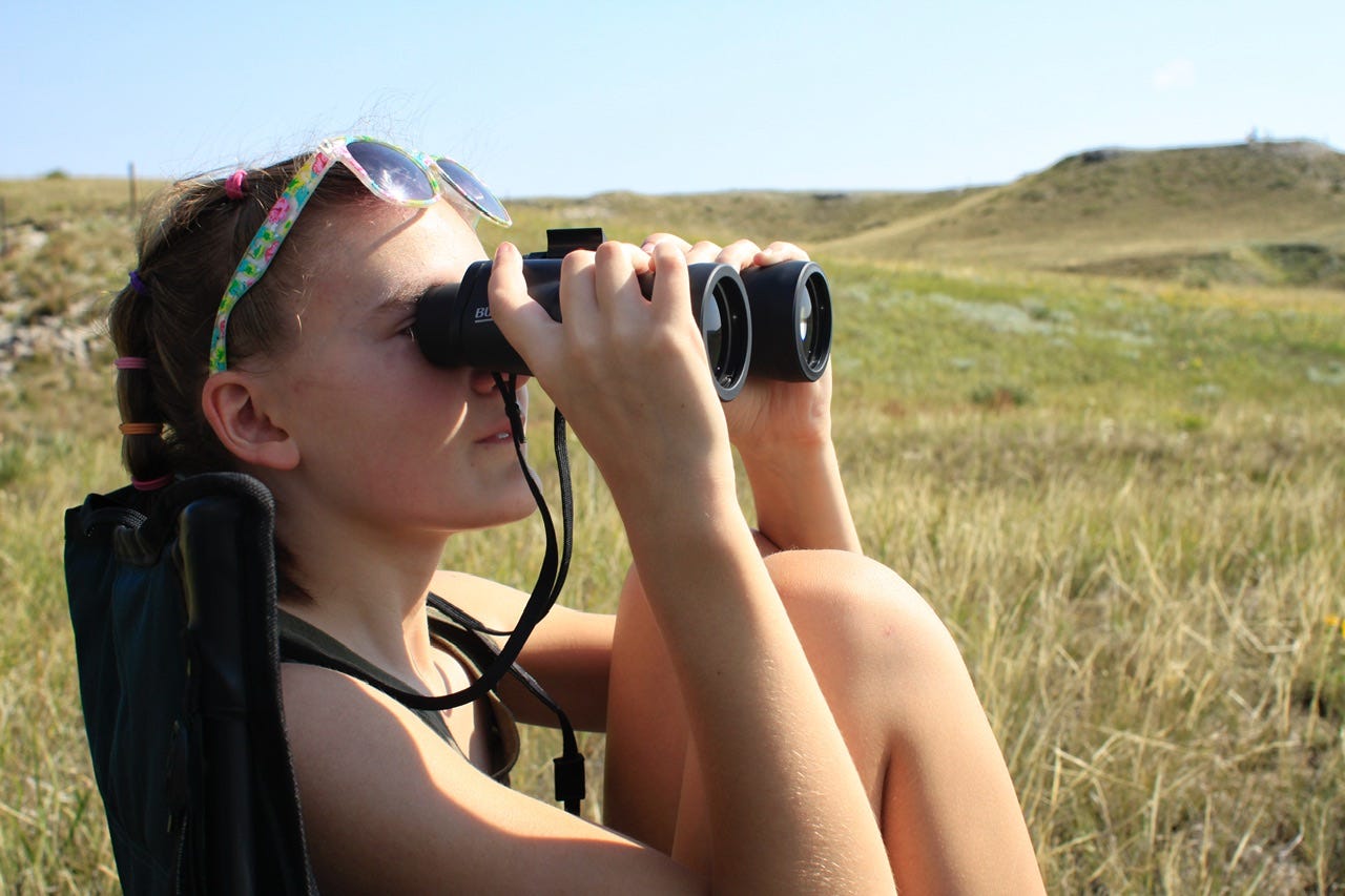
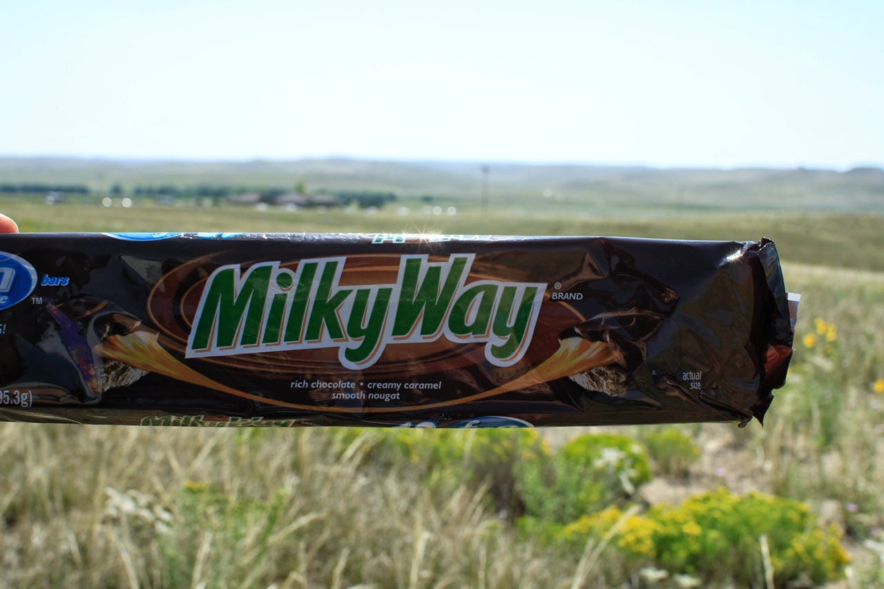
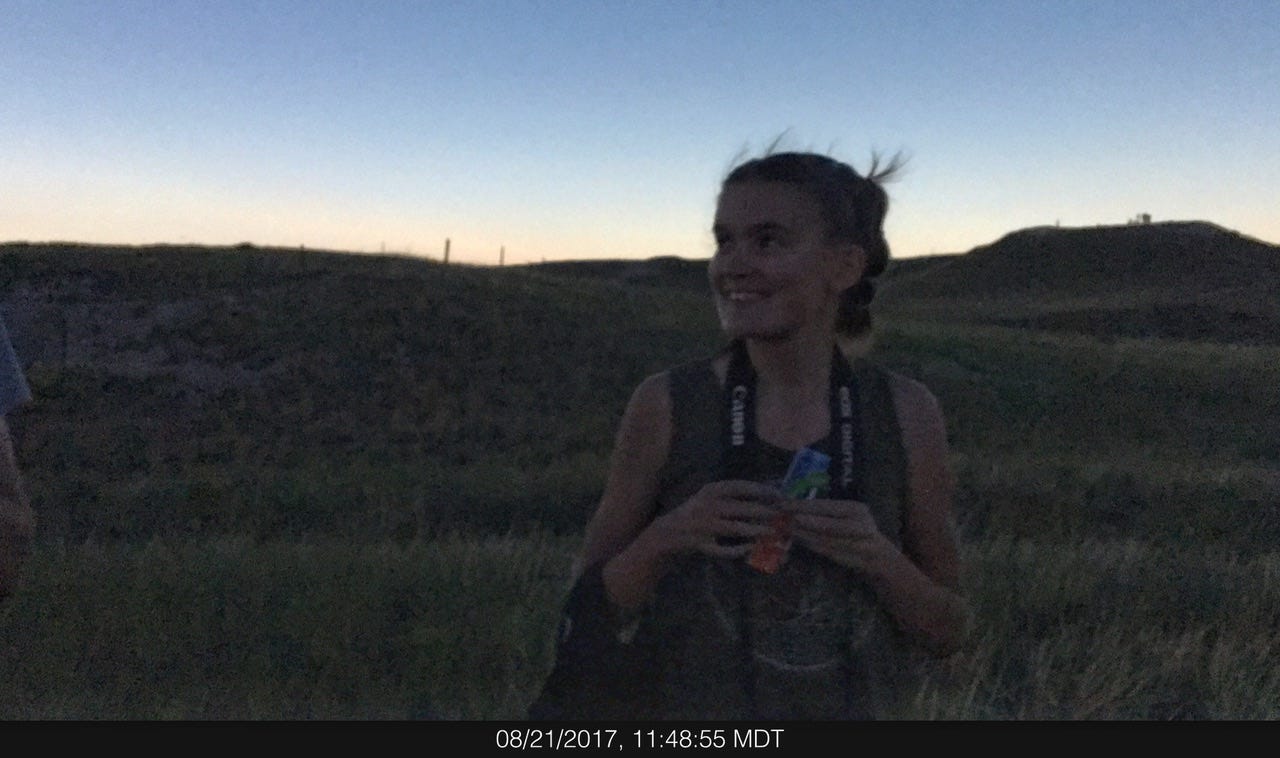
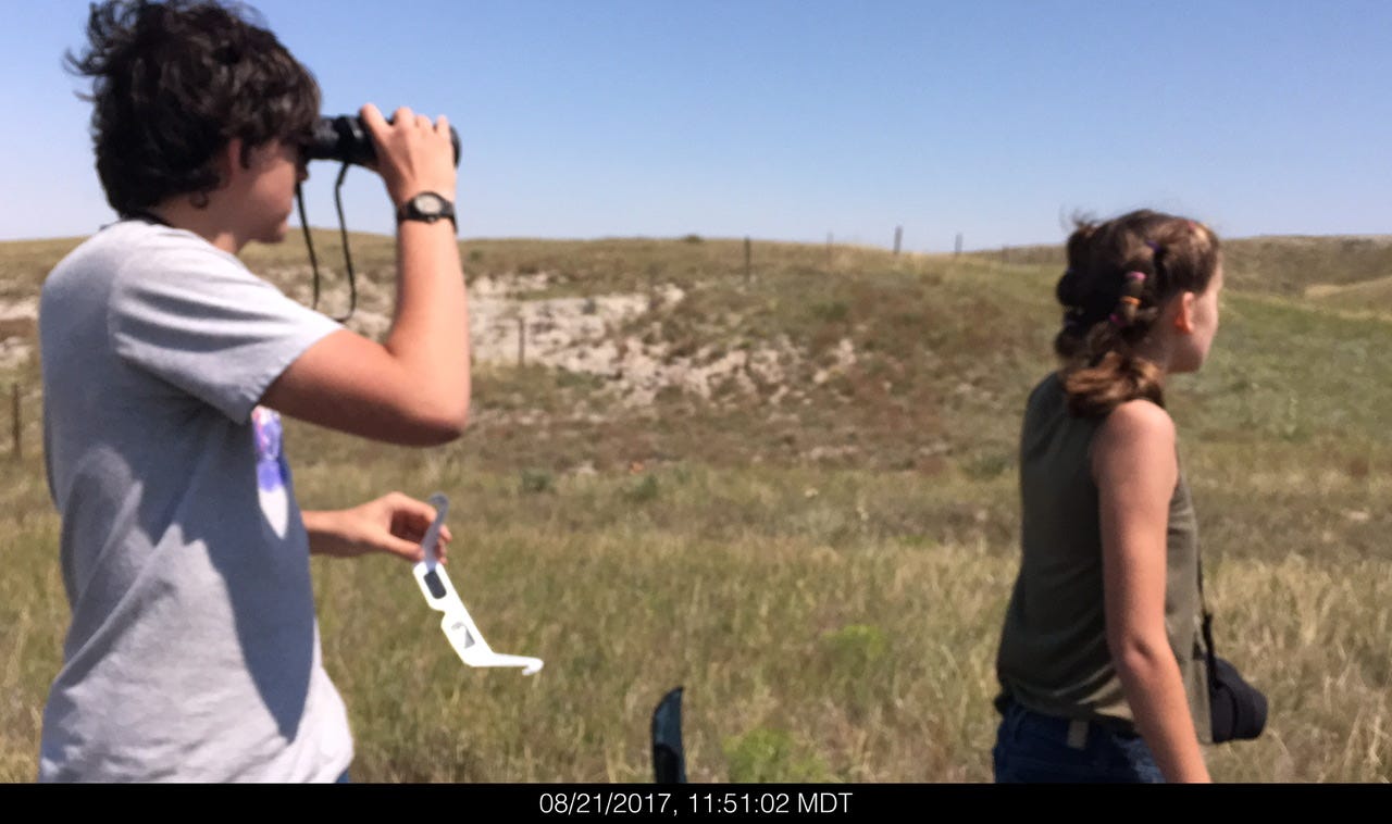
We had claimed our spot with plenty of time left before the eclipse happened. We people-watched through the binoculars, photographed wildflowers, and played with Joey’s homemade eclipse viewers. We tested our real eclipse viewers, took more pictures, and enjoyed Milky Way candy bars to commemorate the upcoming event. We had well over an hour to amuse ourselves and take it all in.


The Great American Eclipse
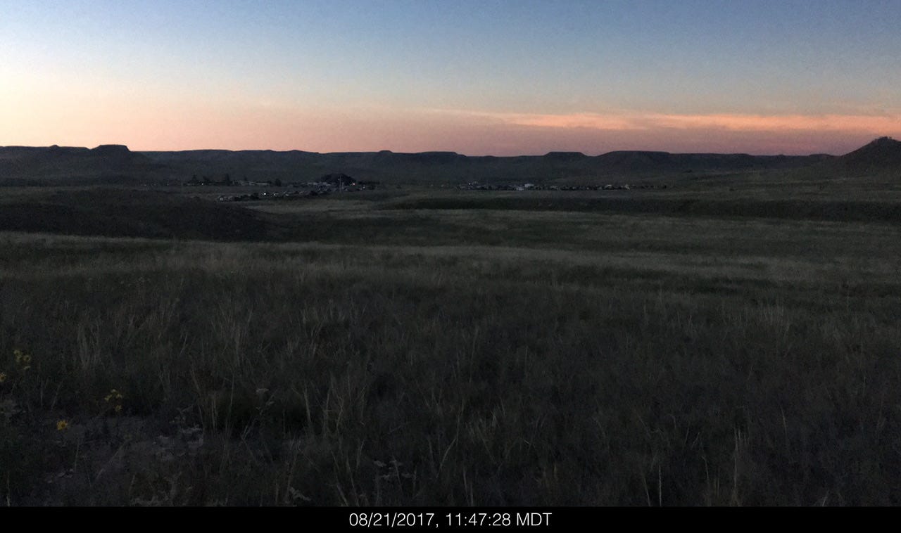
The next set of photos are all from my phone. I didn’t want to fiddle with settings on my DSLR and miss the experience. I think that was a good choice because everything happened so fast, but sort of in slow motion at the same time. The official time for 100% totality was 11:47am for 2 minutes 23 seconds. We had been watching the moon and the sun inch closer and closer together until there was a diamond ring. You could tell something was about to happen because the color of everything was…weird…for lack of a better word.
Then everything went dark, like the sun set all the way around us and it happened in an instant. The people on the hilltops around us all cheered. I don’t know how to describe the experience, other than that it was amazing. Maybe even profound. Surreal.
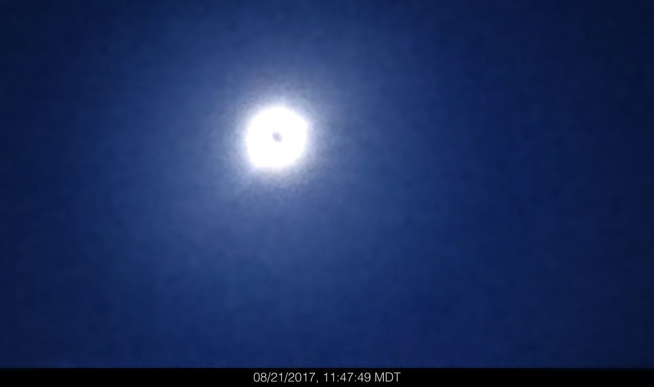
I snapped a few very bad photos of the eclipse. Even though it was neat to see what might be a once-in-a-lifetime moment, I just wanted to take in the surroundings and capture the reactions of the kids. (Amazing photos of the eclipse can be found on NASA’s website.) The sky was too dark, like a weird night time in the middle of the day, with a sunrise on the horizon all the way around us. When our 2 minutes and 23 seconds were over, the sky was almost instantly daylight again. And that was it. The total solar eclipse was over, just like that.
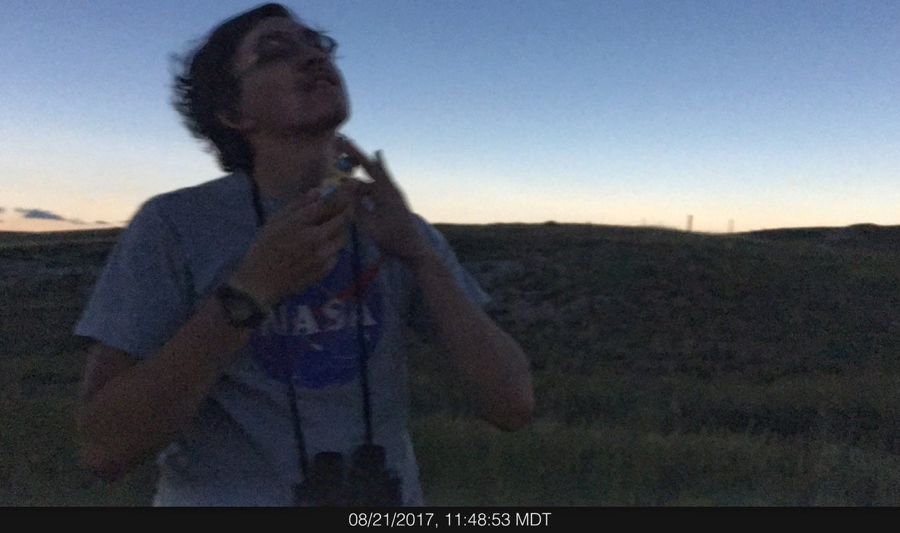
I remember thinking that this would be something I would remember for the rest of my life. It was that good. I was so happy we had gone on this adventure and I immediately wanted to find out when we could go to the next one! I wish I had better photos, or even a video of the day, but I think the memories I have are better than any better photos might have been. The look of wonder on Joey’s face and the amazement on Megan’s…made it worth the effort to take them on this crazy whirlwind trip. I would’ve been fussing with camera settings and not captured those moments at all if I had tried for better photos. I cherish the memories I have of hanging out with just the two of them in that one spot on not-the-highest hill in the park. Even if I didn’t win a “Coolest Mom of the Year Award” for this trip, I felt like I had!
A Midwest Goodbye
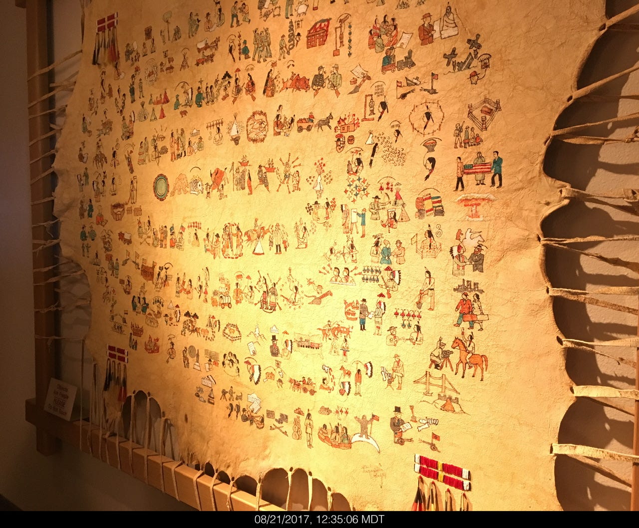
It’s kind of comical to think of it this way, but we totally did a Midwest goodbye at this park, not wanting our adventure to come to an end already. We were in no hurry to pack up and leave with all of the other hundreds (or thousands?) of folks who were getting the heck out of there so they could get on with their Mondays. We walked back to the truck to deposit our stuff and then went down to the visitor center to have a better look around now that it had cleared out a bit. They have a museum of Native American artifacts and I’m not sure what this piece is, but I thought it was neat.
Daemonelix Trail
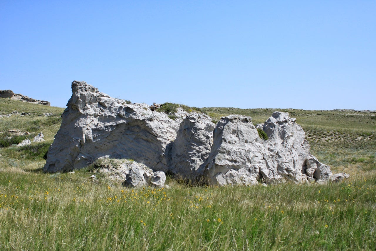
I asked about hiking a trail and the ranger recommended the Daemonelix Trail on our way out of the park. It wasn’t the most exciting trail we’ve ever hiked, but it completed our visit to the park. The one mile trail features the Daemonelix or Devil's Corkscrew, a dry land beaver’s spiral burrow. The rest of the understated landscape featured wide open views of the Great Plains, ancient sand dunes, and fossil grassland soil.


A Fond Farewell
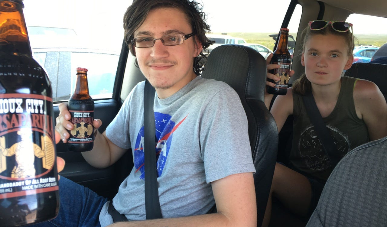
We really needed to be getting on the road to home. We had over a seven hour drive ahead of us and it was now 2pm. When we got back to the truck, we enjoyed the Sarsaparillas I had packed along to celebrate our adventure to the “oooooooooooold west.” Then we stopped at the park sign we didn’t get to photograph properly on the way into the park and then we were off!
One More Stop
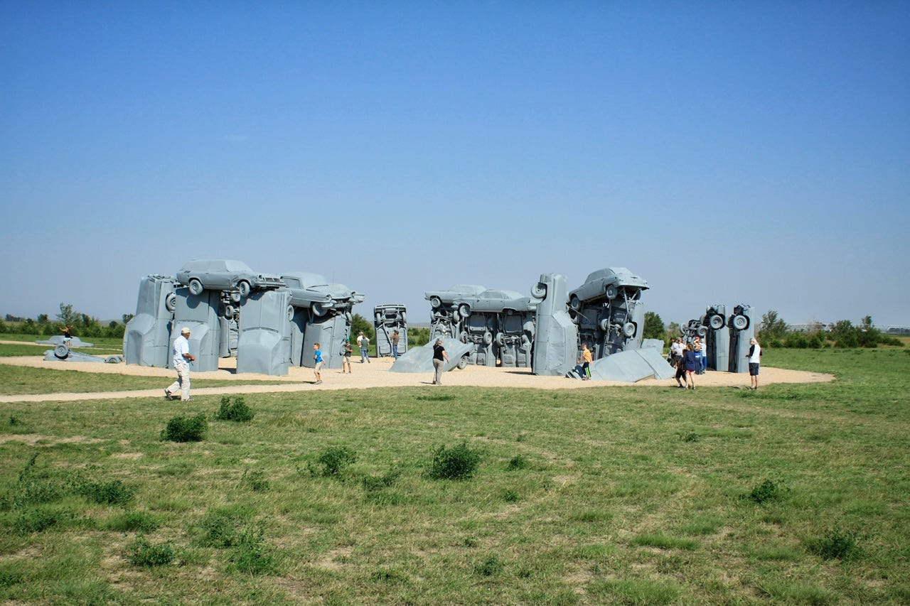
Since I didn’t know if or when we’d ever get that way again, I had one more stop I really wanted to make on our way home. I wanted to show the kids Carhenge! I must have been delirious to think that was a good idea to add to our route home, considering it was kind of out of the way and we had so far to go. We headed south and took whatever “cutoff” road we found that took us over to Highway 71. I found myself back on another gravel road, only this time, we were not alone out there. Everyone leaving their eclipse viewing spots was also kicking up dust on this road.
Western Nebraska has some…interesting…roadside attractions. The “rest area” is hilarious. I have no idea if those hay bale steps lead to a working toilet. I hope not, but you never know! I had to share the fancy John Deere shed with my dad and brothers for inspiration on how they should be storing their favorite John Deere tractors. I suspect they would all rather buy another tractor or two than build a glass-sided shed for just one.


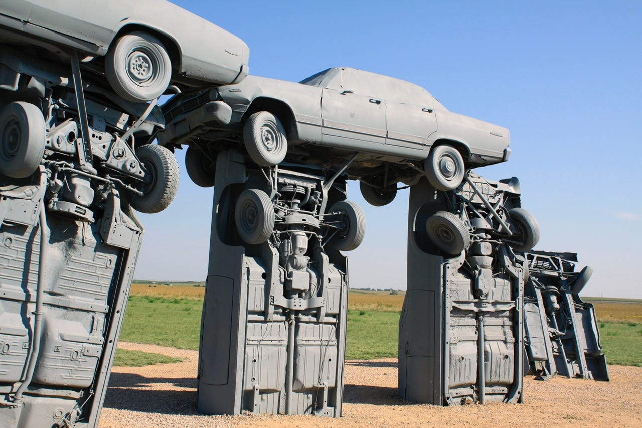
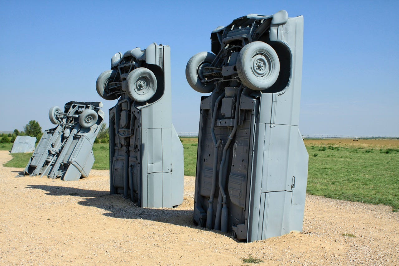
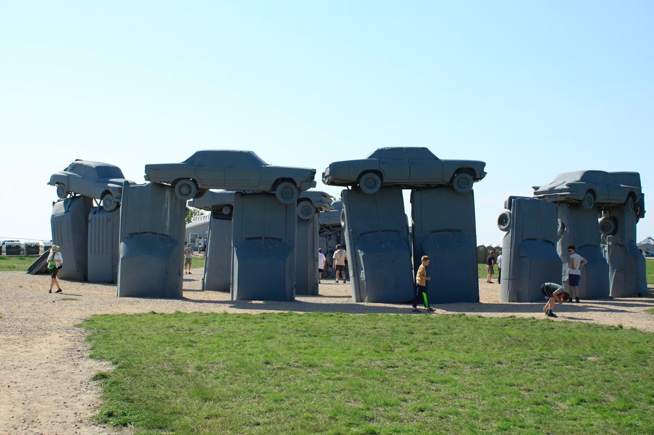
Carhenge
We finally made it to Carhenge, an amusing display of exactly what its’ name implies: cars made to look like Stonehenge…Carhenge. There are other welded metal sculptures, too, but the main attraction is the Carhenge installation. Apparently, they had clouds in the morning and the folks who had gone there for the eclipse had to find somewhere else to see it. Boy, was I glad I had not thought of going there!


A quick 40 minutes later and we were back on the road. Now it was really time to head for home. I had planned to go back through the Black Hills, but we ended up cutting across northern Nebraska instead, since that was shorter from where we were at. We were in need of some supper so we stopped at Runza in Valentine, NE, beginning a new tradition of stopping at a Runza every time we travel through Nebraska. There’s really nothing like a Runza sandwich and Frings anywhere else. A Runza is like a fully enclosed homemade bun with meat, cheese, and shredded cabbage inside. I have no idea how this is good with the cabbage in there, but it is amazing! Frings are a combo pack of French fries and onion rings in one package…the best of both worlds for those who can’t decide which to get!
We went north out of Valentine and got back on the interstate at Murdo, SD for a mostly uneventful drive home in the dark. I say “mostly uneventful” because I decided to get off the interstate at the Humboldt exit so I wouldn’t have to drive 80mph on the interstate when I was kind of tuckered out. I headed out of town and shortly after, I noticed a vehicle following closely. I didn’t think much of it until they turned the same corner as I did and continued to follow me. I didn’t go far before seeing the flashing lights of a highway patrol car in my rearview mirror. Great.
I knew I was not speeding, since the whole point of getting off the interstate was so I could drive slower, but I had no clue what I had done wrong. The officer asked for my license and registration, which I provided, and when he returned with it, he asked about where we were going and where we had come from. I think he was surprised when I said we were on our way home from watching the solar eclipse in Agate Fossil Beds in Nebraska.
He told me he had pulled me over because I had gone over the white line several times while he was following me and wanted to make sure everything was ok. Ahhhhh…that explains it! I told him I have zero depth perception and that I tend to hug the white line because it feels much safer than getting close to the yellow one, which he seemed to find amusing. I told him I was getting tuckered out so I got off the interstate to drive slower, which he must have thought was a good idea. He seemed genuinely interested in our adventures and was in no hurry to get back to work after he handed over a warning ticket. Maybe chatting with tuckered out drivers in the crisp night air is just part of his job. If it was deliberate, his plan worked, because I was wide awake after chatting with him. Eventually, he advised me to drive carefully and we drove away as he walked back to his patrol car.
Twenty minutes later, we were home sweet home. It had been an exciting trip from the beginning to almost the very end. The next day, I had to find out the date of the next total solar eclipse: April 8, 2024. The next total solar eclipse is much further away from home so I’m not sure if we’ll go anywhere to see it or not. Check back with me next April!
In the meantime, be sure to subscribe for tales of our next adventure.